world.wikisort.org - Japan
Nonoichi (野々市市, Nonoichi-shi) is a city located in Ishikawa Prefecture, Japan. As of 31 January 2018[update], the city had an estimated population of 52,143 in 23,111 households, and a population density of 3,800 persons per km².[1] The total area of the city was 13.56 square kilometres (5.24 sq mi).
Nonoichi
野々市市 | |
|---|---|
City | |
 Nonoichi City Hall | |
 Flag  Seal | |
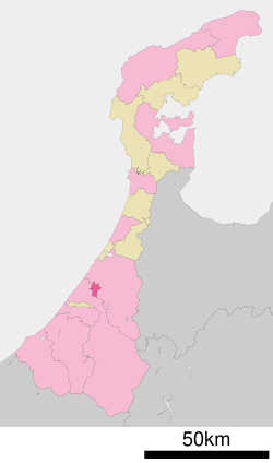 Location of Nonoichi in Ishikawa Prefecture | |
 Nonoichi | |
| Coordinates: 36°31′9.9″N 136°36′35.2″E | |
| Country | Japan |
| Region | Chūbu (Hokuriku) |
| Prefecture | Ishikawa Prefecture |
| Government | |
| • - Mayor | Tadaaki Awa |
| Area | |
| • Total | 13.56 km2 (5.24 sq mi) |
| Population (January 31, 2018) | |
| • Total | 52,143 |
| • Density | 3,800/km2 (10,000/sq mi) |
| Time zone | UTC+9 (Japan Standard Time) |
| City symbols | |
| -Tree | Camellia japonica |
| -Flower | Camellia japonica |
| Phone number | 076-227-600 |
| Address | 1-1 Minō, Nonoichi-shi, Ishikawa-ken 921-8510 |
| Website | Official website |
Geography
Nonoichi is in central Ishikawa Prefecture, sandwiched between the geographically much larger cities of Kanazawa and Hakusan. The city is located on flatlands on the fertile floodplain of the Tedori River
Neighbouring municipalities
- Ishikawa Prefecture
- Kanazawa
- Hakusan
Demographics
Per Japanese census data,[2] the population of Nonoichi has grown rapidly over the past 50 years.
| Year | Pop. | ±% |
|---|---|---|
| 1970 | 13,598 | — |
| 1980 | 31,817 | +134.0% |
| 1990 | 39,769 | +25.0% |
| 2000 | 45,581 | +14.6% |
| 2010 | 51,885 | +13.8% |
| 2020 | 57,238 | +10.3% |
Climate
Nonoichi has a humid continental climate (Köppen Cfa) characterized by mild summers and cold winters with heavy snowfall. The average annual temperature in Nonoichi is 14.3 °C. The average annual rainfall is 2,542 mm with September as the wettest month. The temperatures are highest on average in August, at around 26.8 °C, and lowest in January, at around 3.0 °C.[3]
History
The area around Nonoichi was part of ancient Kaga Province. The area became part Kaga Domain under the Edo period Tokugawa shogunate, and nonoichi was a post station on the Hokuriku kaidō highway.[4] Following the Meiji restoration, the area was organised into Ishikawa District, Ishikawa. The village of Nonoichi was established with the creation of the modern municipalities system on April 1, 1889. It was raised to town status on July 1, 1924. A referendum to merge with the city of Kanazawa was rejected in 1937. On April 1, 1955, Nonoichi expanded by annexing the neighbouring village of Tomioka. Nonoichi was elevated to city status on November 11, 2011. Ishikawa District was dissolved as a result of this merger.[5]
Government
Nonoichi has a mayor-council form of government with a directly elected mayor and a unicameral city legislature of 15 members.
Economy
Nonoichi is primarily a bedroom community for the city of Kanazawa. Local industries include agriculture and food processing.
Education
College and university
- Kanazawa Institute of Technology
- Ishikawa Prefectural University
Primary and secondary education
Nonoichi has five public elementary schools and two middle schools operated by the city government, and one public high school operated by the Ishikawa Prefectural Board of Education. The prefecture also operates one special education school.
Transportation
Railway
![]() West Japan Railway Company - Hokuriku Main Line
West Japan Railway Company - Hokuriku Main Line
![]() Hokuriku Railroad Ishikawa Line
Hokuriku Railroad Ishikawa Line
- Oshino - Nonoichi - Nonoichi-Kōdaimae
Highway
 National Route 8
 National Route 157
 National Route 305
Sister city relations
 - Gisborne New Zealand, from 1990 [6]
 -Shenzhen, China, friendship city
Local attractions
- Okyōzuka Site, a Jomon period archaeological site and National Historic Site[7]
- Suematsu temple ruins, a National Historic Site [8]
References
- "Official statistics page". Archived from the original on 2018-12-05. Retrieved 2018-03-03.
- Nonoichi population statistics
- Nonoichi climate data
- Campbell, Allen; Nobel, David S (1993). Japan: An Illustrated Encyclopedia. Kodansha. p. 1112. ISBN 406205938X.
- 野々市町5万人達成 11月市制施行 Archived 2011-10-01 at the Wayback Machine by Hokkoku Shimbun, February 15, 2011(in Japanese)
- Nonoichi official home page
- 御経塚遺跡 [Okyōzuka Site] (in Japanese). Agency for Cultural Affairs.
- 末松廃寺跡 (in Japanese). Agency for Cultural Affairs.
External links
 Media related to Nonoichi, Ishikawa at Wikimedia Commons
- Official website (in Japanese)
Kanazawa (capital) | ||
| Core city | ||
| Cities | ||
| Districts | ||
List of mergers in Ishikawa Prefecture | ||
This Ishikawa Prefecture location article is a stub. You can help Wikipedia by expanding it. |
На других языках
- [en] Nonoichi, Ishikawa
[ru] Ноноити
Ноноити (яп. 野々市市 Ноноити-си) — город в Японии, находящийся в префектуре Исикава. Площадь города составляет 13,56 км²[1], население — 55 736 человек (1 июля 2014)[2], плотность населения — 4110,32 чел./км². Получил статус города 11 ноября 2011 года.Другой контент может иметь иную лицензию. Перед использованием материалов сайта WikiSort.org внимательно изучите правила лицензирования конкретных элементов наполнения сайта.
WikiSort.org - проект по пересортировке и дополнению контента Википедии