world.wikisort.org - Indonesia
South Tangerang is a city in the province of Banten, Indonesia. Located 30 km (19 mi) on the southwestern border of Jakarta, the city forms part of the Greater Jakarta metropolitan area. It was administratively separated from Tangerang Regency on November 26, 2008.[2] According to the 2020 Census, the city population was 1,354,350 inhabitants, while the official estimarte as at mid 2021 was 1,365,688.[3] The total area is 147.19 km2 (56.83 sq mi).[4] It's the second-largest city in Banten (after Tangerang city immediately to its north) in terms of population, and has grown rapidly, not only as Jakarta's satellite city, but also the development of business districts and commerce due to presence of large-scale planned town by private developers.
This article uses bare URLs, which are uninformative and vulnerable to link rot. (August 2022) |
South Tangerang
Tangerang Selatan | |
|---|---|
City | |
| City of South Tangerang Kota Tangerang Selatan | |
| Other transcription(s) | |
| • Sundanese | ᮒᮍᮨᮛᮀ ᮞᮨᮜᮒᮔ᮪ |
Former South Tangerang city hall, Pandang tower, Surya Research Education Center, Jaletreng Riverpark | |
 Flag  Coat of arms | |
| Motto(s): Cerdas, Modern, Religius (Intelligent, Modern, Religious) | |
 Location within Banten | |
 South Tangerang Location in Java and Indonesia  South Tangerang South Tangerang (Indonesia) | |
| Coordinates: 6°17′20″S 106°43′05″E | |
| Country | Indonesia |
| Province | Banten |
| Granted city status | 26 November 2008 |
| Government | |
| • Mayor | Benyamin Davnie |
| • Vice Mayor | Pilar Saga Ichsan |
| Area | |
| • Total | 147.19 km2 (56.83 sq mi) |
| • Land | 123.58 km2 (47.71 sq mi) |
| • Water | 23.61 km2 (9.12 sq mi) |
| Population (mid 2021 estimate) | |
| • Total | 1,365,688 |
| • Density | 9,300/km2 (24,000/sq mi) |
| [1] | |
| Time zone | UTC+7 (Indonesia Western Time) |
| Postcodes | 15xxx |
| Area code | (+62) 21 |
| HDI | |
| Website | tangerangselatankota.go.id |


South Tangerang is home to some planned towns built by private developers, the notable ones are Alam Sutera (in North Serpong), BSD City (in Serpong and Setu), and Bintaro Jaya (in Pondok Aren and Ciputat), complete with facilities such as business centres, shopping malls, and international schools. Currently, its average land price is the most expensive among Jakarta's satellite cities.[5]
History
The municipality of South Tangerang is an autonomous city established on 26 November 2008, based on Banten province's constitution. This establishment was a division out of the Tangerang Regency, to support the better development of government service, construction project, community service, and also to utilize the natural potential so that a greater public welfare could be achieved.[6]
Administrative districts
The municipality of South Tangerang is divided into seven districts (kecamatan), tabulated below with their areas and population totals from the 2010 Census[7] and 2020 Census,[8] together with the official estimates as at mid 2021.[9] The centre of South Tangerang is the Ciputat district; the western districts of the city (Setu, Serpong and Serpong Utara) are much less densely populated than the eastern districts (Pamulang, Ciputat, Ciputat Timur and Pondok Aren). The table also includes the number of administrative villages (rural desa and urban kelurahan) in each district, and its postal codes. The districts are sub-divided into 49 urban villages (kelurahan) and five rural villages (desa).
| Name | Area in km2 | Population Census 2010[10] | Population Census 2020[11] | Population Estimate mid 2021 | Number of villages | Villages (with their Post codes) |
|---|---|---|---|---|---|---|
| Setu | 14.80 | 66,225 | 84,178 | 86,357 | 6 | Kranggan (15312), Kademangan (15313), Muncul (15314), Setu (15314), Babakan (15315), Bakti Jaya (15315) |
| Serpong | 24.04 | 137,212 | 154,744 | 156,922 | 9 | Buaran (15310), Ciater (15310), Cilenggang (15310), Rawa Mekar Jaya (15310), Serpong (15311), Rawa Buntu (15318), Lengkong Gudan (15321), Lengkong Gudang Timur (15321), Lengkong Wetan (15322) |
| Pamulang | 26.82 | 286,270 | 305,563 | 308,219 | 8 | Kedaung (15415), Bambu Apus (15415), Pondok Benda (15416), Pamulang Barat (15417), Pamulang Timur (15417), Benda Baru (15418), Pondok Cabe Ilir (15418), Pondok Cabe Udik (15418) |
| Ciputat | 18.38 | 192,205 | 202,722 | 210,887 | 7 | Cipayung (15411), Ciputat (15411), Sawah Baru (15413), Sawah Lama (15413), Jombang (15414), Serua (15414), Serua Indah (15414) |
| Ciputat Timur (East Ciputat) | 15.43 | 178,818 | 172,139 | 172,542 | 6 | Cempaka Putih (15412), Pondok Ranji (15412), Rempoa (15412), Rengas (15412), Cireundeu (15419), Pisangan (15419) |
| Pondok Aren | 29.88 | 303,093 | 294,996 | 295,687 | 11 | Pondok Jaya (15220), Pondok Betung (15221), Jurangmangu Timur (15222), Jurangmangu Barat (15223), Pondok Aren (15224), Pondok Karya (15225), Pondok Kacang Barat (15226), Pondok Kacang Timur (15226), Perigi Lama (15227), Perigi Baru (15228), Pondok Pucung (15229) |
| Serpong Utara (North Serpong) | 17.84 | 126,499 | 134,008 | 135,074 | 7 | Lengkong Karya (15320), Pakualam (15320), Jelupang (15323), Paku Jaya (15324), Pakulonan (15325), Pondok Jagung (15326), Pondok Jagung Timur (15326) |
| Totals | 147.19 | 1,290,322 | 1,354,350 | 1,365,688 | 54 |
Climate
South Tangerang has a tropical rainforest climate (Af) with moderate rainfall from June to September and heavy rainfall from October to May.
| Climate data for South Tangerang | |||||||||||||
|---|---|---|---|---|---|---|---|---|---|---|---|---|---|
| Month | Jan | Feb | Mar | Apr | May | Jun | Jul | Aug | Sep | Oct | Nov | Dec | Year |
| Average high °C (°F) | 30.3 (86.5) |
30.5 (86.9) |
31.3 (88.3) |
32.1 (89.8) |
32.4 (90.3) |
32.3 (90.1) |
32.4 (90.3) |
32.9 (91.2) |
33.2 (91.8) |
33.2 (91.8) |
32.5 (90.5) |
31.6 (88.9) |
32.1 (89.7) |
| Daily mean °C (°F) | 26.5 (79.7) |
26.6 (79.9) |
27.0 (80.6) |
27.6 (81.7) |
27.7 (81.9) |
27.3 (81.1) |
27.0 (80.6) |
27.3 (81.1) |
27.5 (81.5) |
27.9 (82.2) |
27.7 (81.9) |
27.2 (81.0) |
27.3 (81.1) |
| Average low °C (°F) | 22.8 (73.0) |
22.8 (73.0) |
22.8 (73.0) |
23.1 (73.6) |
23.0 (73.4) |
22.3 (72.1) |
21.7 (71.1) |
21.7 (71.1) |
21.9 (71.4) |
22.6 (72.7) |
22.9 (73.2) |
22.9 (73.2) |
22.5 (72.6) |
| Average rainfall mm (inches) | 352 (13.9) |
276 (10.9) |
254 (10.0) |
226 (8.9) |
195 (7.7) |
109 (4.3) |
90 (3.5) |
105 (4.1) |
122 (4.8) |
167 (6.6) |
204 (8.0) |
228 (9.0) |
2,328 (91.7) |
| Source: Climate-Data.org[12] | |||||||||||||
Transportation
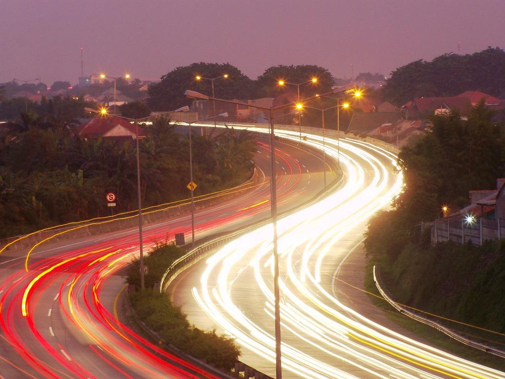
The city is served mainly by land transportation. Buses, minibuses and taxis are the main methods of transportation available. The public transportation mostly goes to Jakarta since many of the residents of South Tangerang commute to Jakarta on a daily basis. There are feeder buses for TransJakarta. The feeder buses goes from Bumi Serpong Damai and Bintaro Jaya to downtown Jakarta in Senayan.
Main road and highway in the city are:
Main road:
- Jl. Raya Serpong
- Jl. Pahlawan Seribu, BSD City
- Jl. Kapten Soebianto Djojohadjikusumo, BSD City
- Jl. Pelayangan, BSD City
- Jl. Ir. H. Juanda, Ciputat
- Jl. Ciater Raya
- Jl. Alam Sutera Boulevard
- Jl. Boulevard Bintaro Jaya
Highway:
- Jakarta-Serpong Toll Road (connecting Serpong and South Jakarta/JORR 1)
- Serpong-Cinere Toll Road (connecting Serpong and Cinere in Depok)
- Kunciran-Serpong Toll Road (connecting Kunciran in Tangerang City/Soekarno Hatta Airport and Serpong)
- Serpong-Balaraja Toll Road (in progress for section 1A) (connecting Serpong and Balaraja in Tangerang Regency)
The city is also served by commuter rail service KRL Commuterline for those commuters who work in Jakarta. There are five stations located in South Tangerang, namely Cisauk, Pondok Ranji, Rawa Buntu, Serpong and Sudimara. All stations serves the Tanah Abang – Rangkasbitung Line.
There are two toll roads servicing the city, namely Jakarta–Serpong Toll Road and Jakarta–Tangerang Toll Road. There are also several toll roads currently under planning. The plans are for a Serpong-Balaraja Toll Road which will continue the Jakarta-Serpong toll road, and Jakarta Outer Ring Road 2 which will be connecting the city to Soekarno–Hatta International Airport in the near future. Kunciran-Serpong Toll Road and Serpong-Cinere Toll Road are the latest new infrastructure built in the city.
Pondok Cabe Airport – which is used for military and civilian services – is the only airport located within the city boundaries. It is owned by PT Pertamina, the national oil company. The airport is also used for the maintenance base for Pelita Air Service, also owned by PT Pertamina.
Cycle rickshaws (becak) are still available in some areas in the city. Becak is the only method of transportation currently forbidden to operate in Jakarta as its slow speed has allegedly led to congestion in the traffic of Jakarta. However, since South Tangerang is located on the outskirts of Jakarta (instead of the city proper), it is allowed in the city.
In April 2015, Corridor-2 of Trans Anggrek Circle Line which is similar to TransJakarta has been launched to serve public from Pondok Cabe Terminal to Rawa Buntu Station of KRL Jabodetabek. It was free until end of 2015, but only operated between 06:00–09:00, 11:00-14:00 and 16:00–18:00 with notation time of serve will be added as needed. The other seven corridors will be applied gradually.[13]
Shopping
South Tangerang offers some shopping center in the area, such as:
- Living World Alam Sutera
- Bintaro Xchange Mall
- Plaza Bintaro Jaya
- BSD Plaza
- TerasKota Entertainment Center BSD
- Transpark Mall Bintaro
- LOTTE Mall Bintaro
- ITC BSD
- Mall WTC Matahari Serpong
- BSD Junction
- AEON Mall, BSD
- Paradise Walk Serpong
Education
Education in South Tangerang consists of the standard Elementary through High School facilities found in most of Indonesia, kindergartens are operated privately. Below are several notable schools in South Tangerang:
International Schools

- Jakarta Japanese School, (Bintaro Jaya)
- Global Jaya School, (Bintaro Jaya)
- German International School Jakarta (BSD City)
- Sinarmas World Academy (BSD City)
- British School Jakarta (Bintaro Jaya)
- BINUS Serpong, Cambridge International School (BSD City)
- Khalifa IMS Bintaro, Cambridge International School
- Mentari Intercultural School Bintaro
Private Schools
- SMK Musik Yayasan Musik Jakarta
- Santa Ursula BSD
- Santa Laurensia School (Alam Sutera)
- BPK Penabur Bintaro Jaya
- SMA Plus Pembangunan Jaya
- SMA Efata Serpong
- SMA Candle Tree
- SMA Islam Cikal Harapan BSD
- SMA Islam Sinar Cendekia
- SMA Stella Maris BSD
- SMA Islam Al Azhar BSD
- Saint John Catholic School BSD
- Sekolah Athalia Villa Melati Mas
- Kharisma Bangsa School
- Sekolah Harapan Bangsa, Modernhill Pondok Cabe
- Ora Et Labora BSD
- TK SD SMP Ora Et Labora Pamulang
- SMK Pustek
- SMA Yaspita
- Strada Villa Melati Mas
- Solideo BSD
- SMAK PENABUR Bintaro Jaya
- SD Islam At Taqwa
- MI As Salaamah Pamulang
- SMA Muhammadiyah 25 Pamulang
- SMA Muhammadiyah 8 Ciputat
- SD SMP SMA Katolik Ricci 2
- TK SD SMP SMA Katolik Bhakti Prima
- Sekolah Mater Dei Pamulang
Public Schools
- SMK Negeri 4 Tangerang Selatan
- SMAN 1 Tangerang Selatan
- SMAN 2 Tangerang Selatan
- SMAN 3 Tangerang Selatan
- SMAN 4 Tangerang Selatan
- SMAN 5 Tangerang Selatan
- SMAN 6 Tangerang Selatan
- SMAN 8 Tangerang Selatan
- SMAN 9 Tangerang Selatan
- SMAN 10 Tangerang Selatan
- SMAN 11 Tangerang Selatan
- SMAN 12 Tangerang Selatan
- MAN Insan Cendekia
Public universities
- Universitas Terbuka
- UIN Syarif Hidayatullah
Government-affiliated colleges
- Sekolah Tinggi Akutansi Negara
- Geophysics and Meteorology Academy (Akademi Meteorologi dan Geofisika)[14]
Private Universities
- Universitas Prasetiya Mulya[15]
- Sekolah Tinggi Internasional Konservatori Musik Indonesia (STIKMI)[16]
- Pamulang University (Universitas Pamulang)[17]
- Muhammadiyah Jakarta University (Universitas Muhammadiyah Jakarta)[18]
- BINUS ASO School of Engineering, Alam Sutera
- Indonesian Institute of Technology (Institut Teknologi Indonesia)[19]
- Universitas Pembangunan Jaya
See also
- Tangerang
- Tangerang Regency
- Jakarta metropolitan area
References
- Badan Pusat Statistik, Jakarta, 2022.
- "Hari Lahir Kota Tangerang Selatan Ditetapkan". 29 July 2010.
- Badan Pusat Statistik, Jakarta, 2022.
- "Kondisi Geografis dan Iklim".
- "Harga Tanah Terkini, Tangsel Paling Mahal". 27 February 2019.
- "Web Portal Tangerang Selatan". berita.tangerangselatankota.go.id. Retrieved 2019-05-29.
- Biro Pusat Statistik, Jakarta, 2011.
- Badan Pusat Statistik, Jakarta, 2021.
- Badan Pusat Statistik, Jakarta, 2022.
- Biro Pusat Statistik, Jakarta, 2011.
- Badan Pusat Statistik, Jakarta, 2021.
- "Climate: Tangerang Selatan". Climate-Data.org. Retrieved 12 November 2020.
- "Tangerang Selatan Uji Coba Lima Bus Gratis "Trans Anggrek Circle Line"". April 13, 2015.
- "Akademi Meteorologi dan Geofisika - AMG Jakarta". Archived from the original on 2012-04-20. Retrieved 2012-04-17.
- "About Us".
- http://www.stikmi.ac.id/
- http://www.unpam.ac.id/
- "Universitas Muhammadiyah Jakarta". Archived from the original on 2012-04-18. Retrieved 2012-04-17.
- http://iti.ac.id/
External links
- Sekolah dan Daycare Alam Sutera
- (in Indonesian) Official website
Regencies and cities of Banten | ||
|---|---|---|
Capital: Serang | ||
| Regencies | ||
| Cities | ||
See also: List of regencies and cities of Indonesia | ||
| |||||||||||||
Authority control | |
|---|---|
| General |
|
| National libraries | |
| Other |
|
На других языках
- [en] South Tangerang
[ru] Тангеранг-Селатан
Тангеранг-Селатан (индон. Tangerang Selatan, Южный Тангеранг) — город в индонезийской провинции Бантен на острове Ява. Население — 1 037 000 человек[1] (2010). Находится в 20 км западнее Джакарты и фактически является пригородом столицы Индонезии.Другой контент может иметь иную лицензию. Перед использованием материалов сайта WikiSort.org внимательно изучите правила лицензирования конкретных элементов наполнения сайта.
WikiSort.org - проект по пересортировке и дополнению контента Википедии