world.wikisort.org - Indonesia
Banjar (Sundanese: ᮘᮔ᮪ᮏᮁ), is a city located in the east of West Java, Indonesia, on the border between West Java and Central Java. This city is also known as Banjar Patroman or Pataruman.
Banjar | |
|---|---|
City | |
 Welcome sign | |
 Flag  Coat of arms | |
| Motto(s): Somahna Bagja di Buana (Its people are happy in this world) | |
 Location within West Java | |
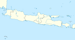
 Banjar City Location in Java and Indonesia  Banjar City Banjar City (Indonesia) | |
| Coordinates: 7°22′10″S 108°32′29″E | |
| Country | |
| Province | |
| Consolidated | March 2, 1992 |
| Government | |
| • Mayor | Ade Uu Sukaesih |
| • Vice Mayor | Nana Suryana |
| Area | |
| • Total | 131.97 km2 (50.95 sq mi) |
| Elevation | 97 m (318 ft) |
| Population (2020 census) | |
| • Total | 200,970 |
| • Density | 1,500/km2 (3,900/sq mi) |
| [1] | |
| Time zone | UTC+7 (Indonesia Western Time) |
| Area code | (+62) 265 |
| Website | banjarkota.go.id |
Administrative districts
The city of Banjar is divided into four administrative districts (Indonesian: kecamatan), tabulated below with their areas and their populations at the 2010 census[2] and the 2020 census.[3] The table also includes the location of the district administrative centres.
| Name | Area in km2 | Pop'n census 2010[2] | Pop'n census 2020[3] | Admin centre |
|---|---|---|---|---|
| Banjar | 26.24 | 52,449 | 59,530 | Balokang |
| Purwaharja | 18.27 | 20,527 | 24,200 | Puwaharja |
| Pataruman | 54.05 | 54,286 | 61,320 | Hegarsari |
| Langensari | 33.41 | 47,895 | 56,920 | Langensari |
| Total city | 131.97 | 175,157 | 200,970 |
Transportation
Rail transport
The currently non-operational train service between Banjar and Cijulang, with a length of 82.385 kilometers, gives a beautiful panorama along the track, including hills and a view of the sea from above Pangandaran. The track has several old stations with class I, II, and III categories, has three tunnels (one of them, the Wilhemina tunnel, with a length of 1,116 metres, is the longest tunnel in Indonesia); it also has the longest (Cikacepit) bridge in Indonesia, with a length of 1,250 metres and a height of 100 metres above the ground. The rail authority has announced their intention to re-activate the train service, and will restore Pangandaran and Cijulang stations while still keeping their original features.[4]
Climate
Banjar has a tropical rainforest climate (Af) with heavy to very heavy rainfall year-round.
| Climate data for Banjar | |||||||||||||
|---|---|---|---|---|---|---|---|---|---|---|---|---|---|
| Month | Jan | Feb | Mar | Apr | May | Jun | Jul | Aug | Sep | Oct | Nov | Dec | Year |
| Average high °C (°F) | 31.0 (87.8) |
31.2 (88.2) |
31.4 (88.5) |
31.5 (88.7) |
31.4 (88.5) |
30.8 (87.4) |
29.9 (85.8) |
30.1 (86.2) |
30.7 (87.3) |
31.4 (88.5) |
31.3 (88.3) |
31.2 (88.2) |
31.0 (87.8) |
| Daily mean °C (°F) | 27.2 (81.0) |
27.1 (80.8) |
27.3 (81.1) |
27.4 (81.3) |
27.4 (81.3) |
26.6 (79.9) |
26.0 (78.8) |
26.0 (78.8) |
26.5 (79.7) |
27.1 (80.8) |
27.3 (81.1) |
27.3 (81.1) |
26.9 (80.5) |
| Average low °C (°F) | 23.4 (74.1) |
23.1 (73.6) |
23.3 (73.9) |
23.4 (74.1) |
23.4 (74.1) |
22.5 (72.5) |
22.1 (71.8) |
21.9 (71.4) |
22.3 (72.1) |
22.9 (73.2) |
23.4 (74.1) |
23.4 (74.1) |
22.9 (73.3) |
| Average rainfall mm (inches) | 412 (16.2) |
353 (13.9) |
335 (13.2) |
267 (10.5) |
206 (8.1) |
118 (4.6) |
144 (5.7) |
104 (4.1) |
131 (5.2) |
204 (8.0) |
261 (10.3) |
343 (13.5) |
2,878 (113.3) |
| Source: Climate-Data.org[5] | |||||||||||||
References
- Badan Pusat Statistik, Jakarta, 2021.
- Biro Pusat Statistik, Jakarta, 2011.
- Badan Pusat Statistik 2021.
- "Terowongan Wilhelmina Terpanjang di Indonesia" (in Indonesian). July 7, 2013.
- "Climate: Banjar". Climate-Data.org. Retrieved 12 November 2020.
External links
- Witton, Patrick (2003). Indonesia. Melbourne: Lonely Planet. p. 193. ISBN 1-74059-154-2.
На других языках
[de] Banjar (Westjava)
Banjar ist eine unabhängige indonesische Stadt (Kota) in der Provinz Jawa Barat, im Westen der Insel Java. Die Stadt mit ihren über 200.000 Einwohnern (Stand 2021)[1] liegt 115 km südöstlich von der Provinzhauptstadt Bandung und 200 km westlich von Yogyakarta. Banjar gehörte bis zur Autonomie zum Kabupaten Ciamis. Die Stadt ist nicht zu verwechseln mit dem gleichnamigen Regierungsbezirk auf der Insel Borneo.- [en] Banjar, West Java
[ru] Банджар (город, Индонезия)
Банджар (индон. Banjar) — город в провинции Западная Ява, Индонезия. Территория города выделена в самостоятельную административную единицу — муниципалитет.Другой контент может иметь иную лицензию. Перед использованием материалов сайта WikiSort.org внимательно изучите правила лицензирования конкретных элементов наполнения сайта.
WikiSort.org - проект по пересортировке и дополнению контента Википедии