world.wikisort.org - Indonesia
Pasuruan (Dutch: Pasoeroean) is a city in East Java, Java, Indonesia. It had a population of 186,262 at the 2010 Census and 208,006 at the 2020 Census.[1]
Pasuruan | |
|---|---|
City | |
| City of Pasuruan | |
 Jami Al-Anwar Mosque at night | |
 Seal | |
| Motto: Sura Dira Satya Pati | |
 Location within East Java | |
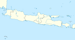
 Pasuruan Location in Java and Indonesia  Pasuruan Pasuruan (Indonesia) | |
| Coordinates: 7°38′26.24″S 112°54′23.32″E | |
| Country | Indonesia |
| Province | East Java |
| Government | |
| • Mayor | Saifullah Yusuf |
| • Vice Mayor | Adi Wibowo |
| Area | |
| • Total | 35.29 km2 (13.63 sq mi) |
| Population (2020 Census) | |
| • Total | 208,006 |
| • Density | 5,900/km2 (15,000/sq mi) |
| Time zone | UTC+7 (IWST) |
| Area code | (+62) 343 |
| Website | pasuruankota.go.id |
It is surrounded by, but administratively separate from, Pasuruan Regency. It is located around 65 kilometers southeast of Surabaya.


Administrative districts
Pasuruan is divided into four districts (kecamatan), tabulated below with areas and their population at the 2010 and 2020 Censuses.[2]
| Name | Area in km2 | Population Census 2010 | Population Census 2020 |
|---|---|---|---|
| Gadingrejo | 8.27 | 62,401 | 49,442 |
| Purworejo | 8.08 | 66,647 | 62,007 |
| Bungulkidul | 11.11 | 57,214 | 31,687 |
| Panggungrejo | 7.83 | (a) | 64,870 |
| Totals | 35.29 | 186,262 | 208,006 |
Note: (a) Panggungrejo District created since 2010 from parts of neighbouring districts; its population in 2010 is included with that of the districts from which it was formed.
Climate
Pasuruan has a tropical savanna climate (Aw) with little to no rainfall from May to November and heavy rainfall from December to April.
| Climate data for Pasuruan | |||||||||||||
|---|---|---|---|---|---|---|---|---|---|---|---|---|---|
| Month | Jan | Feb | Mar | Apr | May | Jun | Jul | Aug | Sep | Oct | Nov | Dec | Year |
| Average high °C (°F) | 32.3 (90.1) |
32.0 (89.6) |
32.0 (89.6) |
32.0 (89.6) |
31.9 (89.4) |
31.9 (89.4) |
31.8 (89.2) |
32.4 (90.3) |
32.8 (91.0) |
33.5 (92.3) |
33.3 (91.9) |
32.6 (90.7) |
32.4 (90.3) |
| Daily mean °C (°F) | 27.4 (81.3) |
27.3 (81.1) |
27.1 (80.8) |
27.0 (80.6) |
26.5 (79.7) |
25.9 (78.6) |
25.3 (77.5) |
25.8 (78.4) |
26.4 (79.5) |
27.2 (81.0) |
27.7 (81.9) |
27.3 (81.1) |
26.7 (80.1) |
| Average low °C (°F) | 22.5 (72.5) |
22.6 (72.7) |
22.3 (72.1) |
22.0 (71.6) |
21.1 (70.0) |
19.9 (67.8) |
18.9 (66.0) |
19.3 (66.7) |
20.0 (68.0) |
21.0 (69.8) |
22.1 (71.8) |
22.1 (71.8) |
21.2 (70.1) |
| Average rainfall mm (inches) | 239 (9.4) |
259 (10.2) |
202 (8.0) |
139 (5.5) |
92 (3.6) |
61 (2.4) |
19 (0.7) |
2 (0.1) |
9 (0.4) |
20 (0.8) |
81 (3.2) |
188 (7.4) |
1,311 (51.7) |
| Source: Climate-Data.org[3] | |||||||||||||
Public transport
Pasuruan located and connected by provincial main road between Surabaya―Banyuwangi. Pasuruan can be reached from Surabaya by bus or local commuter train Surabaya-Pasuruan, which took at least 2 hours. And also, can be reached from Malang by bus or car that took at least 1.3 hours. This town linked with other cities by Trans Java Freeway.
The city has an active railway station as a stop for intercity trains and local commuter from Surabaya Kota. To the west before Bangil railway station there's Kraton railway station which is inactive due to close range from Pasuruan. In the past, this city has local steam tram company named Pasoeroean Stoomtram Maatschappij served from 1896 to 1988 passenger transport as well as goods transport of agricultural products such as sugarcane, tea and tobacco.
Sister cities
 Sungai Petani, Malaysia
References
- Badan Pusat Statistik, Jakarta, 2021.
- Badan Pusat Statiustik, Jakarta, 2021.
- "Climate: Pasuruan". Climate-Data.org. Retrieved 15 November 2020.
External links
- http://www.accuweather.com/id/id/pasuruan/203183/daily-weather-forecast/203183?day=2
- https://www.meteoblue.com/en/weather/forecast/modelclimate/pasuruan_indonesia_1632033
- Pasuruan Info
На других языках
[de] Pasuruan
Pasuruan (Javanisch: ꦥꦱꦸꦫꦸꦃꦲꦤ꧀) ist eine indonesische Stadt (Kota) in der Provinz Jawa Timur, im Osten der Insel Java. Ende 2021 leben hier über 210.000 Menschen.[1] Die Stadt bildet als Kota eine eigene Verwaltungseinheit und gehört nicht zum gleichnamigen Regierungsbezirk.- [en] Pasuruan
[ru] Пасуруан
Пасуруан (индон. Pasuruan) — портовый город в Индонезии, расположенный на территории провинции Восточная Ява. Территория города выделена в самостоятельную административную единицу — муниципалитет.Другой контент может иметь иную лицензию. Перед использованием материалов сайта WikiSort.org внимательно изучите правила лицензирования конкретных элементов наполнения сайта.
WikiSort.org - проект по пересортировке и дополнению контента Википедии
