world.wikisort.org - India
Shimla is a district in the state of Himachal Pradesh in northern India. Its headquarters is the state capital of Shimla. Neighbouring districts are Mandi and Kullu in the north, Kinnaur in the east, Uttarakhand in the southeast, Solan to the southwest and Sirmaur in the south. The elevation of the district ranges from 987 metres (3,238 ft) to 4,500 metres (14,764 ft).
Shimla district | |
|---|---|
District of Himachal Pradesh | |
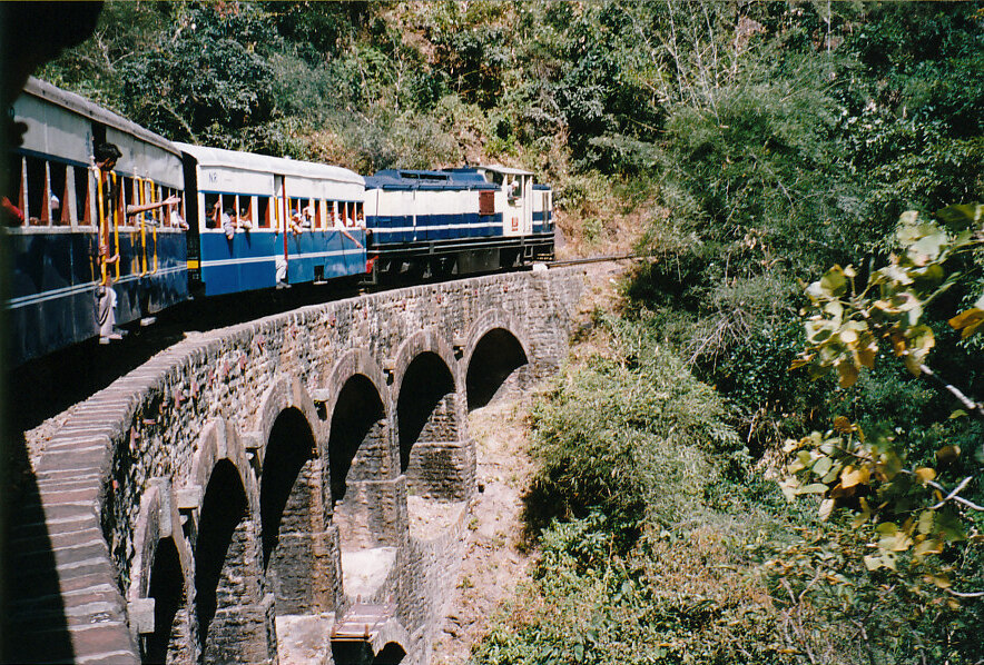
Shimla city, headquarter of Shimla district | |
| Nickname: The Queen of Hills | |
 Shimla district Location in Himachal Pradesh | |
| Country | |
| State | |
| Headquarters | Shimla |
| Government | |
| • Deputy Commissioner | Aditya Negi, IAS |
| • Superintendent of Police | Monika Bhutunguru, IPS |
| • Lok Sabha Constituencies | Shimla |
| • Vidhan. Sabha Constituencies |
|
| Area | |
| • Total | 5,131 km2 (1,981 sq mi) |
| Population (2011) | |
| • Total | 814,010 |
| • Rank | 3rd |
| • Density | 160/km2 (410/sq mi) |
| Languages | |
| • Official | Hindi |
| Demographics | |
| • Sex ratio | 916 |
| • Literacy | 84.55 |
| • Literacy: male | 90.73 |
| • Literacy: female | 77.80 |
| Time zone | UTC+5:30 (IST) |
| Area code | 91 177 xxxxxxx |
| ISO 3166 code | IN-HP |
| Largest city | Shimla |
| Climate | ETh (Köppen) |
| Precipitation | 1,520 millimetres (60 in) |
| Avg. annual temperature | 17 °C (63 °F) |
| Avg. summer temperature | 22 °C (72 °F) |
| Avg. winter temperature | 4 °C (39 °F) |
| Website | hpshimla |
As of 2011 it is the third most populous district of Himachal Pradesh (out of 12), after Kangra and Mandi.[1] It is the most urbanized district of Himachal Pradesh.
Administrative structure
| Sl. No. | Particulars | Description |
|---|---|---|
| 1 | Geographical Area | 5,131 km2 |
| 2 | Area (out of total area) of H.P. | 9.22% |
| 3 | Sub-Divisions | Total = 8
|
| 4 | Tehsils | Total = 17 |
| 5 | Sub-Tehsils | Total = 10 |
| 6 | Towns | (9) Rampur, Kumarsain, Narkanda, Theog, Seoni, Chaupal, Kotkhai, Jubbal, Rohru |
| 7 | C.D. Blocks | (10) Mashobra, Theog, Chaupal, Rampur, Narkanda, Jubbal, Rohru, Chirgaon, Basantpur, Nankhari |
| 8 | Legislative Assembly | (8)
|
| 9 | Villages | 2,914 |
| 10 | Inhabited | 2,520 |
| 11 | Uninhabited | 394 |
| 12 | Density | 159 person per km2 |
| 13 | Panchayts | 363 |
Access
By road
Shimla is connected by road to all the major towns. Distance between the major towns and Shimla:
- Kalka - 80 km
- Patiala - 172 km
- Chandigarh - 119 km
- Ambala - 166 km
- Delhi - 380 km
- Agra - 568 km
- Amritsar - 342 km
- Jammu (via Pathankot) - 482 km
- Srinagar - 787 km
- Jaipur - 629 km
- Dharmsala (via Mandi) - 290 km
- Dharamsala (via Hamirpur) - 235 km
- Dalhousie - 345 km
- Chamba - 401 km
- Kullu - 235 km
- Manali - 280 km
- Mandi - 153 km
- Palampur - 270 km
- Dehradoon - 275 km
- Rampur - 132 km
- Kumarsain - 80 km
- Narkanda - 60 km
- Rohru - 129 km
- Theog - 28 km
- Chaupal - 100 km
Climate
| Climate data for Shimla (1951–1980) | |||||||||||||
|---|---|---|---|---|---|---|---|---|---|---|---|---|---|
| Month | Jan | Feb | Mar | Apr | May | Jun | Jul | Aug | Sep | Oct | Nov | Dec | Year |
| Record high °C (°F) | 21.4 (70.5) |
22.6 (72.7) |
25.8 (78.4) |
29.6 (85.3) |
32.4 (90.3) |
31.5 (88.7) |
28.9 (84.0) |
27.8 (82.0) |
28.6 (83.5) |
25.6 (78.1) |
23.5 (74.3) |
20.5 (68.9) |
32.4 (90.3) |
| Average high °C (°F) | 8.9 (48.0) |
10.6 (51.1) |
14.8 (58.6) |
19.4 (66.9) |
22.9 (73.2) |
24.1 (75.4) |
21.0 (69.8) |
20.2 (68.4) |
20.1 (68.2) |
23.7 (74.7) |
15.1 (59.2) |
12.0 (53.6) |
17.3 (63.1) |
| Average low °C (°F) | 1.7 (35.1) |
3.0 (37.4) |
6.8 (44.2) |
11.1 (52.0) |
14.2 (57.6) |
15.6 (60.1) |
15.0 (59.0) |
14.8 (58.6) |
13.4 (56.1) |
10.7 (51.3) |
7.0 (44.6) |
4.3 (39.7) |
9.8 (49.6) |
| Record low °C (°F) | −10.6 (12.9) |
−8.5 (16.7) |
−6.1 (21.0) |
−1.3 (29.7) |
1.4 (34.5) |
7.8 (46.0) |
9.4 (48.9) |
10.6 (51.1) |
5.0 (41.0) |
0.2 (32.4) |
−1.1 (30.0) |
−12.2 (10.0) |
−12.2 (10.0) |
| Average precipitation mm (inches) | 54.6 (2.15) |
47.2 (1.86) |
59.4 (2.34) |
41.1 (1.62) |
56.4 (2.22) |
175.6 (6.91) |
376.5 (14.82) |
335.1 (13.19) |
190.2 (7.49) |
46.2 (1.82) |
13.8 (0.54) |
16.0 (0.63) |
1,424.8 (56.09) |
| Average rainy days | 4.7 | 4.1 | 5.2 | 3.6 | 4.6 | 10.3 | 18.3 | 18.1 | 9.9 | 2.9 | 1.3 | 1.8 | 84.8 |
| Source: India Meteorological Department (record high and low up to 2010)[2][3] | |||||||||||||
Demographics
| Year | Pop. | ±% p.a. |
|---|---|---|
| 1904 | 230,144 | — |
| 1906 | 223,701 | −1.41% |
| 1921 | 228,138 | +0.13% |
| 1931 | 238,280 | +0.44% |
| 1941 | 259,656 | +0.86% |
| 1951 | 286,111 | +0.97% |
| 1961 | 341,461 | +1.78% |
| 1971 | 419,844 | +2.09% |
| 1981 | 510,932 | +1.98% |
| 1991 | 617,404 | +1.91% |
| 2001 | 722,502 | +1.58% |
| 2011 | 814,010 | +1.20% |
| source:[4] | ||
According to the 2011 census the district had a population of 814,010,[6] This gives it a ranking of 483rd in India (out of a total of 640).[1] The district has a population density of 159 inhabitants per square kilometre (410/sq mi). Its population growth rate over the decade 2001-2011 was 12.67%. Shimla has a sex ratio of 915 females for every 1000 males, and a literacy rate of 83.64%.[6] It has the highest urban population of all districts in Himachal. The urban population forms 24.77% of the district.
Language
Statistics
As of Census of India 2001
- Population count - 813,384
- Males - 424,486
- Females - 388,898
- Sex ratio (females per 1000 males) - 916
- Growth (2001–2011) - 12.58%
- Rural - 555,269
- Urban - 167,233
- Scheduled Caste population - 188,787
- Percentage to total population - 26.13%
- Scheduled Tribe population - 4,112
- Percentage to total population - 0.57%
- Number of households - 1 54,693
- Household size (per household) - 5
Literacy and education levels
- Literates
- Persons - 619,427
- Males - 347,013
- Females - 272,414
- Literacy rate
- Persons - 84.55%
- Males - 90.73%
- Females - 77.80%
Education level attained
Total - 504,330
- Without level - 11,640
- Below primary - 97,060
- Primary - 114,805
- Middle - 78,995
- Matric/Higher Secondary/Diploma - 153,284
- Graduate and above - 48,464
Age groups
- 0 – 4 years - 39,305
- 5 – 14 years - 189,801
- 15 – 59 years - 488,784
- 60 years and above (incl. A.N.S.) - 57,612
Major towns
- Shimla (M Corp.) - 142,555
- Rampur (M Cl) - 9,653
- Rohru (M CI) - 8,205
- Chaupal (NP) - 6786
- Kumarsain (NP) - 5461
- Sunni (NP) - 3934
- Jubbal (NP) - 3856
Total inhabited villages - 2,520
Type of house (% of households occupying)
- Permanent - 83.2
- Semi-permanent - 14.6
- Temporary - 2.2
Politics
| No. | Constituency | Member | Party | Remarks | Reference | |
|---|---|---|---|---|---|---|
| 60 | Chopal | Balbir Singh Verma | Bhartiya Janata Party | |||
| 61 | Theog | Rakesh Singha | Communist Party of India (Marxist) | [8] | ||
| 62 | Kasumpati | Anirudh Singh | Indian National Congress | |||
| 63 | Shimla | Suresh Bhardwaj | Bhartiya Janata Party | Urban Development Minister | ||
| 64 | Shimla Rural | Vikramaditya Singh | Indian National Congress | |||
| 65 | Jubbal-Kotkhai | Narinder Bragta‡ | Bhartiya Janata Party | Member until June 2021 | [9][10] | |
| Rohit Thakur | Indian National Congress | Member from 30.10.2021 | [11][12] | |||
| 66 | Rampur (SC) | Nand Lal | Indian National Congress | |||
| 67 | Rohru (SC) | Mohan Lal Brakta | Indian National Congress | |||
See also
References
- "District Census 2011". Census2011.co.in. 2011. Retrieved 30 September 2011.
- "Shimla Climatological Table Period: 1951–1980". India Meteorological Department. Archived from the original on 14 April 2015. Retrieved 10 April 2015.
- "Ever recorded Maximum and minimum temperatures up to 2010" (PDF). India Meteorological Department. Archived from the original (PDF) on 16 March 2014. Retrieved 10 April 2015.
- Decadal Variation In Population Since 1901
- "Shimla district Population". Census India. Retrieved 11 July 2021.
- http://www.censusindia.gov.in/2011census/dchb/0211_PART_B_DCHB_SHIMLA.pdf pp. 22–23
- C-16 Population By Mother Tongue – Himachal Pradesh (Report). Office of the Registrar General & Census Commissioner, India. Retrieved 6 October 2019.
- "Rakesh Singha". Himachal Pradesh 13th Legislative Assembly (Vidhan Sabha). Archived from the original on 28 November 2021. Retrieved 28 November 2021.
- "Narinder Bragta". Himachal Pradesh 13th Legislative Assembly (Vidhan Sabha). Archived from the original on 22 July 2019.
- "Former Himachal minister, BJP leader Narendra Bragta passes away at PGI". Hindustan Times. 5 June 2021. Archived from the original on 7 June 2021. Retrieved 28 November 2021.
- "Rohit Thakur". Himachal Pradesh 13th Legislative Assembly (Vidhan Sabha). Archived from the original on 16 November 2021.
- "Himachal Pradesh: Rohit Thakur beats BJP rebel to secure Jubbal-Kotkhai". The Indian Express. 3 November 2021. Archived from the original on 5 November 2021. Retrieved 28 November 2021.
External links
- Official website of the Shimla district
- District Profile
- Cultural & tourism heritage of the district
Places adjacent to Shimla district | ||||||||||||||||
|---|---|---|---|---|---|---|---|---|---|---|---|---|---|---|---|---|
| ||||||||||||||||
Capital: Shimla | |||||||
| Topics |
| ||||||
| History |
| ||||||
| Culture |
| ||||||
| Jurisdiction |
| ||||||
| Districts and divisions |
| ||||||
| Major cities | |||||||
| Economy |
| ||||||
| Geography |
| ||||||
| Images and Others |
| ||||||
Geography of Himachal Pradesh | ||
|---|---|---|
| Lakes |  | |
| Rivers | ||
| Districts | ||
| Other |
| |
Capital: Shimla | |||||||
| Topics |
| ||||||
| History |
| ||||||
| Culture |
| ||||||
| Jurisdiction |
| ||||||
| Districts and divisions |
| ||||||
| Major cities | |||||||
| Economy |
| ||||||
| Geography |
| ||||||
| Images and Others |
| ||||||
Authority control | |
|---|---|
| General |
|
| National libraries | |
На других языках
[de] Shimla (Distrikt)
Der Distrikt Shimla (Hindi: ज़िला शिमला) ist ein Distrikt des indischen Bundesstaats Himachal Pradesh. Sitz der Distriktverwaltung ist Shimla – gleichzeitig Hauptstadt von Himachal Pradesh.- [en] Shimla district
[ru] Шимла (округ)
Шимла (англ. Shimla) — округ в индийском штате Химачал-Прадеш. Образован в 1972 году в результате реорганизации округов штата. Административный центр и крупнейший город округа — Шимла. На севере граничит с округами Манди и Куллу, на востоке — с округом Киннаур, на юге — со штатом Уттаракханд и на западе — с округом Сирмаур.Другой контент может иметь иную лицензию. Перед использованием материалов сайта WikiSort.org внимательно изучите правила лицензирования конкретных элементов наполнения сайта.
WikiSort.org - проект по пересортировке и дополнению контента Википедии