world.wikisort.org - Germany
Pankow (German: [ˈpaŋkoː] (![]() listen))[2] is a locality (Ortsteil) of Berlin in the district (Bezirk) of Pankow. Until 2001 it was an autonomous district with the localities of Karow, Niederschönhausen, Wilhelmsruh, Rosenthal, Blankenfelde, Buch and Französisch Buchholz.
listen))[2] is a locality (Ortsteil) of Berlin in the district (Bezirk) of Pankow. Until 2001 it was an autonomous district with the localities of Karow, Niederschönhausen, Wilhelmsruh, Rosenthal, Blankenfelde, Buch and Französisch Buchholz.
Pankow | |
|---|---|
Quarter of Berlin | |
 Gymnasium Pankow | |
 Coat of arms | |
Location of Pankow in Pankow district and Berlin  | |
 Pankow  Pankow | |
| Coordinates: 52°34′09″N 13°24′12″E | |
| Country | Germany |
| State | Berlin |
| City | Berlin |
| Borough | Pankow |
| Founded | 1230 |
| Area | |
| • Total | 5.66 km2 (2.19 sq mi) |
| Elevation | 52 m (171 ft) |
| Population (2020-12-31)[1] | |
| • Total | 65,375 |
| • Density | 12,000/km2 (30,000/sq mi) |
| Time zone | UTC+01:00 (CET) |
| • Summer (DST) | UTC+02:00 (CEST) |
| Postal codes | (nr. 0307) 13187, 13189 |
| Vehicle registration | B |
History
The village of Pankow is named after the small Panke river, a tributary of the Spree. The settlement was first mentioned in a 1311 deed by the Margraves of Brandenburg, though the "Four Evangelists" fieldstone church had already been erected about 1230. In 1691 Elector Frederick III acquired Schönhausen Palace, in neighboring Niederschönhausen, from the heirs of General Joachim Ernst von Grumbkow, which promoted the development of the Pankow village.
As Pankow grew, due to industrialization, in the 19th century, it became a suburb – and popular day-trip destination – of Berlin. It was finally incorporated into the city by the Greater Berlin Act of 1920.
In the East German period, from 1949 to 1990, Pankow, together with Niederschönhausen, was a prominent quarter of East Berlin. From 1949 to 1960 Schönhausen Palace was the presidential residency of East Germany, and throughout the period many embassies were located in the vicinity.[3]
Geography
Pankow is situated in the south-western side of its district. It borders the localities of Niederschönhausen, Französisch Buchholz, Karow, Heinersdorf, Weissensee, Prenzlauer Berg and Gesundbrunnen. Between 1961 and 1990, the Berlin Wall passed through Pankow (in East Berlin) and Gesundbrunnen (in West Berlin).
Transportation
The locality is served by the Berliner S-Bahn lines S1, S2, S25, S85; by the U-Bahn line U2, and by several lines of tramway.
Photogallery
 Pankow Church
 Gothic church of St.George


 Former malthouse
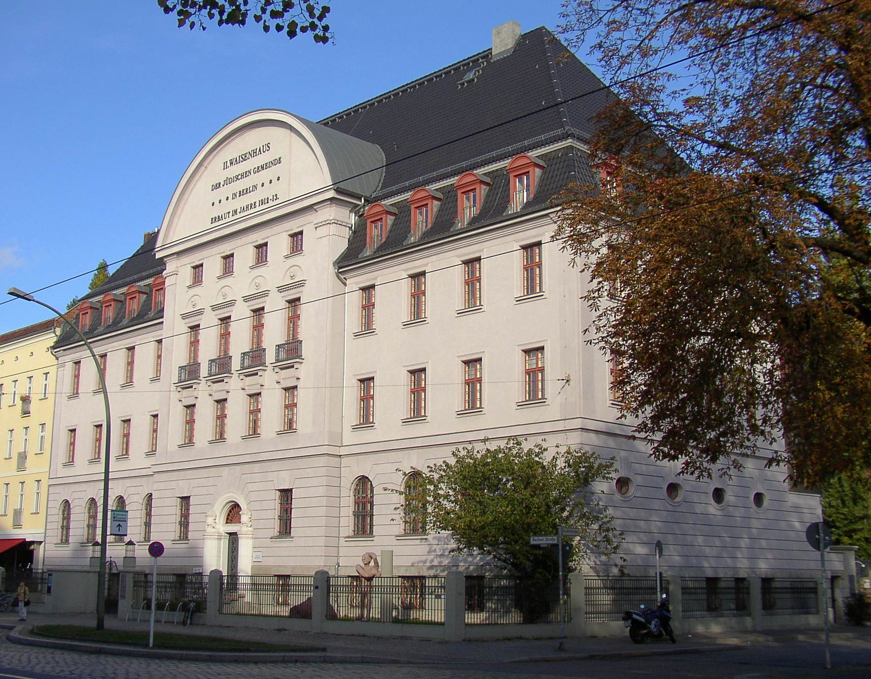
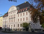 Former Jewish orphanage
 The canal of Blankenburg


See also
- Schönhausen Palace
- Berlin-Pankow railway station
References
- "Einwohnerinnen und Einwohner im Land Berlin am 31. Dezember 2020" (PDF). Amt für Statistik Berlin-Brandenburg. February 2021.
- Duden Aussprachewörterbuch (in German) (6 ed.). Mannheim: Bibliographisches Institut & F.A. Brockhaus AG. 2006. ISBN 3-411-04066-1.
- (in German) "Die Geschichte Pankows [The history of Pankow]". Bezirksamt Pankow. Berlin.de. Retrieved 18 September 2016.
External links
![]() Media related to Berlin-Pankow at Wikimedia Commons
Media related to Berlin-Pankow at Wikimedia Commons
Boroughs and neighborhoods of Berlin | |
|---|---|
| |
На других языках
- [en] Pankow (locality)
[ru] Панков (район Берлина)
Па́нков (нем. Pankow [ˈpaŋkoː]) — одноимённый район Берлина в северо-восточном административном округе Панков. Район Панков внутри своего округа граничит с другими районами: Нидершёнхаузен, Францёзиш-Буххольц, Бланкенбург, Хайнерсдорф, Вайсензе, Пренцлауэр-Берг, а также имеет границу с административным округом Митте.Другой контент может иметь иную лицензию. Перед использованием материалов сайта WikiSort.org внимательно изучите правила лицензирования конкретных элементов наполнения сайта.
WikiSort.org - проект по пересортировке и дополнению контента Википедии