world.wikisort.org - Germany
Mitte (German pronunciation: [ˈmɪtə] (![]() listen)) (German for "middle" or "center") is a central locality (Ortsteil) of Berlin in the eponymous district (Bezirk) of Mitte. Until 2001, it was itself an autonomous district.
listen)) (German for "middle" or "center") is a central locality (Ortsteil) of Berlin in the eponymous district (Bezirk) of Mitte. Until 2001, it was itself an autonomous district.
Mitte | |
|---|---|
Quarter of Berlin | |
 Panoramic view | |
 Coat of arms | |
Location of Mitte in Mitte district and Berlin  | |
 Mitte  Mitte | |
| Coordinates: 52°31′10″N 13°24′24″E | |
| Country | Germany |
| State | Berlin |
| City | Berlin |
| Borough | Mitte |
| Founded | 1920 |
| Subdivisions | 13 zones |
| Area | |
| • Total | 10.7 km2 (4.1 sq mi) |
| Elevation | 52 m (171 ft) |
| Population (2020-12-31)[1] | |
| • Total | 102,338 |
| • Density | 9,600/km2 (25,000/sq mi) |
| Time zone | UTC+01:00 (CET) |
| • Summer (DST) | UTC+02:00 (CEST) |
| Postal codes | (nr. 0101) 10115, 10117, 10119, 10178, 10179, 10435 |
| Vehicle registration | B |


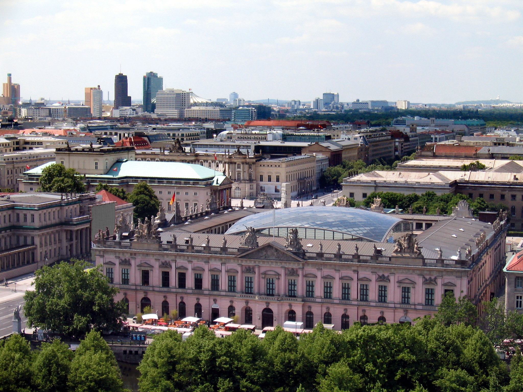
Mitte proper comprises the historic center of Alt-Berlin centered on the churches of St. Nicholas and St. Mary, the Museum Island, the city hall Rotes Rathaus, the city administrative building Altes Stadthaus, the Fernsehturm, Brandenburg Gate at the end of the central boulevard Unter den Linden and other tourist attractions. For these reasons, Mitte is considered the "heart" of Berlin.
History
Mitte comprises the historic center of Berlin (Altberlin and Cölln). Its history thus corresponds to the history of the entire city until the early 20th century, and with the Greater Berlin Act in 1920 it became the first district of the city. It was among the areas of the city most heavily damaged in World War II.
Following a territorial redeployment by the Soviet Union and the United Kingdom that reshaped the borders of West Berlin's British Sector in August 1945, the western part of Staaken became in effect as of 1 February 1951 an exclave of Mitte, then still a borough of East Berlin. This ended on 1 January 1961, when western Staaken was incorporated into then East German Falkensee, which had already been under its de facto administration since 1 June 1952.
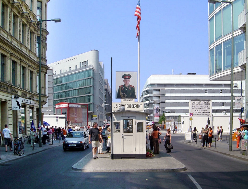
Between 1961 and 1990, Mitte, one of the most important boroughs of East Berlin but close to all three western sectors of the city, was almost surrounded by the Berlin Wall. One of the most important border crossings was Checkpoint Charlie, near Kreuzberg.[2]
Geography
Position
Situated in central Berlin and mostly in its old town, it is traversed by the river Spree. It borders the localities of Tiergarten, Moabit, Wedding, Gesundbrunnen, Prenzlauer Berg (in Pankow district), Friedrichshain, and Kreuzberg (both in Friedrichshain-Kreuzberg district).
Subdivision
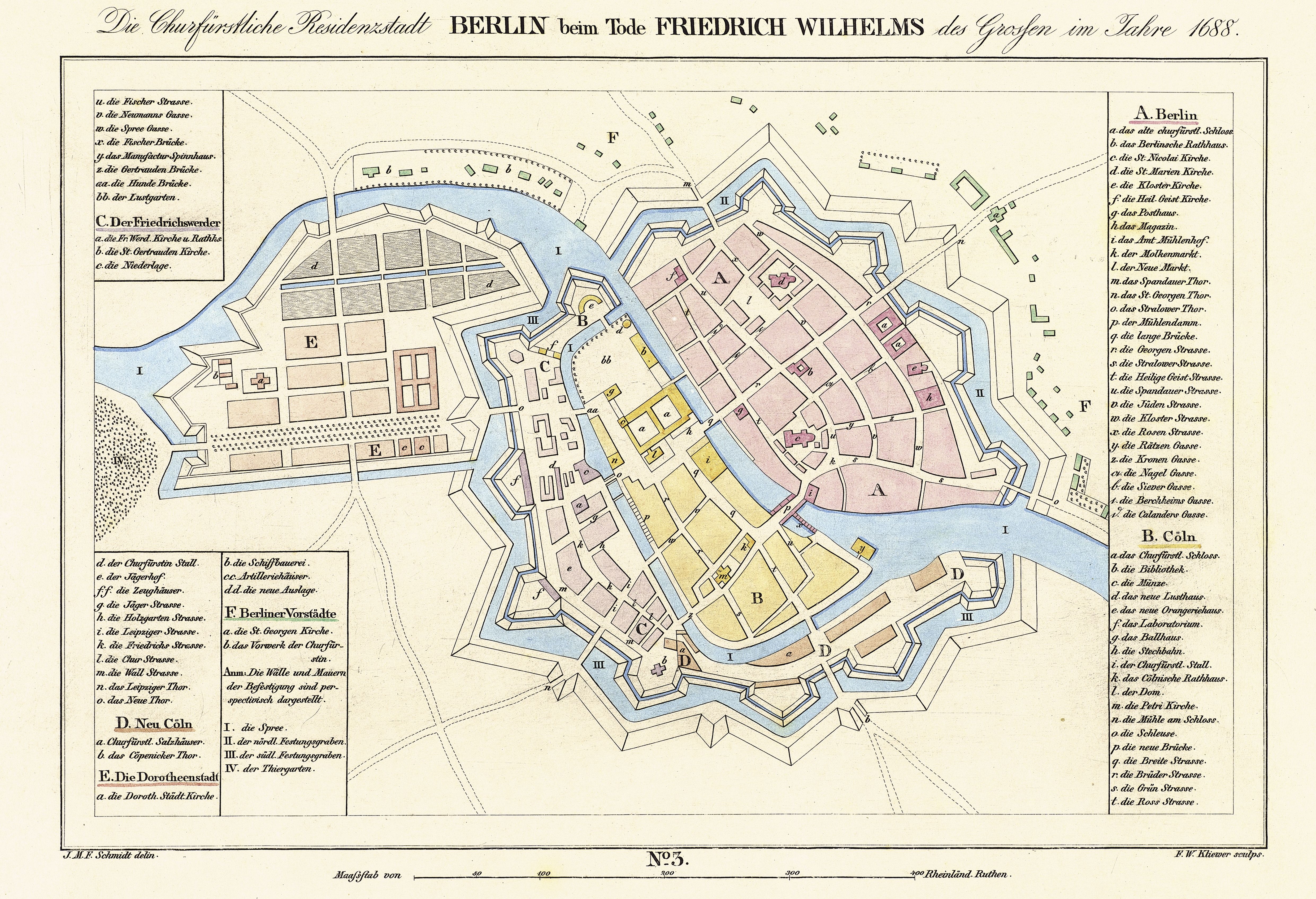
Mitte is subdivided into 13 zones or neighborhoods (Stadtviertel) (the numbers refer to the map above right):
- Cölln (1)
- Museum Island (1a)
- Fisher Island (1b)
- Alt-Berlin (2)
- Nikolaiviertel (2a)
- Friedrichswerder (3)
- Neukölln am Wasser (4)
- Dorotheenstadt (5)
- Friedrichstadt (6)
- Luisenstadt (7)
- Stralauer Vorstadt (8)
- Alexanderplatz (9)
- Spandauer Vorstadt (10)
- Scheunenviertel (10a)
- Friedrich-Wilhelm-Stadt (11)
- Oranienburger Vorstadt (12)
- Rosenthaler Vorstadt (13)
Sister cities
 Higashiōsaka, Japan
 Holon, Israel
Main sights
Buildings and structures
- Alte Nationalgalerie
- Altes Museum
- Altes Stadthaus
- Berlin Cathedral
- Berlin Palace with the Humboldt Forum
- Berlin State Opera
- Berliner Ensemble
- Brandenburg Gate
- Bode Museum
- Bundesrat of Germany
- Checkpoint Charlie
- Deutscher Dom
- Fernsehturm Berlin
- Französischer Dom
- Friedrichstadt-Palast
- Friedrichswerder Church
- Humboldt University
- James Simon Gallery
- Kino Babylon
- Konzerthaus Berlin
- Kunsthaus Tacheles
- Marienkirche
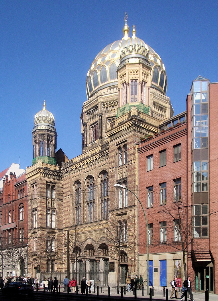
- Neue Synagoge
- Neues Museum
- Nikolaikirche
- Palast der Republik
- Pergamon Museum
- Reich Air Ministry
- Rotes Rathaus
- St. Hedwig's Cathedral
- Sophienkirche
- Staatsratsgebäude
- Stadtschloß
Places, squares and streets
- Alexanderplatz
- Bernauer Straße
- Friedrichstraße
- Gendarmenmarkt
- Karl-Marx-Allee
- Leipziger Straße
- Lustgarten
- Marx-Engels-Forum
- Molkenmarkt
- Museum Island
- Nikolaiviertel
- Oranienburger Straße
- Pariser Platz
- Potsdamer Platz
- Schloßplatz
- Unter den Linden
Photogallery
 Brandenburg Gate
 Fernsehturm
 Rotes Rathaus
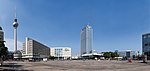 Alexanderplatz
 Unter den Linden
 Humboldt University of Berlin
 Museum für Naturkunde
 Potsdamer Platz
 Pergamon Museum
 Berlin Cathedral and Karl-Liebknecht-Straße
 Inside Berlin State Opera
 Nikolaiviertel
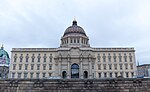 Berlin Palace with the Humboldt Forum
 Museum Island
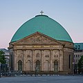 St. Hedwig's Cathedral
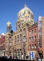 Neue Synagoge
 Gendarmenmarkt with Französischer Dom and Konzerthaus
 Deutscher Dom
 Kunsthaus Tacheles
 Checkpoint Charlie on Friedrichstrasse
 Sophie-Gips-Höfe


Transportation

Mitte is served by S-Bahn lines S5, S7, S75, S9 (both on Berlin Stadtbahn); S1, S2, S25, and U-Bahn lines U2, U5, U6 and U8, as well as numerous tram and bus lines.
See also
- Berlin Alexanderplatz railway station
- Berlin Friedrichstrasse railway station
- Berlin Potsdamer Platz railway station
References
- "Einwohnerinnen und Einwohner im Land Berlin am 31. Dezember 2020" (PDF). Amt für Statistik Berlin-Brandenburg. February 2021.
- (in German) Historical infos about Mitte
External links
![]() Media related to Berlin-Mitte at Wikimedia Commons
Media related to Berlin-Mitte at Wikimedia Commons
|  | ||
Boroughs and neighborhoods of Berlin | |
|---|---|
| |
Boroughs of Berlin (1920–2000) | ||
|---|---|---|
| West boroughs (1920–2000) |  | |
| East boroughs (1920–2000) |
| |
Authority control | |
|---|---|
| General |
|
| National libraries | |
На других языках
[de] Berlin-Mitte
Mitte ist ein Berliner Ortsteil des gleichnamigen Bezirks und umfasst einen Teil der historischen Stadtteile. In ihm liegt die historische Mitte mit den ehemaligen Stadtkernen von Alt-Berlin und Alt-Kölln, dem Brandenburger Tor, der Straße Unter den Linden, der Humboldt-Universität zu Berlin, der Museumsinsel und dem Berliner Fernsehturm. In Mitte befinden sich zahlreiche Einrichtungen des Bundes, des Senates von Berlin im Roten Rathaus und das Abgeordnetenhaus von Berlin im Preußischen Landtag sowie zahlreiche Botschaften.- [en] Mitte (locality)
[ru] Митте (район Берлина)
Берли́н-Ми́тте (нем. Berlin-Mitte — буквально: «середина», «центр») — район в составе одноимённого административного округа Берлина. Полностью совпадает с округом, существовавшим в 1920—2000 годы.Другой контент может иметь иную лицензию. Перед использованием материалов сайта WikiSort.org внимательно изучите правила лицензирования конкретных элементов наполнения сайта.
WikiSort.org - проект по пересортировке и дополнению контента Википедии