world.wikisort.org - France
Saint-Aventin is a commune in the Haute-Garonne department in southwestern France.
Saint-Aventin | |
|---|---|
Commune | |
 A general view of Saint-Aventin | |
 Coat of arms | |
Location of Saint-Aventin  | |
 Saint-Aventin  Saint-Aventin | |
| Coordinates: 42°48′26″N 0°32′49″E | |
| Country | France |
| Region | Occitania |
| Department | Haute-Garonne |
| Arrondissement | Saint-Gaudens |
| Canton | Bagnères-de-Luchon |
| Government | |
| • Mayor (2020–2026) | Jean-Claude Tiné[1] |
| Area 1 | 17.4 km2 (6.7 sq mi) |
| Population | 64 |
| • Density | 3.7/km2 (9.5/sq mi) |
| Time zone | UTC+01:00 (CET) |
| • Summer (DST) | UTC+02:00 (CEST) |
| INSEE/Postal code | 31470 /31110 |
| Elevation | 679–2,676 m (2,228–8,780 ft) (avg. 929 m or 3,048 ft) |
| 1 French Land Register data, which excludes lakes, ponds, glaciers > 1 km2 (0.386 sq mi or 247 acres) and river estuaries. | |
The commune of Saint-Aventin is located in the heart of the Pyrenees, and extends from the Larboust Valley in the north to the Spanish border in the South. The highest point is the Sacroux peek at 2,676 metres. The municipal territory hosts the Luchon-Superbagnères winter sports facilities, accessible only from Bagnères-de-Luchon by road or Cable car. The village of Saint-Aventin, is located in the Larboust Valley, 52 km south of Saint-Gaudens and 5km west of Bagnères-de-Luchon. The population density is 5.3per/km²
Population
|
| ||||||||||||||||||||||||||||||||||||||||||||||||||||||||||||||||||||||||||||||||||||||||||||||||||||||
| Source: EHESS[3] | |||||||||||||||||||||||||||||||||||||||||||||||||||||||||||||||||||||||||||||||||||||||||||||||||||||||
Land Marks
- Luchon-Superbagnères
- La chapelle de Saint-Aventin.
- La vallée du Lis (ou du Lys).
Gallery
 church of Saint-Aventin.
 Deux autels au dieu Abellio encadrant le cippe funéraire d'un couple.
 Le portail de l'église.
 La chapelle de Saint-Aventin.
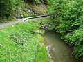 L'One au pont de Miey.
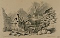 Saint-Aventin near 1840, by Eugène de Malbos.
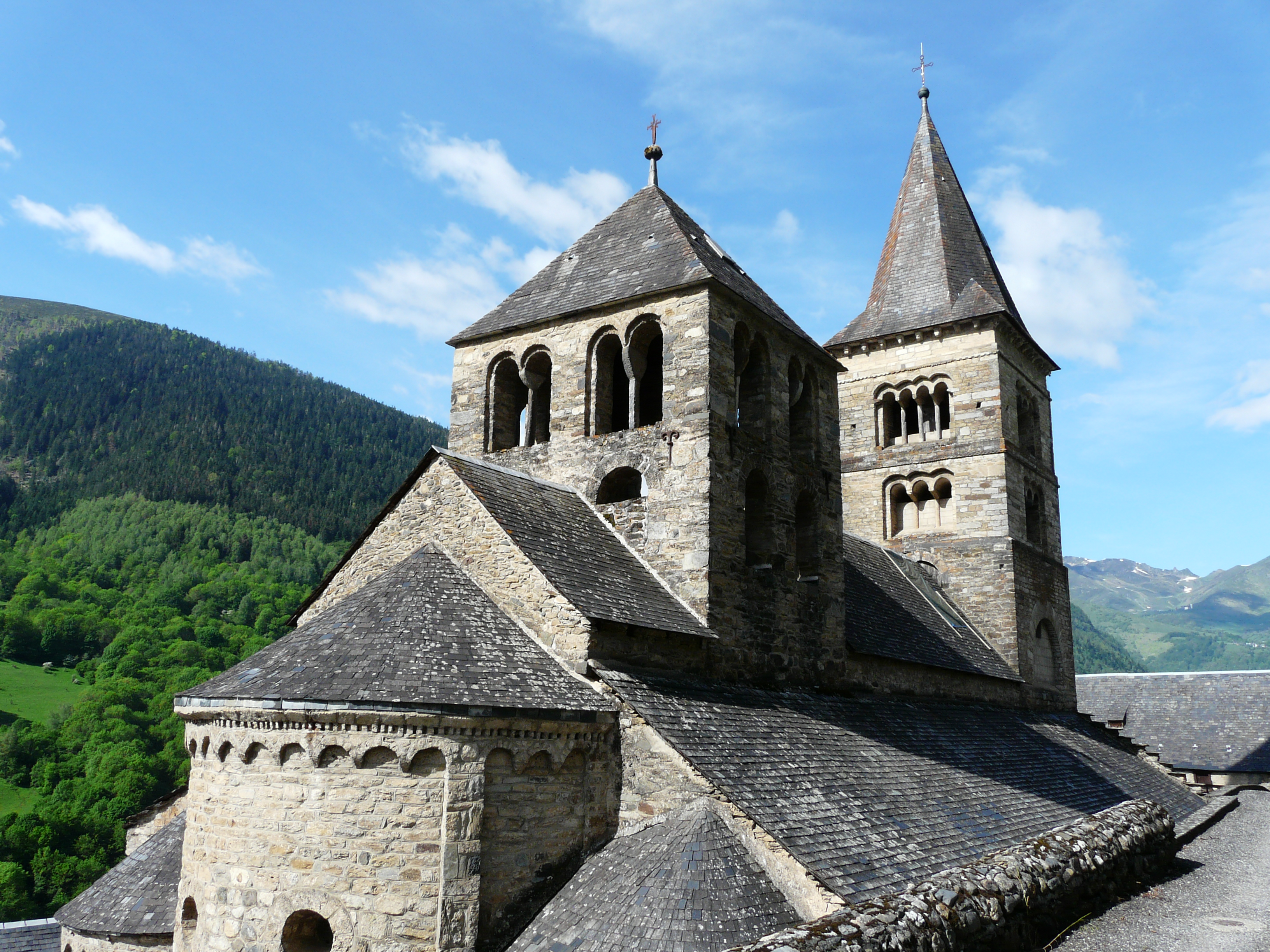


Saint Aventin Church
The Romanesque Church Saint-Aventin dates from the 11th or 12th century, has two bell towers, a porch decorated with sculptures, and capitals showing scenes of the life and martyrdom of saint Aventin.
The exterior walls have incorporated stone from previous buildings that reuse of stelae and pagan altars dedicated to Pyrenean gods, including Abellio and Aherbelst. Inside the church are monumental paintings, a baptismal font and a wrought iron altar. The Church has been classified historical monument since 1840.[4]
See also
References
- "Répertoire national des élus: les maires". data.gouv.fr, Plateforme ouverte des données publiques françaises (in French). 9 August 2021.
- "Populations légales 2019". The National Institute of Statistics and Economic Studies. 29 December 2021.
- Des villages de Cassini aux communes d'aujourd'hui: Commune data sheet Saint-Aventin, EHESS. (in French)
- Base Mérimée: PA00094445, Ministère français de la Culture. (in French)
This Haute-Garonne geographical article is a stub. You can help Wikipedia by expanding it. |
На других языках
[de] Saint-Aventin
Saint-Aventin ist eine französische Gemeinde mit 64 Einwohnern (Stand: 1. Januar 2019) im Département Haute-Garonne in der Region Okzitanien. Sie gehört zum Arrondissement Saint-Gaudens und zum Kanton Bagnères-de-Luchon.- [en] Saint-Aventin
[es] Saint-Aventin
Saint-Aventin es una población y comuna francesa, en la región de Mediodía-Pirineos, departamento de Alto Garona, en el distrito de Saint-Gaudens y cantón de Bagnères-de-Luchon.[ru] Сент-Авантен
Сент-Аванте́н (фр. Saint-Aventin, окс. Sent Avantin) — коммуна во Франции, находится в регионе Юг — Пиренеи. Департамент — Верхняя Гаронна. Входит в состав кантона Баньер-де-Люшон. Округ коммуны — Сен-Годенс.Другой контент может иметь иную лицензию. Перед использованием материалов сайта WikiSort.org внимательно изучите правила лицензирования конкретных элементов наполнения сайта.
WikiSort.org - проект по пересортировке и дополнению контента Википедии