world.wikisort.org - France
Saint-André (French pronunciation: [sɛ̃t‿ɑ̃.dʁe]) is the fifth-largest commune in the French overseas department of Réunion. It is located on the northeast part of the island of Réunion. The small lake Étang de Bois Rouge is located in the commune.
Saint-André | |
|---|---|
Commune | |
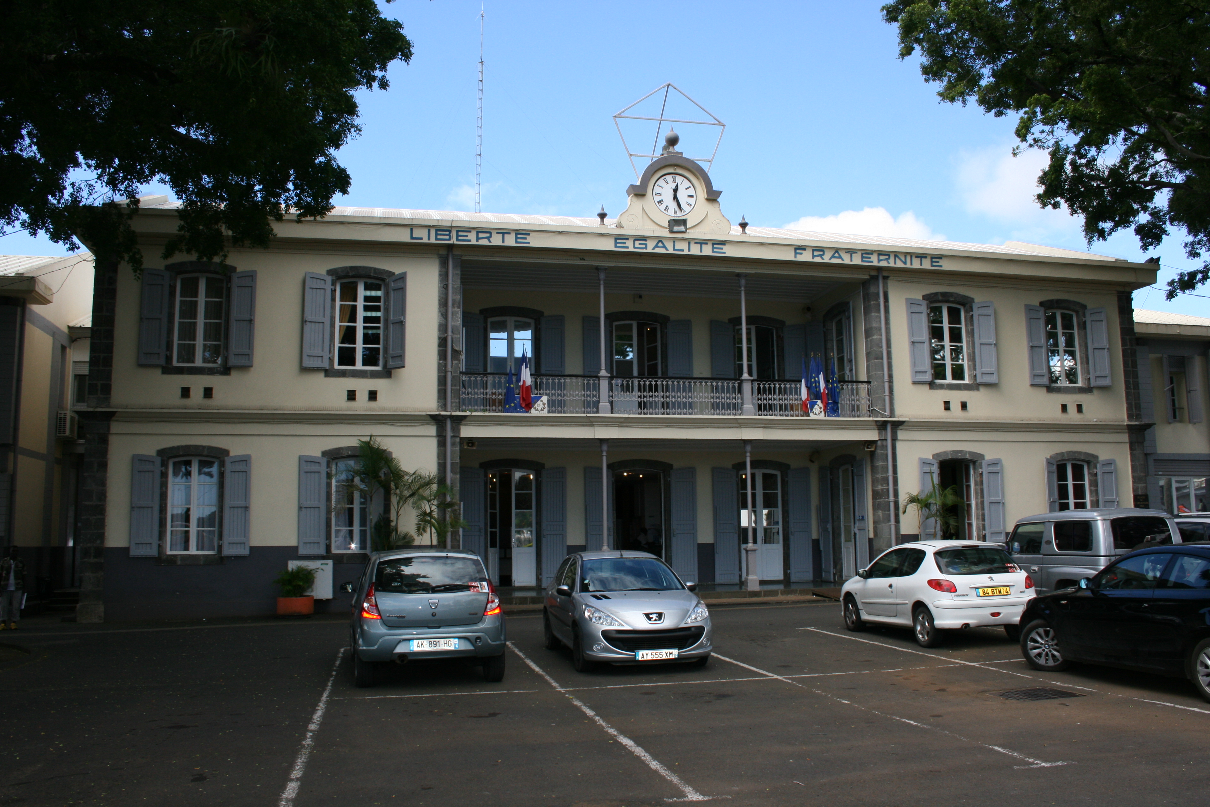 Saint-André town hall | |
 | |
Location of Saint-André  | |
| Coordinates: 20°57′38″S 55°39′02″E | |
| Country | France |
| Overseas region and department | Réunion |
| Arrondissement | Saint-Benoît |
| Canton | Saint-André-1, 2 and 3 |
| Intercommunality | Réunion Est |
| Government | |
| • Mayor (2020–2026) | Joé Bedier[1] |
| Area 1 | 53.07 km2 (20.49 sq mi) |
| Population | 56,902 |
| • Density | 1,100/km2 (2,800/sq mi) |
| Time zone | UTC+04:00 |
| INSEE/Postal code | 97409 /97440 |
| Elevation | 0–920 m (0–3,018 ft) (avg. 90 m or 300 ft) |
| 1 French Land Register data, which excludes lakes, ponds, glaciers > 1 km2 (0.386 sq mi or 247 acres) and river estuaries. | |
This area between the Saint-Jean and the Mât rivers was populated from the middle of the 17th century. Indeed, the first exiles were confined to Bourbon in 1646 by Mr. Promis, governor of the French Comptoir of Fort-Dauphin, to curb their mutinous ardor. Disembarked from the Saint-Laurent, they were settled in the Quartier des Français, on the banks of the Saint-Jean River. The region of Saint-André has historically seen the landing of the first French.[3]
Geography
Climate
Saint-André has a tropical monsoon climate (Köppen climate classification Am). The average annual temperature in Saint-André is 24.6 °C (76.3 °F). The average annual rainfall is 2,503.8 mm (98.57 in) with March as the wettest month. The temperatures are highest on average in February, at around 27.4 °C (81.3 °F), and lowest in July, at around 21.8 °C (71.2 °F). The highest temperature ever recorded in Saint-André was 34.0 °C (93.2 °F) on 18 March 2019; the coldest temperature ever recorded was 13.3 °C (55.9 °F) on 3 July 2005.
| Climate data for Saint-André (1991−2020 normals, extremes 2004−present) | |||||||||||||
|---|---|---|---|---|---|---|---|---|---|---|---|---|---|
| Month | Jan | Feb | Mar | Apr | May | Jun | Jul | Aug | Sep | Oct | Nov | Dec | Year |
| Record high °C (°F) | 33.3 (91.9) |
33.5 (92.3) |
34.0 (93.2) |
32.5 (90.5) |
31.2 (88.2) |
29.6 (85.3) |
30.3 (86.5) |
28.2 (82.8) |
28.9 (84.0) |
30.1 (86.2) |
32.0 (89.6) |
33.3 (91.9) |
34.0 (93.2) |
| Average high °C (°F) | 30.9 (87.6) |
31.0 (87.8) |
30.6 (87.1) |
29.8 (85.6) |
28.2 (82.8) |
26.5 (79.7) |
25.3 (77.5) |
25.5 (77.9) |
26.2 (79.2) |
27.4 (81.3) |
28.9 (84.0) |
30.4 (86.7) |
28.4 (83.1) |
| Daily mean °C (°F) | 27.1 (80.8) |
27.4 (81.3) |
26.9 (80.4) |
26.0 (78.8) |
24.3 (75.7) |
22.8 (73.0) |
21.8 (71.2) |
21.8 (71.2) |
22.4 (72.3) |
23.7 (74.7) |
25.0 (77.0) |
26.5 (79.7) |
24.6 (76.3) |
| Average low °C (°F) | 23.4 (74.1) |
23.7 (74.7) |
23.2 (73.8) |
22.2 (72.0) |
20.5 (68.9) |
19.0 (66.2) |
18.2 (64.8) |
18.1 (64.6) |
18.6 (65.5) |
19.9 (67.8) |
21.1 (70.0) |
22.5 (72.5) |
20.9 (69.6) |
| Record low °C (°F) | 19.2 (66.6) |
19.5 (67.1) |
19.3 (66.7) |
18.4 (65.1) |
16.1 (61.0) |
14.3 (57.7) |
13.3 (55.9) |
14.1 (57.4) |
14.6 (58.3) |
13.4 (56.1) |
16.2 (61.2) |
18.1 (64.6) |
13.3 (55.9) |
| Average precipitation mm (inches) | 373.1 (14.69) |
376.0 (14.80) |
400.7 (15.78) |
259.1 (10.20) |
193.0 (7.60) |
135.3 (5.33) |
129.5 (5.10) |
108.8 (4.28) |
92.2 (3.63) |
85.6 (3.37) |
115.6 (4.55) |
234.9 (9.25) |
2,503.8 (98.57) |
| Average precipitation days (≥ 1.0 mm) | 19.1 | 17.0 | 19.0 | 16.7 | 15.6 | 14.2 | 14.7 | 14.3 | 13.2 | 12.4 | 11.2 | 14.7 | 182.0 |
| Source: Météo-France[4] | |||||||||||||
| Climate data for Saint-André (Menciol, altitude 181m, 1991–2020 normals, extremes 1961–present) | |||||||||||||
|---|---|---|---|---|---|---|---|---|---|---|---|---|---|
| Month | Jan | Feb | Mar | Apr | May | Jun | Jul | Aug | Sep | Oct | Nov | Dec | Year |
| Record high °C (°F) | 32.8 (91.0) |
33.4 (92.1) |
32.4 (90.3) |
32.0 (89.6) |
30.8 (87.4) |
29.4 (84.9) |
30.2 (86.4) |
28.0 (82.4) |
28.7 (83.7) |
29.6 (85.3) |
31.3 (88.3) |
32.5 (90.5) |
33.4 (92.1) |
| Average high °C (°F) | 29.3 (84.7) |
29.6 (85.3) |
29.1 (84.4) |
28.3 (82.9) |
26.6 (79.9) |
25.0 (77.0) |
24.1 (75.4) |
24.1 (75.4) |
24.8 (76.6) |
25.7 (78.3) |
27.1 (80.8) |
28.6 (83.5) |
26.9 (80.4) |
| Daily mean °C (°F) | 25.6 (78.1) |
25.8 (78.4) |
25.4 (77.7) |
24.4 (75.9) |
22.7 (72.9) |
21.1 (70.0) |
20.3 (68.5) |
20.3 (68.5) |
20.8 (69.4) |
21.9 (71.4) |
23.2 (73.8) |
24.7 (76.5) |
23.0 (73.4) |
| Average low °C (°F) | 21.8 (71.2) |
22.0 (71.6) |
21.7 (71.1) |
20.6 (69.1) |
18.9 (66.0) |
17.2 (63.0) |
16.5 (61.7) |
16.5 (61.7) |
16.9 (62.4) |
18.0 (64.4) |
19.2 (66.6) |
20.8 (69.4) |
19.2 (66.6) |
| Record low °C (°F) | 17.8 (64.0) |
16.0 (60.8) |
16.0 (60.8) |
15.0 (59.0) |
13.2 (55.8) |
12.0 (53.6) |
10.4 (50.7) |
11.0 (51.8) |
11.8 (53.2) |
11.2 (52.2) |
13.5 (56.3) |
16.0 (60.8) |
10.4 (50.7) |
| Average precipitation mm (inches) | 482.2 (18.98) |
533.8 (21.02) |
522.5 (20.57) |
327.2 (12.88) |
264.0 (10.39) |
190.0 (7.48) |
176.5 (6.95) |
170.2 (6.70) |
134.6 (5.30) |
128.7 (5.07) |
158.9 (6.26) |
322.3 (12.69) |
3,410.9 (134.29) |
| Average precipitation days (≥ 1.0 mm) | 20.0 | 18.1 | 19.6 | 16.8 | 15.5 | 13.8 | 15.8 | 15.9 | 14.1 | 14.6 | 12.8 | 15.8 | 192.7 |
| Source: Météo-France[5] | |||||||||||||
Population
| Year | Pop. | ±% p.a. |
|---|---|---|
| 1961 | 19,255 | — |
| 1967 | 22,094 | +2.32% |
| 1974 | 25,231 | +1.91% |
| 1982 | 30,075 | +2.22% |
| 1990 | 35,049 | +1.93% |
| 1999 | 43,174 | +2.34% |
| 2007 | 51,964 | +2.34% |
| 2012 | 54,721 | +1.04% |
| 2017 | 56,268 | +0.56% |
| Source: SPLAF[6] and INSEE (1967-2017)[7] | ||
Malaysia Airlines Flight 370 debris
On 29 July 2015, airliner marine debris was found on a beach in the commune, later confirmed to be a part of Malaysia Airlines Flight 370 which disappeared about 4,000 km (2,500 mi) east of Réunion on 8 March 2014.[8][9][10]
Education
- Epitech
See also
References
- "Répertoire national des élus: les maires". data.gouv.fr, Plateforme ouverte des données publiques françaises (in French). 2 December 2020.
- "Populations légales 2019". The National Institute of Statistics and Economic Studies. 29 December 2021.
- "L'histoire de Saint-André". Site officiel de la ville de Saint-André (Ile de la Réunion) (in French). Retrieved 2021-11-21.
- "Fiche Climatologique Statistiques 1991-2020 et records" (PDF) (in French). Météo-France. Retrieved August 30, 2022.
- "Fiche Climatologique Statistiques 1991-2020 et records" (PDF) (in French). Météo-France. Retrieved August 31, 2022.
- SPLAF (Site sur la Population et les Limites Administratives de la France). "Agglomérations et villes de la Réunion". Retrieved 23 February 2021.
- Population en historique depuis 1968, INSEE
- "MH370 search: Réunion debris to be tested in France". BBC News. 30 July 2015. Retrieved 30 July 2015.
- "Plane debris is from missing MH370". BBC News Online. Retrieved 5 August 2015.
- Shahrestani, Vin "MH370: Malaysian government confirms debris is from a Boeing 777" The Telegraph (UK), August 5, 2015
This Réunion location article is a stub. You can help Wikipedia by expanding it. |
На других языках
[de] Saint-André (Réunion)
Saint-André ist eine französische Gemeinde im Übersee-Département Réunion im Indischen Ozean. Sie ist nach André Héguerty, dem von 1739 bis 1743 amtierenden Gouverneur der Insel, benannt. Die Einheimischen nennen sich Saint-Andréens. Das Gemeindegebiet ist unterteilt in die Kantone Saint-André-1, Saint-André-2 und Saint-André-3.- [en] Saint-André, Réunion
Другой контент может иметь иную лицензию. Перед использованием материалов сайта WikiSort.org внимательно изучите правила лицензирования конкретных элементов наполнения сайта.
WikiSort.org - проект по пересортировке и дополнению контента Википедии