world.wikisort.org - France
Saint-Philippe (French pronunciation: [sɛ̃ filip]) is a commune in the French overseas department of Réunion. It is located in south-eastern Reunion.
Saint-Philippe | |
|---|---|
Commune | |
 | |
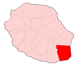 | |
Location of Saint-Philippe  | |
| Coordinates: 21°21′34″S 55°46′04″E | |
| Country | France |
| Overseas region and department | Réunion |
| Arrondissement | Saint-Pierre |
| Canton | Saint-Benoît-2 |
| Intercommunality | CA du Sud |
| Government | |
| • Mayor (2020–2026) | Olivier Rivière[1] |
| Area 1 | 153.94 km2 (59.44 sq mi) |
| Population | 5,198 |
| • Density | 34/km2 (87/sq mi) |
| Time zone | UTC+04:00 |
| INSEE/Postal code | 97417 /97442 |
| Elevation | 0–2,630 m (0–8,629 ft) (avg. 40 m or 130 ft) |
| 1 French Land Register data, which excludes lakes, ponds, glaciers > 1 km2 (0.386 sq mi or 247 acres) and river estuaries. | |
Geography
Saint-Philippe is on the highest point on the island. It borders the municipalities of Saint-Joseph and Sainte-Rose, to the west and north respectively. Although it is a coastal area, the administrative centre is in Les Hauts (the highland area of the island).
Climate
Saint-Philippe has a tropical rainforest climate (Köppen climate classification Af). The average annual temperature in Saint-Philippe is 23.1 °C (73.6 °F). The average annual rainfall is 4,260.3 mm (167.73 in) with March as the wettest month. The temperatures are highest on average in January, at around 26.2 °C (79.2 °F), and lowest in July, at around 20.0 °C (68.0 °F). The highest temperature ever recorded in Saint-Philippe was 34.7 °C (94.5 °F) on 10 December 2019; the coldest temperature ever recorded was 13.7 °C (56.7 °F) on 20 August 2008.
| Climate data for Saint-Philippe (1981−2010 normals, extremes 1989−present) | |||||||||||||
|---|---|---|---|---|---|---|---|---|---|---|---|---|---|
| Month | Jan | Feb | Mar | Apr | May | Jun | Jul | Aug | Sep | Oct | Nov | Dec | Year |
| Record high °C (°F) | 34.3 (93.7) |
34.2 (93.6) |
34.4 (93.9) |
32.2 (90.0) |
30.1 (86.2) |
28.5 (83.3) |
30.0 (86.0) |
29.0 (84.2) |
29.5 (85.1) |
31.7 (89.1) |
32.5 (90.5) |
34.7 (94.5) |
34.7 (94.5) |
| Average high °C (°F) | 29.8 (85.6) |
29.4 (84.9) |
28.7 (83.7) |
27.4 (81.3) |
25.8 (78.4) |
24.0 (75.2) |
22.7 (72.9) |
22.9 (73.2) |
24.0 (75.2) |
25.4 (77.7) |
27.2 (81.0) |
29.0 (84.2) |
26.3 (79.3) |
| Daily mean °C (°F) | 26.2 (79.2) |
26.1 (79.0) |
25.5 (77.9) |
24.4 (75.9) |
22.8 (73.0) |
21.1 (70.0) |
20.0 (68.0) |
20.1 (68.2) |
20.8 (69.4) |
22.0 (71.6) |
23.5 (74.3) |
25.2 (77.4) |
23.1 (73.6) |
| Average low °C (°F) | 22.5 (72.5) |
22.8 (73.0) |
22.4 (72.3) |
21.4 (70.5) |
19.8 (67.6) |
18.2 (64.8) |
17.4 (63.3) |
17.3 (63.1) |
17.6 (63.7) |
18.6 (65.5) |
19.7 (67.5) |
21.5 (70.7) |
19.9 (67.8) |
| Record low °C (°F) | 19.5 (67.1) |
18.3 (64.9) |
18.8 (65.8) |
17.2 (63.0) |
15.7 (60.3) |
14.6 (58.3) |
14.2 (57.6) |
13.7 (56.7) |
14.1 (57.4) |
14.5 (58.1) |
15.4 (59.7) |
17.7 (63.9) |
13.7 (56.7) |
| Average precipitation mm (inches) | 399.0 (15.71) |
555.2 (21.86) |
564.4 (22.22) |
445.4 (17.54) |
345.5 (13.60) |
299.9 (11.81) |
370.1 (14.57) |
341.7 (13.45) |
275.2 (10.83) |
216.0 (8.50) |
172.2 (6.78) |
275.7 (10.85) |
4,260.3 (167.73) |
| Average precipitation days (≥ 1.0 mm) | 18.8 | 20.2 | 21.1 | 20.0 | 19.2 | 19.1 | 23.3 | 20.8 | 17.4 | 15.8 | 12.3 | 14.6 | 222.6 |
| Source: Météo-France[3] | |||||||||||||
History
A notable event in the commune's history was in 1897, when the British troopship RIMS Warren Hastings ran aground in the middle of the night. Two seamen died as a result, the crash sparked by a compass malfunction resulting from the eruption of the Piton de la Fournaise. On board the ship was some electricity, for which the village of Tremblet would have to wait until 1984 to finally receive.
Population
| Year | Pop. | ±% p.a. |
|---|---|---|
| 1967 | 3,336 | — |
| 1974 | 3,453 | +0.49% |
| 1982 | 3,476 | +0.08% |
| 1990 | 4,005 | +1.79% |
| 1999 | 4,860 | +2.17% |
| 2007 | 5,129 | +0.68% |
| 2012 | 5,072 | −0.22% |
| 2017 | 5,260 | +0.73% |
| Source: INSEE[4] | ||
See also
- Communes of the Réunion department
- Ravine d'Ango
References
- "Répertoire national des élus: les maires". data.gouv.fr, Plateforme ouverte des données publiques françaises (in French). 2 December 2020.
- "Populations légales 2019". The National Institute of Statistics and Economic Studies. 29 December 2021.
- "Fiche Climatologique Statistiques 1981-2010 et records" (PDF) (in French). Météo-France. Retrieved August 30, 2022.
- Population en historique depuis 1968, INSEE
This Réunion location article is a stub. You can help Wikipedia by expanding it. |
На других языках
[de] Saint-Philippe (Réunion)
Saint-Philippe ist eine französische Gemeinde am Südzipfel des Übersee-Départements La Réunion. Saint-Philippe gehört zum Arrondissement Saint-Pierre und hat 5198 Einwohner (Stand 1. Januar 2019). Sie bildete bis 2015 den Kanton Saint-Philippe, seither gehört sie zum Kanton Saint-Benoît-2.- [en] Saint-Philippe
Другой контент может иметь иную лицензию. Перед использованием материалов сайта WikiSort.org внимательно изучите правила лицензирования конкретных элементов наполнения сайта.
WikiSort.org - проект по пересортировке и дополнению контента Википедии