world.wikisort.org - France
La Chapelle-des-Marais (French pronunciation: [la ʃapɛl de maʁɛ] (![]() listen); Breton: Chapel-ar-Geunioù) is a commune in the Loire-Atlantique department in western France.La Chapelle-des-Marais is located 25 km north of Saint-Nazaire, 42 km south of Redon, 57 km east of Vannes and 67 km west of Nantes. The neighboring municipalities of La Chapelle-des-Marais are Herbignac, Saint-Joachim, Sainte-Reine-de-Bretagne and Missillac.[2]
listen); Breton: Chapel-ar-Geunioù) is a commune in the Loire-Atlantique department in western France.La Chapelle-des-Marais is located 25 km north of Saint-Nazaire, 42 km south of Redon, 57 km east of Vannes and 67 km west of Nantes. The neighboring municipalities of La Chapelle-des-Marais are Herbignac, Saint-Joachim, Sainte-Reine-de-Bretagne and Missillac.[2]
La Chapelle-des-Marais | |
|---|---|
Commune | |
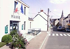
 Town hall | |
 Coat of arms | |
Location of La Chapelle-des-Marais  | |
 La Chapelle-des-Marais  La Chapelle-des-Marais | |
| Coordinates: 47°26′53″N 2°14′25″W | |
| Country | France |
| Region | Pays de la Loire |
| Department | Loire-Atlantique |
| Arrondissement | Saint-Nazaire |
| Canton | Guérande |
| Intercommunality | CA Région Nazairienne et Estuaire |
| Government | |
| • Mayor (2020–2026) | Franck Hervy |
| Area 1 | 18.05 km2 (6.97 sq mi) |
| Population | 4,338 |
| • Density | 240/km2 (620/sq mi) |
| Time zone | UTC+01:00 (CET) |
| • Summer (DST) | UTC+02:00 (CEST) |
| INSEE/Postal code | 44030 /44410 |
| Elevation | 0–11 m (0–36 ft) |
| 1 French Land Register data, which excludes lakes, ponds, glaciers > 1 km2 (0.386 sq mi or 247 acres) and river estuaries. | |
History
The territory of La Chapelle-des-Marais commune has two distinct parts: the "mainland" where the village developed and which is home to some "small villages" and the marsh surrounding the Mayun peninsula and the twin islands of Camer-Camerun.
In 1846, the region had 1,900 inhabitants. Two-thirds of them worked and lived in the two large villages of Mayun and Camer-Camerun. With 330 inhabitants, the Bourg only gathered 17% of the total population. It contained the church, the school, and the few services and businesses necessary for the economic and social life of a territory whose main activities were related to agriculture.[3]
The village is twinned with the village of Ingleton in North Yorkshire.
Population
|
|
Sports
The city has one association football team, FC La Chapelle-des-Marais, playing in Group H of the Championnat de France amateur 2, the 5th division of the French football league system. They play in pink shirts, black shorts, and black socks. They were founded in 1989[4] and play at the Stade Municipal de la Perriere.
References
- "Populations légales 2019". The National Institute of Statistics and Economic Studies. 29 December 2021.
- "Localiser la Chapelle des Marais".
- "L'histoire de la Chapelle des Marais".
- "L'historique du club". fccm44.fr. Archived from the original on 2009-11-05. Retrieved 2009-11-06.
See also
- Communes of the Loire-Atlantique department
- FC La Chapelle-des-Marais
- Parc naturel régional de Brière
На других языках
- [en] La Chapelle-des-Marais
[ru] Ла-Шапель-де-Маре
Ла-Шапель-де-Маре (фр. La Chapelle-des-Marais) — коммуна на западе Франции, находится в регионе Пеи-де-ла-Луар, департамент Атлантическая Луара, округ Сен-Назер, кантон Геранд. Расположена в 23 км к северу от Сен-Назера и в 48 км к юго-востоку от Вана, в 6 км от национальной автомагистрали N165 (Е60). Южная часть коммуны занята обширным болотом Гран-Бриер.Другой контент может иметь иную лицензию. Перед использованием материалов сайта WikiSort.org внимательно изучите правила лицензирования конкретных элементов наполнения сайта.
WikiSort.org - проект по пересортировке и дополнению контента Википедии