world.wikisort.org - France
Loireauxence (French pronunciation: [lwaʁoksɑ̃s]; Breton: Ligeraosant) is a commune in the department of Loire-Atlantique, western France. The municipality was established on 1 January 2016 by merger of the former communes of Varades, Belligné, La Chapelle-Saint-Sauveur and La Rouxière.[2]
Loireauxence | |
|---|---|
Commune | |
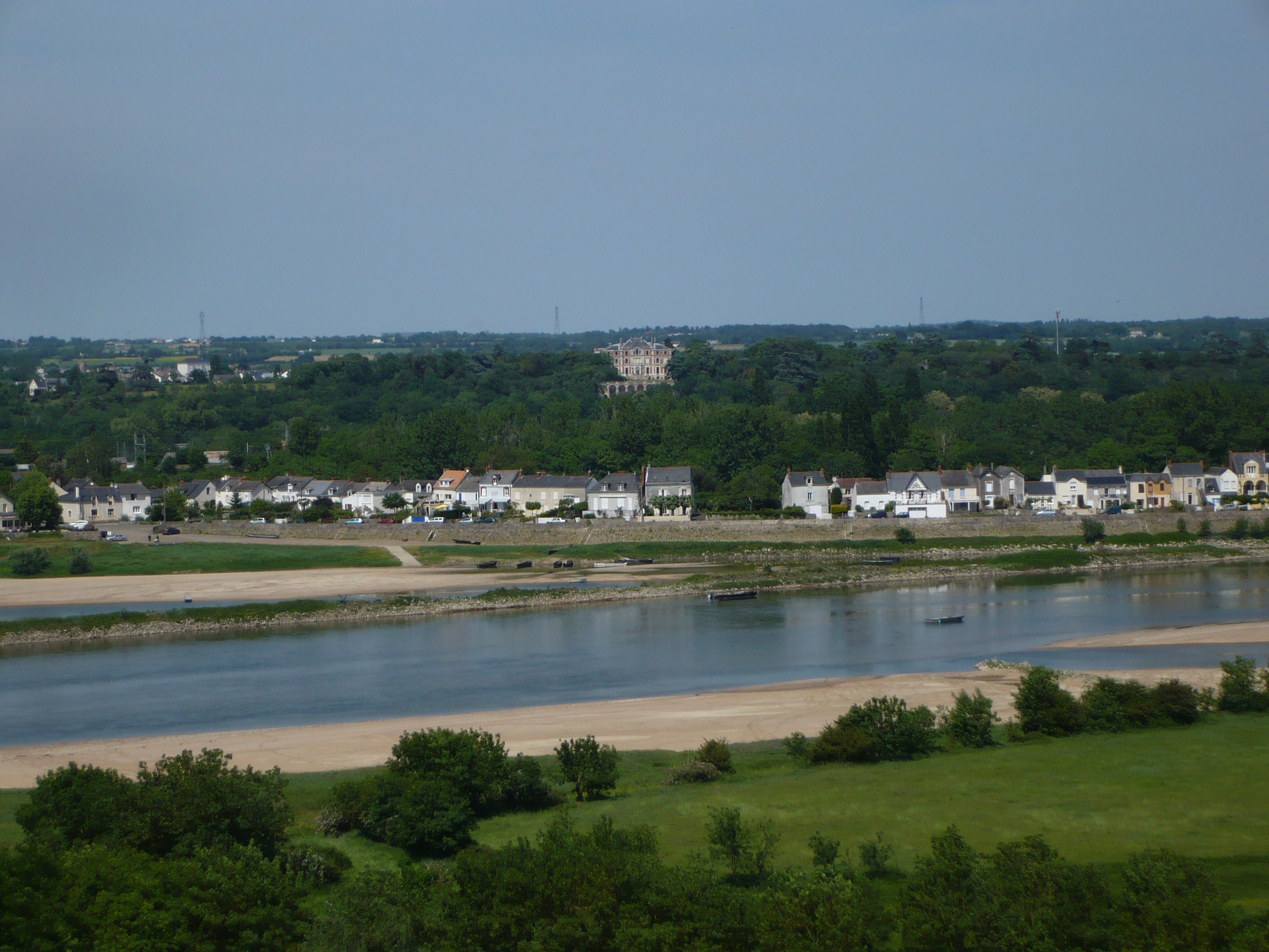 Loire River and Varades | |
Location of Loireauxence  | |
 Loireauxence  Loireauxence | |
| Coordinates: 47°23′10″N 1°01′55″W | |
| Country | France |
| Region | Pays de la Loire |
| Department | Loire-Atlantique |
| Arrondissement | Châteaubriant-Ancenis |
| Canton | Ancenis-Saint-Géréon |
| Government | |
| • Mayor (2020–2026) | Christine Blanchet |
| Area 1 | 118.28 km2 (45.67 sq mi) |
| Population | 7,480 |
| • Density | 63/km2 (160/sq mi) |
| Time zone | UTC+01:00 (CET) |
| • Summer (DST) | UTC+02:00 (CEST) |
| INSEE/Postal code | 44213 /44370 |
| Elevation | 7–94 m (23–308 ft) |
| 1 French Land Register data, which excludes lakes, ponds, glaciers > 1 km2 (0.386 sq mi or 247 acres) and river estuaries. | |
Population
| Year | Pop. | ±% p.a. |
|---|---|---|
| 1968 | 5,785 | — |
| 1975 | 5,631 | −0.38% |
| 1982 | 5,653 | +0.06% |
| 1990 | 5,860 | +0.45% |
| 1999 | 6,144 | +0.53% |
| 2007 | 6,920 | +1.50% |
| 2012 | 7,204 | +0.81% |
| 2017 | 7,522 | +0.87% |
| Source: INSEE[3] | ||
See also
References
- "Populations légales 2019". The National Institute of Statistics and Economic Studies. 29 December 2021.
- Arrêté préfectoral 18 December 2015 (in French)
- Population en historique depuis 1968, INSEE
Wikimedia Commons has media related to Loireauxence.
This Loire-Atlantique geographical article is a stub. You can help Wikipedia by expanding it. |
На других языках
[de] Loireauxence
Loireauxence ist eine französische Gemeinde im Département Loire-Atlantique in der Region Pays de la Loire. Sie gehört zum Arrondissement Châteaubriant-Ancenis ist Teil des Kantons Ancenis. Loireauxence wurde als commune nouvelle am 1. Januar 2016 aus den Gemeinden Varades, Belligné, La Chapelle-Saint-Sauveur und La Rouxière gebildet.- [en] Loireauxence
[ru] Луароксанс
Луароксанс (фр. Loireauxence) — новая коммуна на западе Франции, находится в регионе Пеи-де-ла-Луар, департамент Атлантическая Луара, округ Шатобриан-Ансени, кантон Ансени. Расположена в 43 км к востоку от Нанта и в 35 км к западу от Анже, на правом берегу реки Луара. Через территорию коммуны проходит автомагистраль А11. В 2 км к югу от центра коммуны находится железнодорожная станция Варад–Сен-Флоран-ле-Вьей линии Тур–Сен-Назер.Текст в блоке "Читать" взят с сайта "Википедия" и доступен по лицензии Creative Commons Attribution-ShareAlike; в отдельных случаях могут действовать дополнительные условия.
Другой контент может иметь иную лицензию. Перед использованием материалов сайта WikiSort.org внимательно изучите правила лицензирования конкретных элементов наполнения сайта.
Другой контент может иметь иную лицензию. Перед использованием материалов сайта WikiSort.org внимательно изучите правила лицензирования конкретных элементов наполнения сайта.
2019-2026
WikiSort.org - проект по пересортировке и дополнению контента Википедии
WikiSort.org - проект по пересортировке и дополнению контента Википедии