world.wikisort.org - France
La Turballe (French pronunciation: [la tyʁbal]; Breton: An Turball) is a commune in the Loire-Atlantique department in western France. This commune is known for its harbor, which is the first fishing harbor in the region. Every summer, there is a sardine party (fête de la sardine in French).
La Turballe | |
|---|---|
Commune | |
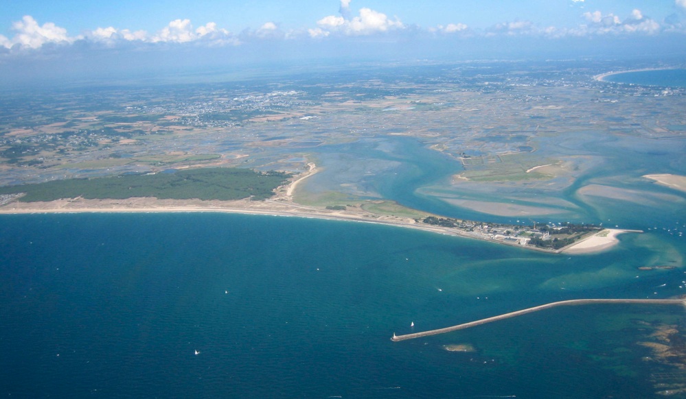 An aerial view of Pen-Bron, in La Turballe | |
 Coat of arms | |
Location of La Turballe  | |
 La Turballe  La Turballe | |
| Coordinates: 47°20′47″N 2°30′20″W | |
| Country | France |
| Region | Pays de la Loire |
| Department | Loire-Atlantique |
| Arrondissement | Saint-Nazaire |
| Canton | Guérande |
| Intercommunality | CA de la Presqu'île de Guérande Atlantique |
| Government | |
| • Mayor (2020–2026) | Didier Cadro[1] |
| Area 1 | 18.53 km2 (7.15 sq mi) |
| Population | 4,734 |
| • Density | 260/km2 (660/sq mi) |
| Demonym(s) | Turballais, Turballaise |
| Time zone | UTC+01:00 (CET) |
| • Summer (DST) | UTC+02:00 (CEST) |
| INSEE/Postal code | 44211 /44420 |
| Elevation | 0–45 m (0–148 ft) (avg. 6 m or 20 ft) |
| 1 French Land Register data, which excludes lakes, ponds, glaciers > 1 km2 (0.386 sq mi or 247 acres) and river estuaries. | |
La Turballe is close to the La Baule seaside resort.
The town, located on the Côte d'Amour, has 11 kilometers of beaches.
See also
- La Baule - Guérande Peninsula
- Communes of the Loire-Atlantique department
References
- "Répertoire national des élus: les maires" (in French). data.gouv.fr, Plateforme ouverte des données publiques françaises. 4 May 2022.
- "Populations légales 2019". The National Institute of Statistics and Economic Studies. 29 December 2021.
Wikimedia Commons has media related to La Turballe.
Authority control | |
|---|---|
| General |
|
| National libraries | |
This Loire-Atlantique geographical article is a stub. You can help Wikipedia by expanding it. |
На других языках
[de] La Turballe
La Turballe (bretonisch An Turball) ist eine französische Gemeinde mit 4734 Einwohnern (Stand: 1. Januar 2019) im Département Loire-Atlantique in der Region Pays de la Loire. La Turballe gehört zum Arrondissement Saint-Nazaire und zum Kanton Guérande. Die Einwohner werden Turballais(es) genannt.- [en] La Turballe
[ru] Ла-Тюрбаль
Ла-Тюрбаль (фр. La Turballe) — коммуна на западе Франции, находится в регионе Пеи-де-ла-Луар, департамент Атлантическая Луара, округ Сен-Назер, кантон Геранд. Расположена в 27 км к северо-западу от Сен-Назера и в 56 км к юго-востоку от Вана, в 27 км от национальной автомагистрали N171, на побережье Бискайского залива. Южная часть коммуны занята солончаками Геранд.Текст в блоке "Читать" взят с сайта "Википедия" и доступен по лицензии Creative Commons Attribution-ShareAlike; в отдельных случаях могут действовать дополнительные условия.
Другой контент может иметь иную лицензию. Перед использованием материалов сайта WikiSort.org внимательно изучите правила лицензирования конкретных элементов наполнения сайта.
Другой контент может иметь иную лицензию. Перед использованием материалов сайта WikiSort.org внимательно изучите правила лицензирования конкретных элементов наполнения сайта.
2019-2026
WikiSort.org - проект по пересортировке и дополнению контента Википедии
WikiSort.org - проект по пересортировке и дополнению контента Википедии