world.wikisort.org - France
Couargues (French pronunciation: [kwaʁɡ]) is a commune in the Cher department in the Centre-Val de Loire region of France.
Couargues | |
|---|---|
Commune | |
Location of Couargues  | |
 Couargues  Couargues | |
| Coordinates: 47°16′41″N 2°55′47″E | |
| Country | France |
| Region | Centre-Val de Loire |
| Department | Cher |
| Arrondissement | Bourges |
| Canton | Sancerre |
| Intercommunality | CC Pays Fort Sancerrois Val de Loire |
| Government | |
| • Mayor (2020–2026) | Jacqueline Boulay[1] |
| Area 1 | 11.62 km2 (4.49 sq mi) |
| Population | 200 |
| • Density | 17/km2 (45/sq mi) |
| Time zone | UTC+01:00 (CET) |
| • Summer (DST) | UTC+02:00 (CEST) |
| INSEE/Postal code | 18074 /18300 |
| Elevation | 141–155 m (463–509 ft) (avg. 178 m or 584 ft) |
| 1 French Land Register data, which excludes lakes, ponds, glaciers > 1 km2 (0.386 sq mi or 247 acres) and river estuaries. | |
Geography
A farming area comprising five hamlets situated between the banks of the Loire and the canal parallel to the Loire, some 30 miles (48 km) northeast of Bourges at the junction of the D59 with the D206 and D259 roads.
Population
| Year | Pop. | ±% |
|---|---|---|
| 1962 | 199 | — |
| 1968 | 238 | +19.6% |
| 1975 | 224 | −5.9% |
| 1982 | 211 | −5.8% |
| 1990 | 207 | −1.9% |
| 1999 | 228 | +10.1% |
| 2008 | 210 | −7.9% |
Sights
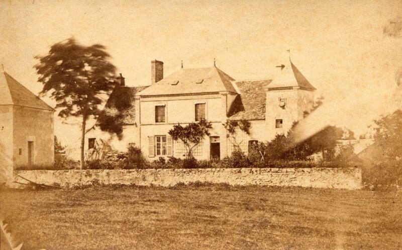
- The presbytery of St. Aignan, dating from the fifteenth century.
- Two watermills.
See also
References
- "Répertoire national des élus: les maires". data.gouv.fr, Plateforme ouverte des données publiques françaises (in French). 9 August 2021.
- "Populations légales 2019". The National Institute of Statistics and Economic Studies. 29 December 2021.
External links
Wikimedia Commons has media related to Couargues.
- Website about Couargues (in French)
На других языках
- [en] Couargues
[ru] Куарг
Куа́рг (фр. Couargues) — коммуна во Франции, находится в регионе Центр. Департамент — Шер. Входит в состав кантона Сансер. Округ коммуны — Бурж.Текст в блоке "Читать" взят с сайта "Википедия" и доступен по лицензии Creative Commons Attribution-ShareAlike; в отдельных случаях могут действовать дополнительные условия.
Другой контент может иметь иную лицензию. Перед использованием материалов сайта WikiSort.org внимательно изучите правила лицензирования конкретных элементов наполнения сайта.
Другой контент может иметь иную лицензию. Перед использованием материалов сайта WikiSort.org внимательно изучите правила лицензирования конкретных элементов наполнения сайта.
2019-2026
WikiSort.org - проект по пересортировке и дополнению контента Википедии
WikiSort.org - проект по пересортировке и дополнению контента Википедии