world.wikisort.org - France
Branoux-les-Taillades (French pronunciation: [bʁanu le tajad]; Occitan: Branós e las Talhadas) is a commune in the Gard department in southern France, and in the region Occitanie.
Branoux-les-Taillades | |
|---|---|
Commune | |
 A general view of Branoux-les-Taillades | |
 Coat of arms | |
Location of Branoux-les-Taillades  | |
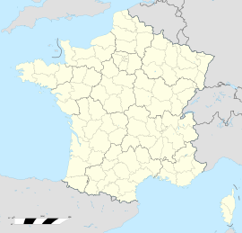  Branoux-les-Taillades  Branoux-les-Taillades | |
| Coordinates: 44°13′16″N 3°59′27″E | |
| Country | France |
| Region | Occitania |
| Department | Gard |
| Arrondissement | Alès |
| Canton | La Grand-Combe |
| Intercommunality | Alès Agglomération |
| Government | |
| • Mayor (2020–2026) | Michel Vigne |
| Area 1 | 15.02 km2 (5.80 sq mi) |
| Population | 1,338 |
| • Density | 89/km2 (230/sq mi) |
| Time zone | UTC+01:00 (CET) |
| • Summer (DST) | UTC+02:00 (CEST) |
| INSEE/Postal code | 30051 /30110 |
| Elevation | 189–900 m (620–2,953 ft) (avg. 360 m or 1,180 ft) |
| 1 French Land Register data, which excludes lakes, ponds, glaciers > 1 km2 (0.386 sq mi or 247 acres) and river estuaries. | |
Geography
Localization
Branoux is located near the mountain la Baraque, and close to the D32 road, on a relatively flat place called la Plaine. Les Taillades is an extension due to the demographic boom caused by the influx of workers and miners employed in la Grand-Combe. Les Taillades was built in the Gardon valley, on the right bank and crossed by the RN106. Blannaves is a hamlet, mostly in ruins and close to the Cambous Lake.
Hamlets
- L'Abrit
- L'Arenas
- Branoux
- Le Camp des Nonnes
- Le Castanet de Blannaves
- La Civadière
- Le Fraissinet
- Le Galissard
- Le Lauzas
- Mas de Léon
- Le Monnier
- La Planquette
- Les Taillades
Population
|
|
Politics and administration
Political trends and results

List of mayors
City council
Sister towns
See also
References
- "Populations légales 2019". The National Institute of Statistics and Economic Studies. 29 December 2021.

Wikimedia Commons has media related to Branoux-les-Taillades.

Authority control | |
|---|---|
| General |
|
| National libraries | |

 | This Gard geographical article is a stub. You can help Wikipedia by expanding it. |
Текст в блоке "Читать" взят с сайта "Википедия" и доступен по лицензии Creative Commons Attribution-ShareAlike; в отдельных случаях могут действовать дополнительные условия.
Другой контент может иметь иную лицензию. Перед использованием материалов сайта WikiSort.org внимательно изучите правила лицензирования конкретных элементов наполнения сайта.
Другой контент может иметь иную лицензию. Перед использованием материалов сайта WikiSort.org внимательно изучите правила лицензирования конкретных элементов наполнения сайта.
2019-2026
WikiSort.org - проект по пересортировке и дополнению контента Википедии
WikiSort.org - проект по пересортировке и дополнению контента Википедии