world.wikisort.org - Colombia
Quípama is a town and municipality in the Colombian Department of Boyacá, part of the subregion of the Western Boyacá Province.
Quípama | |
|---|---|
Municipality and town | |
 View of Quípama | |
 Flag | |
 Location of the municipality and town of Quipama in the Boyacá Department of Colombia. | |
| Country | |
| Department | Boyacá |
| Province | Western Boyacá Province |
| Government | |
| • Mayor | Carlos Alberto Ávila Cepeda (2020-2023) |
| Elevation | 1,200 m (3,900 ft) |
| Time zone | UTC-5 (Colombia Standard Time) |
Climate
Quípama has a tropical rainforest climate (Af) with heavy to very heavy rainfall year-round.
| Climate data for Quípama | |||||||||||||
|---|---|---|---|---|---|---|---|---|---|---|---|---|---|
| Month | Jan | Feb | Mar | Apr | May | Jun | Jul | Aug | Sep | Oct | Nov | Dec | Year |
| Average high °C (°F) | 26.2 (79.2) |
26.5 (79.7) |
26.9 (80.4) |
26.9 (80.4) |
26.6 (79.9) |
26.3 (79.3) |
27.0 (80.6) |
26.7 (80.1) |
26.4 (79.5) |
25.8 (78.4) |
25.5 (77.9) |
25.6 (78.1) |
26.4 (79.5) |
| Daily mean °C (°F) | 21.5 (70.7) |
21.9 (71.4) |
22.4 (72.3) |
22.7 (72.9) |
22.4 (72.3) |
21.8 (71.2) |
22.1 (71.8) |
21.9 (71.4) |
21.6 (70.9) |
21.4 (70.5) |
21.2 (70.2) |
21.2 (70.2) |
21.8 (71.3) |
| Average low °C (°F) | 16.9 (62.4) |
17.4 (63.3) |
18.0 (64.4) |
18.5 (65.3) |
18.3 (64.9) |
17.4 (63.3) |
17.3 (63.1) |
17.1 (62.8) |
16.9 (62.4) |
17.1 (62.8) |
17.0 (62.6) |
16.9 (62.4) |
17.4 (63.3) |
| Average rainfall mm (inches) | 129.0 (5.08) |
208.4 (8.20) |
314.8 (12.39) |
365.8 (14.40) |
338.3 (13.32) |
239.6 (9.43) |
198.2 (7.80) |
191.8 (7.55) |
274.9 (10.82) |
391.2 (15.40) |
283.1 (11.15) |
179.1 (7.05) |
3,114.2 (122.59) |
| Average rainy days | 17 | 17 | 22 | 23 | 25 | 21 | 19 | 18 | 22 | 24 | 22 | 19 | 249 |
| Average relative humidity (%) | 84 | 85 | 86 | 87 | 87 | 85 | 83 | 82 | 84 | 85 | 86 | 86 | 85 |
| Source 1: IDEAM[1] | |||||||||||||
| Source 2: Climate-Data.org[2] | |||||||||||||
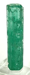
It is home of one of the largest emerald mines in the world.
See also
References
- "Data". www.ideam.gov.co. Retrieved 2020-08-23.
- "Climate: Quípama". Climate-Data.org. Retrieved August 23, 2020.
External links
| Wikimedia Commons has media related to Quípama. |
На других языках
- [en] Quípama
[ru] Кипама
Кипама (исп. Quípama) — город и муниципалитет в центральной части Колумбии, на территории департамента Бояка. Входит в состав Западной (исп.) (рус. провинции.Текст в блоке "Читать" взят с сайта "Википедия" и доступен по лицензии Creative Commons Attribution-ShareAlike; в отдельных случаях могут действовать дополнительные условия.
Другой контент может иметь иную лицензию. Перед использованием материалов сайта WikiSort.org внимательно изучите правила лицензирования конкретных элементов наполнения сайта.
Другой контент может иметь иную лицензию. Перед использованием материалов сайта WikiSort.org внимательно изучите правила лицензирования конкретных элементов наполнения сайта.
2019-2025
WikiSort.org - проект по пересортировке и дополнению контента Википедии
WikiSort.org - проект по пересортировке и дополнению контента Википедии

