world.wikisort.org - Brazil
Oiapoque (Portuguese pronunciation: [ɔjɐˈpɔki]) is a municipality in the north of the state of Amapá, Brazil. Its population is 27,906[3] and its area is 22,625 square kilometres (8,736 sq mi).[4] Oiapoque is also a major river in the same state, forming the international border with French Guiana. The Oyapock River Bridge, connecting the village with Saint-Georges in French Guiana, was completed in 2011 but not opened to pedestrian or vehicle traffic until 2017.[5]
Oiapoque | |
|---|---|
Municipality | |
| Município de Oiapoque | |
 A street in Oiapoque. | |
 Flag  Seal | |
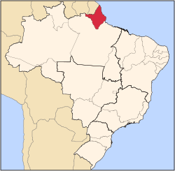
 Location of Oiapoque in the State of Amapá | |
 | |
| Coordinates: 03°50′34″N 51°50′06″W | |
| Country | |
| Region | North |
| State | |
| Founded | 1945 |
| Government | |
| • Mayor | Maria Orlana (PSDB) |
| Area | |
| • Total | 22,625 km2 (8,736 sq mi) |
| Elevation | 3 m (10 ft) |
| Population (2020) | |
| • Total | 27,906 |
| • Density | 0.85/km2 (2.2/sq mi) |
| [1] | |
| Time zone | UTC−3 (BRT) |
| HDI (2000) | 0.738 – medium[2] |
| Website | oiapoque.com.br |
Lying on the northern coast of Brazil, Oiapoque is popularly considered the northernmost point of Brazil. The phrase do Oiapoque ao Chuí ("from Oiapoque to Chuí") means "all of Brazil."[6] However, there are more northerly points in Roraima state such as the municipality of Uiramutã. Oiapoque remains the northernmost coastal city of Brazil, and the northernmost city of Amapá. It occupies more than half of the north border of the state.
Early history
The Oiapoque River is said to have been discovered by Vicente Yáñez Pinzón in the first years of the 16th century. It has been called Japoc, Yapoc, Iapoco, and even Vicente Pinzón River. The name Oiapoque was officially used from 1900, when a territorial dispute between Brazil and France was resolved through Swiss diplomatic arbitration.
Clevelândia
At the beginning of the 20th century, the village of Oiapoque hosted a political and criminal concentration camp called Clevelândia. In 1922 an agricultural outpost called the Núcleo Colonial Cleveland was transformed into a camp during the presidency of Arthur Bernardes (1922–1926). Many Brazilian anarchist militants were sentenced to hard labour here. Of the 946 prisoners interned at Clevelândia between 1924 and 1927, 491 died. Many of the survivors returned to São Paulo and Rio de Janeiro permanently sickened with malaria.[7]
Geography
Oiapoque is bordered to the west by its long frontier with French Guiana. It is bordered to the north by the Atlantic Ocean. On its eastern and southern sides it borders the municipalities of Calçoene, Serra do Navio, Pedra Branca do Amapari, and Laranjal do Jari.[4]
The municipality contains 24.15% of the 2,369,400 hectares (5,855,000 acres) Amapá State Forest, a sustainable use conservation unit established in 2006.[8] The Cabo Orange National Park is located on the coast of the municipality, and covers 6,573 square kilometres (2,538 sq mi) of rainforest on the coast line.[9]
Oiapoque can be accessed by air via the Oiapoque Airport.[10]
Kuahí Museum
The Kuahí Museum was opened in 2007 by the four indigenous groups living the municipality: the Palikur, the Galibi Marwono, the Galibi do Oiapoque, and the Karipuna do Amapá. The museum contains more than 400 objects used by the Amerindians.[11] The project was conceived in the 1990s to promote and transmit the knowledge of the indigenous community. The museum is a public not-for-profit entity linked to the Amapá State Secretariat of Culture.[12]
Climate
Oiapoque has a tropical monsoon climate (Am) with moderate to little rainfall from August to November and heavy to very heavy rainfall in the remaining months.
| Climate data for Oiapoque | |||||||||||||
|---|---|---|---|---|---|---|---|---|---|---|---|---|---|
| Month | Jan | Feb | Mar | Apr | May | Jun | Jul | Aug | Sep | Oct | Nov | Dec | Year |
| Average high °C (°F) | 29.2 (84.6) |
28.6 (83.5) |
29.8 (85.6) |
29.3 (84.7) |
29.5 (85.1) |
30.0 (86.0) |
31.0 (87.8) |
31.9 (89.4) |
32.6 (90.7) |
33.0 (91.4) |
32.3 (90.1) |
30.3 (86.5) |
30.6 (87.1) |
| Daily mean °C (°F) | 25.4 (77.7) |
25.0 (77.0) |
25.7 (78.3) |
25.6 (78.1) |
25.8 (78.4) |
25.8 (78.4) |
26.0 (78.8) |
26.4 (79.5) |
26.5 (79.7) |
26.5 (79.7) |
26.3 (79.3) |
25.7 (78.3) |
25.9 (78.6) |
| Average low °C (°F) | 21.6 (70.9) |
21.5 (70.7) |
21.6 (70.9) |
22.0 (71.6) |
22.1 (71.8) |
21.6 (70.9) |
21.0 (69.8) |
20.9 (69.6) |
20.5 (68.9) |
20.0 (68.0) |
20.4 (68.7) |
21.2 (70.2) |
21.2 (70.2) |
| Average rainfall mm (inches) | 395 (15.6) |
345 (13.6) |
396 (15.6) |
450 (17.7) |
537 (21.1) |
370 (14.6) |
193 (7.6) |
102 (4.0) |
48 (1.9) |
44 (1.7) |
116 (4.6) |
313 (12.3) |
3,309 (130.3) |
| Source: Climate-Data.org[13] | |||||||||||||
Subdivisions
The municipality of Oiapoque contains three districts:[14]
| Name / Main settlement | Other settlements |
|---|---|
| The town of Oiapoque | |
| Clevelândia do Norte | Ilha Bela, Vila Brasil |
| Vila Velha |
There are four indigenous tribes in the municipality located in indigenous territories:[11]
| Tribe | Main settlement | Other settlements |
|---|---|---|
| Galibi Marwono | Kumarumã | |
| Galibi do Oiapoque | São José dos Galibi | |
| Karipuna do Amapá | Manga | Espírito Santo, Santa Isabel |
| Palikur | Kumenê | Flecha, Kamuywa |
Gallery


References
- ESTIMATIVAS DAS POPULAÇÕES RESIDENTES, EM 1o DE JULHO DE 2008, SEGUNDO OS MUNICÍPIOS
- Archived 2013-07-28 at the Wayback Machine UNDP
- IBGE 2020
- "Oiapoque". Macapá: Amapá Digital. 2003. Retrieved 2014-12-04.
- Pacheco, John (2014). "Tráfego na ponte binacional em Oiapoque terá limitação de horários" (in Portuguese). G1 Amapá. Retrieved 2014-12-04.
- Pacheco, John (2014). "Oiapoque/Brazil". Lonely Planet. Archived from the original on 2014-12-08. Retrieved 2014-12-04.
- Romani, Carlo. "Clevelândia (Oiapoque): colônia penal ou campo de concentração?". Verve: revista semestral autogestionária do Nu-Sol (in Portuguese). Núcleo de Sociabilidade Libertária do Programa de Estudos Pós-Graduados em Ciências Sociais da PUC-SP. 2003 (3): 112–130. Retrieved 4 December 2014.
- FES do Amapá (in Portuguese), ISA: Instituto Socioambiental, retrieved 2016-07-06
- "Unidade de Conservação: PARQUE NACIONAL DO CABO ORANGE". Ministério do Meio Ambiente (in Portuguese). Retrieved 27 March 2021.
- "Aeroporto / OIAPOQUE". Flight Market (in Portuguese). Retrieved 3 April 2021.
- "Kuahí Museum of the Indigenous Peoples of Oiapoque". Contemporary And. Retrieved 29 March 2021.
- Lux Vidal (2013). "Kuahí The Indians of the Lower Oiapoque and their museum". Cultural Heritage and Museums. v10n1.
- "Climate: Oiapoque". Climate-Data.org. Retrieved August 14, 2020.
- "Histórico". Municipality of Oiapoque (in Portuguese). Retrieved 30 March 2021.
External links
- Oiapoque City Hall official website
 Media related to Oiapoque at Wikimedia Commons
Capital: Macapá | ||
| Amapá |
|  |
| Macapá |
| |
| Mazagão |
| |
| Oiapoque | ||
На других языках
[de] Oiapoque
Oiapoque, amtlich portugiesisch Município de Oiapoque, ist eine Kleinstadt mit großem Gemeindegebiet im äußersten Norden Brasiliens im Bundesstaat Amapá. Die Bevölkerungszahl wurde zum 1. Juli 2020 auf 27.906 Einwohner geschätzt, die Oiapoquenser (oiapoquenses) genannt werden und auf einer Gemeindefläche von rund 23.034,4 km² leben, der zweitgrößten Fläche der 16 Munizips des Bundesstaates.[2] Wirtschaftlich bedeutend ist sie vor allem als Grenzstadt nach Französisch-Guayana, von dem die Stadt durch den Oiapoque-Fluss getrennt ist. Die Entfernung zur Hauptstadt Macapá beträgt 550 km.- [en] Oiapoque
[es] Oiapoque
Oiapoque es un municipio brasileño en el estado de Amapá al norte de Brasil en la frontera con la Guayana Francesa. Tiene un área de 22.625 km², su población se estimaba al 2005 en 16.226 habitantes.[ru] Ояпоки
Ояпоки (порт. Oiapoque) — муниципалитет в Бразилии, входит в штат Амапа. Составная часть мезорегиона Север штата Амапа. Входит в экономико-статистический микрорегион Ояпоки. Население составляет 20 509 человек на 2007 год. Занимает площадь 22 625,286 км². Плотность населения — 0,91 чел./км².Другой контент может иметь иную лицензию. Перед использованием материалов сайта WikiSort.org внимательно изучите правила лицензирования конкретных элементов наполнения сайта.
WikiSort.org - проект по пересортировке и дополнению контента Википедии