world.wikisort.org - Brazil
Kumenê (also Ukumene[2]) is a Palikur Amerindian village in the Brazilian municipality of Oiapoque, Amapá. It is the largest village of the tribe.[3][4][5] Kumenê is located on the Urucaua River[5] in the Uaçá Indigenous Territory.[6]
Kumenê
Ukumene | |
|---|---|
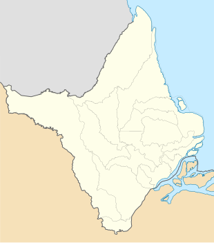 Kumenê Location in Brazil  Kumenê Kumenê (Brazil) | |
| Coordinates: 3.4881°N 51.4846°W | |
| Country | |
| Region | North |
| State | Amapá |
| Municipality | Oiapoque |
| Population (2016)[1] | |
| • Total | 1,056 |
| Time zone | UTC-3 |
Overview
The area around the Urucaua River is the ancestral territory of the Palikur.[7] In 1965, two linguists of the Summer Institute of Linguistics arrived in Kumenê to learn the language. They stayed for about 11 years, and founded the first school.[3]
[n the 1980s, pastors from the Assembly of God of Macapá arrived and started to convert the population.[8] They built a church and banned shamanism, traditional dances, nudism, and caxixi, a local alcoholic beverage. Nowadays, the village is Pentecostal.[8]

The village contains the health centre for the region.[8] The houses in the village are built on stilts.[9] In 2017, there was a malaria outbreak in the region.[10]
Kumenê can only be reached by boat, and is located about seven hours from Oiapoque.[8] Monte Carupina, a 325 metres (1,066 ft) high mountain, is located near the village.[11]
References
- "Caracterização do DSEI Amapá e Norte do Pará, conforme Edital de Chamada Pública n. 2/2017" (PDF). Ministry of Health (Brazil) (in Portuguese). Retrieved 28 March 2021.
- Pierre Grenand and Marie-Françoise Prévost (1994). "Les plantes colorantes utilisées en Guyane française". Journal d'agriculture traditionnelle et de botanique appliquée (in French). 36–1: 146.
- "Palikur". Socio Ambiental. Retrieved 27 March 2021.
- Stan Anonby (2007). "A report on the creoles of Amapá". Journal of Language Survey Reports. 20: 10.
- "Expressão feminina na Aldeia Kumenê". Padre Nello (in Portuguese). Retrieved 27 March 2021.
- "Mulheres indígenas de Oiapoque realizam VII Assembleia da AMIM e intercâmbio sobre plantas medicinais". Instituo Iepé (in Portuguese). Retrieved 27 March 2021.
- Martijn van den Bel (2009). "The Palikur Potters: an ethnoarchaeological case study on the Palikur pottery tradition in French-Guiana and Amapá, Brazil" (PDF). Cayenne: Institute National de Recherches Archéologiques. p. 41.
- "Médico do Programa Mais Médicos resgata saber tradicional de tribo indígena no Oiapoque, Amapá". Pan American Health Organization (in Portuguese). Retrieved 27 March 2021.
- Patricia Leandro-Reguillo, Richard Thomson-Luque and Wuelton Marcelo Monteiro (2014). THE AMAZONIAN INDIGENOUS SETTLEMENTS: TIPOLOGIES ANALYSIS FOR MALARIA ELIMINATION. ASTMH annual meeting 2014 The American Society Tropical Medicine and Hygiene. p. Abstract.
- Emilie Mosner (2020). "Resurgence risk for malaria, and the characterization of a recent outbreak in an Amazonian border area between French Guiana and Brazil". BMC Infectious Diseases. 20. doi:10.1186/s12879-020-05086-4. PMC 7249302.
- "Monte Carupina". Peakery. Retrieved 27 March 2021.
This Amapá, Brazil location article is a stub. You can help Wikipedia by expanding it. |
Другой контент может иметь иную лицензию. Перед использованием материалов сайта WikiSort.org внимательно изучите правила лицензирования конкретных элементов наполнения сайта.
WikiSort.org - проект по пересортировке и дополнению контента Википедии