world.wikisort.org - Brazil
Cantá (Portuguese pronunciation: [kɐ̃ˈta]) is a municipality located in the mideast of the state of Roraima in Brazil. Its population is 18,799 (2020) and its area is 7,665 km².[2]
Cantá | |
|---|---|
Municipality | |
 Serra Grande in the background | |
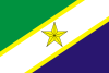 Flag  Coat of arms | |
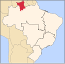
 Cantá Location in Brazil  Cantá Cantá (Brazil) | |
| Coordinates: 2°36′36″N 60°35′49″W | |
| Country | Brazil |
| Region | North |
| State | Roraima |
| Area | |
| • Total | 7,665 km2 (2,959 sq mi) |
| Population (2020 [1]) | |
| • Total | 18,799 |
| • Density | 2.5/km2 (6.4/sq mi) |
| Time zone | UTC-04:00 (BRT-1) |
| Website | canta.rr.gov.br |
The municipality of Cantá was established in 1995.[3] It is an agricultural community based on dairy production, livestock and bananas.[4]
The municipality is known for its nature. Tourist attractions include the Serra Grande mountains, and the waterfalls of Véu de Noiva.[5] Cantá can be reached from Boa Vista via the BR-432 highway.[6]
The Malacacheta Indigenous Territory is located in the municipality. The 28,658 hectares (70,820 acres) territory is home to Wapishana Amerindians. [7] The Tabalascada Indigenous Territory is shared by the Wapishana and the Macushi people, and measures 13,037 hectares (32,220 acres).[8]
References
- IBGE 2020
- "IBGE | Cidades | Roraima | Cantá". cidades.ibge.gov.br. Retrieved 2016-06-15.
- "Cantá". IBGE (in Portuguese). Retrieved 10 April 2021.
- "TRAFEGABILIDADE Governo inicia recuperação de mais duas vicinais no Cantá". Government of Roraima (in Portuguese). Retrieved 10 April 2021.
- "Roraima TV: Fala Comunidade visita município do Cantá, em Roraima". Globo (in Portuguese). Retrieved 10 April 2021.
- "Obras na BR-432/RR irão reduzir trajeto de Manaus a Boa Vista em 60 km". Estradas (in Portuguese). Retrieved 10 April 2021.
- "Terra Indígena Malacacheta". Terras Indigenas (in Portuguese). Retrieved 10 April 2021.
- "Terra Indígena Tabalascada". Terras Indigenas (in Portuguese). Retrieved 10 April 2021.
External links
- Official website (in Portuguese)
 Media related to Cantá at Wikimedia Commons
Capital: Boa Vista | ||
| Boa Vista |
|  |
| Nordeste de Roraima | ||
| Caracarai | ||
| Sudeste de Roraima | ||
 | This Roraima, Brazil location article is a stub. You can help Wikipedia by expanding it. |
На других языках
- [en] Cantá
[ru] Канта (Бразилия)
Канта (порт. Cantá) — муниципалитет в Бразилии. входит в штат Рорайма. Составная часть мезорегиона Север штата Рорайма. Входит в экономико-статистический микрорегион Нордести-ди-Рорайма, который входит в Север штата Рорайма. Население составляет 13 902 человека на 2010 год. Занимает площадь 7 664,831 км². Плотность населения — 1,81 чел./км².Другой контент может иметь иную лицензию. Перед использованием материалов сайта WikiSort.org внимательно изучите правила лицензирования конкретных элементов наполнения сайта.
WikiSort.org - проект по пересортировке и дополнению контента Википедии