world.wikisort.org - Brazil
Amajari (Portuguese pronunciation: [ɐmaʒaˈɾi]) is a municipality located in the northwest of the state of Roraima in Brazil. Its population is 13,185 and its area is 28,472 km². It is the westernmost municipality in Roraima.
Amajari | |
|---|---|
Municipality | |
| The Municipality of Amajari | |
 Paiva waterfall | |
 Flag  Seal | |
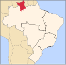
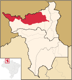 Location of Amajari in the State of Roraima | |
| Coordinates: 03°39′07″N 61°22′15″W | |
| Country | |
| Region | North |
| State | |
| Founded | 17 October 1995 |
| Government | |
| • Mayor | Vera Lúcia (PSC) |
| Area | |
| • Total | 28,472 km2 (10,993 sq mi) |
| Elevation | 100 m (300 ft) |
| Population (2020 [1]) | |
| • Total | 13,185 |
| • Density | 0.21/km2 (0.5/sq mi) |
| Time zone | UTC-4 |
| HDI (2000) | 0.654 – medium[2] |
| Website | amajari.rr.gov.br |
The municipality of Amajari is a region of 8 indigenous segments with a total of 19 indigenous communities living there. The present ethnic groups are the Macuxi, Wapichana, Sapará and Taurepang people. The 8 indigenous segments: TI Araçá, TI Ouro, TI Anaro, TI Ponta da Serra, TI Aningal, TI Garagem, TI Santa Inês and TI Ananás. The indigenous communities that are located in the region are: Araçá, Mutamba, Mangueira, Três Corações, Guariba, Anaro, Ponta da Serra, Urucuri, Juraci, Nova União, Ouro, San Francisco, Cajueiro, Garagem, Ananás, Leão de Ouro, Santa Inês, Aningal and Vida Nova.
Main townships
The following is a list of the main populated places within the municipality and their population according to the census of 2010.[3]
- 1,219 inhabitants - Vila Brasil
- 116 inhabitants - Vila Tepequém
- 587 inhabitants - Vila Três Corações
- 693 inhabitants - Vila do Trairão
Notable people
- Suely Campos (1953), politician and former governor of Roraima[4]
References
- IBGE 2020
- "Archived copy". Archived from the original on 2009-10-03. Retrieved 2009-12-17.
{{cite web}}: CS1 maint: archived copy as title (link) - UNDP - Instituto Brasileiro de Geografia e Estatística (IBGE) (16 November 2011). "Sinopse por setores". Retrieved 7 April 2021.
- "Maria Sueli Silva Campos" (in Portuguese). Retrieved 15 April 2021.
External links
- Official site (in Portuguese)
 Media related to Amajari at Wikimedia Commons
Capital: Boa Vista | ||
| Boa Vista |
|  |
| Nordeste de Roraima |
| |
| Caracarai | ||
| Sudeste de Roraima | ||
 | This Roraima, Brazil location article is a stub. You can help Wikipedia by expanding it. |
На других языках
- [en] Amajari
[ru] Амажари
Амажари (порт. Amajari) — муниципалитет в Бразилии, входит в штат Рорайма. Составная часть мезорегиона Север штата Рорайма. Входит в экономико-статистический микрорегион Боа-Виста. Население составляет 9 327 человек на 2010 год. Занимает площадь 28 472,31 км². Плотность населения — 0,33 чел./км².Другой контент может иметь иную лицензию. Перед использованием материалов сайта WikiSort.org внимательно изучите правила лицензирования конкретных элементов наполнения сайта.
WikiSort.org - проект по пересортировке и дополнению контента Википедии