world.wikisort.org - Brazil
Iracema (Portuguese pronunciation: [iɾaˈsẽmɐ]) is a municipality located in the midwest of the state of Roraima in Brazil. Its population is 12,296 (2020) and its area is 14,413 km².[2] Iracema started as an agricultural community. It became an independent municipality in 1994.[3] The town is located on the BR-174 highway, and is known for its waterfall.[4]
Iracema | |
|---|---|
Municipality | |
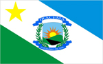 Flag  Coat of arms | |
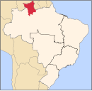
 Iracema Location in Brazil  Iracema Iracema (Brazil) | |
| Coordinates: 2°10′55″N 61°2′27″W | |
| Country | Brazil |
| Region | North |
| State | Roraima |
| Government | |
| • Mayor | Jairo Andre Ribeiro Sousa (PMDB) |
| Area | |
| • Total | 14,413 km2 (5,565 sq mi) |
| Population (2020 [1]) | |
| • Total | 12,296 |
| • Density | 0.85/km2 (2.2/sq mi) |
| Time zone | UTC-04:00 (BRT-1) |
References
- IBGE 2020
- "IBGE | Cidades | Roraima | Iracema". cidades.ibge.gov.br. Retrieved 2016-06-15.
- "Iracema". IBGE (in Portuguese). Retrieved 15 April 2021.
- "Cachoeiras na Amazônia: deleite para os olhos e purificação para as almas". OLiberal (in Portuguese). Retrieved 15 April 2021.
Wikimedia Commons has media related to Iracema (Roraima).
Capital: Boa Vista | ||
| Boa Vista |
|  |
| Nordeste de Roraima |
| |
| Caracarai | ||
| Sudeste de Roraima | ||
 | This Roraima, Brazil location article is a stub. You can help Wikipedia by expanding it. |
На других языках
- [en] Iracema, Roraima
[ru] Ирасема (Рорайма)
Ирасема (порт. Iracema) — муниципалитет в Бразилии, входит в штат Рорайма. Составная часть мезорегиона Юг штата Рорайма. Входит в экономико-статистический микрорегион Каракараи. Население составляет 8 696 человек на 2010 год. Занимает площадь 14 412,688 км². Плотность населения — 0,60 чел./км².Текст в блоке "Читать" взят с сайта "Википедия" и доступен по лицензии Creative Commons Attribution-ShareAlike; в отдельных случаях могут действовать дополнительные условия.
Другой контент может иметь иную лицензию. Перед использованием материалов сайта WikiSort.org внимательно изучите правила лицензирования конкретных элементов наполнения сайта.
Другой контент может иметь иную лицензию. Перед использованием материалов сайта WikiSort.org внимательно изучите правила лицензирования конкретных элементов наполнения сайта.
2019-2026
WikiSort.org - проект по пересортировке и дополнению контента Википедии
WikiSort.org - проект по пересортировке и дополнению контента Википедии