world.wikisort.org - Brazil
Alto Alegre (Portuguese pronunciation: [ˈawtu aˈlɛgɾi]) is a city in the Brazilian state of Roraima. The population in 2020 was 15,380, and the area is 25,567 km².[2] Its limits are Amajari to the north, Boa Vista in the east, Mucajaí and Iracema in the south, and Venezuela in the west.
Alto Alegre | |
|---|---|
Municipality | |
 Flag  Coat of arms | |
 Location in Roraima state | |
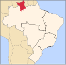
 Alto Alegre Location in Brazil | |
| Coordinates: 2°59′16″N 61°18′16″W | |
| Country | Brazil |
| Region | North |
| State | Roraima |
| Government | |
| • Mayor | Pedro Henrique Machado (PSD) |
| Area | |
| • Total | 25,567 km2 (9,871 sq mi) |
| Population (2020 [1]) | |
| • Total | 15,380 |
| • Density | 0.60/km2 (1.6/sq mi) |
| Time zone | UTC-04:00 (BRT-1) |
| Website | altoalegre.rr.gov.br |
Alto Alegre was founded by Pedro Costa, a gold miner. In 1982, it became an independent municipality.[3] It can be accessed from the RR-205 highway from Boa Vista.[4]
The municipality contains part of the Roraima National Forest.[5]
References
- IBGE 2020
- "IBGE | Cidades | Roraima | Alto Alegre". cidades.ibge.gov.br. Retrieved 2016-06-15.
- "Alto Alegre". IBGE (in Portuguese). Retrieved 15 April 2021.
- "sobre Alto Alegre". Municipality of Alto Alegre (in Portuguese). Retrieved 15 April 2021.
- Características da UC (in Portuguese), ICMBio, retrieved 2016-05-19
External links
- Official website (in Portuguese)
 Media related to Alto Alegre (Roraima) at Wikimedia Commons
Destinations from Alto Alegre | ||||||||||||||||
|---|---|---|---|---|---|---|---|---|---|---|---|---|---|---|---|---|
| ||||||||||||||||
Capital: Boa Vista | ||
| Boa Vista |
|  |
| Nordeste de Roraima |
| |
| Caracarai |
| |
| Sudeste de Roraima |
| |
 | This Roraima, Brazil location article is a stub. You can help Wikipedia by expanding it. |
На других языках
- [en] Alto Alegre, Roraima
[ru] Алту-Алегри (Рорайма)
Алту-Алегри (порт. Alto Alegre) — муниципалитет в Бразилии, входит в штат Рорайма. Составная часть мезорегиона Север штата Рорайма. Входит в экономико-статистический микрорегион Боа-Виста. Население составляет 16 448 человек на 2010 год. Занимает площадь 25567,031 км². Плотность населения — 0,64 чел./км².Текст в блоке "Читать" взят с сайта "Википедия" и доступен по лицензии Creative Commons Attribution-ShareAlike; в отдельных случаях могут действовать дополнительные условия.
Другой контент может иметь иную лицензию. Перед использованием материалов сайта WikiSort.org внимательно изучите правила лицензирования конкретных элементов наполнения сайта.
Другой контент может иметь иную лицензию. Перед использованием материалов сайта WikiSort.org внимательно изучите правила лицензирования конкретных элементов наполнения сайта.
2019-2025
WikiSort.org - проект по пересортировке и дополнению контента Википедии
WikiSort.org - проект по пересортировке и дополнению контента Википедии