world.wikisort.org - Australia
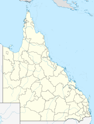
Fleurbaix is a locality in the Southern Downs Region, Queensland, Australia.[2] In the 2016 census, Fleurbaix had a population of 39 people.[1]
| Fleurbaix Queensland | |||||||||||||||
|---|---|---|---|---|---|---|---|---|---|---|---|---|---|---|---|
  Fleurbaix | |||||||||||||||
| Coordinates | 28.5277°S 151.9136°E | ||||||||||||||
| Population | 39 (2016 census)[1] | ||||||||||||||
| • Density | 5.20/km2 (13.47/sq mi) | ||||||||||||||
| Postcode(s) | 4375 | ||||||||||||||
| Area | 7.5 km2 (2.9 sq mi) | ||||||||||||||
| LGA(s) | Southern Downs Region | ||||||||||||||
| State electorate(s) | Southern Downs | ||||||||||||||
| Federal division(s) | Maranoa | ||||||||||||||
| |||||||||||||||
Geography
The north of the locality is hilly and undeveloped; it is part of the Herries Range. The south of the locality is also hilly. The area in-between is flatter and is used for farming. A number of creeks flow through this area.[3]
History
The locality was established as a soldier settlement area which was named after the railway station. The name was proposed by surveyor George Grant and refers to the site of French World War I Battle of Fleurbaix which involved the 5th Australian Division on 19 July 1916.[2]
References
- Australian Bureau of Statistics (27 June 2017). "Fleurbaix (SSC)". 2016 Census QuickStats. Retrieved 20 October 2018.
- "Fleurbaix – locality in Southern Downs Region (entry 45928)". Queensland Place Names. Queensland Government. Retrieved 25 November 2018.
- "Queensland Globe". State of Queensland. Retrieved 25 November 2018.

 | This Southern Downs Region, Queensland, Australia location article is a stub. You can help Wikipedia by expanding it. |
Другой контент может иметь иную лицензию. Перед использованием материалов сайта WikiSort.org внимательно изучите правила лицензирования конкретных элементов наполнения сайта.
WikiSort.org - проект по пересортировке и дополнению контента Википедии