world.wikisort.org - Australia
Glengallan is a rural locality in the Southern Downs Region, Queensland, Australia.[2] In the 2016 census, Glengallan had a population of 54 people.[1]
| Glengallan Queensland | |||||||||||||||
|---|---|---|---|---|---|---|---|---|---|---|---|---|---|---|---|
 Glengallan | |||||||||||||||
| Coordinates | 28.1091°S 152.0616°E | ||||||||||||||
| Population | 54 (2016 census)[1] | ||||||||||||||
| • Density | 2.126/km2 (5.51/sq mi) | ||||||||||||||
| Postcode(s) | 4370 | ||||||||||||||
| Area | 25.4 km2 (9.8 sq mi) | ||||||||||||||
| LGA(s) | Southern Downs Region | ||||||||||||||
| State electorate(s) | Southern Downs | ||||||||||||||
| Federal division(s) | Maranoa | ||||||||||||||
| |||||||||||||||
Geography
Glengalla is part of the Darling Downs.[3]
The New England Highway enters the locality from the north-west (Mount Marshall). The Cunningham Highway enters the locality from the south-east and merges with the New England Highway, and then together exits the locality to the south (Willowvale and Sladevale).[3]
History
The name Glengallan derives from the name of the pastoral run, taken up by Colin and John Campbell in 1841.[2]
Glengallan Station School opened circa 1886 for the education for the children of the staff of Glengallan Station. In 1891 it became Glengallan Provisional School. On 1 January 1909, it became Glengallon State School. It closed in 1921. In late 1922 or early 1923, it was amalgamated with Wilsonville State School to become Mount Marshall State School.[4]
A Methodist church was built in Glengallan in 1908.[5]
St Andrew's Anglican Church was dedicated on 23 November 1908 by Archbishop St Clair Donaldson. It closed in 1962.[6]
Heritage listings
Glengallan has a number of heritage-listed sites, including:
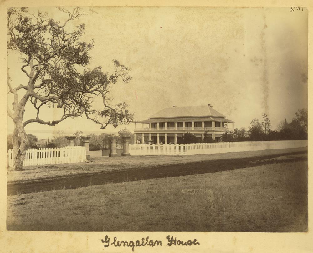
- New England Highway: Glengallan Homestead[7]
References
| Wikimedia Commons has media related to Glengallan, Queensland. |
- Australian Bureau of Statistics (27 June 2017). "Glengallan (SSC)". 2016 Census QuickStats. Retrieved 20 October 2018.
- "Glengallan – locality in Southern Downs Region (entry 49208)". Queensland Place Names. Queensland Government. Retrieved 6 May 2019.
- "Queensland Globe". State of Queensland. Retrieved 6 May 2019.
- Queensland Family History Society (2010), Queensland schools past and present (Version 1.01 ed.), Queensland Family History Society, ISBN 978-1-921171-26-0
- "METHODISM". Warwick Daily News. No. 5109. Queensland, Australia. 30 November 1935. p. 8. Retrieved 10 September 2021 – via National Library of Australia.
- "Closed Anglican Churches". Anglican Church South Queensland. Archived from the original on 3 April 2019. Retrieved 29 June 2020.
- "Glengallan Homestead (entry 600007)". Queensland Heritage Register. Queensland Heritage Council. Retrieved 13 July 2013.
Другой контент может иметь иную лицензию. Перед использованием материалов сайта WikiSort.org внимательно изучите правила лицензирования конкретных элементов наполнения сайта.
WikiSort.org - проект по пересортировке и дополнению контента Википедии