world.wikisort.org - Australia
Glenlyon is a rural locality in the Southern Downs Region, Queensland, Australia.[2] In the 2016 census, Glenlyon had a population of 24 people.[1]
| Glenlyon Queensland | |||||||||||||||
|---|---|---|---|---|---|---|---|---|---|---|---|---|---|---|---|
 Lake Glenlyon, 2012 | |||||||||||||||
 Glenlyon | |||||||||||||||
| Coordinates | 28.9194°S 151.4522°E | ||||||||||||||
| Population | 24 (2016 census)[1] | ||||||||||||||
| • Density | 0.0596/km2 (0.154/sq mi) | ||||||||||||||
| Postcode(s) | 4380 | ||||||||||||||
| Area | 402.9 km2 (155.6 sq mi) | ||||||||||||||
| Location |
| ||||||||||||||
| LGA(s) | Southern Downs Region | ||||||||||||||
| State electorate(s) | Southern Downs | ||||||||||||||
| Federal division(s) | Maranoa | ||||||||||||||
| |||||||||||||||
Geography
Lake Glenlyon is a long thin north–south lake in the middle of the locality; it was created by impounding Pike Creek with the Glenlyon Dam.[3] It is also known as the Pike Creek Reservoir.
Road infrastructure
The Stanthorpe – Texas Road runs through from north to west.[4]
History
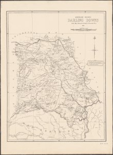
The locality's name is derived from Glenlyon pastoral run taken up in 1844 by Alexander McLeod. The run can be seen on an 1883 Darling Downs Run Map on Pikes Creek, south of Pikes Creek run.[2] In 1996 Scott McLeod Walker, a great grandson of Alexander McLeod, privately wrote and published a book entitled Glenlyon Connections. The book contains a history of the pastoral run and of some of the families who owned it.[5]
References
- Australian Bureau of Statistics (27 June 2017). "Glenlyon (SSC)". 2016 Census QuickStats. Retrieved 6 November 2018.
- "Glenlyon – locality in Southern Downs Region (entry 46010)". Queensland Place Names. Queensland Government. Retrieved 8 November 2017.
- "Queensland Globe". State of Queensland. Retrieved 6 November 2018.
- Glenlyon, Queensland (Map). Google Maps. Retrieved 23 October 2021.
- Scott McLeod Walker: Glenlyon Connections: ISBN 0-646-13431-0 : published 1996
External links
![]() Media related to Glenlyon, Queensland at Wikimedia Commons
Media related to Glenlyon, Queensland at Wikimedia Commons
This Southern Downs Region, Queensland, Australia location article is a stub. You can help Wikipedia by expanding it. |
Другой контент может иметь иную лицензию. Перед использованием материалов сайта WikiSort.org внимательно изучите правила лицензирования конкретных элементов наполнения сайта.
WikiSort.org - проект по пересортировке и дополнению контента Википедии