world.wikisort.org - Australia
Deniliquin, (/dəˈnɪlɪkwɪn/)[2] known locally as "Deni", is a town in the Riverina region of New South Wales, Australia, close to the border with Victoria. It is the largest town in the Edward River Council local government area.
| Deniliquin New South Wales | |||||||||
|---|---|---|---|---|---|---|---|---|---|
 Deniliquin town centre | |||||||||
Deniliquin | |||||||||
| Coordinates | 35°32′0″S 144°58′0″E | ||||||||
| Population | 7,862 (2016 census)[1] | ||||||||
| Postcode(s) | 2710 | ||||||||
| Elevation | 93.0 m (305 ft) | ||||||||
| Location |
| ||||||||
| LGA(s) | Edward River Council | ||||||||
| County | Townsend | ||||||||
| State electorate(s) | Murray | ||||||||
| Federal division(s) | Farrer | ||||||||
| |||||||||
Deniliquin is located at the intersection of the Riverina and Cobb Highway approximately 725 kilometres (450 mi) south west of the state capital, Sydney and 285 kilometres (177 mi) due north of Melbourne. The town is divided in two parts by the Edward River, an anabranch of the Murray River, with the main business district located on the south bank.
The town services a productive agricultural district with prominent rice, wool and timber industries. At the 2016 census, the urban population of Deniliquin was 6,833.[3]
History
Prior to European settlement, the Aboriginal inhabitants of the Deniliquin area were the Barababaraba people.[4]
In 1843, the entrepreneur and speculator Benjamin Boyd acquired land in the vicinity of present-day Deniliquin (probably via his agent Augustus Morris). The location was known as The Sandhills, but Boyd (or Morris) named it Deniliquin after 'Denilakoon', a local Aborigine famed for his wrestling prowess.[5] An inn and a punt were established on the site between 1845 and 1847; the town site was surveyed in 1848, and gazetted in 1850.[4] The original Native Police force of Frederick Walker was organised at Deniliquin in 1848. Deniliquin Post Office opened on 1 January 1850.[6]
In 1853, William John Wills of the Burke and Wills expedition worked as a shepherd at the Royal Bank sheep station near Deniliquin.
As Deniliquin was established on the convergence of major stock routes between the colonies of Queensland, New South Wales and the Victorian gold rush centres of Victoria, it soon became an important river crossing and the first bridge was built over the Edward River in 1861. The Deniliquin and Moama Railway Company built a private railway in 1879 to connect with Moama, across the Murray River from the busy river port of Echuca, connected by rail to Melbourne.[4]

Wool growing quickly became a major industry and the area around Deniliquin was home to several Merino studs.[4] In 1861, George Hall Peppin and his two sons, experienced English sheep breeders, established a Merino stud at Wanganella station, north of Deniliquin. There, the brothers developed the Peppin Merino, able to thrive in drier inland regions. Today, as many as 70 per cent of Merinos in Australia are said to be directly descended from these sheep.[7]
In the 1860s, Deniliquin was the centre of a short-lived campaign by wealthy pastoralists including Peppin, George Desailly, Robert Landale and William Brodribb for secession from New South Wales and the creation of a new Riverina colony. This campaign was supported by David Jones, proprietor of the local newspaper, the Pastoral Times.[8][9]
On 19 December 1868, Deniliquin was constituted as the Municipality of Deniliquin, and the first municipal election was held on 23 February 1869. In 1993, the enactment of the Local Government Act (NSW) saw the name of the council changed from the Municipality of Deniliquin to the Deniliquin Council.[10]
Large-scale irrigation schemes came to the Deniliquin area with the establishment of the Deniboota and Denimein Irrigation Districts in 1938 and the Berriquin Irrigation District in 1939, using water diverted from the Murray River at Lake Mulwala through the Mulwala Canal. An ample and reliable water supply led to the development of water-intensive industries such as rice growing.[11]
During the Second World War, RAAF Station Deniliquin was home to No. 7 Service Flying Training School RAAF. It was also a final disbanding site for squadrons returning from active duty against the Japanese in the Pacific. No. 22 Squadron RAAF[12] and No. 30 Squadron RAAF[13] were disbanded here in 1946, and in 1945 and 1946 it was also a base for No. 78 Squadron RAAF before it was finally disbanded in Williamtown.[14]
Also during World War II, Muswellbrook was the location of RAAF No.15 Inland Aircraft Fuel Depot (IAFD), completed in 1942 and closed on 29 August 1944. Usually consisting of 4 tanks, 31 fuel depots were built across Australia for the storage and supply of aircraft fuel for the RAAF and the US Army Air Forces at a total cost of £900,000 ($1,800,000).[15]
In April 2006, the Herald Sun reported on its front cover that the Edward River was dry, with an accompanying photograph showing a dry creek.[16] This was later revealed to be erroneous; the photograph was of an unknown channel on a farm within 60 kilometres (37 mi) of Deniliquin, while the Edward River was in fact still running. Deniliquin Council and members of the Deniliquin community have since attempted to rectify the damage to local tourism by improving the profile of Deniliquin in various media outlets.[17]
Heritage listings
Deniliquin has a number of heritage-listed sites, including:
- Cressy Street (South): Old St Paul's Anglican Church[18]
- Cressy Street: Waring Gardens[19]
- 72 End Street: Deniliquin 12 Pounder Rifled Breech-Loading Gun[20]
- 72 End Street: Deniliquin 75mm Field Gun[21]
- George Street: Deniliquin Public School and School Master's Residence[22]
- Poictiers Street: St Andrew's Uniting Church[23]
Population
According to the 2016 census of Population, there were 7,862 people in Deniliquin, including the surrounding rural area.
- Aboriginal and Torres Strait Islander people made up 4.5% of the population.
- 82.3% of people were born in Australia. The next most common country of birth was England at 1.4%.
- 87.5% of people spoke only English at home.
- The most common responses for religion were No Religion 27.6%, Catholic 24.6% and Anglican 17.7%.[1]
Industry


Deniliquin is a service centre for the surrounding agricultural region. The region includes both dryland and irrigated areas. The dryland areas support grazing, in particular beef cattle and wool growing. Deniliquin is home to many famous Merino studs and the saltbush plains produce quality medium class wool.
The irrigated areas produce a range of high-yield crops. Rice was a major crop until the recent drought. The largest rice mill in the southern hemisphere is in Deniliquin, producing large packs and bulk rice for export markets.[24] The rice mill closed in December 2007 and will reopen in April 2011.[25][26]
Deniliquin is also the headquarters of Murray Irrigation Limited, an irrigator owned private company and one of the largest privately owned irrigation supply companies in the world. Murray Irrigation manages the operations of the Berriquin, Deniboota, Denimein and Wakool Irrigation Areas in the Murray Valley. These areas produce 50% of Australia's rice crop, 20% of NSW milk production, 75% of NSW processing tomatoes and 40% of NSW potatoes.[27]
Sawmills in the area process timber harvested from the River red gum forests lining the Edward and Murray floodplains.[28]
As the largest town in the south western Riverina, there is a range of government and commercial services to residents of the town and the surrounding area.
Climate
Deniliquin has a semi-arid climate with hot, dry summers and cool winters. The town's highest temperature of 49.6 °C (121.3 °F) was reached on 12 January 1878, and is one of the highest ever recorded in Australia.[29][30]
| Climate data for Deniliquin Visitor Information Centre (1858–2020); 96 m AMSL; 35.53° S, 144.97° E | |||||||||||||
|---|---|---|---|---|---|---|---|---|---|---|---|---|---|
| Month | Jan | Feb | Mar | Apr | May | Jun | Jul | Aug | Sep | Oct | Nov | Dec | Year |
| Record high °C (°F) | 49.6 (121.3) |
47.2 (117.0) |
45.0 (113.0) |
41.7 (107.1) |
31.1 (88.0) |
25.6 (78.1) |
25.9 (78.6) |
29.8 (85.6) |
35.0 (95.0) |
40.8 (105.4) |
44.2 (111.6) |
47.8 (118.0) |
49.6 (121.3) |
| Average high °C (°F) | 32.5 (90.5) |
32.0 (89.6) |
28.7 (83.7) |
23.5 (74.3) |
18.6 (65.5) |
15.1 (59.2) |
14.4 (57.9) |
16.4 (61.5) |
19.7 (67.5) |
23.6 (74.5) |
27.5 (81.5) |
30.6 (87.1) |
23.6 (74.4) |
| Average low °C (°F) | 15.7 (60.3) |
15.7 (60.3) |
13.3 (55.9) |
9.5 (49.1) |
6.5 (43.7) |
4.5 (40.1) |
3.4 (38.1) |
4.4 (39.9) |
6.2 (43.2) |
8.8 (47.8) |
11.7 (53.1) |
14.1 (57.4) |
9.5 (49.1) |
| Record low °C (°F) | 4.4 (39.9) |
4.5 (40.1) |
0.6 (33.1) |
0.0 (32.0) |
−3.9 (25.0) |
−5.6 (21.9) |
−6.1 (21.0) |
−6.1 (21.0) |
−3.3 (26.1) |
−1.7 (28.9) |
0.6 (33.1) |
2.2 (36.0) |
−6.1 (21.0) |
| Average precipitation mm (inches) | 28.2 (1.11) |
28.2 (1.11) |
32.1 (1.26) |
30.2 (1.19) |
38.0 (1.50) |
39.8 (1.57) |
34.9 (1.37) |
36.7 (1.44) |
37.7 (1.48) |
39.3 (1.55) |
29.9 (1.18) |
29.7 (1.17) |
405.7 (15.97) |
| Average precipitation days | 3.8 | 3.6 | 4.1 | 5.1 | 7.4 | 9.1 | 9.6 | 9.5 | 8.4 | 7.4 | 5.3 | 4.6 | 77.9 |
| Average relative humidity (%) | 30 | 33 | 37 | 44 | 56 | 63 | 62 | 55 | 48 | 40 | 34 | 31 | 44 |
| Source: [31] | |||||||||||||
Notable people
Notable people from, or who have lived in, the Deniliquin area include:
- Adam Alexander Armstrong MC, OBE, former Member for Riverina, official Victoria Racing Club starter (21 Melbourne Cups), Military Cross awarded WW 2 for bravery in New Guinea[32]
- Leo Barry, an Australian rules football player with Sydney Swans[33]
- Eileen Mary Casey (1881–1972), suffragette[34]
- Michael Cavanagh, drummer for Australian psychedelic rock band King Gizzard and The Lizard Wizard[35]
- Aileen Dent (1890–1978), artist[36]
- Malcolm Fraser, a former Liberal Prime Minister[37]
- Adam Gilchrist, test and one day cricket wicket keeper and sports commentator[38]
- Roy Higgins, Melbourne Cup winning jockey
- Patrick Jennings, a former Premier of New South Wales[39]
- Sam Lloyd, an Australian rules football player with Richmond Tigers
- Todd Marshall, an Australian rules football player with Port Adelaide Power
- Peter McIntyre, an Australian rules football player with Adelaide Crows
- Eric Moore, drummer and manager for Australian psychedelic rock band King Gizzard and The Lizard Wizard[35]
- Lee Naimo, Axis of Awesome guitarist
- Simon O'Donnell, test and one day cricket player, Australian rules football player and media personality[40]
Education
Deniliquin is well serviced by the education sector. The town has 3 public primary schools (Deniliquin South PS, Deniliquin North P.S, Edward PS), 1 Catholic primary school (St Michael's PS), 1 public high school (Deniliquin HS) and 1 independent K-10 school (Deniliquin Christian School)
It has a TAFE NSW Campus, which is part of the Riverina Institute of TAFE.[41]
Deniliquin is also the base for the NSW Department of Education South West Riverina regional office. South West Music Regional Conservatorium, part of a network of regional Conservatoriums in NSW, also offers a range of music tuition in schools and at their campus in Hardinge St.
Sport
Sporting clubs in the area include:
- Australian rules football
- Deniliquin Rams Football Club, have competed in the Murray Football League since 1933.
- Deniliquin Rovers Football Club competing in the Picola & District Football League.
The Deniliquin Football Association ran from 1900 to 1932.
- Rugby union football
- Deniliquin Drovers, competing in the Victorian Rugby Union Country Division
- Cricket
- Deniliquin Rhinos Cricket Team, competing in the Murray Valley Cricket Association
- Soccer
- Deniliquin Wanderers Soccer Club
Formed in the 1960s. Currently playing in the Griffith and District Football Association
Deni Play on the Plains Festival
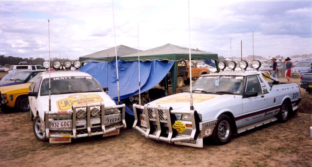
Deniliquin is home to the Play on the Plains Festival, held each September/October on the New South Wales Labour Day long weekend. The festival includes the well-known Deniliquin Ute Muster.[42][self-published source?] The Deni Play on the Plains Festival has set a number of world records, including the following:[42][self-published source?]
| Year | Number of utes in one location | Number of people wearing blue singlets |
|---|---|---|
| 1999 | 2839 | |
| 2000 | 2990 | |
| 2001 | 3012 | |
| 2002 | 3070 | |
| 2003 | 3418 | |
| 2004 | 4012 | 1328 |
| 2005 | 6172 | 1474 |
| 2006 | 6211 | 1566 |
| 2007 | 6235 | 1587 |
| 2008 | 7242 | 2702 |
| 2009 | 7000 | 2230 |
| 2010 | 10,152 | 3500 |
Music

Deniliquin has had many local bands, some notable ones being the Lincolns, the Stormtroopers and the Lexies. Attempts been made to encourage other bands to come to Deniliquin to perform, with varying success. Solo performers who came from Deniliquin include Shane McGrath, Michael Gorham and Joel Sulman, with local artists often showcased at the Deniliquin Ute Muster.[43]
Music festivals
Deniliquin has been home to many music festivals. These include:
- Deniliquin Blues and Roots Festival: Held over the Easter long weekend and has bought acts such as Status Quo, Santana, Jason Mraz (2013) and held in 2014 John Mayer, Elvis Costello, local artist Michael Gorham and previous local blues artist Joel Sulman. It won Best Inland Festival in 2013.
- The Flat Earth Festival, organised by a youth committee under the auspices of South West Music, beginning in 1999 and running until 2003. The aim of the Flat Earth Festival (so named because Deniliquin is on the Hay Plains, the area with the smallest deviation of elevation on Earth)[44] was to provide a music festival accompanied by other activities (such as motorcross demonstrations) in a drug- and alcohol-free environment.[45] The Flat Earth Festival youth committee failed to attract new members as previous members moved on, and the event recessed. Bands attending the Flat Earth Festival included Grinspoon and Sunk Loto.
- Shakedown Festival, which involves live bands and DJs. It is organised by the Deniliquin Youth Council, a sub-committee of the Deniliquin Municipal Council,[46] and is held during National Youth Week, on 14 April.[47] Notable acts appearing at Shakedown include Dukes of Windsor, Behind Crimson Eyes and Andy Van.
- Spring Blues Festival, inaugurated in 2006. The aim of the festival is to expose Deniliquin residents to talented blues musicians performing in Australia, as well as providing music workshops and impromptu jam sessions. Notable acts appearing at The Spring Blues Festival have included Dutch Tilders and Jeff Lang.[48]

Media
The local newspaper is the Deniliquin Pastoral Times. It is published on Tuesdays and Fridays and – on each of these days – has a circulation of 2787, with an estimated readership of 10,260.[49] Other newspapers circulated throughout the Deniliquin region include the Herald Sun, The Age, The Sydney Morning Herald and The Daily Telegraph.
There are three local radio stations: 102.5 Edge FM, 1521 2QN (classic hits) and 106.1FM (country music narrowcast), while ABC Local Radio's ABC Riverina service (broadcast from Wagga Wagga) is available on AM675. Other stations broadcasting throughout the region include Radio National, SBS Radio and Sky Sports Radio.
Locally available TV stations include ABC Television (ABC TV, ABC TV Plus, ABC Me and ABC News), SBS Television (SBS TV, SBS Viceland, SBS Food, NITV, SBS WorldWatch, SBS World Movies), Prime7 (Prime7 HD, 7Two, 7mate, 7flix and Racing.com), WIN Television (WIN HD, 9Go!, 9Gem, TVSN, WIN Gold and 9Life) and Southern Cross 10 (10 HD, 10 Peach, 10 Bold, 10 Shake, SBN and Sky News Regional). WIN Television produces a half-hour-long regional news bulletin which screens from Monday to Friday at 6pm.
The thriller The Clinic was filmed in Deniliquin in 2008. The producers used many locations in the town while shooting, including the Peppin Motor Inn, Warbreccan Homestead, Deniliquin abattoirs and the largest rice mill in the Southern Hemisphere.
References
- Australian Bureau of Statistics (27 June 2017). "Deniliquin (State Suburb)". 2016 Census QuickStats. Retrieved 3 January 2018.
- Macquarie Dictionary, Fourth Edition (2005). Melbourne, The Macquarie Library Pty Ltd. ISBN 1-876429-14-3
- Australian Bureau of Statistics (27 June 2017). "Deniliquin (Urban Centre)". 2016 Census QuickStats. Retrieved 3 January 2018.
- "Walkabout Australian Travel Guide - Deniliquin". Fairfax. Archived from the original on 22 February 2007. Retrieved 2007-02-04.
- Reed, A. W., Place-names of New South Wales: Their Origins and Meanings, (Reed: 1969).
- Premier Postal History. "Post Office List". Retrieved 11 April 2008.
- "Merino Sheep in Australia". The Australian Association of Stud Merino Breeders Limited. Archived from the original on 19 August 2006. Retrieved 4 February 2007.
- Hogg, Robert (2004). "jas review: Leighton Frappell, Lords of the Saltbush Plains: Frontier Squatters and the Pastoral Independence Movement 1865-1866". API Review of Books. Curtin University of Technology. Archived from the original on 21 September 2007. Retrieved 4 February 2007.
- "Peppin, George Hall (1800-1872)". Australian Dictionary of Biography. Australian National University. Retrieved 4 February 2007.
- "About Deniliquin Council". Deniliquin Council. Archived from the original on 21 August 2006. Retrieved 17 May 2007.
- Meyer, Wayne (2005). "The Irrigation Industry in the Murray and Murrumbidgee Basins" (PDF). CRC for Irrigation Futures Technical Report No. 03/05. CRC for Irrigation Futures. Archived from the original (PDF) on 18 September 2006. Retrieved 4 February 2007.
- Australian War Memorial website No. 22 Squadron Retrieved 10 February 2015
- Australian War Memorial website No. 30 Squadron Retrieved 10 February 2015
- Australian War Memorial website No. 78 Squadron Retrieved 10 February 2015
- Australia. Royal Australian Air Force. Historical Section (1995), Logistics units, AGPS Press, ISBN 978-0-644-42798-2
- "Country News". McPherson Media. Archived from the original on 29 September 2007. Retrieved 17 May 2007.
- "Deniliquin tries to counteract photo bungle". Australian Broadcasting Corporation. Archived from the original on 30 December 2010. Retrieved 17 May 2007.
- "St. Pauls Anglican Church & Hall (former)". New South Wales State Heritage Register. Office of Environment & Heritage. H00062. Retrieved 18 May 2018.
- "Waring Gardens, Bandstand and Pavilion". New South Wales Heritage Database. Office of Environment and Heritage. Retrieved 31 July 2020.
- "12 Pounder Rifled Breech-Loading Gun (Armstrong) (moveable heritage item)". New South Wales State Heritage Register. Office of Environment & Heritage. H01947. Retrieved 18 February 2020.
- "75mm Field Gun (moveable heritage item)". New South Wales State Heritage Register. Office of Environment & Heritage. H01948. Retrieved 18 February 2020.
- "Public School & School Masters Residence (former)". New South Wales State Heritage Register. Office of Environment & Heritage. H00144. Retrieved 18 May 2018.
- "St. Andrew's Uniting Church". New South Wales State Heritage Register. Office of Environment & Heritage. H00372. Retrieved 18 May 2018.
- "SunRice Deniliquin". Ricegrowers Limited. Archived from the original on 8 October 2006. Retrieved 4 February 2007.
- "Deniliquin buckles under Murray Darling crisis Deniliquin". Australia: ABC News. Retrieved 12 August 2008.
- Wood, Patrick (3 November 2010). "Deniliquin SunRice to reopen mill despite takeover bid". The Daily Advertiser. Retrieved 3 November 2010.
- "Taking up the challenge ~ Responsible irrigation management" (PDF). Murray Irrigation Limited. Archived from the original (PDF) on 29 August 2007. Retrieved 4 February 2007.
- "Managing Murray's mighty river red gums". Bush Telegraph Magazine. New South Wales Department of Primary Industries. Archived from the original on 28 September 2007. Retrieved 4 February 2007.
- "Rainfall and Temperature Records". Bureau of Meteorology. Retrieved 9 February 2015.
- "Australia: Highest Temperature". Arizona State University. Archived from the original on 16 February 2015. Retrieved 9 February 2015.
- "Climate statistics for". Bureau of Meteorology. Retrieved 20 January 2014.
- "Adam Alexander ("Bill") Armstrong, O.B.E, M.C." Michael McCormack. Retrieved 7 May 2021.
- "Hall of Fame: Leo Barry". sydneyswans.com.au. Retrieved 6 May 2021.
- "Biography – Eileen Mary Casey – People Australia". peopleaustralia.anu.edu.au. Retrieved 7 May 2021.
- NardwuarServiette (10 June 2018), Nardwuar vs. King Gizzard & The Lizard Wizard, retrieved 17 March 2019
- "Aileen Rose Dent | Robin Gibson Gallery". robingibson.net. Retrieved 7 May 2021.
- "A man of the land and the people". weeklytimesnow.com.au. 24 March 2015. Retrieved 7 May 2021.
- "adam gilchrist | Bradman Foundation". Retrieved 8 May 2021.
- "Obituary – Sir Patrick Alfred Jennings – Obituaries Australia". oa.anu.edu.au. Retrieved 8 May 2021.
- "Simon O'Donnell profile and biography, stats, records, averages, photos and videos". ESPNcricinfo. Retrieved 8 May 2021.
- TAFE NSW, Deniliquin Campus Archived 30 December 2006 at the Wayback Machine
- "Deniliquin Ute Muster Play on the Plains Festival". Deni-Play on the Plains Festival Limited. Retrieved 30 March 2007.[self-published source?]
- Meme, Deni. "Touring". Monday, 14 January 2013. AuspOp. Retrieved 2 July 2013.
- "Visit Hay – Real People, Real Experiences". Hay Tourism & Development Inc. Archived from the original on 10 March 2007. Retrieved 1 April 2007.
- "The Music Council of Australia: Way Out West". The Music Council of Australia. Retrieved 1 April 2007.
- "What's on in Deniliquin". Deniliquin Municipal Council. Archived from the original on 29 August 2007. Retrieved 1 April 2007.
- "National Youth Week 2007". Australian Government Department of Families, Community Services and Indigenous Affairs. Archived from the original on 29 March 2007. Retrieved 1 April 2007.
- "Deniliquin Spring Blues Festival". Deniliquin Spring Blues Festival. Archived from the original on 24 October 2006. Retrieved 2 April 2007.
- "Deniliquin Pastoral Times". Rural Press Sales. Retrieved 27 August 2011.
External links
- Series of Images of Deniliquin, New South Wales, 1994 – National Library of Australia
- Deniliquin Play On The Plain Festival
- Deniliquin Pastoral Times
- Deniliquin Businesses
Authority control | |
|---|---|
| General |
|
| National libraries | |
На других языках
[de] Deniliquin
Deniliquin ist eine Stadt im australischen Bundesstaat New South Wales und hat 6.833 Einwohner (Stand 2016).[1] Sie liegt in der Riverina-Region um den Murray River etwa 290 km nördlich von Melbourne.- [en] Deniliquin
Другой контент может иметь иную лицензию. Перед использованием материалов сайта WikiSort.org внимательно изучите правила лицензирования конкретных элементов наполнения сайта.
WikiSort.org - проект по пересортировке и дополнению контента Википедии