world.wikisort.org - Australia
The City of Frankston (officially known as Frankston City Council) is a local government area (LGA) in Victoria, Australia in the southern suburbs of Melbourne. It has an area of 130 square kilometres, and in June 2018, the City of Frankston recorded a population of 141,845.[1]
| City of Frankston Victoria | |||||||||||||||
|---|---|---|---|---|---|---|---|---|---|---|---|---|---|---|---|
 | |||||||||||||||
| Population | 139,281 (2021)[1] | ||||||||||||||
| • Density | 1,070/km2 (2,770/sq mi) | ||||||||||||||
| Established | 1994 1860 (original) | ||||||||||||||
| Area | 130 km2 (50.2 sq mi)[1] | ||||||||||||||
| Mayor | Cr Nathan Conroy | ||||||||||||||
| Council seat | Frankston | ||||||||||||||
| Region | South Eastern Melbourne | ||||||||||||||
| State electorate(s) |
| ||||||||||||||
| Federal division(s) | Dunkley | ||||||||||||||
| Website | City of Frankston | ||||||||||||||
| |||||||||||||||
Despite its similar area and name, the City of Frankston is a different entity to the former City of Frankston which existed from 1966 until 1994, which was a continuation of the former Shire of Frankston and was abolished under state government reforms. This is similar to the situation for the Shire of South Gippsland and Shire of Glenelg, but is unlike the City of Melbourne, City of Knox, City of Whittlesea and City of Melton, whose administrations stayed intact through the amalgamations of the early 1990s.[citation needed]
Geography
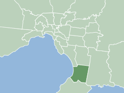
The City is located on the eastern shores of Port Phillip, and is bounded on the north by the City of Kingston and the City of Greater Dandenong, on the east by the City of Casey, and on the south by the Shire of Mornington Peninsula. The boundaries of the City are defined largely on the north by Eel Race Road and Thompsons Road, on the east by the Dandenong-Hastings Road, and on the south by a complex boundary featuring Baxter-Tooradin Road, Golf Links Road and Humphries Road.[2]
History
The City of Frankston was created in 1994 out of the remains of three abolished councils — all but the suburb of Mount Eliza from the former City of Frankston; the suburbs of Carrum Downs, Langwarrin and Skye from the City of Cranbourne; and part of Carrum Downs from the City of Springvale.[3]
The major part of the City was first incorporated in 1860 as the Mornington Roads District, which became a shire in 1871 and was renamed Shire of Frankston and Hastings in 1893, losing its western riding to form the Shire of Mornington, which has since been amalgamated into the Shire of Mornington Peninsula.[citation needed] On 19 October 1960, the Shire of Frankston and Hastings split in two, with the western part remaining as the Shire of Frankston, and the eastern part being incorporated as the Shire of Hastings.[citation needed]
Frankston was officially proclaimed as a City on 24 August 1966.[4]
In 1993 the state government announced a major statewide program of local government amalgamations, most of which took effect on 15 December 1994. Most councils and their LGA's were abolished with new ones being created to replace them.[citation needed]
Some changes occurred between the release of the Local Government Board report in July and the actual amalgamation — the original plan was to merge with the City of Chelsea and take Braeside and Carrum Downs from the City of Springvale. However, Frankston City Council submitted that it should expand eastwards instead, as well as taking Mount Eliza and Baxter.[5] By October, the present boundaries had been agreed upon, but the new entity was to be known as the City of Nepean. This appeared in the Board's final report in November 1994.[6][7] However, the State Government ultimately decided to use the old name for the new entity, departing from the Board's recommendation.[8]
Council
The current council, as of November 2020, in order of election, is:[9]
| Ward | Party | Councillor | Notes | |
|---|---|---|---|---|
| North-East | Liberal | Nathan Conroy | Mayor | |
| Independent | David Asker | |||
| Independent | Suzette Tayler | Deputy Mayor | ||
| North-West | Independent | Steven Hughes | ||
| Independent | Kris Bolam | |||
| Independent | Sue Baker | |||
| South | Labor | Brad Hill | ||
| Independent | Claire Harvey | |||
| Independent | Liam Hughes | |||
Mayors
The following Frankston councillors have served as mayor since the inaugural elections in 1997:
- 1997-1998 Wayne Woods
- 1998-1999 Wiliam Parkin
- 1999-2000 David-Jon Dawn
- 2000-2001 Mark Conroy
- 2001-2003 Cathy Wilson
- 2003-2004 Barry Priestly
- 2004-2005 Rochelle McCarther
- 2005-2006 Vicki McClelland
- 2006-2007 Glenn Aitken
- 2007-2008 Alistair Wardle
- 2008-2009 Colin Hampton
- 2009-2010 Christine Richards
- 2010-2011 Kris Bolam JP
- 2011-2012 Brian Cunial
- 2012-2013 Sandra Mayer
- 2013-2014 Darrel Taylor
- 2014-2015 Sandra Mayer
- 2015-2016 James Dooley
- 2016-2017 Brian Cunial
- 2017-2018 Colin Hampton
- 2018-2019 Michael O'Reilly
- 2019-2020 Sandra Mayer
- 2020-2021 Kris Bolam JP
- 2021-2022 Nathan Conroy
Suburbs
- Carrum Downs
- Frankston
- Frankston North
- Frankston South
- Langwarrin South
- Langwarrin
- Sandhurst
- Seaford
- Skye
Wards
Ratepayers within the municipality are represented by elected city councillors. In the 2005 elections, held on 26 November 2005, where the previous single-councillor ward system was replaced with three, multi-councillor wards.[citation needed] These wards are known as North-West Ward (covering mostly Seaford, Frankston North and parts of Frankston), South-West Ward (covering the southern parts of Frankston and Frankston South) and East Ward (covering Langwarrin and Carrum Downs).[citation needed] Voting is compulsory and conducted by postal ballot, and is based on a preferential voting system.[citation needed]
Elections were last held in October 2020, and councillors were elected for a four-year term. Current councillors are:
- North West Ward: Steven Hughes, Kris Bolam JP and Sue Baker
- North East Ward: Nathan Conroy, David Asker and Suzette Tayler
- South Ward: Brad Hill, Claire Harvey and Liam Hughes[11]
Facilities
Notable facilities/locations within the LGA include;
- Peninsula Aquatic and Recreation Centre or PARC; a $49.7 million aquatic facility constructed in 2014 owned wholly by the Frankston City Council
- Frankston Park; known commercially as Skybus Stadium, is a suburban Australian rules football ground located in Frankston, Victoria, in Australia. It is home to the Frankston Football Club, which plays in the Victorian Football League. It is also the location of the first ever Australian Scout Jamboree in 1935 attendees by Lord Robert Baden-Powell
- Robinsons Reserve; The home of Frankston Softball Association and Frankston Tomatoes Baseball Club located in Frankston South
- Jubilee Park; a 13ha site in Frankston currently hosting both community cricket and Football clubs
- Ballam Park; 30 hectares of open areas and sporting fields including a premier athletics track which is home to the Frankston Little Athletics Club, AFL, soccer and cricket. It also The Park is also home to Ballam Park Homestead, an historic home and museum from the 1850s run by the Frankston Historical Society.
- Frankston Arts Centre; a purpose-built 800 seat performing and visual arts venue designed by renowned Australian Architect, Daryl Jackson, it was opened in 1995 by then Prime Minister, the Hon. Paul Keating.
Sister Cities
 Susono, in Shizuoka, Japan (established in 1982)[12]
 Wuxi, in Jiangsu Province, China (established in 2011)[13]
 Suva, in Rewa Province, Fiji (established in 2021)[14]
See also
- City of Frankston (former)
- List of places on the Victorian Heritage Register in the City of Frankston
- Mornington Peninsula and Western Port Biosphere Reserve
References
- "3218.0 – Regional Population Growth, Australia, 2017-18: Population Estimates by Local Government Area (ASGS 2018), 2017 to 2018". Australian Bureau of Statistics. Australian Bureau of Statistics. 27 March 2019. Retrieved 25 October 2019. Estimated resident population, 30 June 2018.
- "VICNAMES - The Register of Geographic Names". Victoria State Government Environment, Land, Water and Planning. Retrieved 10 July 2020.
- Australian Bureau of Statistics (1 August 1995). Victorian local government amalgamations 1994-1995: Changes to the Australian Standard Geographical Classification (PDF). Commonwealth of Australia. p. 6. ISBN 0-642-23117-6. Retrieved 16 December 2007.
- Victorian Municipal Directory. Brunswick: Arnall & Jackson. 1992. pp. 377–378, 695. Accessed at State Library of Victoria, La Trobe Reading Room.
- Neales, Sue (27 July 1994). "Crunch time for councils in south and south-east". The Age. p. 8.
- "The councils shake-up". The Age. 22 October 1994. p. 10.
- Gettler, Leon (19 November 1994). "Report outlines new council boundaries". The Age. p. 10.
- Gettler, Leon (16 December 1994). "Most council elections in 1996". The Age. p. 6.
- "Frankston City Council election results 2020". www.vec.vic.gov.au. Retrieved 8 November 2020.
- "Councillors". Frankston City Council. Retrieved 10 December 2020.
- "Councillors". Frankston City Council. Retrieved 12 March 2021.
- Frankston Susono Friendship Association
- Frankston City Council Archived 15 March 2012 at the Wayback Machine
- "Suva Fiji".
External links
Authority control | |
|---|---|
| General | |
| National libraries | |
На других языках
[de] Frankston City
-38.15145.13333333333 Frankston City ist ein lokales Verwaltungsgebiet (LGA) im australischen Bundesstaat Victoria. Frankston gehört zur Metropole Melbourne, der Hauptstadt Victorias. Das Gebiet ist 131 km² groß und hat etwa 130.000 Einwohner.- [en] City of Frankston
[ru] Франкстон
Городская территория Франкстон (англ. The City of Frankston) — район местного самоуправления в штате Виктория, Австралия, расположенный в южном пригороде Мельбурна. Занимает территорию 131 квадратный километр. По оценке на 2009 год население Франкстона составляло 128 576 человек[1].Другой контент может иметь иную лицензию. Перед использованием материалов сайта WikiSort.org внимательно изучите правила лицензирования конкретных элементов наполнения сайта.
WikiSort.org - проект по пересортировке и дополнению контента Википедии