world.wikisort.org - Australia
The Shire of South Gippsland is a local government area in Victoria, Australia, located in the south-eastern part of the state. It covers an area of 3,296 square kilometres (1,273 sq mi) and, in June 2018, had a population of 29,576.
| Shire of South Gippsland Victoria | |||||||||||||||
|---|---|---|---|---|---|---|---|---|---|---|---|---|---|---|---|
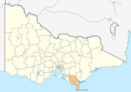 Location in Victoria | |||||||||||||||
| Population | 29,576 (2018)[1] | ||||||||||||||
| • Density | 8.9733/km2 (23.241/sq mi) | ||||||||||||||
| Established | 1994 | ||||||||||||||
| Gazetted | 2 December 1994[2] | ||||||||||||||
| Area | 3,296 km2 (1,272.6 sq mi)[1] | ||||||||||||||
| Mayor | Vacant | ||||||||||||||
| Council seat | Leongatha | ||||||||||||||
| Region | Eastern Victoria | ||||||||||||||
| State electorate(s) | Gippsland South | ||||||||||||||
| Federal division(s) | Monash | ||||||||||||||
 | |||||||||||||||
| Website | Shire of South Gippsland | ||||||||||||||
| |||||||||||||||
It includes the towns of Leongatha, Korumburra, Foster, Poowong, Mirboo North and Meeniyan. It was formed in 1994 from the amalgamation of the former Shire of South Gippsland with the Shire of Mirboo, and parts of the Shire of Korumburra and Shire of Woorayl.[2]
The Shire is governed and administered by the South Gippsland Shire Council; its seat of local government and administrative centre is located at the council headquarters in Leongatha, it also has a service centre located in Mirboo North. The Shire is named after the Gippsland region, in which the LGA occupies the southernmost portion, including Wilsons Promontory at the southern tip of the Australian continent.
Council
Current composition
The council is composed of three wards and nine councillors, with three councillors per ward elected to represent each ward.[3] The entire council were sacked by the state government on 19 June 2019 due to bullying allegations and general dysfunctionality.[4] The council was run by administrators until 2021 when a new council was elected.[5]
Administration and governance
The council meets in the council chambers at the council headquarters in the Leongatha Municipal Offices, which is also the location of the council's administrative activities. It also provides customer services at both its administrative centre in Leongatha, and its service centre in Mirboo North.
Townships and localities
In June 2018 the shire had a population of 29,576.[1]
| Population | |
| Locality | Total |
| Agnes | 57 |
| Arawata | 79 |
| Bena | 294 |
| Buffalo | 272 |
| Dumbalk | 413 |
| Fish Creek | 827 |
| Foster | 1,164 |
| Kongwak | 193 |
| Population | |
| Locality | Total |
| Koonwarra | 404 |
| Korumburra | 3,639 |
| Leongatha | 5,119 |
| Leongatha South | 628 |
| Loch | 638 |
| Middle Tarwin | 95 |
| Meeniyan | 1,040 |
| Mirboo | 290 |
| Mirboo North | 1,697 |
| Nyora | 1,527 |
| Population | |
| Locality | Total |
| Poowong | 360 |
| Port Franklin | 134 |
| Port Welshpool | 209 |
| Ruby | 188 |
| Sandy Point | 270 |
| Stony Creek | 281 |
| Tarwin | 56 |
| Tarwin Lower | 358 |
| Population | |
| Locality | Total |
| Toora | 681 |
| Venus Bay | 944 |
| Walkerville | 84 |
| Waratah Bay | 56 |
| Welshpool | 331 |
| Yanakie | 251 |
See also
List of localities (Victoria)
References
- "3218.0 – Regional Population Growth, Australia, 2017-18: Population Estimates by Local Government Area (ASGS 2018), 2017 to 2018". Australian Bureau of Statistics. Australian Bureau of Statistics. 27 March 2019. Retrieved 25 October 2019. Estimated resident population, 30 June 2018.
- Victoria Government Gazette – Online Archive (1837–1997). "S94 of 1994: Order estg (Part 6) the Shire of South Gippsland". State Library of Victoria. State Government of Victoria (published 2 December 1994). p. 3. Retrieved 10 January 2014.
- Local Government in Victoria. "South Gippsland Shire Council". Department of Transport, Planning and Local Infrastructure. State Government of Victoria. Retrieved 10 January 2014.
- South Gippsland council sacked
- Legg, Christine. "Councillors". www.southgippsland.vic.gov.au. Retrieved 6 April 2022.
External links
- South Gippsland Shire Council official website
- Metlink local public transport map
- Link to Land Victoria interactive maps
Другой контент может иметь иную лицензию. Перед использованием материалов сайта WikiSort.org внимательно изучите правила лицензирования конкретных элементов наполнения сайта.
WikiSort.org - проект по пересортировке и дополнению контента Википедии