world.wikisort.org - Australia
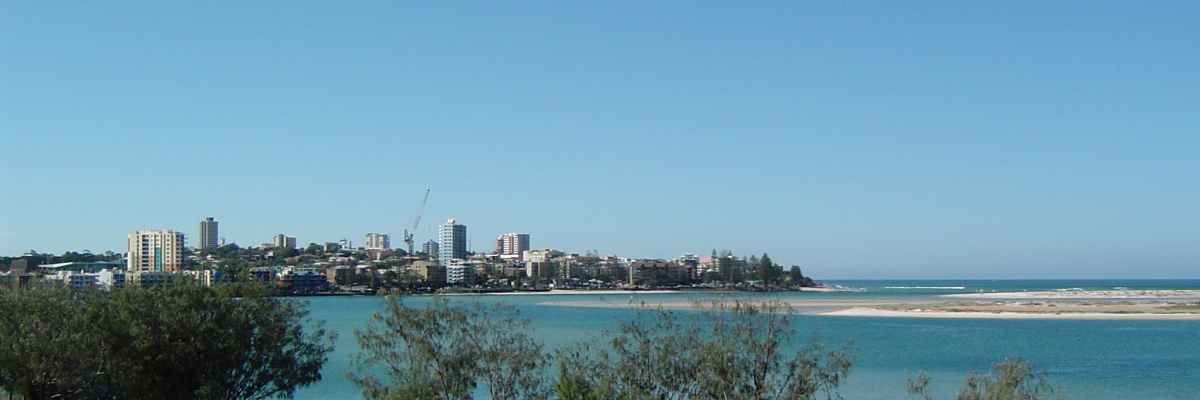
Caloundra (/kəˈlaʊndrə/ kə-LOWN-drə)[2] is a coastal town and the southernmost town in the Sunshine Coast Region in South East Queensland, Australia.[3]
| Caloundra Queensland | |
|---|---|
 | |
 | |
 Caloundra | |
| Coordinates | 26°48′S 153°08′E |
| Population | 51,095 (2016 census)[1] |
| Postcode(s) | 4551 |
| Time zone | AEST (UTC+10:00) |
| Location | 90 km (56 mi) from Brisbane |
| LGA(s) | Sunshine Coast Region |
| State electorate(s) | Caloundra, Kawana |
| Federal division(s) | Fisher |
Geography
Caloundra is 90 kilometres (55.9 mi) north of the Brisbane central business district. Caloundra is accessible from Landsborough railway station, 21 km away, and the Caloundra bus station. Bribie Island North is located across the Pumicestone Passage. Caloundra marks the coastal, northern extent of the Moreton Bay Marine Park.
History
Caloundra lies within the Aboriginal Gubbi Gubbi (Kabi Kabi, Cabbee, Carbi, Gabi Gabi) language region.[4] The name Caloundra is from the Gubbi Gubbi language Cullowundoor with Kal Owen meaning 'beech tree' (Gmelina leichhardtii) and Dha meaning 'place'.[3]
Caloundra Head was previously known as Petrie Point and Point Wickham (or Wickham Point). Point Wickham takes its name from John Clements Wickham, who did a hydrographic survey of the northern section of Moreton Bay in 1846 and was later the Government Resident of Moreton Bay from 1853 to 1859.[5] Point Wickham was in use by 1860, where it was noted on official maps.[6] In an 1892 map it is named "Caloundra Head (Wickham Point)"[7] and at some time later the use of Caloundra Head became dominant and the use of the name Point Wickham seems to have discontinued.[8]
In 1875, Robert Bulcock, an English immigrant who founded a Brisbane newspaper and later represented the Brisbane electorate of Enoggera in the Legislative Assembly of Queensland from 1885 until 1888, bought 277 acres (1.12 km2) of land in the region.[9] A town was surveyed in the 1870s, and land sales commenced in 1883. The first allotments of land in Caloundra were advertised for public auction on 28 August 1883. The map states 'the land is of a sandstone nature, undulating and ridgy, heavily timbered with Gum, Bloodwood, Tea-tree and Oak'.[10] A 1907 map shows several sections from George Street to Ernest St advertised for auction on 7 January 1907 by the Government Land Office.[11]
With its proximity to beaches, the area became popular with tourists and a number of hotels and guest houses were set up to accommodate them.[12]

In 1917, Bulcock's son, Robert Bulcock Jr, who was a councillor in the Shire of Landsborough, subdivided part of the land into 404 lots. This area became known as Bulcock Beach.[9] 404 allotments of 'Bulcock Estate' were advertised for auction on 16 August 1917 by Isle, Love and Co, auctioneers, with an edge of the Estate mapped as adjacent to Tripcony's store and the Tramway terminus.[13][14][15]
In 1919, 29 subdivided allotments of 'Caloundra Heads Estate' were advertised to be auctioned on 20 December 1919 by Cameron Bros. in Brisbane. A map advertising the auction shows the majority of blocks were on Albert Street between King Street and Kings Beach.[16][17] Another undated map shows more blocks of this estate were advertised for auction on King Street towards Ernest Street.[18]
By 1933, Caloundra had a population of 271.[19]
On Saturday 29 December 1934, Caloundra Methodist Church was opened and dedicated by the President of the Methodist State Conference, C. C. Truman. It was the first church in Caloundra.[20]
The Caloundra branch of the Queensland Country Women's Association was established in July 1937.[21][22]
St Andrew's Anglican Church was dedicated on Sunday 22 January 1939 by Archbishop William Wand. The construction of the church had been strongly encouraged by Wand who holidayed at Caloundra with his friend Queensland Governor Leslie Wilson. The Governor also attended the church's dedication.[23] On 10 December 1966 the foundation stone of the new church was laid Archbishop Philip Strong, who opened and dedicated the new church on 8 December 1967. The new church was consecrated in 1974.[24][25]
The first female councillor was Miriam Westaway, who represented Division 5 from 29 April 1961 to 30 March 1973. She was one of the first teachers at Caloundra State School. She was active in community groups such as the RSL Women's Auxiliary and a founder of the Caloundra Branch of the Queensland Country Women's Association and the local branch of the Red Cross.[26]
During World War II, the area became key to Australian defence due to defensive positions along the beaches. Radar stations and machine gun pits were mounted, and Australian and US armed forces came to the area. From the early 1950s onwards, Caloundra experienced a boom in development and population, and by 1968, it had come to dominate the Shire of Landsborough so completely that the council chambers were relocated to Caloundra.[12]
The Caloundra Library opened in 1986 with a major refurbishment in 2017.[27]


Heritage listings
Caloundra has a number of heritage-listed sites, including:
- Bowman Road: Tripcony Hibiscus Caravan Park[28]
- 6 Arthur Street and 3 Canberra Terrace, Kings Beach: Caloundra Lighthouses[29]
- Ormonde Terrace, Kings Beach: Kings Beach Bathing Pavilion[30]
Suburbs
Caloundra is not strictly defined, but the boundary used by the Australian Bureau of Statistics for census purposes and the urban zone defined by the Sunshine Coast Regional Council (formerly the Caloundra City Council) almost exactly coincide. This region is bounded roughly by Currimundi Creek, Rainforest Drive and the Mooloolah River to the north, Beerwah State Forest and Bruce Highway to the west, the Pumicestone Passage (separating the area from Bribie Island) and the ocean to the east, and Bells Creek to the south. The central business district (CBD) for the area is located on Bulcock Street, Caloundra.
The Caloundra urban centre consists of the following suburbs:
|
|
Population
| Year | Population |
|---|---|
| 1933 | 271 |
| 1947 | 1,718 |
| 1954 | 2,124 |
| 1961 | 2,807 |
| 1966 | 3,657 |
| 1971 | 6,150 |
| 1976 | 10,602 |
| 1981 | 16,758 |
| 1986 | 16,215 |
| 1991 | 22,959 |
| 1996 | 29,096 |
| 2001 | 34,879 |
| 2006 | 41,293 |
| 2011 | 47,762 |
| 2016 | 51,095 |
Census populations for the Caloundra urban centre have been recorded since 1933. Since the 2001 census, it is divided between the Caloundra North and Caloundra South statistical local areas. The drop between 1981 and 1986 reflects an adjustment of the boundary with the Kawana Waters urban centre.
Climate
| Climate data for Caloundra, Queensland | |||||||||||||
|---|---|---|---|---|---|---|---|---|---|---|---|---|---|
| Month | Jan | Feb | Mar | Apr | May | Jun | Jul | Aug | Sep | Oct | Nov | Dec | Year |
| Record high °C (°F) | 37.6 (99.7) |
35.2 (95.4) |
33.8 (92.8) |
32.5 (90.5) |
29.6 (85.3) |
26.5 (79.7) |
27.0 (80.6) |
28.4 (83.1) |
33.3 (91.9) |
32.2 (90.0) |
34.6 (94.3) |
35.5 (95.9) |
37.6 (99.7) |
| Average high °C (°F) | 27.6 (81.7) |
27.2 (81.0) |
26.4 (79.5) |
24.6 (76.3) |
22.2 (72.0) |
19.8 (67.6) |
19.3 (66.7) |
20.3 (68.5) |
22.3 (72.1) |
24.1 (75.4) |
25.4 (77.7) |
27.0 (80.6) |
23.8 (74.8) |
| Average low °C (°F) | 21.4 (70.5) |
21.2 (70.2) |
19.9 (67.8) |
17.4 (63.3) |
14.9 (58.8) |
11.7 (53.1) |
10.8 (51.4) |
11.6 (52.9) |
13.9 (57.0) |
16.5 (61.7) |
18.5 (65.3) |
20.3 (68.5) |
16.5 (61.7) |
| Record low °C (°F) | 15.0 (59.0) |
15.3 (59.5) |
13.4 (56.1) |
9.3 (48.7) |
6.4 (43.5) |
4.3 (39.7) |
3.3 (37.9) |
5.0 (41.0) |
6.8 (44.2) |
9.2 (48.6) |
11.7 (53.1) |
12.7 (54.9) |
3.3 (37.9) |
| Average precipitation mm (inches) | 174.0 (6.85) |
202.4 (7.97) |
208.0 (8.19) |
172.9 (6.81) |
170.3 (6.70) |
102.4 (4.03) |
89.2 (3.51) |
60.8 (2.39) |
54.3 (2.14) |
81.1 (3.19) |
113.3 (4.46) |
147.4 (5.80) |
1,578.3 (62.14) |
| Source: Bureau of Meteorology[31] | |||||||||||||
Transport
The region of the Sunshine Coast, including Caloundra, is serviced by the Sunshine Coast Airport, located at Marcoola. A smaller regional airport is also located at Caloundra.
Caloundra's suburbs are served by Sunbus Sunshine Coast, who operate the Caloundra bus station in Cooma Terrace in the CBD. Bus routes 600, 602, 603, 605, 607, 609 connect Caloundra to Kawana Waters, Maroochydore, Buderim and Landsborough.[32]
Landsborough railway station on the Sunshine Coast line has regular services to Roma Street railway station in Brisbane, operated by Queensland Rail. There are several bus companies providing coach services from Caloundra to Brisbane Airport.
Industry
Tourism


Caloundra has a variety of beaches, providing amenity to the local residents and tourists.
- Golden Beach is protected by Bribie Island to the east, and is used for swimming, windsurfing, boating and fishing. At low tide, Golden Beach and Bribie Island are relatively close.
- Bulcock Beach which is a still water beach, has board-walks, piers and numerous restaurants, and is situated opposite the northern end of Bribie Island. The Des Dywer walking track is an oceanway that starts at Bulcock beach and follows the coastline on cliffs and boardwalks. The walking track ends at Moffat Beach north-east of Bulcock, and is about a one-hour walk. Bulcock Beach is patrolled by volunteer lifesavers from Ithaca–Caloundra City Life Saving Club.
- Kings Beach, named for Allan King who ran a guest house in the area in 1888, is the main beach of Caloundra. Kings is patrolled all year round by Metropolitan – Caloundra Surf Life Saving Club and has a picnic and children's play area. Kings Beach also has a swimming pool which, whilst built to be separate from the ocean, is fed directly from seawater.
- Shelly Beach is not a swimming beach, with the danger of wild rough waves and rocks. However, the northern and southern ends are safer for more advanced or supervised swimmers. Locals often find these places appropriate as, not only is it remote from the crowds of the adjacent King's beach, but local council laws allow dogs on the sand. On low tide, shells and rock pools can be found along the beach. Shelly is surrounded by residential housing with a maximum of five storeys.
- Moffat Beach is not a patrolled beach, but Dicky Beach, located one kilometre north, has a surf lifesaving club and is patrolled year-round. Moffat Beach is surrounded by residential housing, cafes, a post office, a newsagent, parkland and apartments.
- The surf beaches are Kings Beach and Dicky Beach which commence at the eastern end of Bulcock Beach, namely
- Happy Valley (full east/south-east exposure) – Officially Happy Valley is part of and shown on maps as Bulcock Beach.
- Kings Beach (E/SE)
- Shelly Beach(E/NE)
- Moffat Beach (E/NE)
- Dicky Beach (E/NE)
- On Caloundra's outskirts is Aussie World, located at the Glenview turnoff on the Bruce Highway.
- Corbould Park Racetrack – Home of Sunshine Coast Turf Club which holds an important race meet during the Queensland Winter Racing Carnival, with the Group 3 Sunshine Coast Guineas and Listed Caloundra Cup.[33]
Amenities
The Sunshine Coast Regional Council operates a public library at 8 Omrah Avenue.[34]
The Caloundra branch of the Queensland Country Women's Association meets at 17 Kalinga Street.[35]
St Andrew's Anglican Church is at 46 Upper Gay Terrace, Kings Beach (26.8032°S 153.1381°E).[36]
Awards
Caloundra has won the Australian Tidy Town Award in 2012.
Notable residents
- Robert Bulcock, pastoralist and Queensland politician
- James C. Moffat, chemist and pastoralist
References
- Australian Bureau of Statistics (27 June 2017). "Caloundra (C) – Caloundra N. (Statistical Local Area)". 2016 Census QuickStats. Retrieved 14 March 2019.
* Australian Bureau of Statistics (25 October 2007). "Caloundra (C) – Caloundra S. (Statistical Local Area)". 2006 Census QuickStats. Retrieved 14 March 2019. - Create Caloundra – Stage 2 Community Engagement on YouTube, Sunshine Coast Council, 4 August 2021; Erosion threatening Golden Beach at Caloundra on YouTube, Seven News, 5 September 2022
- "Caloundra – town in Sunshine Coast Region (entry 5784)". Queensland Place Names. Queensland Government. Retrieved 29 June 2017.
-
 This Wikipedia article incorporates CC-BY-4.0 licensed text from: "Gubbi Gubbi". Queensland Aboriginal and Torres Strait Islander languages map. State Library of Queensland. Retrieved 23 January 2020.
- "Caloundra Head – cape in the Sunshine Coast Region (entry 5786)". Queensland Place Names. Queensland Government. Retrieved 18 April 2021.
- "Sketch to illustrate Sir George Bowen's Official Tour in March 1860". Queensland Government Open Data Portal. Retrieved 27 August 2022.
- "Wickham Point". Sunshine Coast Places. Archived from the original on 1 April 2015. Retrieved 18 April 2021.
- Queensland Surveyor General's Map of The Catchment Areas of Brisbane River and the Logan and Albert Rivers, July 1893
- "Bulcock Beach's Rich History". Salt Magazine. Spring 2009. Archived from the original on 20 June 2011. Retrieved 21 June 2011.
- "Town of Caloundra". State Library of Queensland. 28 August 1883. Archived from the original on 25 September 2020. Retrieved 20 May 2020.
- "Plan of allotments in sections 4, 10, 11 & 12, town of Caloundra, and allotments in suburban sections 5, 6, 8, 9, 2a, 5a to 7a and 9a, Parish of Bribie (Caloundra)". State Library of Queensland. 7 January 1907. Archived from the original on 25 September 2020. Retrieved 22 May 2020.
- University of Queensland (2011). "Queensland Places: Caloundra". Archived from the original on 6 July 2011. Retrieved 21 June 2011.
- "Bulcock Estate". State Library of Queensland. 1917. Archived from the original on 25 September 2020. Retrieved 22 May 2020.
- "The Bulcock Estate". The Brisbane Courier. Queensland, Australia. 21 July 1917. p. 12. Archived from the original on 25 September 2020. Retrieved 22 May 2020 – via Trove.
- "Bulcock Estate, Caloundra". The Brisbane Courier. Queensland, Australia. 9 August 1917. p. 8. Archived from the original on 25 September 2020. Retrieved 22 May 2020 – via Trove.
- "Caloundra Heads Estate". State Library of Queensland. 20 December 1919. Archived from the original on 25 September 2020. Retrieved 20 May 2020.
- "Advertising". The Brisbane Courier. Queensland, Australia. 16 December 1919. p. 10. Archived from the original on 25 September 2020. Retrieved 20 May 2020 – via Trove.
- "Caloundra Heads Estate : second section". State Library of Queensland. Archived from the original on 25 September 2020. Retrieved 20 May 2020.
- Commonwealth Statistician (1934). Census of the Commonwealth of Australia, 30 June 1933: Part VIII, Population and Occupied Dwellings in Localities. p. 14. Archived from the original on 5 June 2011. Retrieved 21 June 2011.
- "Caloundra Church Dedicated". Truth. No. 1814. Queensland, Australia. 30 December 1934. p. 15. Archived from the original on 25 September 2020. Retrieved 25 September 2020 – via National Library of Australia.
- "C.W.A. Branch Formed at Caloundra". Nambour Chronicle and North Coast Advertiser. Vol. XXXII, no. 1730. Queensland, Australia. 30 July 1937. p. 5. Archived from the original on 14 September 2020. Retrieved 1 January 2019 – via National Library of Australia.
- "MALENY". The Telegraph. Queensland, Australia. 13 August 1937. p. 17 (City Final Last Minute News). Archived from the original on 14 September 2020. Retrieved 1 January 2019 – via National Library of Australia.
- "Dedication of Church At Caloundra". The Telegraph. Queensland, Australia. 23 January 1939. p. 3 (CITY FINAL LAST MINUTE NEWS). Archived from the original on 25 September 2020. Retrieved 25 September 2020 – via National Library of Australia.
- "Year Book" (PDF). Anglican Archdiocese of Brisbane. 2019. p. 137. Archived (PDF) from the original on 15 September 2020. Retrieved 15 September 2020.
- "Parish profile" (PDF). The Anglican Parish of Caloundra-Glasshouse Country. p. 3. Archived (PDF) from the original on 24 September 2020. Retrieved 25 September 2020.
- Unknown (2012). "Landsborough Shire Councillor Miriam Westaway, ca 1965". Archived from the original on 14 September 2020. Retrieved 1 January 2019.
- "Public Libraries Statistical Bulletin 2016-17" (PDF). Public Libraries Connect. State Library of Queensland. November 2017. p. 15. Archived (PDF) from the original on 30 January 2018. Retrieved 30 January 2018.
- "Tripcony Hibiscus Caravan Park (entry 602708)". Queensland Heritage Register. Queensland Heritage Council. Retrieved 14 July 2013.
- "Caloundra Lighthouses (entry 602746)". Queensland Heritage Register. Queensland Heritage Council. Retrieved 14 July 2013.
- "Kings Beach Bathing Pavilion (entry 601513)". Queensland Heritage Register. Queensland Heritage Council. Retrieved 14 July 2013.
- "Climate Statistics for Caloundra, Queensland". Archived from the original on 24 February 2020. Retrieved 9 June 2012.
- Translink Queensland. "All bus timetables". Archived from the original on 17 March 2018. Retrieved 29 July 2017.
- "Winners and Past Results for the Sunshine Coast Guineas". Races.com (Australia). 2015. Archived from the original on 18 May 2015. Retrieved 12 May 2015.
- "Caloundra Library". Sunshine Coast Regional Council. Archived from the original on 30 January 2018. Retrieved 30 January 2018.
- "Branch Locations". Queensland Country Women's Association. Archived from the original on 26 December 2018. Retrieved 26 December 2018.
- "Contact Details". St Andrew's (Caloundra & Glasshouse Country). Archived from the original on 24 September 2020. Retrieved 24 September 2020.
External links
 Media related to Caloundra, Queensland at Wikimedia Commons
- Caloundra Regional Art Gallery Artabase page Archived 11 December 2007 at the Wayback Machine
- Caloundra Tourism
Authority control | |
|---|---|
| General | |
| National libraries | |
На других языках
[de] Caloundra
Caloundra (.mw-parser-output .IPA a{text-decoration:none}/kəˈlæɔn.dɹə/) ist die südlichste Stadt an der Sunshine Coast in Queensland, Australien. Caloundra hatte 2016 etwa 80.500 Einwohner[1] und befindet sich etwa eine Stunde nördlich vom Geschäftszentrum (CBD – City Business District) von Brisbane. Bis zum Brisbane International Airport sind es etwa 45 Minuten.- [en] Caloundra
[ru] Калаундра
Калаундра (англ. Caloundra) — город в восточной части австралийского штата Квинсленд, входит в состав района Саншайн-Кост. Население города по оценкам на 2006 год составляло примерно 87,6 тысяч человек[1], а население всего района — 313 тысяч человек (2008 год)[2]. Ближайший крупный город — Брисбен (расположен в 70 километрах на юге).Другой контент может иметь иную лицензию. Перед использованием материалов сайта WikiSort.org внимательно изучите правила лицензирования конкретных элементов наполнения сайта.
WikiSort.org - проект по пересортировке и дополнению контента Википедии