world.wikisort.org - Australia
Brisbane City is the central suburb and central business district of Brisbane, the state capital of Queensland, Australia.[3] It is colloquially referred to as the "Brisbane CBD" or "the city". It is located on a point on the northern bank of the Brisbane River, historically known as Meanjin, Mianjin or Meeanjin in the local Aboriginal Australian dialect.[4] The triangular shaped area is bounded by the median of the Brisbane River to the east, south and west.[5] The point, known at its tip as Gardens Point, slopes upward to the north-west where the city is bounded by parkland and the inner city suburb of Spring Hill to the north. The CBD is bounded to the north-east by the suburb of Fortitude Valley. To the west the CBD is bounded by Petrie Terrace, which in 2010 was reinstated as a suburb (after being made a locality of Brisbane City in the 1970s).
| Brisbane CBD Brisbane, Queensland | |||||||||||||||
|---|---|---|---|---|---|---|---|---|---|---|---|---|---|---|---|
 Brisbane CBD from Mount Coot-tha at night | |||||||||||||||
 Brisbane CBD | |||||||||||||||
| Coordinates | 27.4677°S 153.0261°E | ||||||||||||||
| Population | 9,460 (2016 census)[1] | ||||||||||||||
| • Density | 3,780/km2 (9,800/sq mi) | ||||||||||||||
| Established | 1825 | ||||||||||||||
| Postcode(s) | 4000 | ||||||||||||||
| Area | 2.5 km2 (1.0 sq mi) | ||||||||||||||
| Time zone | AEST (UTC+10:00) | ||||||||||||||
| LGA(s) | City of Brisbane (Central Ward)[2] | ||||||||||||||
| County | Stanley | ||||||||||||||
| Parish | North Brisbane | ||||||||||||||
| State electorate(s) | McConnel | ||||||||||||||
| Federal division(s) | Brisbane | ||||||||||||||
| |||||||||||||||

In the 2016 census the suburb of Brisbane City had a population of 9,460 people.[1]
Geography
The Brisbane central business district is an area of densely concentrated skyscrapers and other buildings, interspersed by several parks such as Roma Street Parklands, City Botanic Gardens and Wickham Park. It occupies an area of 1.367 km2. The city is laid out according to a grid pattern surveyed during the city's early colonial days, a feature typical of most Australian street patterns.
Most central streets are named after members of the House of Hanover. Queen Street (named in honour of Queen Victoria) is Brisbane's traditional main street and contains its largest pedestrian mall, the Queen Street Mall. Streets named after female members (Adelaide, Alice, Ann, Charlotte, Elizabeth, Margaret, and Mary) run parallel to Queen Street and perpendicular to streets named after male members (Albert, Edward, George, and William).
The CBD's squares include King George Square, Post Office Square and ANZAC Square (home to the city's central war memorial).
The Brisbane central business district was built on a spur of the Taylor Range with the highest spot in the suburb being Wickham Terrace.[6] North Quay is an area in the CBD that was a landing point during the first European exploration of the Brisbane River.
Petrie Bight
Petrie Bight is a reach of the Brisbane River (27.4636°S 153.0351°E),[7] which gives its name to the small pocket of land centred on the area under the Story Bridge's northern point, around the Brisbane River to Admiralty Towers II. The location was originally known as Petrie Gardens and was an early settlement farm, one of two that provided food for the colony.[8] The site was named after Andrew Petrie and has been the base for water police and in earlier times wharves.[9] The location of Customs House and the preference for wharves was due to site being directly downstream from the central business district.[9]
History
Wharf Street Baptist Church opened at 38 Wharf Street (corner of Adelaide Street, 27.4652°S 153.0296°E) on 6 February 1859. It was the first Baptist church to be built in Queensland, the Brisbane congregation having previously met in a range of public buildings since forming in 1855. It was designed in the Early Italianate style and was built by Andrew Petrie. The church was 57 by 34 feet (17 by 10 m) and could accommodate 250 people. The cost was £2000 for the land and building, but part of the cost was covered by donations, e.g. Thomas Blacket Stephens partially donated the land. In 1881, the church was enlarged, but the need for further growth resulted in a decision to build a new church, the City Tabernacle in Wickham Terrace. The Wharf Street church was sold, holding its last service on 5 October 1890 with the tabernacle being dedicated on 9 October 1890.[10][11][12][13] The building is no longer extant. On Tuesday 25 May 2021, a Baptist Historic plaque was placed at the site to commemorate the church.[14][15]
On 2 April 1860 the Queensland Government opened its first school, the Brisbane National School in Adelaide Street under headmaster John Rendall with an initial enrolment of 50 boys and 8 girls.[16]

A congregation of the Church of Christ was established on 23 September 1883 in the Brisbane central area. In the late 1890s the congregation purchased 430 Ann Street (27.4628°S 153.0302°E) to establish their first church, still operating as at 2021 under the name Your Church.[17][18][19][20]
The Brisbane City Library opened in 1965, moving into Brisbane Square in 2006.[21]
In 2010 and 2011, the city centre was damaged by floods.
In the 2016 census Brisbane City had a population of 9,460 people.[1]

Buildings and precincts

Up until 1964, a Brisbane City Council regulation limited building heights to 132 ft (40 m).[22] Some of the first skyscrapers built in the CBD include the SGIO building (now Suncorp Plaza) in 1970 and AMP Place in 1977.
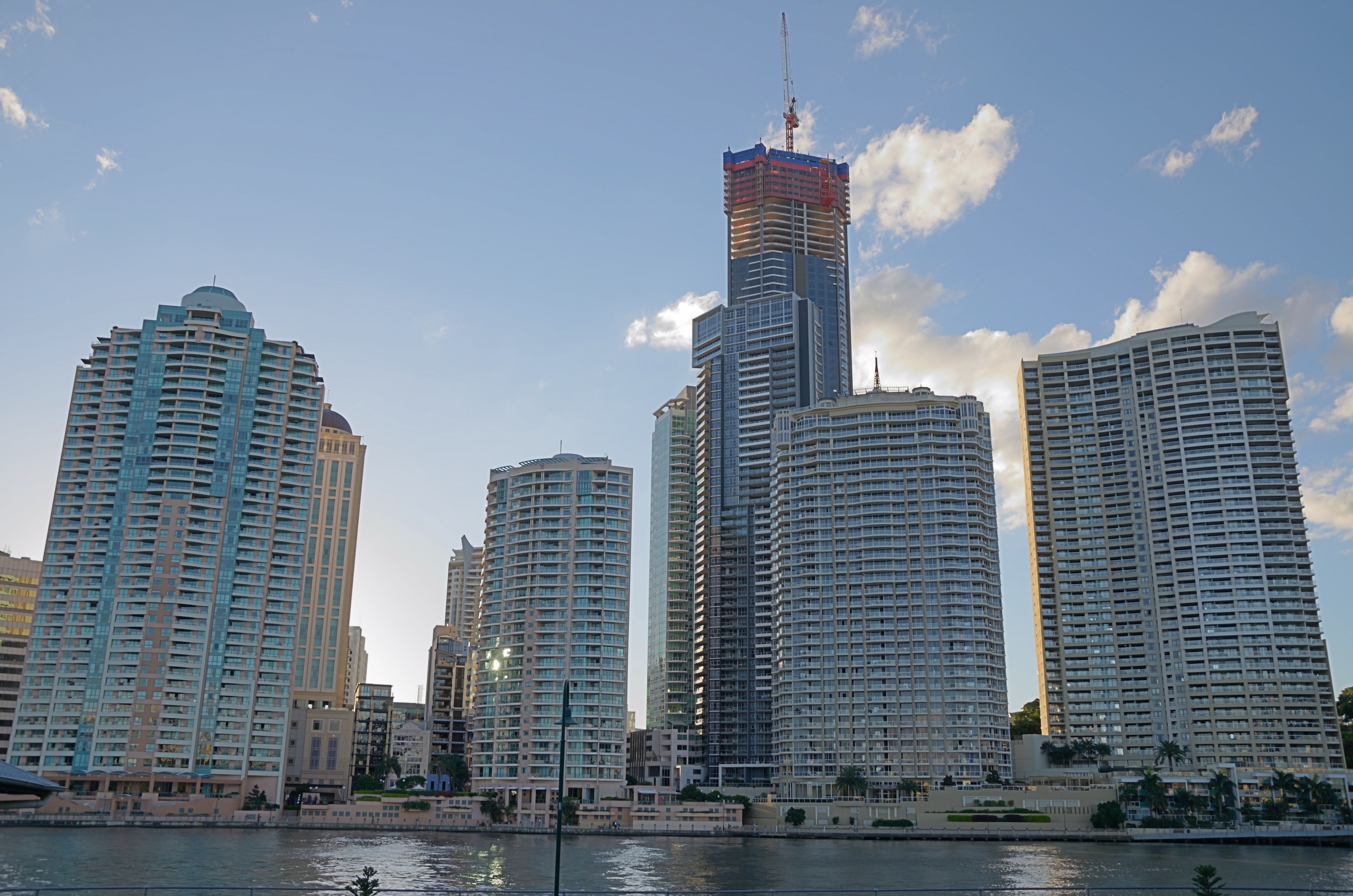
In the last few decades the number of apartment buildings that have been constructed has increased substantially. Brisbane is home to several of Australia's tallest buildings. Brisbane's tallest buildings are Brisbane Skytower at 270 metres, The One at 264 metres, One William Street at 260 metres, Soleil at 243 metres, Aurora Tower at 207 metres, Riparian Plaza at 200 metres, One One One Eagle Street at 195 metres, and Infinity at 249 metres, which was completed in 2014.
The Brisbane CBD is one of the major business hubs in Australia.[23] The City contains many tall office buildings occupied by organisations, businesses and all three levels of government that have emerged into a number of precincts. The areas around the Queen Street Mall and Adelaide Street is primarily a retail precinct. A legal precinct exists around the various court buildings located around the intersections of George Street and Adelaide and Ann Streets.
The government precinct was an area centred on the Executive Building that includes many Queensland Government offices. 111 George Street, Mineral House, and Education House are also located here. 1 William Street was completed in 2016, now serving the role of the former Executive Building. The Executive Building and Neville Bonner building were demolished for the state's largest infrastructure project. An urban renewal project based around the Queen's Wharf megaproject is under construction along the southern end of William Street, which includes a pedestrian bridge crossing the Riverside Expressway.[24]
Schools
The city is serviced by a number of schools in the surrounding suburbs including the Petrie Terrace State School in Paddington and The Albert Park Flexi School in Petrie Terrace.
Rental prices

Like most other Australian capital cities, Brisbane has experienced dramatic rises in rental prices for residential and office space before the global financial crisis. At the beginning of 2008, the Brisbane central business district contained 1.7 million square metres of office space.[25] High demand in the office market had pushed vacancy rates in the Brisbane CBD to 0.7% by January 2008, the lowest in Australia.[25] Premium grade office space was even less vacant with an occupancy rate of 99.9%. By the end of 2009 the situation had reversed. In mid 2013 the market for office space had declined to its worst position in two decades with a vacancy rate of just under 13%.[26]
Attractions

Major landmarks and attractions in the CBD include City Hall (including the Museum of Brisbane), the Story Bridge, the Howard Smith Wharves, ANZAC Square, St John's Cathedral, the Brisbane River and its Riverwalk network, the City Botanic Gardens, Roma Street Parkland, Queensland Parliament House, Old Government House and Customs House.
Heritage listings

Brisbane has many heritage-listed sites, including:
- a number of properties in Adelaide Street, Brisbane
- a number of properties in Albert Street, Brisbane
- a number of properties in Alice Street, Brisbane
- a number of properties in Ann Street, Brisbane
- Boundary Street: Howard Smith Wharves[27]
- a number of properties in Charlotte Street, Brisbane
- Coronation Drive: Coronation Drive retaining wall[28]
- 15 Countess Street: Roma Street railway station[29]
- a number of properties in Creek Street, Brisbane
- 118 Eagle Street: Mooney Memorial Fountain[30]
- 118A Eagle Street: Eagle Street Fig Trees[31]
- a number of properties in Edward Street, Brisbane
- a number of properties in Elizabeth Street, Brisbane
- a number of properties in Margaret Street, Brisbane
- 20–30 Market Street: Wenley House[32]
- a number of properties in Mary Street, Brisbane
- a number of properties in North Quay, Brisbane
- a number of properties in Queen Street, Brisbane
- Skew Street: First Brisbane Burial Ground[33]
- Skew Street: William Jolly Bridge[34]
- 168 Turbot Street: Brisbane Dental Hospital and College[35]
- 224 Turbot Street: King Edward Park Air Raid Shelter[36]
- 436 Upper Roma Street: Hellesvere[37]
- a number of properties in William Street, Brisbane
Population
In the 2016 Census, there were 9,460 people in Brisbane City. 32.2% of people were born in Australia. The most common countries of birth were China 8.9%, South Korea 8.3%, England 3.7%, Taiwan 3.2% and Brazil 2.8%. 43.7% of people only spoke English at home. Other languages spoken at home included Mandarin 12.3%, Korean 7.7%, Cantonese 3.6%, Spanish 2.9% and Portuguese 2.7%. The most common responses for religion were No Religion 43.0% and Catholic 16.8%.[1]
Transport
By road, four road bridges connect the CBD with the southern bank of the Brisbane River: the Captain Cook Bridge, the Victoria Bridge, the William Jolly Bridge and the Go Between Bridge. The Story Bridge connects Fortitude Valley with Kangaroo Point and provides access to the city from the southern bank. The Captain Cook Bridge connects the Pacific Motorway, south of the river, with the Riverside Expressway which runs along the south western edge of the city. Heading under and bypassing the CBD is the Clem Jones Tunnel. Because on-street car parking is in high demand, parking meters are installed across the inner city.[38]
By bicycle and foot, the Goodwill Bridge allows cross river access to South Bank. The Kurilpa Bridge allows cross river access from North Quay to South Brisbane. Cyclists and pedestrians may also cross while using the Victoria, William Jolly, Go Between and Story road bridges.
The Brisbane central business district is the central hub for all public transport services in Brisbane. Bus services are centred on the Queen Street bus station and King George Square busway station. Suburban train services pass through Central railway station, and Roma Street railway station. Roma Street also serves as the terminus for long distance and country services. The central business district is served by various city ferries. Brisbane's CityCat high speed ferry service, popular with tourists and commuters, operates services along the Brisbane River between the University of Queensland and Northshore Hamilton, stopping at several CBD wharves.
The Brisbane Riverwalk, a pedestrian and cyclist pathway adjoins the central business district along the river bank.[39]

In popular culture
The Brisbane CBD has featured in a number of films, including:
- Inspector Gadget 2, the sequel to Inspector Gadget, featured many scenes showing the Brisbane CBD, South Bank and Kangaroo Point.
- The Marine, a film featuring John Cena, featured the Golden Triangle district of the CBD, during a scene in which an explosion occurred.
- Fool's Gold, a 2008 film featured the CBD primarily the Botanic Gardens throughout the beginning of the film.
- One of Jackie Chan's films, Jackie Chan's First Strike, featured the city in many scenes to the end of the film from Fortitude Valley, east of the CBD.
- The Brisbane CBD was used in Powderfinger's 2009 music video "All of the Dreamers".
- The 2009 vampire film Daybreakers was filmed in Brisbane.
- In the 2015 film San Andreas starring Dwayne Johnson, several streets of the CBD were used to portray San Francisco.[40]
- In the 2017 film Thor: Ragnarok, Mary Street was used in a scene with Chris Hemsworth and Tom Hiddleston to portray New York City.[41]
See also
- List of Brisbane suburbs
References
- Australian Bureau of Statistics (27 June 2017). "Brisbane City (SSC)". 2016 Census QuickStats. Retrieved 20 October 2018.
- "Central Ward". Brisbane City Council. Brisbane City Council. Archived from the original on 18 February 2017. Retrieved 4 March 2017.
- "Brisbane City – suburb in City of Brisbane (entry 49245)". Queensland Place Names. Queensland Government. Retrieved 26 December 2020.
- "Indigenous Placenames of South East Queensland". Archived from the original on 24 December 2021. Retrieved 29 January 2021.
- "Queensland Globe; Layer:Boundaries". Archived from the original on 19 December 2017. Retrieved 24 December 2021.
- Gregory, Helen (2007). Brisbane Then and Now. Wingfield, South Australia: Salamander Books. p. 60. ISBN 978-1-74173-011-1.
- "Petrie Bight (entry 26538)". Queensland Place Names. Queensland Government. Retrieved 3 February 2015.
- "Brisbane – Then and Now – The Centenary of Federation". Australian Broadcasting Corporation. 24 April 2001. Archived from the original on 10 November 2012. Retrieved 21 August 2009.
- Gregory, Helen (2007). Brisbane Then and Now. Wingfield, South Australia: Salamander Books. p. 20. ISBN 978-1-74173-011-1.
- "Queensland Baptist churches by date of erection/opening". Baptist Church Archives Queensland. Archived from the original on 26 November 2021. Retrieved 29 November 2021.
- "1859 Wharf Street". Baptist Church Archives Queensland. Archived from the original on 26 November 2021. Retrieved 29 November 2021.
- "THE ROSTER AT IPSWICH". The Moreton Bay Courier. Vol. XIII, no. 728. Queensland, Australia. 12 February 1859. p. 3. Archived from the original on 2 December 2021. Retrieved 29 November 2021 – via National Library of Australia.
- "Baptist City Tabernacle (entry 600175)". Queensland Heritage Register. Queensland Heritage Council. Retrieved 1 August 2014.
- "Archives and Baptist Heritage: Baptist Heritage – 7th Historic Plaque Unveiled at Significant City Site". The QB Magazine. 1 June 2021. Archived from the original on 6 December 2021. Retrieved 24 December 2021.
- "Plaque No 7". Baptist Heritage Queensland. Archived from the original on 24 December 2021. Retrieved 24 December 2021.
- "Agency ID 8518, Brisbane National School". Queensland State Archives. Retrieved 25 July 2020.
- Haigh, George; Churches of Christ in Queensland (1983), Churches of Christ in Queensland : 100 years venturing in faith, Historical Committee, Conference of Churches of Christ in Queensland, p. 111, ISBN 978-0-909116-38-5
- "Your Church in Brisbane City". Archived from the original on 24 June 2021. Retrieved 21 June 2021.
- "Since 1883 – Your Church in Brisbane City". Archived from the original on 24 June 2021. Retrieved 21 June 2021.
- Google (21 June 2021). "430 Ann Street" (Map). Google Maps. Google. Retrieved 21 June 2021.
- "Public Libraries Statistical Bulletin 2016–17" (PDF). Public Libraries Connect. State Library of Queensland. November 2017. Archived (PDF) from the original on 30 January 2018. Retrieved 30 January 2018.
- McBride, Frank; et al. (2009). Brisbane 150 Stories. Brisbane City Council Publication. pp. 284–285. ISBN 978-1-876091-60-6.
- "Brisbane business visitor numbers skyrocket". Brisbane Marketing Convention Bureau. e-Travel Blackboard. 3 January 2008. Archived from the original on 20 January 2011. Retrieved 13 January 2008.
- "Gallery". 6 May 2022.
- "Business boom leaves Brisbane without office space". news.com.au. News Limited. Archived from the original on 28 July 2007. Retrieved 25 November 2008.
- Marissa Calligeros (15 August 2013). "Brisbane office space overload". Brisbane Times. Fairfax Media. Archived from the original on 16 August 2013. Retrieved 15 August 2013.
- "Howard Smith Wharves (entry 601781)". Queensland Heritage Register. Queensland Heritage Council. Retrieved 19 June 2013.
- "Coronation Drive (North Quay) Retaining Wall (entry 600134)". Queensland Heritage Register. Queensland Heritage Council. Retrieved 1 August 2014.
- "Roma Street Railway Station (entry 601208)". Queensland Heritage Register. Queensland Heritage Council. Retrieved 19 June 2013.
- "Eagle Street Fountain (entry 600087)". Queensland Heritage Register. Queensland Heritage Council. Retrieved 19 June 2013.
- "Eagle Street Fig Trees (entry 602440)". Queensland Heritage Register. Queensland Heritage Council. Retrieved 19 June 2013.
- "Wenley House (entry 600128)". Queensland Heritage Register. Queensland Heritage Council. Retrieved 19 June 2013.
- "First Brisbane Burial Ground (entry 700009)". Queensland Heritage Register. Queensland Heritage Council. Retrieved 19 June 2013.
- "William Jolly Bridge (entry 601694)". Queensland Heritage Register. Queensland Heritage Council. Retrieved 19 June 2013.
- "Brisbane Dental Hospital and College (entry 601909)". Queensland Heritage Register. Queensland Heritage Council. Retrieved 19 June 2013.
- "King Edward Park Air Raid Shelter (entry 602475)". Queensland Heritage Register. Queensland Heritage Council. Retrieved 19 June 2013.
- "Hellesvere (entry 600280)". Queensland Heritage Register. Queensland Heritage Council. Retrieved 19 June 2013.
- Parking meters and fees Archived 12 March 2022 at the Wayback Machine. Brisbane City Council. Retrieved on 14 March 2022.
- "About RiverWalk". Brisbane City Council. Archived from the original on 16 September 2006. Retrieved 5 January 2008.
- Arnold, Rikki-Lee (30 May 2015). "Lockyer Valley, Gold Coast and Brisbane star in background of disaster film San Andreas". The Courier-Mail. Archived from the original on 14 October 2017.
- Price, Amy (12 April 2017). "Thor Ragnarok trailer features scene filmed in Brisbane laneway". news.com.au. Archived from the original on 19 April 2017.
Further reading
- Petrie-Terrace Brisbane 1858–1988 – Its ups and downs, R. Fisher, Boolarong, 1988 ISBN 0-86439-050-5
External links
- "Explore the Classic City Centre" (PDF). Brisbane Heritage Trails. Brisbane City Council. 2013. Archived (PDF) from the original on 21 July 2021.
Другой контент может иметь иную лицензию. Перед использованием материалов сайта WikiSort.org внимательно изучите правила лицензирования конкретных элементов наполнения сайта.
WikiSort.org - проект по пересортировке и дополнению контента Википедии