world.wikisort.org - Australia
The Shire of Noosa is a local government area about 130 kilometres (81 mi) north of Brisbane in the Sunshine Coast district of South East Queensland, Australia. The shire covers an area of 870 square kilometres (335.9 sq mi). It existed as a local government entity from 1910 until 2008, when it was amalgamated with the Shire of Maroochy and City of Caloundra to form the Sunshine Coast Region. The shire was re-established on 1 January 2014.
| Shire of Noosa Queensland | |||||||||||||||
|---|---|---|---|---|---|---|---|---|---|---|---|---|---|---|---|
 Location within South East Queensland | |||||||||||||||
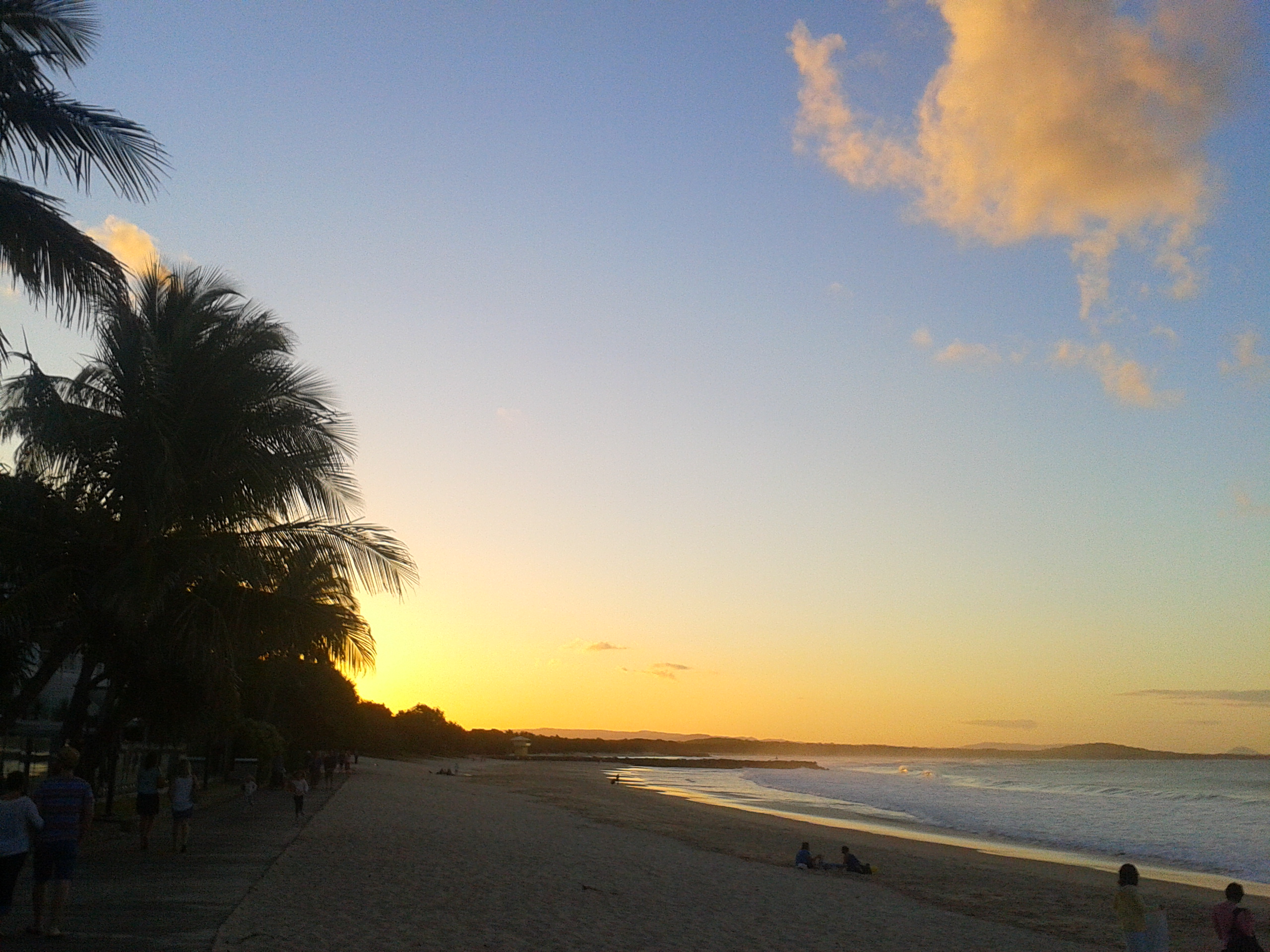
 Sunrise in Noosa. | |||||||||||||||
| Population | 55,369 (2018)[1] | ||||||||||||||
| • Density | 63.6/km2 (164.8/sq mi) | ||||||||||||||
| Established | 11 May 1910 – 15 March 2008 1 January 2014 | ||||||||||||||
| Area | 870 km2 (335.9 sq mi)[1] | ||||||||||||||
| Mayor | Clare Stewart | ||||||||||||||
| Council seat | Tewantin | ||||||||||||||
| Region | South East Queensland | ||||||||||||||
| State electorate(s) | Noosa | ||||||||||||||
| Federal division(s) | Wide Bay | ||||||||||||||
| Website | Shire of Noosa | ||||||||||||||
| |||||||||||||||
History
Geological history
The Noosa Hinterland was formed during the Oligocene era around 25-30 million years ago when volcanic activity created the ranges. By the beginning of the Neolithic era, Noosa's coast experienced a change in sea level rises when its beaches and waterways began to take shape.
Ancient history
The Noosa area was originally home to several Aboriginal groups. They primarily include the Undumbi tribe to the south, the Dulingbara to the north, and the Kabi Kabi (or Gabbi Gabbi) to the west.
Gubbi Gubbi (Kabi Kabi, Cabbee, Carbi, Gabi Gabi) is an Australian Aboriginal language spoken on Gubbi Gubbi country. The Gubbi Gubbi language region includes the landscape within the local government boundaries of the Sunshine Coast Region and Gympie Region, particularly the towns of Caloundra, Noosa Heads, Gympie and extending north towards Maryborough and south to Caboolture.[2]
In 2003, the Federal Court of Australia determined (title claim QC2013/003) that the native title holders for the Noosa area are the Kabi Kabi First Nation.[3]
Although much of the culture and presence of the traditional owners of the Noosa district has been lost during the short period of white settlement, there still exist many subtle reminders. They include:
- bora rings, used during rituals.
- canoe trees, marks on trees where bark was removed for canoes.
- border/navigation trees, marks on trees used to mark paths and/or tribal borders.
- stone carvings
- burial trees
- middens, shell mound created by thousands of years of discarded shells.
- stone axes
- spoken legends, many local legends which were traditionally passed through the generations survive today.
- place names, many local names are versions of the original Aboriginal names.
It is widely accepted that the name Noosa comes from the local Aboriginal word "Noothera" or "Gnuthuru", in the Kabi Kabi language, for shadow or shady place.[4] An 1870 map of Noosa shows the Noosa River written as Nusa River. This has led to an unfounded belief that the word Nusa is derived from the Indonesian word for island.[5]
A Keeping Place of indigenous cultural and sacred objects is maintained at the Noosa Shire Museum, Pomona.
Early European settlement
Although reports of the area can be traced back to Captain Cook's voyages in May 1770, European settlement in the region did not proceed until almost a century later. The difficulty of transport in the region, which persisted to the 1920s and beyond, was one major reason for that. European settlement was initially driven by timber logging, and then by a gold rush in the Gympie area, north of Noosa.
In 1871, the Government laid out a port at Tewantin. The surrounding land was duly surveyed and, by 1877, contained two hotels, a boarding house, school, police station and telegraph office. In 1872, the Noosa Heads and coastal region south to Peregian Beach was set aside as an Aboriginal Mission, but that was cancelled in 1878, and land was opened for selection on 15 January 1879. With the construction of the North Coast Railway inland from Tewantin, the port declined in importance after 1890.[6]
Noosa is a region, not a town. It contains beaches and a beach national park, the cleanest river in South-East Queensland and an extensive trail network inland, linking a number of lifestyle villages, including Cooroy and Pomona. In the last 50 years, Noosa has been transformed from an isolated fishing village to a tourist destination. Although that has had its costs, the shire is known for its generally greener approach to development. Most development in Noosa has been restrained. There are no high-rise buildings, due both to local community pressure and to council planning action, and much remaining native forest. 34.8% of the Noosa district consists of National Parks, Conservation Parks, State Forests, and other generally protected land, including parts of the biosphere reserve.
One of the reasons for the popularity of Noosa Heads is that it is one of the few north-facing beaches on Australia's east coast, hence Noosa Beach is relatively protected from the prevailing on-shore wind and from storms.
Council history
The area was originally incorporated on 11 November 1879, under the Divisional Boards Act 1879, as part of the Widgee Divisional Board. Noosa was created as a separate shire in 1910, under the Local Authorities Act 1902, with an initial population of 2,000. The first elections were held on 22 April 1910 and resulted in James Duke becoming the first shire chairman. The Noosa Shire Hall was constructed in Pomona in 1911.[6]
On 8 September 1917, an Honour Roll was unveiled at the Noosa Shire Hall in Pomona, to commemorate those from the district who had left Australia to serve in the armed forces during World War I.[7]
In the early 1970s, with Queensland Government backing, development commenced in the area around Noosa Sound. In December 1980, the shire headquarters moved to Pelican Street, Tewantin. The former shire hall in Pomona became the Noosa Museum, operated by the Cooroora Historical Society.[8][9]
In 1982, the Noosa community elected a young and energetic pro-environment and pro-planning council. The councillors who were most influential in that change were elected in a group called The Resident's Team[citation needed]. They laid the foundation for many of the planning and environmental-protection concepts for which Noosa is now well known[citation needed]. The 1982-1985 Noosa Council was the first to introduce the idea of a development/population cap[citation needed], the concept of strategic planning, a focus on community arts, and the use of design and landscape controls in development applications, and it produced drafts of many of the first development control plans for each of the Noosa townships. The business lobby, supported by several local media personalities, were successful in replacing that council with a pro-development one in the 1985 election,[citation needed] but the pro-development council was, in turn, largely removed by the Noosa community in 1988, at the next election.[citation needed]
Following the 1988 election of Noosa's first green mayor,[clarification needed] Noel Playford, who was a member of the 1982-1985 Residents Team[citation needed], Noosa's first formal strategic plan was gazetted, and in 1990, the height of developments was limited to four storeys. In 1993, a major council and community complex covering 9 hectares (22.2 acres) opened at Wallace Park, Noosaville.
In 1995, mayor Noel Playford controversially announced a "population cap" of 56,500 people for Noosa Shire, based on the initial concepts developed during the 1982-1985 Council term.[10] The population cap was the expected population under the planning scheme if all available land was developed in accordance with it. Noosa council had performed the calculation for all land in the shire and provided the results in strategic planning documents. Noosa was the first council in Australia to do so.[11]
On 15 March 2008, under the Local Government (Reform Implementation) Act 2007, passed by the Parliament of Queensland in August 2007, the Shire of Noosa was merged with the Shire of Maroochy and the City of Caloundra to form the Sunshine Coast Region. Noosa's mayor, Bob Abbot, won the mayoralty of the new council over Maroochy's Joe Natoli, with 70% of the combined vote.[12] The amalgamation occurred despite a 2007 referendum in Noosa Shire, conducted by the Australian Electoral Commission, in which 95% of voters rejected amalgamation.[13]
In 2012, following a change of state government, a proposal was made to de-amalgamate the Shire of Noosa from the Sunshine Coast Region.[14] On 9 March 2013, 81% of Noosa residents voted to de-amalgamate Noosa from the Sunshine Coast Region.[15] On 18 March 2013, the Sunshine Coast Regional Council decided its new planning scheme should not apply to those areas that were part of the former Noosa Shire (different attitudes to planning and developments having been a major objection by residents of Noosa Shire to the amalgamation).[16]
The Shire of Noosa was re-established on 1 January 2014,[17][18] and the new councillors and mayor were sworn in the next day. In attendance were Warren Truss, Deputy Prime Minister of Australia and member for Wide Bay, as well as David Gibson, Member for Gympie. The ceremony was followed by the first meeting of the council, held at the Cooroy Memorial Hall, Cooroy.[19]
Structure
The elected council consists of a mayor and six councillors. Noosa Shire does not have divisional electoral boundaries.[20][21]
Current council members
| Name | Term | Party | Position in council | Notes |
|---|---|---|---|---|
| Clare Stewart | 2020–present | Independent | Mayor | [22] |
| Frank Wilkie | 2014–present | Independent | Deputy Mayor | [22] |
| Joe Jurisevic | 2014–present | Independent | [22] | |
| Brian Stockwell | 2016–present | Independent | [22] | |
| Amelia Lorenston | 2020–present | Independent | [22] | |
| Tom Wegener | 2020–present | Independent | [22] | |
| Karen Finzel | 2020–present | Independent | [22] |
Towns and localities
The Shire of Noosa includes the following settlements:
|
Greater Noosa:
Coastal Region:
|
Hinterland:
|
1 - includes part of Great Sandy National Park
2 - shared with Sunshine Coast Region
Population
| Year | Population |
|---|---|
| 1933 | 7,291 |
| 1947 | 5,000 |
| 1954 | 6,296 |
| 1961 | 6,117 |
| 1966 | 6,673 |
| 1971 | 7,746 |
| 1976 | 10,825 |
| 1981 | 17,071 |
| 1986 | 20,328 |
| 1991 | 29,378 |
| 1996 | 41,171 |
| 2001 | 47,321 |
| 2006 | 51,962 |
| 2011 | 56,151 |
| 2016 | 52,149 |
| 2018 | 55,369 |
Chairmen and mayors of Noosa Shire
Elected by fellow councillors:
- James Duke (1910–1911)
- Frank Conroy (1911–1914)
- Eugene von Blankensee (1914–1915)
- Alexander Chapman (1915–1916)
- Charles Livingstone (1916–1917)
- Alexander Parker (1917–1918)
- Alexander Chapman (1918–1919)
- Charles Crank (1919–1920)
- Alexander Parker (1920–1921)
Directly elected:[23]
- William Ferguson (1921–1927)
- Frederick Bryan (1927–1930)
- Charles Crank (1930–1939)
- William Ferguson (1939–1946)
- Robert McAnally (1946–1955)
- Victor Gee (1955–1958)
- S.T. (Stanley) Adams (1958–1964)
- Ian MacDonald (1964–1980)
- Bert Wansley AM (1980–1988)
- Noel Playford OAM (1988–1997)
- Bob Abbot (1997–2008)
- For mayor during amalgamation (2008–2013) see: Sunshine Coast Region
- Noel Playford OAM (2014–2016)
- Tony Wellington (2016–2020)[24]
- Clare Stewart (2020–present)

Culture
The Noosa Film Festival was held in Noosa between 2 and 8 September in 1999.[25] A number of other festivals are also held in Noosa, including the Noosa Festival of Surfing.
Noosa Arts Theatre is a flourishing and widely reputed centre for performing arts in the area. As well as various other food and cultural festivals, each year Noosa boasts the Noosa Long Weekend Festival, a 10-day (and night) multi-arts genre cultural festival. Theatre, dance, music, food, film, supper clubs, workshops and more are featured as part of the program of free and ticketed events. The festival attracts over 10,000 people each year.
The recently developed J Centre in Noosa Heads has become another venue for live theatre and musical performances, as well as a secondary campus for the University of the Sunshine Coast.
The Noosa Country Show, established 1909, is a yearly event to showcase the shire's best cattle, horsemen etc. The show is held at the Pomona Showgrounds on the second weekend of every September.
Pomona is also home to the Noosa Shire Museum, where European and indigenous history is displayed side by side, and The Majestic Theatre, a performing arts centre for the Noosa Northern Hinterland. An art gallery has been established in the old Pomona Railway Station.
Services
The Shire of Noosa operates libraries in Noosaville and Cooroy.[26] A mobile library service visits the following districts on a weekly schedule: Noosa Heads, Sunrise Beach, Cooran, Federal, Kin Kin, Boreen Point, Peregian Beach and Pomona.[27]
See also
- Noosa Biosphere Reserve
- Noosa National Park
- Noosa Festival of Surfing
- Noosa Triathlon
References
- "3218.0 – Regional Population Growth, Australia, 2017-18: Population Estimates by Local Government Area (ASGS 2018), 2017 to 2018". Australian Bureau of Statistics. Australian Bureau of Statistics. 27 March 2019. Retrieved 25 October 2019. Estimated resident population, 30 June 2018.
-
 This Wikipedia article incorporates CC-BY-4.0 licensed text from: "Gubbi Gubbi". Queensland Aboriginal and Torres Strait Islander languages map. State Library of Queensland. Retrieved 23 January 2020.
- "Native Title Applications and Determination Areas" (PDF). Retrieved 25 May 2016.
- Potter, Ron. "Place Names of South-East Queensland". Archived from the original on 16 August 2008. Retrieved 25 March 2008.
- Fesl, Eve. "Place Names of South-East Queensland". Retrieved 25 May 2016.
- Noosa Council (2005). "Noosa Community Guide - 2005 and Beyond (5th ed.)" (PDF). pp. 44–57. Archived from the original (PDF) on 24 July 2008. Retrieved 25 March 2008.
- "The Chronicle. Nullius addictus jurare in verba magistri. Nambour, Friday, Sept. 11, 1917". Chronicle And North Coast Advertiser. Vol. XIV, no. 724. Queensland, Australia. 14 September 1917. p. 2. Retrieved 28 December 2016 – via National Library of Australia.
- "Pomona". Noosa Museum. Cooroora Historical Society. Archived from the original on 29 December 2016. Retrieved 28 December 2016.
- "Timeline of Noosa: 1950 - 1999". Noosa Library Service. Archived from the original on 27 October 2017. Retrieved 27 October 2017.
- Winsbury, John. "If the cap fits - can we wear it?". Archived from the original on 15 April 2016. Retrieved 25 May 2016.
- Summers, Paul. "Population Cap or Not?" (PDF). Archived from the original (PDF) on 11 March 2015. Retrieved 25 May 2016.
- "Abbot claims Sunshine Coast mayor crown". ABC Online. 15 March 2008. Archived from the original on 18 April 2008. Retrieved 25 March 2008.
- ""Australian Electoral Commission 2007 Results of plebiscites on council amalgamations"". Retrieved 25 May 2016.
- "Proposal regarding the de-amalgamation of Noosa" (PDF). Archived from the original (PDF) on 28 April 2013. Retrieved 14 August 2013.
- "Noosa Area De-amalgamation Poll - Noosa - Poll Area Summary". Electoral Commission Queensland. Archived from the original on 12 May 2013. Retrieved 14 August 2013.
- "Council votes to separate Noosa and Sunshine Coast planning". Sunshine Coast Daily. 19 March 2013. Retrieved 22 March 2013.
- "De-amalgamation". Queensland Government. Archived from the original on 26 August 2013. Retrieved 14 August 2013.
- "Local Government (De-amalgamation Implementation) Regulation 2013" (PDF). Local Government Act 2009. Queensland Government. Archived (PDF) from the original on 26 May 2013. Retrieved 14 August 2013.
- "Crowd watches Noosa Shire Council sworn in". Sunshine Coast Daily. 3 January 2014. Archived from the original on 17 December 2017. Retrieved 17 December 2017.
- "2013 Noosa Shire Council - Councillor Election". Electoral Commission of Queensland. Archived from the original on 16 September 2014. Retrieved 16 September 2014.
- Howard, Jonathon (19 June 2014). "'No division' Noosa shire". Star Community. Archived from the original on 16 September 2014. Retrieved 16 September 2014.
- "2020 Local Government Elections: Saturday, 28 March 2020". Electoral Commission of Queensland. 2020. Retrieved 16 June 2020.[dead link]
- "The end of an era". Sunshine Coast Daily. 14 March 2008. Retrieved 25 March 2008.
- "2016 Noosa Shire Council - Mayoral Election - Election Summary". results.ecq.qld.gov.au. Archived from the original on 23 March 2016. Retrieved 4 April 2016.
-
- Noosa Longweekend Festival 2010 Archived 19 February 2011 at the Wayback Machine, Australia, 2010.
- "Noosa Libraries". Noosa Council. Archived from the original on 7 June 2017. Retrieved 19 January 2018.
- "Noosa Mobile Library - Mobile Stops - Noosa Mobile Hours". Shire of Noosa. Archived from the original on 30 January 2018. Retrieved 19 January 2018.
Further reading
- Wells, Robin A. (2003). In the Tracks of a Rainbow: Indigenous Culture and Legends of the Sunshine Coast. Gullirae Books. ISBN 0-9580854-0-4.
- Cato, Nancy (1979). The Noosa Story: a study in unplanned development. John Wiley & Sons. ISBN 0-7016-2635-6.
- Petrie, Tom (1904). Tom Petrie's reminiscences of Early Queensland. Angus & Robertson Publishers. ISBN 0-207-14629-2.
External links
- Noosa Shire Council Home.
- Noosa News - Latest news, local stories and sport from Noosa, on the Sunshine Coast, Queensland
- Official Tourism Noosa Website - News, history, accommodation, activities, events & visitor information
- Noosa Arts Theatre Official Website
- Noosa Longweekend Annual Event Official Website
На других языках
[de] Noosa Shire
Noosa Shire (Shire of Noosa) war eine Local Government Area etwa 130 km nördlich von Brisbane in der Sunshine Coast Region in Queensland. Die Grafschaft umfasste 868,7 Quadratkilometer und existierte als lokale Verwaltungszone von 1910 bis 2008, als es mit dem Maroochy Shire und der Stadt Caloundra zum neuen Sunshine Coast Regional Council zusammengelegt wurde.- [en] Shire of Noosa
Другой контент может иметь иную лицензию. Перед использованием материалов сайта WikiSort.org внимательно изучите правила лицензирования конкретных элементов наполнения сайта.
WikiSort.org - проект по пересортировке и дополнению контента Википедии