world.wikisort.org - Australia
Gympie (/ˈɡɪmpi/ GHIM-pee)[3] is a city and a locality in the Gympie Region, Queensland, Australia.[4][5] In the Wide Bay-Burnett District, Gympie is about 170.7 kilometres (110 mi) north of the state capital, Brisbane. The city lies on the Mary River, which floods Gympie occasionally. The locality of Gympie is the central business district for the city of Gympie and also the administrative centre for the Gympie Region local government area. As of June 2021, Gympie had a population of 53,851.[1]
| Gympie Queensland | |||||||||||||||
|---|---|---|---|---|---|---|---|---|---|---|---|---|---|---|---|
 Gympie Town Hall, 2015 | |||||||||||||||
 Gympie | |||||||||||||||
| Coordinates | 26.19°S 152.6655°E | ||||||||||||||
| Population | 53,851 (30 June 2021)[1] | ||||||||||||||
| • Density | 777.1/km2 (2,012.6/sq mi) | ||||||||||||||
| Established | 1867 | ||||||||||||||
| Postcode(s) | 4570 | ||||||||||||||
| Elevation | 73 m (240 ft) | ||||||||||||||
| Area | 69.3 km2 (26.8 sq mi)[2] (2011 urban) | ||||||||||||||
| Location |
| ||||||||||||||
| LGA(s) | Gympie Region | ||||||||||||||
| State electorate(s) | Gympie | ||||||||||||||
| Federal division(s) | Wide Bay | ||||||||||||||
| |||||||||||||||
| |||||||||||||||
Gympie is famous for its gold field.[6] It contains a number of historic buildings registered on the Queensland Heritage Register.
History

Gubbi Gubbi (Kabi Kabi, Cabbee, Carbi, Gabi Gabi) is an Australian Aboriginal language formerly spoken by the indigenous peoples of the Sunshine Coast Region and Gympie Region, particularly the towns of Caloundra, Noosa Heads, Gympie and extending north towards Maryborough and south to Caboolture.[7]
Gympie's name derives from the Gubbi Gubbi word gimpi-gimpi, which means "stinging tree"[8] and refers to Dendrocnide moroides. The tree has large, round leaves that have similar properties to stinging nettles. The city was previously named Nashville, after James Nash, who discovered gold in the area in 1867.[9] The name was changed to Gympie in 1868.[10]

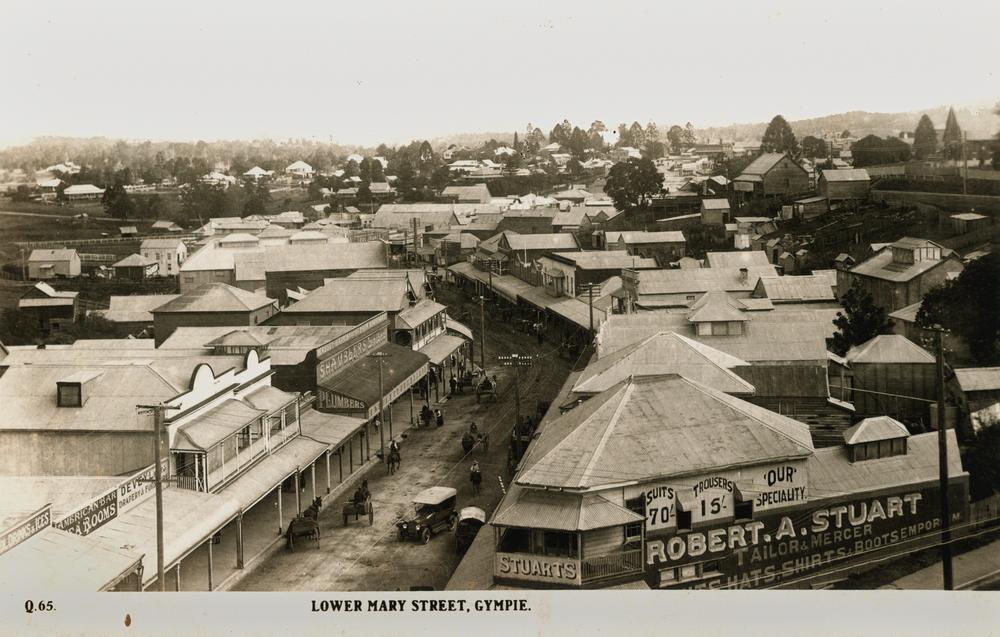
Graziers were the original European settlers. Subsequently, James Nash reported the discovery of 'payable' alluvial gold on 16 October 1867.[11] At the time of Nash's discovery, Queensland was suffering from a severe economic depression. Nash probably saved Queensland from bankruptcy. A memorial fountain in Gympie's Park honours Nash's discovery.[11] The Gympie Gold Rush Festival celebrates the event today. The Gold Rush Festival holds 10 days of cultural events in October.[12] Gold mining still plays a role in the area's fortunes, along with agriculture (dairy predominantly), timber and tourism. The gold rush's rapid development led to streets that are in an irregular fashion.[13]
In 1882 a handful of macadamia seeds were taken from trees in Gympie to Hawaii, where they became the basis of Hawaii's macadamia industry.[14] In 2019, researchers collected samples from hundreds of macadamia trees in Queensland, and compared their genetic profiles to samples from Hawaiian orchards. They determined that essentially all the Hawaiian trees must have descended from a small population of Australian trees from Gympie, possibly just a single tree.[15] This lack of genetic diversity in the commercial crop puts it at risk of succumbing to pathogens (as has happened in the past to banana cultivars). Growers may seek to diversify the cultivated population, by hybridizing with wild specimens.
Gympie Creek Post Office opened on 1 December 1867. It was renamed Gympie in 1868.[16]
In 1868 a slab hut was built behind the Northumberland Hotel and called the Miner's Bethel. This hut was used to hold religious services by the Anglican Church, the Roman Catholic Church and Methodist Church until each had established their own church.[17]
A Primitive Methodist Church opened on the diggings at Gympie Creek circa July 1868. It was claimed to be the first church in Gympie.[18] A new Primitive Methodist Church was opened on Commissioner's Hill on Sunday 30 July 1876.[19] Commissioners Hill is described as being from the post office in Duke Street to the corner of Chandon and Henry Streets.[20]
In August 1868, Wesleyan Methodists erected a bark hut of pole construction on Surface Hill to use as a basic chapel. It was replaced by a more permanent timber church on the same site facing Reef Street, which opened on Sunday 4 July 1869. The architect was Charles G. Smith and the builder was John Nesbit.[21] In 1890 a brick church was built on the site facing Channon Street and became the Surface Hill Uniting Church (26.189°S 152.6572°E).[22]
A Presbyterian Church opened on One Mile Road at One Mile on Sunday 8 November 1868.[23][24]
In 1869 the Church of England constructed a timber church on the corner of Palantine and School Streets; the first rector was Reverend Henry Jephson Campbell. It was known as the Church of St Peter. This church became the parish hall when a second church was built in Lady Mary Terrace in 1887. This was then superseded by the third and current church, built in brick, on the corner of Lady Mary Terrace and Amy Street (26.1887°S 152.6697°E).[17]
In January 1870 tenders were called for the erection of a Roman Catholic Church.[25]
The railway from Maryborough was completed in 1881.[13] The North Coast railway linked Gympie to Brisbane in 1891.[13]
St Andrew's Anglican Church was first established at Mount Pleasant / One Mile in 1876.[26] It closed circa 1968.[27] As at 2019, the church building no longer exists but the rectory in Graham Street had become a private home. In 2020, this was relocated to the Gympie Airfield.[17]
Gympie Apollonian Vale Baptist Church opened on Sunday 5 November 1899.[28][29] Prior to this, the Baptist congregation had met in the Oddfellows Hall and other venues.[30][31]
A fire brigade was in operation in 1900.
The state declared Gympie a town in 1903.
A powdered milk factory began operations in 1953.
In the 2016 census, the locality of Gympie had a population of 10,803 people.[32]
Flooding

Significant floods along the Mary River have caused inundations of the city in 1870, 1873, 1893, 1955, 1968, 1974, 1989, 1992, 1999, 2011,[33] 2013, and 2022. The first recorded flood in Gympie was in 1870. Most of the floods occur between December and April and are typically caused by heavy rainfall in the headwaters to the south.[34]
The highest flood ever recorded in Gympie occurred on 2 February 1893 when the river peaked at 25.45 m.[34] Gympie was declared a natural disaster area during the 1999 floods.[35] The river peaked at 21.9 m then. On the 27 February 2022 the river peaked at 22.96 metres, superseding the 1999 flood record by over a metre.
Numerous highways and roads in and around the city which were destroyed or damaged during floods in 2011 were repaired under Operation Queenslander,[36] the name given to post-flood reconstruction efforts in Queensland.
In March 2012, the Gympie Regional Council decided to spend about $30,000 for a cost benefit analysis on flood mitigation measures.[37] Major flooding also occurred in 2022.[38]
Heritage listings

Gympie has a number of heritage-listed sites, including:
- Brisbane Road: Monkland State School Residence[39]
- 2 Caledonian Hill: Gympie Town Hall[40]
- Channon Street: Gympie Court House[41]
- Channon Street: Old Gympie Post Office[42]
- Channon Street: Surface Hill Uniting Church[43]
- 26 Channon Street: Gympie Lands Office[44]
- cnr Channon Street and Nash Streets: former Queensland National Bank[45]
- Church Street: St Patricks Church[46]
- 17 Crown Road: former Gympie Ambulance Station[47]
- 1 Everson Road (26.1888°S 152.6794°E): Gympie State High School buildings[48]
- Mary Street: Gympie and Widgee War Memorial Gates[49]
- 199 Mary Street: former Royal Bank of Queensland[50]
- 216 Mary Street: former Crawford and Co Building[51]
- 218 Mary Street: Tozer's Building[52]
- 235 Mary Street: Smithfield Chambers[53]
- 236 Mary Street: former Australian Joint Stock Bank and former Gympie Stock Exchange offices & club[54]
- 242 Mary Street: former Bank of New South Wales[55]
- 39 Nash Street: Gympie School of Arts[56]
- River Road: Gympie Memorial Park[57]
- 1 Station Road: Railway Hotel[58]
- Tozer Street: Gympie railway station[59]
Population
According to the 2016 census of Population, there were 20,966 people in Gympie.
- Aboriginal and Torres Strait Islander people made up 3.9% of the population.
- 82.4% of people were born in Australia. The next most common countries of birth were England 2.6%, New Zealand 1.9% and Philippines 0.6%.
- 89.6% of people spoke only English at home.
- The most common responses for religion were No Religion 30.1%, Catholic 16.8% and Anglican 15.6%.[60]
Climate
Gympie experiences a humid subtropical climate (Köppen: Cfa, Trewartha: Cfal), with hot, muggy summers and mild winters.[61]
| Climate data for Gympie, Queensland, Australia (1991-2020 normals, extremes 1870-present); 65 m AMSL | |||||||||||||
|---|---|---|---|---|---|---|---|---|---|---|---|---|---|
| Month | Jan | Feb | Mar | Apr | May | Jun | Jul | Aug | Sep | Oct | Nov | Dec | Year |
| Record high °C (°F) | 42.4 (108.3) |
41.3 (106.3) |
38.1 (100.6) |
35.6 (96.1) |
32.8 (91.0) |
29.2 (84.6) |
30.2 (86.4) |
34.3 (93.7) |
38.2 (100.8) |
40.1 (104.2) |
42.2 (108.0) |
42.0 (107.6) |
42.4 (108.3) |
| Mean maximum °C (°F) | 35.4 (95.7) |
34.4 (93.9) |
32.6 (90.7) |
30.4 (86.7) |
27.1 (80.8) |
24.8 (76.6) |
24.8 (76.6) |
26.7 (80.1) |
30.4 (86.7) |
32.8 (91.0) |
34.4 (93.9) |
35.5 (95.9) |
35.5 (95.9) |
| Average high °C (°F) | 31.3 (88.3) |
30.5 (86.9) |
29.2 (84.6) |
27.0 (80.6) |
24.3 (75.7) |
22.2 (72.0) |
22.1 (71.8) |
23.8 (74.8) |
26.7 (80.1) |
28.3 (82.9) |
30.1 (86.2) |
30.9 (87.6) |
27.2 (81.0) |
| Daily mean °C (°F) | 25.6 (78.1) |
25.2 (77.4) |
23.8 (74.8) |
21.0 (69.8) |
17.7 (63.9) |
15.4 (59.7) |
14.4 (57.9) |
15.4 (59.7) |
18.8 (65.8) |
21.1 (70.0) |
23.3 (73.9) |
24.8 (76.6) |
20.5 (69.0) |
| Average low °C (°F) | 19.8 (67.6) |
19.9 (67.8) |
18.3 (64.9) |
14.9 (58.8) |
11.1 (52.0) |
8.5 (47.3) |
6.7 (44.1) |
7.0 (44.6) |
10.8 (51.4) |
13.9 (57.0) |
16.5 (61.7) |
18.6 (65.5) |
13.8 (56.9) |
| Mean minimum °C (°F) | 16.9 (62.4) |
17.3 (63.1) |
15.1 (59.2) |
11.1 (52.0) |
5.4 (41.7) |
2.6 (36.7) |
0.9 (33.6) |
2.0 (35.6) |
5.4 (41.7) |
9.4 (48.9) |
12.5 (54.5) |
15.1 (59.2) |
0.9 (33.6) |
| Record low °C (°F) | 12.0 (53.6) |
12.3 (54.1) |
9.8 (49.6) |
3.6 (38.5) |
−0.9 (30.4) |
−3.3 (26.1) |
−4.3 (24.3) |
−1.8 (28.8) |
1.3 (34.3) |
4.6 (40.3) |
3.5 (38.3) |
10.1 (50.2) |
−4.3 (24.3) |
| Average precipitation mm (inches) | 138.9 (5.47) |
182.4 (7.18) |
124.7 (4.91) |
63.7 (2.51) |
63.0 (2.48) |
46.2 (1.82) |
30.7 (1.21) |
36.6 (1.44) |
35.1 (1.38) |
65.3 (2.57) |
79.1 (3.11) |
143.5 (5.65) |
1,009.2 (39.73) |
| Average precipitation days (≥ 1.0 mm) | 10.0 | 10.7 | 10.7 | 8.2 | 7.3 | 5.7 | 4.5 | 3.6 | 4.1 | 6.3 | 6.7 | 9.2 | 87 |
| Average relative humidity (%) | 63.5 | 68.0 | 67.0 | 67.0 | 69.0 | 67.5 | 63.5 | 58.0 | 53.0 | 53.5 | 56.5 | 58.5 | 62.1 |
| Average dew point °C (°F) | 19.5 (67.1) |
20.0 (68.0) |
18.4 (65.1) |
15.9 (60.6) |
13.2 (55.8) |
10.5 (50.9) |
8.5 (47.3) |
8.5 (47.3) |
10.8 (51.4) |
13.3 (55.9) |
15.8 (60.4) |
17.8 (64.0) |
14.4 (57.8) |
| Source 1: Australian Bureau of Meteorology (1991-2020 normals)[62] | |||||||||||||
| Source 2: Australian Bureau of Meteorology (1870-present extremes)[63] | |||||||||||||
Attractions

The Gympie Gold Mining and Historical Museum houses memorabilia from the early gold mining era, as well as displays showcasing military, rural, transport, communications, and steam development in Australia. The WoodWorks Museum provides an insight into the timber industry and social history of yesteryear through displays and demonstrations. Features include a large selection of pioneering hand tools, a 1925 Republic truck, bullock wagons, and a blacksmith shop.
The Valley Rattler steam train is a tourist train that began operations in 1996. It follows the Mary River through the forests and plantations of the Mary Valley to Amamoor.[64] The train departs and returns to the Old Gympie Railway Station in Tozer Street, an original railway station from the 1900s gold rush.
Approximately 25 km south of Gympie, the town of Amamoor hosts the annual National Country Music Muster. Held over six days and nights in August in the Amamoor Forest Reserve,[65] the Muster is the largest outdoor country music festival in Australia.
Gympie's Mary St offers a wide array of bars, cafes, and shops with 19th Century Victorian architecture. The historic Railway Hotel was built in 1915 and is listed on the Queensland Heritage Register.[66] The Gympie Town Hall Reserve Complex, built in 1890, was added to the Queensland Heritage Register in 2011.[67]
Mothar Mountain Speedway is Gympie's local Speedway track. With a history spanning over 50 years, It's most well known feature is the unique right hand kink. The venue hosts a variety of Classes including SSA Modified Sedans, SSA Super Sedans, SSA Junior Sedans SSA Production Sedans, SSA Street Stocks, Modlites and Late Models.[68] The Speedway has hosted the Australian Title for SSA Production Sedans in 2014, and is scheduled to host the Australian Titles for Modlites and SSA Super Sedans in April 2023. [69]
The annual Heart of Gold International Short Film Festival is held in Gympie in March.
24 km south-east of Gympie, Woondum National Park provides access to subtropical rainforest, creeks and granite outcrops.[70] Facilities include picnic tables, barbecues, firewood, fresh water, amenities, and bush-walking tracks. Access is by dirt road and a high-clearance vehicle is recommended.[71]
About 30 minutes' drive east of Gympie is Tin Can Bay, where one can hand-feed Indo-Pacific hump-backed dolphins. The feeding is regulated for the protection of the dolphins.
Gympie and the surrounding area is part of the Great Sandy Biosphere Reserve, listed by UNESCO as a world conservation site.
Gympie Cemetery crawls are run by the Gympie Family History Society.[72] Participants learn about the town's pioneering families.
Education
Gympie has many schools, reflecting its importance as a regional service centre. State primary schools include:
- Gympie West State School opened on 28 January 1958.[73]
- Chatsworth State School opened on 18 April 1900.[73]
- Monkland State School opened on 24 September 1884.[73]
- Jones Hill State School opened on 29 January 1902.[73]
- Gympie Central State School opened on 18 October 1869.[73]
- Two Mile State School opened on 9 July 1883.[74]
- One Mile State School was the first school opened in Gympie on 20 September 1869 as One Mile Boys State School with the One Mile Girls and Infants State School opening in October 1874. In January 1943, they were merged into One Mile State School.[74]
- Gympie East State School opened on 25 January 1965.[73]
- Gympie South State School opened on 4 July 1910.[73]
State secondary schools include:
- James Nash State High School opened on 24 January 1977.[75][73]
- Gympie State High School opened on 29 January 1912.[76] This school is one of the oldest state secondary schools in Queensland.[77]
Private schools offer both primary and secondary education. They include Victory College, Cooloola Christian College and St Patrick's.[78] St Patrick's College in Gympie opened on 30 December 1916.[73]
Gympie is home to one campus of the Wide Bay Institute of TAFE located on Cartwright Road.[79]
The University of the Sunshine Coast (USC) has a campus in Gympie located on Cartwright Road. This campus offers undergraduate study in primary education, nursing, business, and commerce.[80]
Amenities
The Gympie Regional Council operates a public library at 8–14 Mellor Street.[81] It opened in 1995.[82]
The Gympie branch of the Queensland Country Women's Association meets at the St Johns Ambulance Rooms at 20 Apollonian Vale.[83]
Gympie Regional Uniting Church is at 15-17 Red Hill Road (26.1939°S 152.6727°E).[84][85][86] It is part of the Mary Burnett Presbytery of the Uniting Church in Australia.[87]
Gympie Wesleyan Methodist Church is at 70 Exhibition Road, Southside (26.2022°S 152.6436°E). It is part of the Wesleyan Methodist Church of Australia.[88]
There are two lawn bowls clubs in Gympie:
Transport
Road connection to Gympie is via the Bruce Highway. Rail connects via QR's North Coast railway line, which is served by daily Queensland Rail City network services to Brisbane and Traveltrain services for long distances. There are few public buses in Gympie and automobiles are the main mode of transportation.
Gympie Airport is a small local airport located to the south of the city. It has general aviation, recreational aviation and gliding communities. The nearest domestic airport is Sunshine Coast Airport & the closest international airport is Brisbane Airport.
Governance
Eight councilors are elected to the Gympie Region local government area.[90]
The Electoral district of Gympie in the state legislature was created in 1873 and includes Tin Can Bay, Rainbow Beach, Cooran, Pomona and parts of the Mary Valley.[91] In 1893, Andrew Fisher was elected to the Legislative Assembly of Queensland as Labor member for Gympie and went on to become the fifth Prime Minister of Australia.[91] Gympie's seat was eliminated in 1950 but restored in 1960.[91] Since 1960, it has been considered a safe State Liberal-National seat having been won by the Country or National Party every election except for a brief period in the early 2000s.[91] (It was held from 2002 to 2006 by Elisa Roberts, first as a member of the One Nation party and then as an independent, before returning to the National Party with the election of David Gibson.)[91]
Since 2015, Tony Perrett of the Liberal National Party is the member for Gympie in the Queensland Legislative Assembly.[92]
Traveston Crossing Dam
The Queensland Government had plans to build a dam on the Mary River at Traveston Crossing, about 16 kilometres (9.9 mi) south of Gympie, arguing that there is sound geology and that the South East Queensland region needed greater water security due to the threat of climate change and population growth.[93] The project was scrapped in 2010.
The proposed dam would have flooded about 900 properties. The affected land owners and other shire residents staged rallies protesting against the proposed dam. Strong opposition to the dam from the wider and international community based on environmental concerns related to the endangered Mary River cod, Mary River turtle, giant barred frog, Cascade tree frog and Coxen's fig parrot and the vulnerable Queensland lungfish, tusked frog, honey blue-eye fish, the Richmond birdwing butterfly and the Illidge's ant blue butterfly finally shut down the project.
Notable people
- The Amity Affliction – musicians
- John Francis (Frank) Barnes – politician
- John O'Connell Bligh – Native Police Commandant
- Allan Boase – Australian Army Lieutenant General[94]
- Henry Ernest Boote – writer
- Glen Boss – jockey[95]
- Archie Bradley – boxer
- Jimmy Downey – football player
- Thomas Dunstan – politician[96]
- Hugo William Du Rietz – gold miner, architect
- Tino Fa’asuamaleaui - NRL Rugby League Player
- Andrew Fisher – Australian Prime Minister
- Sir Thomas William Glasgow – Australian Army Major General
- Kaden Groves – professional cyclist
- Darren Hanlon – musician
- Peter Hanlon – sports writer
- Kenneth Hayne – Supreme Court Justice
- Trevor Housley – Postmaster-General
- Angus Finlay Hutton – naturalist
- Thelma Keane – businesswoman
- James Kidgell – politician
- Tracey Lewis – Paralympic swimmer
- George Mackay – politician
- Barry McTaggart – rugby player
- Mathew Mellor – politician
- James Nash – prospector
- Tom Petersen – veteran, comedian.
- Francis Isidore Power – politician
- Gregory Charles Rivers – actor
- Marjorie Roche – Red Cross nurse
- Christopher Scott – Paralympic cyclist[97]
- Sir Christopher Sheehy – dairy industry administrator
- Ann Caroline Sherry AO – businesswoman
- Jacob Stumm – newspaper owner
- Harry Sunderland – rugby administrator[98]
- Estelle Thompson – crime novelist
- Vivian Tozer – politician
- Harry Frederick Walker - Member of the Queensland Legislative Assembly
See also
- The Gympie Times, a current newspaper
- The Gympie Miner, a former newspaper
- Gympie Cemetery
- Djaki kundu
References
- "3218.0 – Regional Population Growth, Australia, 2017–18: Population Estimates by Significant Urban Area, 2008 to 2018". Australian Bureau of Statistics. Australian Bureau of Statistics. 27 March 2019. Archived from the original on 27 March 2019. Retrieved 25 October 2019. Estimated resident population, 30 June 2018.
- "2011 Census Community Profiles: Gympie". ABS Census. Australian Bureau of Statistics. Archived from the original on 19 April 2018. Retrieved 15 September 2016.
- Macquarie Dictionary, Fourth Edition (2005). Melbourne, The Macquarie Library Pty Ltd. ISBN 1-876429-14-3
- "Gympie – town in Gympie Region (entry 15149)". Queensland Place Names. Queensland Government. Retrieved 6 November 2017.
- "Gympie – locality in Gympie Region (entry 46339)". Queensland Place Names. Queensland Government. Retrieved 6 November 2017.
- Khan, M. Ali; A.Balakishan (2007). Encyclopedia of World Geography. Sarup & Sons. p. 45. ISBN 978-8176257732. Archived from the original on 29 June 2016. Retrieved 20 May 2012.
-
 This Wikipedia article incorporates CC-BY-4.0 licensed text from: "Gubbi Gubbi". Queensland Aboriginal and Torres Strait Islander languages map. State Library of Queensland. Retrieved 23 January 2020.
- "History". Gympie Regional Council. Archived from the original on 17 March 2012. Retrieved 20 May 2012.
- Hon. C. Wallace, Gympie residents have chance to make their mark on the map Archived 16 July 2011 at the Wayback Machine, 14 January 2008. Accessed 18 April 2009.
- Unidentified (1955). "Gympie Fire Station in 1955". John Oxley Library, State Library of Queensland. Archived from the original on 5 September 2020. Retrieved 20 April 2018.
- Stoodley, June. Nash, James (1834–1913) Archived 9 May 2012 at Wikiwix. Australian Dictionary of Biography, National Centre of Biography. Australian National University.
- "Gold Rush Festival – Gympie Goldrush". goldrush.org.au. Retrieved 19 April 2018.[permanent dead link]
- Environmental Protection Agency (2000). Heritage Trails of the Great South East. State of Queensland. pp. 90, 148. ISBN 0-7345-1008-X.
- Kean, Zoe (12 December 2020). "In a nutshell: how the macadamia became a 'vulnerable' species". The Guardian. Archived from the original on 13 December 2020. Retrieved 14 December 2020.
- Imbler, Sabrina (3 June 2019). "70 Percent of the World's Macadamia Nuts Came From One Tree in Australia". Atlas Obscura. Archived from the original on 7 June 2019. Retrieved 5 June 2019.
- Premier Postal History. "Post Office List". Premier Postal Auctions. Archived from the original on 15 May 2014. Retrieved 10 May 2014.
- "St Peter's celebrates 150 years". The Gympie Times. 10 August 2019. Archived from the original on 2 July 2020. Retrieved 2 July 2020.
- "PUBLIC WORKS". The Brisbane Courier. Vol. XXIII, no. 3, 365. Queensland, Australia. 11 July 1868. p. 2. Archived from the original on 4 August 2022. Retrieved 17 September 2021 – via National Library of Australia.
- "Advertising". Gympie Times And Mary River Mining Gazette. Vol. IX, no. 907. Queensland, Australia. 26 July 1876. p. 2. Archived from the original on 4 August 2022. Retrieved 20 September 2021 – via National Library of Australia.
- "Hills of Gympie". Gympie Regional Memories. 13 August 2020. Archived from the original on 20 September 2021. Retrieved 20 September 2021.
- "Advertising". Gympie Times And Mary River Mining Gazette. Vol. II, no. 168. Queensland, Australia. 3 July 1869. p. 2. Archived from the original on 5 September 2020. Retrieved 2 July 2020 – via National Library of Australia.
- "Surface Hill Uniting Church (entry 601529)". Queensland Heritage Register. Queensland Heritage Council. Retrieved 1 August 2014.
- "Advertising". Gympie Times And Mary River Mining Gazette. Vol. I, no. 82. Queensland, Australia. 7 November 1868. p. 2. Archived from the original on 5 September 2020. Retrieved 2 July 2020 – via National Library of Australia.
- "Advertising". Gympie Times And Mary River Mining Gazette. Vol. I, no. 88. Queensland, Australia. 21 November 1868. p. 2. Archived from the original on 5 September 2020. Retrieved 2 July 2020 – via National Library of Australia.
- "Advertising". Gympie Times And Mary River Mining Gazette. Vol. II, no. 223. Queensland, Australia. 15 January 1870. p. 2. Archived from the original on 5 September 2020. Retrieved 2 July 2020 – via National Library of Australia.
- "LOCAL AND GENERAL NEWS". Gympie Times And Mary River Mining Gazette. Vol. IX, no. 914. Queensland, Australia. 19 August 1876. p. 2. Archived from the original on 5 September 2020. Retrieved 2 July 2020 – via National Library of Australia.
- Anglican Church of Southern Queensland. "Closed Churches". Archived from the original on 3 April 2019. Retrieved 3 April 2019.
- "Queensland Baptist churches by date of erection/opening". Baptist Church Archives Queensland. Archived from the original on 26 November 2021. Retrieved 29 November 2021.
- "1899 Gympie Apollonian Vale". Baptist Church Archives Queensland. Archived from the original on 26 November 2021. Retrieved 29 November 2021.
- "Notes and News". Gympie Times And Mary River Mining Gazette. Vol. XXXI, no. 3979. Queensland, Australia. 4 November 1899. p. 3. Archived from the original on 4 August 2022. Retrieved 29 November 2021 – via National Library of Australia.
- "Notes and News". Gympie Times And Mary River Mining Gazette. Vol. XXXI, no. 3983. Queensland, Australia. 14 November 1899. p. 3. Archived from the original on 4 August 2022. Retrieved 29 November 2021 – via National Library of Australia.
- Australian Bureau of Statistics (27 June 2017). "Gympie (SSC)". 2016 Census QuickStats. Retrieved 20 October 2018.
- "Flood Warning System for the Mary River". Bureau of Meteorology. Archived from the original on 21 April 2012. Retrieved 6 May 2012.
- Jannette Parke (6 March 2010). "Mary, Mary quite contrary". The Gympie Times. Archived from the original on 11 March 2010. Retrieved 6 May 2012.
- "Qld flood crisis hits Gympie". The Weekly Times. 10 January 2011. Archived from the original on 8 May 2012. Retrieved 6 May 2012.
- "Road flood repairs on-going". The Gympie Times. 7 May 2012. Archived from the original on 18 May 2012. Retrieved 20 May 2012.
- "Staying afloat". Sunshine Coast Daily. Sunshine Coast Newspaper Company. 9 March 2012. Archived from the original on 5 September 2020. Retrieved 6 May 2012.
- Hanna, Conal (2 February 2022). "Floods in south-east Queensland and northern NSW: what has happened and which areas could be hit next?". Sydney. Archived from the original on 5 April 2022. Retrieved 5 April 2022.
- "Monkland State School Residence (entry 602013)". Queensland Heritage Register. Queensland Heritage Council. Retrieved 8 July 2013.
- "Gympie Town Hall Reserve Complex (entry 602789)". Queensland Heritage Register. Queensland Heritage Council. Retrieved 8 July 2013.
- "Gympie Court House (entry 600533)". Queensland Heritage Register. Queensland Heritage Council. Retrieved 8 July 2013.
- "My Country; Old Post Office (entry 600534)". Queensland Heritage Register. Queensland Heritage Council. Retrieved 8 July 2013.
- "Surface Hill Uniting Church (entry 601529)". Queensland Heritage Register. Queensland Heritage Council. Retrieved 8 July 2013.
- "Gympie Court House and Lands Office (former) (entry 602778)". Queensland Heritage Register. Queensland Heritage Council. Retrieved 8 July 2013.
- "Queensland National Bank (former) (entry 602773)". Queensland Heritage Register. Queensland Heritage Council. Retrieved 8 July 2013.
- "St Patricks Church (entry 601503)". Queensland Heritage Register. Queensland Heritage Council. Retrieved 8 July 2013.
- "Gympie Ambulance Station (former) (entry 602794)". Queensland Heritage Register. Queensland Heritage Council. Retrieved 8 July 2013.
- "Gympie State High School (entry 650064)". Queensland Heritage Register. Queensland Heritage Council. Retrieved 26 April 2021.
- "Gympie and Widgee War Memorial Gates (entry 600535)". Queensland Heritage Register. Queensland Heritage Council. Retrieved 8 July 2013.
- "Royal Bank of Queensland (former) (entry 602774)". Queensland Heritage Register. Queensland Heritage Council. Retrieved 8 July 2013.
- "Crawford and Co. Building (former) (entry 602780)". Queensland Heritage Register. Queensland Heritage Council. Retrieved 8 July 2013.
- "Tozer's Building (entry 602779)". Queensland Heritage Register. Queensland Heritage Council. Retrieved 8 July 2013.
- "Smithfield Chambers (entry 602777)". Queensland Heritage Register. Queensland Heritage Council. Retrieved 8 July 2013.
- "Australian Joint Stock Bank (former)/Gympie Stock Exchange Offices and Club (former) (entry 602772)". Queensland Heritage Register. Queensland Heritage Council. Retrieved 8 July 2013.
- "Bank of New South Wales (former) (entry 602775)". Queensland Heritage Register. Queensland Heritage Council. Retrieved 8 July 2013.
- "Gympie School of Arts (entry 601910)". Queensland Heritage Register. Queensland Heritage Council. Retrieved 8 July 2013.
- "Memorial Park (entry 602729)". Queensland Heritage Register. Queensland Heritage Council. Retrieved 8 July 2013.
- "Railway Hotel (entry 602540)". Queensland Heritage Register. Queensland Heritage Council. Retrieved 8 July 2013.
- "Gympie Railway Station Platform Complex (entry 602036)". Queensland Heritage Register. Queensland Heritage Council. Retrieved 8 July 2013.
- Australian Bureau of Statistics (27 June 2017). "Gympie (Significant Urban Area)". 2016 Census QuickStats. Retrieved 24 March 2019.
 Material was copied from this source, which is available under a Creative Commons Attribution 4.0 International License Archived 16 October 2017 at the Wayback Machine.
 - "Gympie climate: Average Temperature, weather by month, Gympie weather averages - Climate-Data.org". en.climate-data.org. Archived from the original on 19 May 2022. Retrieved 19 May 2022.
- "Gympie, QLD Climate (1991-2020 normals)". Australian Bureau of Meteorology. Archived from the original on 4 August 2022. Retrieved 19 May 2022.
- "Gympie, QLD Climate (1870-present extremes)". Australian Bureau of Meteorology. Archived from the original on 5 April 2022. Retrieved 19 May 2022.
- "Mary Valley". Queensland Places. Centre for the Government of Queensland, University of Queensland. Archived from the original on 25 October 2012. Retrieved 20 May 2012.
- "Amamoor State Forest and Forest Reserve – Camping information". Department of Environment and Resource Management. 14 October 2011. Archived from the original on 9 May 2012. Retrieved 20 May 2012.
- Lee Gailer (17 January 2012). "Piece of history goes on the block". The Gympie Times. Archived from the original on 2 February 2012. Retrieved 6 May 2012.
- "State heritage listing for Gympie icon". Queensland Heritage Council. 9 September 2012. Archived from the original on 29 March 2013. Retrieved 21 May 2012.
- "Home". Corbet's Group Mothar Mountain Speedway. Gympie Saloon Car Club. 17 October 2022. Archived from the original on 17 October 2022. Retrieved 17 October 2022.
- "Gympie Speedway 2022 calendar". Gympie Saloon Car Club. 17 October 2022. Archived from the original on 15 July 2022. Retrieved 17 October 2022.
- "Woondum National Park". Department of Environment and Resource Management. 9 June 2011. Archived from the original on 5 May 2012. Retrieved 21 May 2012.
- Alexia Purcell (24 March 2010). "Trip to Mothar Mountain rock pools". Sunshine Coast Daily. Sunshine Coast Newspaper Company. Archived from the original on 5 September 2020. Retrieved 21 May 2012.
- "Cemetery Crawls". Gympie Family History Society Inc. Archived from the original on 29 February 2016. Retrieved 19 March 2016.
- "Opening and closing dates of Queensland Schools". Queensland Government. Retrieved 18 April 2019.
- Queensland Family History Society (2010), Queensland schools past and present (Version 1.01 ed.), Queensland Family History Society, ISBN 978-1-921171-26-0
- "James Nash SHS". Archived from the original on 2 February 2017. Retrieved 29 January 2017.
- "Gympie SHS". Archived from the original on 4 February 2017. Retrieved 29 January 2017.
- "The oldest state secondary schools in Queensland". education.qld.gov.au. Archived from the original on 29 January 2018. Retrieved 29 January 2018.
- "Gympie Regional Council – Schools". Archived from the original on 18 May 2009. Retrieved 19 April 2018.
- "Gympie". Wide Bay Institute of TAFE. Archived from the original on 20 March 2012. Retrieved 20 May 2012.
- "USC Gympie". www.usc.edu.au. Archived from the original on 3 August 2017. Retrieved 19 April 2018.
- "Library locations". Gympie Regional Council. Archived from the original on 31 January 2018. Retrieved 31 January 2018.
- "Public Libraries Statistical Bulletin 2016–17" (PDF). Public Libraries Connect. State Library of Queensland. November 2017. p. 13. Archived (PDF) from the original on 30 January 2018. Retrieved 30 January 2018.
- "Branch Locations". Queensland Country Women's Association. Archived from the original on 26 December 2018. Retrieved 26 December 2018.
- "Find a Church". Uniting Church in Australia, Queensland Synod. Archived from the original on 24 October 2020. Retrieved 22 November 2020.
- "Gympie Uniting Church". Churches Australia. Archived from the original on 28 October 2021. Retrieved 19 October 2021.
- "Gympie Regional Uniting Church". Archived from the original on 28 October 2021. Retrieved 19 October 2021.
- "Queensland congregations and faith communities" (PDF). Uniting Church in Australia, Queensland Synod. March 2019. Archived (PDF) from the original on 20 October 2021. Retrieved 19 October 2021.
- "South Queensland". Wesleyan Methodist Church Australia. Archived from the original on 21 August 2021. Retrieved 25 August 2021.
- "Bowls Clubs". Gympie Regional Council. Archived from the original on 15 March 2022. Retrieved 19 August 2022.
- Carly Morrissey (14 May 2012). "Ready for council? My oath". The Gympie Times. Archived from the original on 5 September 2020. Retrieved 20 May 2012.
- "Latest on elections with The Times". The Gympie Times. 3 March 2012. Archived from the original on 5 September 2020. Retrieved 21 May 2012.
- Green, Antony. "Gympie". Queensland Election 2015. Australian Broadcasting Corporation. Archived from the original on 6 July 2018. Retrieved 14 July 2018.
- Josephine Gillespie (26 March 2008). "Plan promises no more water woes". The Queensland Times. APN News & Media. Archived from the original on 22 June 2010. Retrieved 19 December 2010.
- Dicker, George. Boase, Allan Joseph (1894–1964). Australian Dictionary of Biography. Australian National University. Archived from the original on 30 September 2017. Retrieved 29 September 2017.
- "Glen Boss Australian Champion Jockey". ProGroup Racing. Archived from the original on 9 March 2013. Retrieved 28 April 2017.
- "Former Members". Parliament of Queensland. 2015. Archived from the original on 6 May 2016. Retrieved 15 April 2016.
- – cyclist"Australians at the 1996 Atlanta Paralympics: Cyclists". Australian Sports Commission. Archived from the original on 20 January 2000. Retrieved 15 January 2012.
- Edmond, Scott (2002). Australian Dictionary of Biography. Sunderland, Harry (1889–1964). Australian Dictionary of Biography. Archived from the original on 30 March 2015. Retrieved 30 March 2015.
External links
- Gympie Cooloola Tourism
- Gympie Region
- "Gympie". Queensland Places. Centre for the Government of Queensland, University of Queensland.
- Gympie Library
Authority control | |
|---|---|
| General | |
| National libraries | |
| Other |
|
На других языках
[de] Gympie
Gympie ist eine Stadt im australischen Bundesstaat Queensland mit 10.933 Einwohnern. Sie liegt etwa 160 km nördlich von Brisbane auf einer Höhe von circa 95 m am Mary River.- [en] Gympie
[ru] Гимпи
Ги́мпи — большой город в Квинсленде, Австралия. Город расположен на реке Мэри, которая периодически заливает город. Гимпи является центром одноимённого региона. Находится он в 160 км от Брисбена.Другой контент может иметь иную лицензию. Перед использованием материалов сайта WikiSort.org внимательно изучите правила лицензирования конкретных элементов наполнения сайта.
WikiSort.org - проект по пересортировке и дополнению контента Википедии