world.wikisort.org - USA
Whitewater Township is one of thirteen townships in Franklin County, Indiana. As of the 2010 census, its population was 2,684.[3]
Whitewater Township | |
|---|---|
Township | |
 Snow Hill Covered Bridge | |
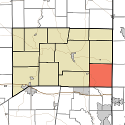 Location of Whitewater Township in Franklin County | |
| Coordinates: 39°20′55″N 84°52′18″W | |
| Country | United States |
| State | Indiana |
| County | Franklin |
| Government | |
| • Type | Indiana township |
| Area | |
| • Total | 35.21 sq mi (91.2 km2) |
| • Land | 34.98 sq mi (90.6 km2) |
| • Water | 0.23 sq mi (0.6 km2) |
| Elevation | 889 ft (271 m) |
| Population (2010) | |
| • Total | 2,684 |
| • Density | 76.7/sq mi (29.6/km2) |
| FIPS code | 18-84068[2] |
| GNIS feature ID | 454057 |
History
Whitewater Township was created in 1816.[4]
The Snow Hill Covered Bridge and Salmon Turrell Farmstead are listed on the National Register of Historic Places.[5]
Geography
According to the 2010 census, the township has a total area of 35.21 square miles (91.2 km2), of which 34.98 square miles (90.6 km2) (or 99.35%) is land and 0.23 square miles (0.60 km2) (or 0.65%) is water.[3]
Unincorporated towns
- Ashby (extinct)
- Drewersburg
- New Trenton
- Rockdale
- Sharptown
(This list is based on USGS data and may include former settlements.)
Major highways
- U.S. Route 52
- Indiana State Road 252
Cemeteries
The township contains two cemeteries: Otwell and Snow.
References
- "US Board on Geographic Names". United States Geological Survey. 2007-10-25. Retrieved 2008-01-31.
- "U.S. Census website". United States Census Bureau. Retrieved 2008-01-31.
- "Population, Housing Units, Area, and Density: 2010 - County -- County Subdivision and Place -- 2010 Census Summary File 1". United States Census. Archived from the original on 2020-02-12. Retrieved 2013-05-10.
- Reifel, August Jacob (1915). History of Franklin County, Indiana. Windmill Publications. pp. 127.
- "National Register Information System". National Register of Historic Places. National Park Service. July 9, 2010.
External links
Places adjacent to Whitewater Township, Franklin County, Indiana | ||||||||||||||||
|---|---|---|---|---|---|---|---|---|---|---|---|---|---|---|---|---|
| ||||||||||||||||
Municipalities and communities of Franklin County, Indiana, United States | ||
|---|---|---|
County seat: Brookville | ||
| City |
|  |
| Towns |
| |
| Townships |
| |
| CDPs |
| |
| Other unincorporated communities |
| |
| Footnotes | ‡This populated place also has portions in an adjacent county or counties | |
| ||
This Franklin County, Indiana location article is a stub. You can help Wikipedia by expanding it. |
Текст в блоке "Читать" взят с сайта "Википедия" и доступен по лицензии Creative Commons Attribution-ShareAlike; в отдельных случаях могут действовать дополнительные условия.
Другой контент может иметь иную лицензию. Перед использованием материалов сайта WikiSort.org внимательно изучите правила лицензирования конкретных элементов наполнения сайта.
Другой контент может иметь иную лицензию. Перед использованием материалов сайта WikiSort.org внимательно изучите правила лицензирования конкретных элементов наполнения сайта.
2019-2026
WikiSort.org - проект по пересортировке и дополнению контента Википедии
WikiSort.org - проект по пересортировке и дополнению контента Википедии