world.wikisort.org - USA
Brookville Township is one of thirteen townships in Franklin County, Indiana. As of the 2010 census, its population was 5,773.[3]
Brookville Township | |
|---|---|
Township | |
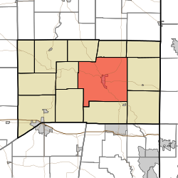 Location of Brookville Township in Franklin County | |
| Coordinates: 39°25′16″N 85°00′25″W | |
| Country | United States |
| State | Indiana |
| County | Franklin |
| Government | |
| • Type | Indiana township |
| Area | |
| • Total | 67.09 sq mi (173.8 km2) |
| • Land | 64.25 sq mi (166.4 km2) |
| • Water | 2.83 sq mi (7.3 km2) |
| Elevation | 630 ft (192 m) |
| Population (2010) | |
| • Total | 5,773 |
| • Density | 89.8/sq mi (34.7/km2) |
| FIPS code | 18-08200[2] |
| GNIS feature ID | 453136 |
Geography
According to the 2010 census, the township has a total area of 67.09 square miles (173.8 km2), of which 64.25 square miles (166.4 km2) (or 95.77%) is land and 2.83 square miles (7.3 km2) (or 4.22%) is water.[3]
Cities and towns
- Brookville (the county seat)
Unincorporated towns
- Mound Haven
- Stavetown
- Whitcomb
- Yellow Bank
- Youngs Corner
(This list is based on USGS data and may include former settlements.)
Adjacent townships
- Fairfield Township (north)
- Bath Township (northeast)
- Springfield Township (east)
- Whitewater Township (southeast)
- Highland Township (south)
- Butler Township (southwest)
- Metamora Township (west)
- Blooming Grove Township (northwest)
Major highways
- U.S. Route 52
- Indiana State Road 1
- Indiana State Road 101
- Indiana State Road 252
Cemeteries
The township contains three cemeteries: Maple Grove, Saint Michaels and Usher.
Education
Brookville Township residents may obtain a free library card from the Franklin County Public Library District in Brookville.[4]
References
- "Brookville Township, Franklin County, Indiana". Geographic Names Information System. United States Geological Survey. Retrieved 2009-09-24.
- United States Census Bureau cartographic boundary files
- "US Board on Geographic Names". United States Geological Survey. 2007-10-25. Retrieved 2008-01-31.
- "U.S. Census website". United States Census Bureau. Retrieved 2008-01-31.
- "Population, Housing Units, Area, and Density: 2010 - County -- County Subdivision and Place -- 2010 Census Summary File 1". United States Census. Archived from the original on 2020-02-12. Retrieved 2013-05-10.
- "Policies". Franklin County Public Library District. Retrieved 7 March 2018.
External links
Municipalities and communities of Franklin County, Indiana, United States | ||
|---|---|---|
County seat: Brookville | ||
| City |
|  |
| Towns |
| |
| Townships |
| |
| CDPs |
| |
| Other unincorporated communities |
| |
| Footnotes | ‡This populated place also has portions in an adjacent county or counties | |
| ||
This Franklin County, Indiana location article is a stub. You can help Wikipedia by expanding it. |
Текст в блоке "Читать" взят с сайта "Википедия" и доступен по лицензии Creative Commons Attribution-ShareAlike; в отдельных случаях могут действовать дополнительные условия.
Другой контент может иметь иную лицензию. Перед использованием материалов сайта WikiSort.org внимательно изучите правила лицензирования конкретных элементов наполнения сайта.
Другой контент может иметь иную лицензию. Перед использованием материалов сайта WikiSort.org внимательно изучите правила лицензирования конкретных элементов наполнения сайта.
2019-2025
WikiSort.org - проект по пересортировке и дополнению контента Википедии
WikiSort.org - проект по пересортировке и дополнению контента Википедии