world.wikisort.org - USA
Millers Ferry is an unincorporated community in Wilcox County, Alabama, United States.[1] The Millers Ferry Lock and Dam is located near the community on the Alabama River.
Millers Ferry, Alabama | |
|---|---|
Unincorporated community | |
 Millers Ferry, Alabama Location within the state of Alabama  Millers Ferry, Alabama Millers Ferry, Alabama (the United States) | |
| Coordinates: 32°5′58.52″N 87°22′2.98″W | |
| Country | United States |
| State | Alabama |
| County | Wilcox |
| Elevation | 131 ft (40 m) |
| Time zone | UTC-6 (Central (CST)) |
| • Summer (DST) | UTC-5 (CDT) |
| Area code | 334 |
2007 tornado
On March 1, 2007, Millers Ferry was struck by a violent EF4 tornado. One person was killed, two others were injured, and over 70 houses were damaged or destroyed. The tornado caused well over $2 million in damage.[2]
Gallery
Below are photographs taken in Millers Ferry as part of the Historic American Buildings Survey:
 Rosemary House and Plantation
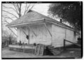 Old store, Rosemary House and Plantation
 Sellers-Henderson House


References
- U.S. Geological Survey Geographic Names Information System: Millers Ferry, Alabama
- National Weather Service-March 1 2007, Mills Ferry EF4 Tornado"Alabama Event Report: EF4 Tornado". National Centers for Environmental Information. National Weather Service. Retrieved 7 June 2022.Spann, James (March 2, 2007). "Wilcox County Damage". ABC33/40. Archived from the original on March 13, 2014. Retrieved March 12, 2014."Storm Events Database - Event Details | National Centers for Environmental Information". www.ncdc.noaa.gov. Archived from the original on 2014-03-13. Retrieved 2014-03-13.
Municipalities and communities of Wilcox County, Alabama, United States | ||
|---|---|---|
County seat: Camden | ||
| City | 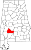 | |
| Towns | ||
| CDPs | ||
| Unincorporated communities | ||
| Ghost towns | ||
| ||
This Wilcox County, Alabama state location article is a stub. You can help Wikipedia by expanding it. |
Текст в блоке "Читать" взят с сайта "Википедия" и доступен по лицензии Creative Commons Attribution-ShareAlike; в отдельных случаях могут действовать дополнительные условия.
Другой контент может иметь иную лицензию. Перед использованием материалов сайта WikiSort.org внимательно изучите правила лицензирования конкретных элементов наполнения сайта.
Другой контент может иметь иную лицензию. Перед использованием материалов сайта WikiSort.org внимательно изучите правила лицензирования конкретных элементов наполнения сайта.
2019-2026
WikiSort.org - проект по пересортировке и дополнению контента Википедии
WikiSort.org - проект по пересортировке и дополнению контента Википедии