world.wikisort.org - USA
Canton Bend, once known simply as Canton, is an unincorporated community in Wilcox County, Alabama, United States.[1] Located on the south bank of the Alabama River, it served as the first county seat for Wilcox County from 1819 until its move to Camden in 1833.[2] It has several historic sites, including Youpon Plantation and the Tristram Bethea House.[3]
Canton Bend, Alabama | |
|---|---|
Unincorporated community | |
 Canton Bend, Alabama Location within the state of Alabama  Canton Bend, Alabama Canton Bend, Alabama (the United States) | |
| Coordinates: 32.05347°N 87.34888°W | |
| Country | United States |
| State | Alabama |
| County | Wilcox |
| Elevation | 213 ft (65 m) |
| Time zone | UTC-6 (Central (CST)) |
| • Summer (DST) | UTC-5 (CDT) |
| Area code | 334 |
Geography
Canton Bend is located at 32.05347°N 87.34888°W and has an elevation of 213 feet (65 m).[1]
References
- U.S. Geological Survey Geographic Names Information System: Canton Bend, Alabama
- "History of Wilcox County, Alabama". Wilcox Area Chamber of Commerce. Wilcox Area Chamber of Commerce. Archived from the original on 10 March 2011. Retrieved 3 April 2011.
- "National Register Information System". National Register of Historic Places. National Park Service. April 15, 2008.
Municipalities and communities of Wilcox County, Alabama, United States | ||
|---|---|---|
County seat: Camden | ||
| City | 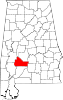 | |
| Towns | ||
| CDPs | ||
| Unincorporated communities | ||
| Ghost towns | ||
| ||
This Wilcox County, Alabama state location article is a stub. You can help Wikipedia by expanding it. |
Текст в блоке "Читать" взят с сайта "Википедия" и доступен по лицензии Creative Commons Attribution-ShareAlike; в отдельных случаях могут действовать дополнительные условия.
Другой контент может иметь иную лицензию. Перед использованием материалов сайта WikiSort.org внимательно изучите правила лицензирования конкретных элементов наполнения сайта.
Другой контент может иметь иную лицензию. Перед использованием материалов сайта WikiSort.org внимательно изучите правила лицензирования конкретных элементов наполнения сайта.
2019-2026
WikiSort.org - проект по пересортировке и дополнению контента Википедии
WikiSort.org - проект по пересортировке и дополнению контента Википедии