world.wikisort.org - USA
Coy is an unincorporated community in Wilcox County, Alabama, United States.[1][2] Coy is located in a bend of the Alabama River and is home to several historic plantations. The most notable of these is Dry Fork Plantation, included on the National Register of Historic Places.[3]
Coy, Alabama | |
|---|---|
Unincorporated community | |
 Coy, Alabama Location within the state of Alabama  Coy, Alabama Coy, Alabama (the United States) | |
| Coordinates: 31°53′42″N 87°27′46.8″W | |
| Country | United States |
| State | Alabama |
| County | Wilcox |
| Elevation | 95 ft (29 m) |
| Time zone | UTC-6 (Central (CST)) |
| • Summer (DST) | UTC-5 (CDT) |
| ZIP code | 36435 |
| Area code | 334 |
Geography
Coy is located at 31.8950°N 87.4630°W and has an elevation of 95 feet (29 m).[2]
Notable person
- John Cooper Godbold, United States Circuit Judge for the United States Court of Appeals for the Eleventh Circuit, was born in Coy.[4]
References
- "Coy, Alabama". Geographic Names Information System. United States Geological Survey, United States Department of the Interior.
- "Coy, Alabama". "AL HomeTownLocator". Retrieved 2008-10-14.
- "National Register Information System". National Register of Historic Places. National Park Service. April 15, 2008.
- Federal Judicial Center-John Cooper Godbold
Municipalities and communities of Wilcox County, Alabama, United States | ||
|---|---|---|
County seat: Camden | ||
| City | 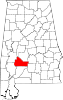 | |
| Towns | ||
| CDPs | ||
| Unincorporated communities | ||
| Ghost towns | ||
| ||
This Wilcox County, Alabama state location article is a stub. You can help Wikipedia by expanding it. |
На других языках
[de] Coy (Alabama)
Coy ist ein gemeindefreies Gebiet im Wilcox County im Bundesstaat Alabama in den Vereinigten Staaten.- [en] Coy, Alabama
Текст в блоке "Читать" взят с сайта "Википедия" и доступен по лицензии Creative Commons Attribution-ShareAlike; в отдельных случаях могут действовать дополнительные условия.
Другой контент может иметь иную лицензию. Перед использованием материалов сайта WikiSort.org внимательно изучите правила лицензирования конкретных элементов наполнения сайта.
Другой контент может иметь иную лицензию. Перед использованием материалов сайта WikiSort.org внимательно изучите правила лицензирования конкретных элементов наполнения сайта.
2019-2026
WikiSort.org - проект по пересортировке и дополнению контента Википедии
WikiSort.org - проект по пересортировке и дополнению контента Википедии