world.wikisort.org - USA
Lower Peach Tree is an unincorporated community in Wilcox County, Alabama, United States.[1]
Lower Peach Tree, Alabama | |
|---|---|
Unincorporated community | |
 Lower Peach Tree, Alabama Location within the state of Alabama  Lower Peach Tree, Alabama Lower Peach Tree, Alabama (the United States) | |
| Coordinates: 31°50′26.55″N 87°32′42.99″W | |
| Country | United States |
| State | Alabama |
| County | Wilcox |
| Elevation | 190 ft (60 m) |
| Time zone | UTC-6 (Central (CST)) |
| • Summer (DST) | UTC-5 (CDT) |
| ZIP code | 36751 |
| Area code | 334 |
The community was named for a peach tree which stood near the original town site (the town's name was prefixed with "Lower" to avoid repetition with another place called "Peach Tree" in the state).[2] This town was devastated by an F4 Tornado on March 21st, 1913, killing 27 people.
Geography
Lower Peach Tree is located at 31.84070°N 87.54527°W and has an elevation of 190 feet (58 m).[1]
Notable people
- James Crawford, former professional basketball player who played in the Australian National Basketball League
- Brenda Lee Eager, soul singer and musical theatre performer. Grew up in Lower Peach Tree.
References
- U.S. Geological Survey Geographic Names Information System: Lower Peach Tree, Alabama
- Moyer, Armond; Moyer, Winifred (1958). The origins of unusual place-names. Keystone Pub. Associates. p. 80.
Municipalities and communities of Wilcox County, Alabama, United States | ||
|---|---|---|
County seat: Camden | ||
| City | 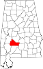 | |
| Towns | ||
| CDPs | ||
| Unincorporated communities | ||
| Ghost towns | ||
| ||
This Wilcox County, Alabama state location article is a stub. You can help Wikipedia by expanding it. |
Текст в блоке "Читать" взят с сайта "Википедия" и доступен по лицензии Creative Commons Attribution-ShareAlike; в отдельных случаях могут действовать дополнительные условия.
Другой контент может иметь иную лицензию. Перед использованием материалов сайта WikiSort.org внимательно изучите правила лицензирования конкретных элементов наполнения сайта.
Другой контент может иметь иную лицензию. Перед использованием материалов сайта WikiSort.org внимательно изучите правила лицензирования конкретных элементов наполнения сайта.
2019-2026
WikiSort.org - проект по пересортировке и дополнению контента Википедии
WikiSort.org - проект по пересортировке и дополнению контента Википедии