world.wikisort.org - USA
Marble Falls is a city in Burnet County, Texas, United States. As of the 2020 United States Census, the city population was 7,033.[5] Lake Marble Falls is part of the Highland Lakes on the Colorado River, the largest chain of lakes in Texas.[6]
Marble Falls, Texas | |
|---|---|
City | |
 Hill view of Marble Falls, 2007 | |
| Nickname: Marble | |
| Motto: "Lakeside Charm with Downtown Flair" | |
 Location of Marble Falls, Texas | |
 | |
| Coordinates: 30°34′N 98°17′W | |
| Country | United States |
| State | Texas |
| County | Burnet |
| Area | |
| • Total | 15.16 sq mi (39.26 km2) |
| • Land | 14.51 sq mi (37.59 km2) |
| • Water | 0.65 sq mi (1.67 km2) |
| Elevation | 823 ft (251 m) |
| Population (2010) | |
| • Total | 6,077 |
| • Estimate (2019)[2] | 7,038 |
| • Density | 484.94/sq mi (187.24/km2) |
| Time zone | UTC-6 (Central (CST)) |
| • Summer (DST) | UTC-5 (CDT) |
| ZIP codes | 78654, 78657 |
| Area code | 830 |
| FIPS code | 48-46584[3] |
| GNIS feature ID | 1362162[4] |
| Website | ci |
History
Marble Falls was founded by Adam Rankin Johnson[7] in 1887, a former Indian fighter and Confederate general, known as "Stovepipe" Johnson for his Civil War escapades, which included duping the Union army in Newburgh, Indiana, with fake "cannons," constructed from stovepipes and wagon wheels. Johnson had viewed the natural Marble Falls during his pre-war days as a Burnet County surveyor, and had dreamed of building an industrial city, powered by the tumbling Colorado River, not to be confused with the river of the same name in Colorado and Arizona. Despite a "friendly fire" incident which blinded him near the end of the Civil War, General Johnson followed through with his dream, facilitating the construction of a railroad to nearby Granite Mountain in 1884, then (with ten partners, including one son, one nephew and two sons-in-law) platting the townsite and selling lots, beginning July 12, 1887. Johnson built a fine home, a college (soon to be home of the "Falls on the Colorado Museum") and a large factory near the falls. The town grew to a population of 1,800 within ten years.
Marble Falls made history in 1917 by electing Ophelia Crosby "Birdie" Harwood as the first woman mayor in Texas, three years before women were allowed to vote.
When the Max Starcke Dam was completed in 1951, the marble falls which had given the town its name were submerged under the new Lake Marble Falls. While the town's economy struggled through the drought of the 1950s, a new economy based on tourism and retirement began to grow in the 1970s. During the last thirty years, Marble Falls has grown into the retail and entertainment center for the Highland Lakes area, and continues to attract tourists, retirees and new businesses.[8]
Geography
Marble Falls is located in southern Burnet County at 30°34′N 98°17′W (30.5741, –98.2782),[9] on the banks of Lake Marble Falls. According to the Handbook of Texas website, the former falls were flooded by the lake, which was created by a shelf of limestone running diagonally across the Colorado River from northeast to southwest. The upper layer of limestone, brownish on the exterior but a deep blue inside, was so hard and cherty it was mistaken for marble. The falls were actually three distinct formations at the head of a canyon 1.25 miles (2.01 km) long, with a drop of some 50 feet (15 m) through the limestone strata. The natural lake and waterfall were covered when the Colorado River was dammed with the completion of Max Starcke Dam in 1951. A photo of the falls as they once existed can be seen at the website for the Wallace Guest House, a local bed and breakfast.[10] Lake Marble Falls sits between Lake Lyndon B. Johnson to the north and Lake Travis to the south. The falls for which the city is named are now underwater but are revealed every few years when the lake is lowered.
Equally noteworthy is the huge igneous batholith called Granite Mountain looming on the town's western edge that secured Marble Falls' place in Texas history. The famed pink granite was used for the construction of the Texas State Capitol and other state government office buildings, and can also be found in the Galveston Seawall and Austin–Bergstrom International Airport.[citation needed]
According to the United States Census Bureau, the city has a total area of 12.2 square miles (31.6 km2), of which 11.6 square miles (30.0 km2) is land and 0.62 square miles (1.6 km2), or 5.21%, is water.[5]
Demographics
| Historical population | |||
|---|---|---|---|
| Census | Pop. | %± | |
| 1890 | 587 | — | |
| 1910 | 1,061 | — | |
| 1920 | 630 | −40.6% | |
| 1930 | 865 | 37.3% | |
| 1940 | 1,021 | 18.0% | |
| 1950 | 2,044 | 100.2% | |
| 1960 | 2,161 | 5.7% | |
| 1970 | 2,209 | 2.2% | |
| 1980 | 3,252 | 47.2% | |
| 1990 | 4,007 | 23.2% | |
| 2000 | 4,959 | 23.8% | |
| 2010 | 6,077 | 22.5% | |
| 2019 (est.) | 7,038 | [2] | 15.8% |
| U.S. Decennial Census[11] | |||
2020 census
| Race | Number | Percentage |
|---|---|---|
| White (NH) | 4,505 | 64.02% |
| Black or African American (NH) | 138 | 1.96% |
| Native American or Alaska Native (NH) | 23 | 0.33% |
| Asian (NH) | 161 | 2.29% |
| Pacific Islander (NH) | 1 | 0.01% |
| Some Other Race (NH) | 12 | 0.17% |
| Mixed/Multi-Racial (NH) | 292 | 4.15% |
| Hispanic or Latino | 1,905 | 27.07% |
| Total | 7,037 |
As of the 2020 United States census, there were 7,037 people, 2,789 households, and 1,664 families residing in the city.
2010 census
As of the census[3] of 2010, there were 6,077 people, 2,486 households, and 1,542 families residing in the city. There were 28,235 housing units. The racial makeup of the city was 83.1% White, 3.9% African American, 0.7% Native American, 0.8% Asian, 9.1% from other races, and 2.4% from two or more races. Hispanic or Latino of any race were 24.2% of the population.
There were 2,486 households, out of which 29.8% had children under the age of 18 living with them, 42% were married couples living together, 14.6% had a female householder with no husband present, and 38% were non-families. The average household size was 2.41 and the average family size was 3.08.
Marble Falls, as of December 1, 2009, is the anchor of the Marble Falls, TX Micropolitan Statistical Area. The census bureau has defined this area as including all of Burnet County and has a total population of 42,896. The micropolitan area, due to close ties to nearby Austin, is a component of the Austin-Round Rock-Marble Falls, TX Consolidated Statistical Area.[14]
Education
Marble Falls Independent School District operates public schools, including Marble Falls High School.
Post-secondary institutions
- Texas Tech University at Highland Lakes
- Central Texas College – Marble Falls
Notable people
- J. Frank Dobie (1888–1964), folklorist, writer, and newspaper columnist owned a ranch in Marble Falls
- Gerald Lyda (1923–2005), general contractor and cattle rancher, born and raised in Marble Falls[15]
- Leonel Manzano, silver medal winner in the 1500m at the 2012 London Olympics, NCAA 1500m Champion, member of the USA 2008 Beijing Olympic Team and the USA 2012 London Olympic Team
- John Arthur Martinez, second-place winner on USA Network's Nashville Star, taught English and tennis at Marble Falls High School
- David Morgan, Tight end for the Minnesota Vikings
Gallery
 Marble Falls City Hall, 2011
 Marble Falls Public Library, 2011
 The Uptown Theater in downtown Marble Falls, 2011
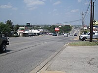 Texas Ranch to Market Road 1431 in Marble Falls extends westward, 2011


References
- "2019 U.S. Gazetteer Files". United States Census Bureau. Retrieved August 7, 2020.
- "Population and Housing Unit Estimates". United States Census Bureau. May 24, 2020. Retrieved May 27, 2020.
- "U.S. Census website". United States Census Bureau. Retrieved January 31, 2008.
- "US Board on Geographic Names". United States Geological Survey. October 25, 2007. Retrieved January 31, 2008.
- "Geographic Identifiers: 2010 Demographic Profile Data (G001): Marble Falls city, Texas". U.S. Census Bureau, American Factfinder. Archived from the original on February 12, 2020. Retrieved April 23, 2014.
- "Welcome to the City of Marble Falls". Ci.marble-falls.tx.us. May 18, 1907. Archived from the original on February 17, 2010. Retrieved February 9, 2010.
- Smyrl, Vivian Elizabeth (June 15, 2010). "Marble Falls, TX". Texas State Historical Association. Retrieved April 28, 2020.
- "Marble Falls community information and history". Marblefalls.info. Archived from the original on March 21, 2009. Retrieved February 9, 2010.
- "US Gazetteer files: 2010, 2000, and 1990". United States Census Bureau. February 12, 2011. Retrieved April 23, 2011.
- "The Wallace Guest House". www.thewallaceguesthouse.com.
- "Census of Population and Housing". Census.gov. Retrieved June 4, 2015.
- "Explore Census Data". data.census.gov. Retrieved May 20, 2022.
- "About the Hispanic Population and its Origin". www.census.gov. Retrieved May 18, 2022.
- "Bulletin" (PDF). obamawhitehouse.archives.gov.
- "La Escalera Ranch - The Legacy - Gerald Lyda". Escalera.us. Archived from the original on October 29, 2009. Retrieved February 9, 2010.
- Note: the US Census treats Hispanic/Latino as an ethnic category. This table excludes Latinos from the racial categories and assigns them to a separate category. Hispanics/Latinos can be of any race.[13]
External links
- City of Marble Falls official website
- Marble Falls, Texas from the Handbook of Texas Online
- Marble Falls/Lake LBJ Chamber of Commerce
- The Highlander, Marble Falls newspaper
- Granite Mountain article
Municipalities and communities of Burnet County, Texas, United States | ||
|---|---|---|
County seat: Burnet | ||
| Cities |  | |
| CDP |
| |
| Other communities |
| |
| Footnotes | ‡This populated place also has portions in an adjacent county or counties | |
| ||
Austin–Round Rock–San Marcos | |||||
|---|---|---|---|---|---|
| Central city |  | ||||
| Satellite cities | |||||
| Other communities | |||||
| Counties |
| ||||
| Parks and preserves |
| ||||
| Geography |
| ||||
| Bodies of water | |||||
| Transportation |
| ||||
State of Texas | |
|---|---|
Austin (capital) | |
| Topics |
|
| Society |
|
| Regions |
|
| Metropolitan areas |
|
| Counties | See: List of counties in Texas |
Authority control | |
|---|---|
| General | |
| National libraries | |
| Other |
|
На других языках
[de] Marble Falls
Marble Falls ist eine Stadt im Burnet County im US-Bundesstaat Texas in den Vereinigten Staaten.- [en] Marble Falls, Texas
Другой контент может иметь иную лицензию. Перед использованием материалов сайта WikiSort.org внимательно изучите правила лицензирования конкретных элементов наполнения сайта.
WikiSort.org - проект по пересортировке и дополнению контента Википедии