world.wikisort.org - USA
La Paz County is the 15th county in the U.S. state of Arizona, located in the western part of the state. As of the 2020 census, its population was 16,557,[1] making it the second-least populous county in Arizona. The county seat is Parker.[2] The name of the county is the Spanish word for "the peace", and is taken from the early settlement (now ghost town) of La Paz along the Colorado River.
La Paz County | |
|---|---|
U.S. county | |
 | |
 Seal | |
 Location within the U.S. state of Arizona | |
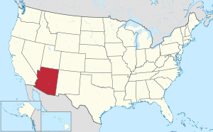 Arizona's location within the U.S. | |
| Coordinates: 33°50′25″N 113°56′34″W | |
| Country | |
| State | |
| Founded | January 1, 1983 |
| Named for | La Paz, Arizona |
| Seat | Parker |
| Largest town | Parker |
| Area | |
| • Total | 4,514 sq mi (11,690 km2) |
| • Land | 4,500 sq mi (12,000 km2) |
| • Water | 14 sq mi (40 km2) 0.3% |
| Population (2020) | |
| • Total | 16,557 |
| • Estimate (2021) | 16,408 |
| • Density | 3.7/sq mi (1.4/km2) |
| Time zone | UTC−7 (Mountain) |
| Congressional district | 4th |
| Website | www |
History
La Paz County was established in 1983 after voters approved separating the northern portion of Yuma County, making it the only county to be established after Arizona became a state in 1912, and currently the second youngest county in the United States (behind the consolidated city-county of Broomfield, Colorado, which was established in 2001). The county did not have a large enough tax base to begin supporting a separate county government immediately and had to rely on state money at first. As a result, Arizona laws were changed to make splitting other existing counties much more difficult.
Under the revised Arizona laws, a county shall not be formed or divided by county initiative unless each proposed county would have all of the following characteristics: (1) at least three-fourths of one percent of the total state assessed valuation and at least the statewide per capita assessed valuation; (2) a population of at least three-fourths of one percent of the total state population according to the most recent United States decennial census; (3) at least one hundred square miles of privately owned land; (4) common boundaries with either (a) at least three other existing or proposed counties; or (b) at least two other existing or proposed counties and the state boundary.[3] A county formation commission is required to be formed to evaluate the feasibility of the proposed county.[4] A proposal to divide a county must be approved by a majority of the votes cast in each proposed new county.[5]
The Colorado River Indian Reservation is located in the western portion of the county. Part of the reservation extends westward into San Bernardino and Riverside counties in California.
Geography
According to the United States Census Bureau, the county has a total area of 4,514 sq mi (11691 km2), of which 4500 sq mi (11655 km2) is land and 14 sq mi (36 km2) (0.3%) is water.[6]
The area that now makes up La Paz County was formerly part of Yuma County.
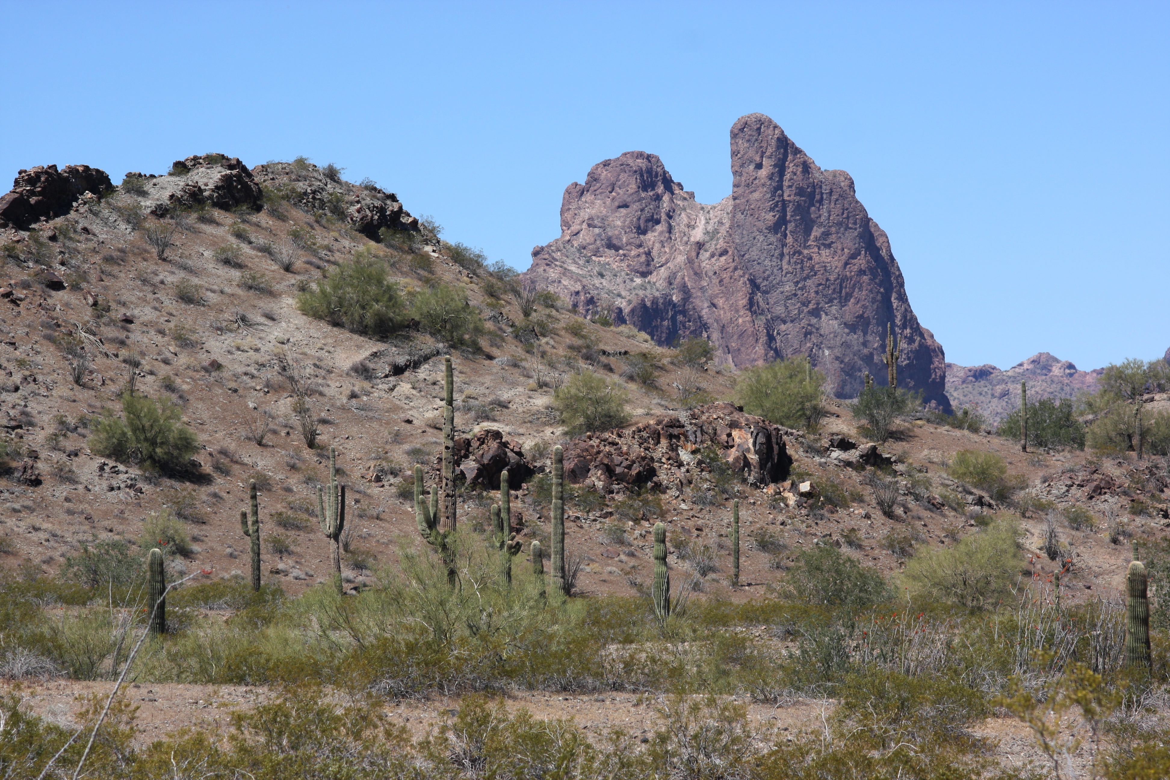
Flora and fauna
La Paz County hosts a variety of flora and fauna.[7] The endangered California Fan Palm, Washingtonia filifera grows in a few spots in the county.[8]
Adjacent counties
- Mohave County – north
- Yavapai County – northeast
- Maricopa County – east
- Yuma County – south
- Imperial County, California – southwest
- Riverside County, California – west
- San Bernardino County, California – northwest
National protected areas
- Bill Williams River National Wildlife Refuge (part)
- Cibola National Wildlife Refuge (part)
- Imperial National Wildlife Refuge (part)
- Kofa National Wildlife Refuge (part)
Demographics
| Historical population | |||
|---|---|---|---|
| Census | Pop. | %± | |
| 1990 | 13,844 | — | |
| 2000 | 19,715 | 42.4% | |
| 2010 | 20,489 | 3.9% | |
| 2020 | 16,557 | −19.2% | |
| 2021 (est.) | 16,408 | [9] | −0.9% |
| U.S. Decennial Census[10] 1990–2000[11] 2010–2020[1] | |||
2000 census
As of the census of 2000, there were 19,715 people, 8,362 households, and 5,619 families living in the county. The population density was 4.4 people per square mile (1.7/km2). There were 15,133 housing units at an average density of 3.4/sq mi (1.3/km2). The racial makeup of the county was 74.2% white, 0.8% black or African American, 12.5% Native American, 0.4% Asian, 0.1% Pacific Islander, 9.4% from other races, and 2.7% from two or more races. 22.4% of the population were Hispanic or Latino of any race. 18.9% reported speaking Spanish at home.[12]
There were 8,362 households, with 21.2% having children under the age of 18, 54.2% were married couples living together, 8.2% had a female householder with no husband present, and 32.8% were non-families. 26.6% of households were made up of individuals, and 12.9% had someone living alone who was 65 years of age or older. The average household size was 2.32 and the average family size was 2.79.
The county population had 21.1% under the age of 18, 6.1% from 18 to 24, 20.4% from 25 to 44, 26.6% from 45 to 64, and 25.8% who were 65 years of age or older. The median age was 47 years. For every 100 females there were 105.50 males. For every 100 females age 18 and over, there were 105.10 males.
The median income for a household in the county was $25,839, and the median income for a family was $29,141. Males had a median income of $26,642 versus $20,965 for females. The per capita income for the county was $14,916. About 13.6% of families and 19.60% of the population were below the poverty line, including 28.5% of those under age 18 and 12.9% of those age 65 or over.
2010 census
As of the census of 2010, there were 20,489 people, 9,198 households, and 5,584 families living in the county.[13] The population density was 4.5//sq mi (1.8/km2). There were 16,049 housing units at an average density of 3.56/sq mi (1.37/km2).[14] The racial makeup of the county was 69.8% white, 12.8% American Indian, 0.6% black or African American, 0.5% Asian, 12.5% from other races, and 3.7% from two or more races. Those of Hispanic or Latino origin made up 23.5% of the population.[13] In terms of ancestry, 22.4% were German, 15.9% were Irish, 15.3% were English, and 2.1% were American.[15]
Of the 9,198 households, 19.3% had children under the age of 18 living with them, 47.2% were married couples living together, 9.4% had a female householder with no husband present, 39.3% were non-families, and 32.1% of all households were made up of individuals. The average household size was 2.19 and the average family size was 2.72. The median age was 53.9 years.[13]
The median income for a household in the county was $32,147 and the median income for a family was $37,721. Males had a median income of $35,464 versus $27,484 for females. The per capita income for the county was $21,165. About 14.3% of families and 20.3% of the population were below the poverty line, including 36.4% of those under age 18 and 6.5% of those age 65 or over.[16]
Law enforcement
| La Paz County Sheriff's Office | |
|---|---|
 Patch of La Paz County Sheriff's Office | |
| Abbreviation | LPCSO |
| Agency overview | |
| Formed | 1983 |
| Jurisdictional structure | |
| General nature |
|
| Operational structure | |
| Headquarters | Parker, Arizona |
| Agency executive |
|
| Website | |
| La Paz County Sheriff | |
The La Paz County Sheriff's Office provides general-service law enforcement to unincorporated areas of La Paz County, serving as the equivalent of the police for unincorporated areas of the county. It also operates the county jail system. The Sheriff's Office is headquartered in Parker.[17]
Past sheriffs are:
- Rayburn Evans (1983–88)
- Marvin Hare (1989–2000)
- Daniel "Hal" Collett (2001–08)
- Donald Lowery (2009–12)
- John Drum (2013–16)
- William Risen (2017-2020)
- William Ponce (2021-Present)
Government
La Paz County is entirely within Arizona's 4th congressional district, currently represented by Republican Paul Gosar.
| Year | Republican | Democratic | Third party | |||
|---|---|---|---|---|---|---|
| No. | % | No. | % | No. | % | |
| 2020 | 5,129 | 68.64% | 2,236 | 29.93% | 107 | 1.43% |
| 2016 | 4,003 | 67.27% | 1,575 | 26.47% | 373 | 6.27% |
| 2012 | 3,714 | 64.76% | 1,880 | 32.78% | 141 | 2.46% |
| 2008 | 3,509 | 62.92% | 1,929 | 34.59% | 139 | 2.49% |
| 2004 | 3,158 | 62.42% | 1,849 | 36.55% | 52 | 1.03% |
| 2000 | 2,543 | 56.73% | 1,769 | 39.46% | 171 | 3.81% |
| 1996 | 1,902 | 42.33% | 1,964 | 43.71% | 627 | 13.96% |
| 1992 | 1,599 | 32.23% | 1,808 | 36.44% | 1,554 | 31.32% |
| 1988 | 2,562 | 57.24% | 1,746 | 39.01% | 168 | 3.75% |
| 1984 | 2,757 | 63.92% | 1,502 | 34.82% | 54 | 1.25% |
Transportation
Major highways
 Interstate 10
 U.S. Route 60
 U.S. Route 95
 State Route 72
 State Route 95
Air
Avi Suquilla Airport (FAA LID: P20) is a public use airport located one nautical mile (1.9 km) east of the central business district of Parker, Arizona. It is owned by the Colorado River Indian Tribes.
Rail
The county is served by the Arizona and California Railroad for freight through Parker, Arizona.
Communities

Towns
- Parker (county seat)
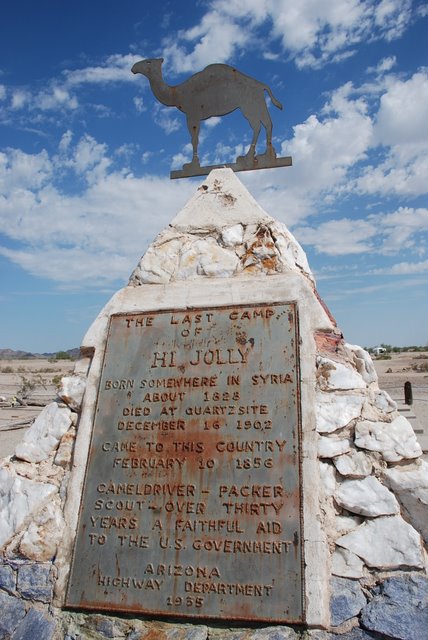
- Quartzsite
Census-designated places
Unincorporated community
- Hope
- Love
Ghost towns
- Clip
- Drift Desert
- Empire Flat
- Eureka
- La Paz
- Mineral City
- Nortons Landing
- Olive City
- Swansea
- Williamsport
Indian communities
Colorado River Indian Reservation
County population ranking
The population ranking of the following table is based on the 2010 census of La Paz County.[19][20]
† county seat
| Rank | City/Town/etc. | Population (2010 Census) | Municipal type | Incorporated |
|---|---|---|---|---|
| 1 | Quartzsite | 3,677 | Town | 1989 |
| 2 | † Parker | 3,083 | Town | 1948 |
| 3 | Cienega Springs | 1,798 | CDP | |
| 4 | Salome | 1,530 | CDP | |
| 5 | Ehrenburg | 1,470 | CDP | |
| 6 | Bouse | 996 | CDP | |
| 7 | Wenden | 728 | CDP | |
| 8 | Bluewater | 725 | CDP | |
| 9 | La Paz Valley | 699 | CDP | |
| 10 | Brenda | 676 | CDP | |
| 11 | Parker Strip | 662 | CDP | |
| 12 | Vicksburg | 597 | CDP | |
| 13 | Poston | 285 | CDP | |
| 14 | Cibola | 250 | CDP | |
| 15 | Utting | 126 | CDP | |
| 16 | Alamo Lake | 25 | CDP | |
| 17 | Sunwest | 15 | CDP |
See also
- National Register of Historic Places listings in La Paz County, Arizona
References
- "State & County QuickFacts". United States Census Bureau. Retrieved September 27, 2022.
- "Find a County". National Association of Counties. Retrieved June 7, 2011.
- Ariz. Rev. Stat. § 11-132(B)
- Ariz. Rev. Stat. § 11-136
- Ariz. Rev. Stat. § 11-137(H)
- "2010 Census Gazetteer Files". United States Census Bureau. Retrieved August 23, 2015.
- Forrest Shreve and Ira Loren Wiggins. 1964. Vegetation and flora of the Sonoran Desert, pp. 50 et seq., Stanford University Press, 1740 pages ISBN 978-0804701631
- C. Michael Hogan. 2009. California Fan Palm: Washingtonia filifera, GlobalTwitcher.com, ed. Nicklas Stromberg Archived September 30, 2009, at the Wayback Machine
- "Annual Estimates of the Resident Population for Counties: April 1, 2020 to July 1, 2021". Retrieved September 27, 2022.
- "U.S. Decennial Census". United States Census Bureau. Retrieved May 18, 2014.
- "Census 2000 PHC-T-4. Ranking Tables for Counties: 1990 and 2000" (PDF). United States Census Bureau. Archived (PDF) from the original on October 9, 2022. Retrieved May 18, 2014.
- "Language Map Data Center". apps.mla.org.
- "DP-1 Profile of General Population and Housing Characteristics: 2010 Demographic Profile Data". United States Census Bureau. Archived from the original on February 13, 2020. Retrieved January 20, 2016.
- "Population, Housing Units, Area, and Density: 2010 - County". United States Census Bureau. Archived from the original on February 13, 2020. Retrieved January 20, 2016.
- "DP02 Selected Social Characteristics in the United States – 2006–2010 American Community Survey 5-Year Estimates". United States Census Bureau. Archived from the original on February 13, 2020. Retrieved January 20, 2016.
- "DP03 Selected Economics Characteristics – 2006–2010 American Community Survey 5-Year Estimates". United States Census Bureau. Archived from the original on February 13, 2020. Retrieved January 20, 2016.
- "Official Website". La Paz County Sheriff's Office. Archived from the original on March 7, 2008.
- "Dave Leip's Atlas of United States Presidential Elections". Retrieved June 11, 2011.
- Bureau, US Census. "Decennial Census of Population and Housing by Decades". Census.gov.
- "2010 Census Maps". Archived from the original on December 29, 2014. Retrieved December 7, 2017.
External links
- County website
 Geographic data related to La Paz County, Arizona at OpenStreetMap
- "Bills tackle county growth", Arizona Republic, February 10, 2005
- "Arizona County Formation", Arizona Association of Counties
Places adjacent to La Paz County, Arizona | |
|---|---|
Municipalities and communities of La Paz County, Arizona, United States | ||
|---|---|---|
County seat: Parker | ||
| Towns |  | |
| CDPs | ||
| Populated places | ||
| Indian reservations |
| |
| Ghost towns |
| |
| ||
State of Arizona | |
|---|---|
Phoenix (capital) | |
| Topics |
|
| Society |
|
| Regions |
|
| Counties | |
| Cities |
|
Authority control | |
|---|---|
| General | |
| National libraries | |
| Other | |
На других языках
[de] La Paz County
La Paz County[1] ist ein County im Bundesstaat Arizona der Vereinigten Staaten. Der Sitz der Countyverwaltung (County Seat) ist in Parker.- [en] La Paz County, Arizona
[ru] Ла-Пас (округ)
Ла-Пас (англ. La Paz County) — округ в штате Аризона, США.Другой контент может иметь иную лицензию. Перед использованием материалов сайта WikiSort.org внимательно изучите правила лицензирования конкретных элементов наполнения сайта.
WikiSort.org - проект по пересортировке и дополнению контента Википедии