world.wikisort.org - USA
Brenda is an unincorporated community and census-designated place (CDP) in La Paz County, Arizona, United States. It is located approximately 16 miles (26 km) east of Quartzsite and 4 miles (6 km) northeast of Interstate 10 on U.S. Route 60. Its population was 466 as of the 2020 census. The community lies 5 miles (8 km) east of the Plomosa Mountains, and it is the closest community to the New Water Mountains Wilderness, five air miles to the south. Brenda is four miles northeast of the western terminus of US 60 (the last community on the highway westbound).
Brenda, Arizona | |
|---|---|
Census-designated place | |
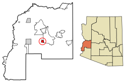 Location of Brenda in La Paz County, Arizona | |
 Brenda  Brenda | |
| Coordinates: 33°40′47″N 113°56′41″W | |
| Country | United States |
| State | Arizona |
| County | La Paz |
| Area | |
| • Total | 6.91 sq mi (17.90 km2) |
| • Land | 6.91 sq mi (17.90 km2) |
| • Water | 0.00 sq mi (0.00 km2) |
| Elevation | 1,375 ft (419 m) |
| Population (2020) | |
| • Total | 466 |
| • Density | 67.44/sq mi (26.04/km2) |
| Time zone | UTC-7 (Mountain (MST)) |
| Area code(s) | 928 |
| GNIS feature ID | 24335 |
| FIPS code | 04-07590 |
Demographics
| Historical population | |||
|---|---|---|---|
| Census | Pop. | %± | |
| 2010 | 676 | — | |
| 2020 | 466 | −31.1% | |
| U.S. Decennial Census[2] | |||
Brenda first appeared on the 2010 U.S. Census as a census-designated place (CDP).[3]
References
- "2020 U.S. Gazetteer Files". United States Census Bureau. Retrieved October 29, 2021.
- "Census of Population and Housing". Census.gov. Retrieved June 4, 2016.
- ftp://ftp2.census.gov/library/publications/2012/dec/cph-1-4.pdf
Municipalities and communities of La Paz County, Arizona, United States | ||
|---|---|---|
County seat: Parker | ||
| Towns |
|  |
| CDPs |
| |
| Populated places | ||
| Indian reservations |
| |
| Ghost towns |
| |
| ||
Текст в блоке "Читать" взят с сайта "Википедия" и доступен по лицензии Creative Commons Attribution-ShareAlike; в отдельных случаях могут действовать дополнительные условия.
Другой контент может иметь иную лицензию. Перед использованием материалов сайта WikiSort.org внимательно изучите правила лицензирования конкретных элементов наполнения сайта.
Другой контент может иметь иную лицензию. Перед использованием материалов сайта WikiSort.org внимательно изучите правила лицензирования конкретных элементов наполнения сайта.
2019-2026
WikiSort.org - проект по пересортировке и дополнению контента Википедии
WikiSort.org - проект по пересортировке и дополнению контента Википедии