world.wikisort.org - USA
Jefferson County is an exurban[4] county located in the U.S. state of Tennessee. As of the 2020 census, the population was 54,683.[5] Its county seat is Dandridge.[6] Jefferson County is part of the Morristown Metropolitan Statistical Area with neighboring Grainger and Hamblen counties. The county, along with the Morristown MSA, is included in the Knoxville-Morristown-Sevierville Combined Statistical Area.[7]
Jefferson County | |
|---|---|
U.S. county | |
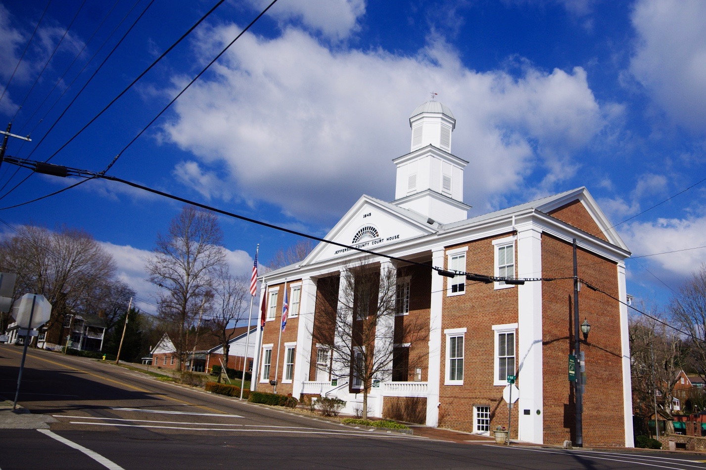 Jefferson County Courthouse in Dandridge | |
 Seal | |
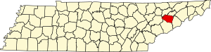 Location within the U.S. state of Tennessee | |
 Tennessee's location within the U.S. | |
| Coordinates: 36°03′N 83°27′W | |
| Country | |
| State | |
| Founded | June 11, 1792 |
| Named for | Thomas Jefferson[1] |
| Seat | Dandridge |
| Largest city | Jefferson City |
| Government | |
| • Mayor | Mark Potts (R)[2][3] |
| Area | |
| • Total | 314 sq mi (810 km2) |
| • Land | 274 sq mi (710 km2) |
| • Water | 40 sq mi (100 km2) 13%% |
| Population (2020) | |
| • Total | 54,683 |
| • Density | 195/sq mi (75/km2) |
| Time zone | UTC−5 (Eastern) |
| • Summer (DST) | UTC−4 (EDT) |
| ZIP Codes | 37725, 37760, 37820, 37871, 37890 |
| Area code | 865 |
| Congressional districts | 1st, 2nd |
| Website | jeffersoncountytn |
History
Jefferson County was established on June 11, 1792, by William Blount, Governor of the Southwest Territory.[8] It had been a part of Caswell County during the State of Franklin period (1784–1789). Its county seat, Dandridge, was settled in 1783.[8]
On the eve of the Civil War, Jefferson County, like most other counties in mountainous East Tennessee, was opposed to secession. In Tennessee's Ordinance of Secession referendum on June 8, 1861, Jefferson County voters rejected secession by a margin of 1,987 to 603.[9] A railroad bridge at Strawberry Plains was among those targeted by the East Tennessee bridge-burning conspiracy in November 1861.[10] This led to internal conflict in the area throughout the war, with men from the county enlisting in both of the rival armies.
On October 2, 2013, on I-40 in Jefferson County near the I-40 and I-81 split, a multi-vehicle collision involving a church bus, a tractor-trailer, and a SUV occurred at mile marker 423.[11] Tennessee Highway Patrol officials discovered that the church bus had blown a tire, leading it to merge into oncoming traffic, clipping the SUV and colliding with the semi-truck, causing it to burst into flames.[11] The accident resulted in 8 fatalities and 14 injuries.[11]
Geography
According to the U.S. Census Bureau, the county has a total area of 314 square miles (810 km2), of which 274 square miles (710 km2) is land and 40 square miles (100 km2) (13%) is water.[12] The county is affected by two artificial lakes: Douglas Lake, created by the damming of the French Broad River in the south, and Cherokee Lake, created by the damming of the Holston River in the north.
Adjacent counties
- Hamblen County (northeast)
- Cocke County (southeast)
- Sevier County (south)
- Knox County (west)
- Grainger County (north)
State protected areas
- Henderson Island Refuge
Transportation
Principal highways
 I-40
I-40 I-81
I-81 US 11E
 US 25E
 US 25W
 US 411
 SR 9
SR 9 SR 32
SR 32 SR 34
SR 34 SR 35
SR 35 SR 66
SR 66 SR 92
SR 92
Major surface routes
 SR 113
 SR 139
 SR 341
 SR 363
Demographics
| Historical population | |||
|---|---|---|---|
| Census | Pop. | %± | |
| 1810 | 7,309 | — | |
| 1820 | 8,953 | 22.5% | |
| 1830 | 11,801 | 31.8% | |
| 1840 | 12,076 | 2.3% | |
| 1850 | 13,204 | 9.3% | |
| 1860 | 16,043 | 21.5% | |
| 1870 | 19,476 | 21.4% | |
| 1880 | 15,846 | −18.6% | |
| 1890 | 16,478 | 4.0% | |
| 1900 | 18,590 | 12.8% | |
| 1910 | 17,755 | −4.5% | |
| 1920 | 17,677 | −0.4% | |
| 1930 | 17,914 | 1.3% | |
| 1940 | 18,621 | 3.9% | |
| 1950 | 19,667 | 5.6% | |
| 1960 | 21,493 | 9.3% | |
| 1970 | 24,940 | 16.0% | |
| 1980 | 31,284 | 25.4% | |
| 1990 | 33,016 | 5.5% | |
| 2000 | 44,294 | 34.2% | |
| 2010 | 51,407 | 16.1% | |
| 2020 | 54,683 | 6.4% | |
| U.S. Decennial Census[13] 1790-1960[14] 1900-1990[15] 1990-2000[16] 2010-2014[5] | |||
![Age pyramid Jefferson County[17]](http://upload.wikimedia.org/wikipedia/commons/thumb/0/02/USA_Jefferson_County%2C_Tennessee.csv_age_pyramid.svg/150px-USA_Jefferson_County%2C_Tennessee.csv_age_pyramid.svg.png)
2020 census
| Race | Number | Percentage |
|---|---|---|
| White (non-Hispanic) | 48,975 | 89.56% |
| Black or African American (non-Hispanic) | 787 | 1.44% |
| Native American | 159 | 0.29% |
| Asian | 257 | 0.47% |
| Pacific Islander | 20 | 0.04% |
| Other/Mixed | 2,093 | 3.83% |
| Hispanic or Latino | 2,392 | 4.37% |
As of the 2020 United States census, there were 54,683 people, 20,154 households, and 13,998 families residing in the county.
2000 census
As of the census[19] of 2000, there were 44,294 people, 17,155 households, and 12,608 families residing in the county. The population density was 162 people per square mile (62/km2). There were 19,319 housing units at an average density of 71 per square mile (27/km2). The racial makeup of the county was 95.66% White, 2.32% Black or African American, 0.31% Native American, 0.27% Asian, 0.04% Pacific Islander, 0.63% from other races, and 0.77% from two or more races. 1.33% of the population were Hispanic or Latino of any race.
There were 17,155 households, out of which 31.00% had children under the age of 18 living with them, 59.90% were married couples living together, 9.80% had a female householder with no husband present, and 26.50% were non-families. 22.50% of all households were made up of individuals, and 8.20% had someone living alone who was 65 years of age or older. The average household size was 2.49 and the average family size was 2.89.
In the county, the population was spread out, with 22.90% under the age of 18, 10.60% from 18 to 24, 29.10% from 25 to 44, 24.50% from 45 to 64, and 12.90% who were 65 years of age or older. The median age was 36 years. For every 100 females, there were 97.50 males. For every 100 females age 18 and over, there were 94.00 males. However, the last statistic is somewhat misleading because of female longevity, and if adults 18-65 were considered, the numbers would be very close to equal.
The median income for a household in the county was $32,824, and the median income for a family was $38,537. Males had a median income of $29,123 versus $20,269 for females. The per capita income for the county was $16,841. About 9.60% of families and 13.40% of the population were below the poverty line, including 16.90% of those under age 18 and 12.60% of those age 65 or over.
Economy
According to a data profile produced by the Tennessee Department of Economic and Community Development in 2018,[20] the top employers in the county are:
| # | Employer | # of Employees |
|---|---|---|
| 1 | Jefferson County Board of Education | 1,100 |
| 2 | Bush Brothers and Company | 500 |
| 3 | Nyrstar | 450 |
| 4 | Carson–Newman University | 320 |
| 5 | Walmart (Jefferson City) | 300 |
| 6 | Jefferson County Government | 300 |
| 7 | Jefferson Memorial Hospital | 205 |
| 8 | Jefferson County Nursing Home | 200 |
| 9 | Matsuo Industries | 180 |
| 10 | Nashua Corporation | 180 |
Politics
| Year | Republican | Democratic | Third party | |||
|---|---|---|---|---|---|---|
| No. | % | No. | % | No. | % | |
| 2020 | 18,651 | 78.98% | 4,654 | 19.71% | 311 | 1.32% |
| 2016 | 14,776 | 77.47% | 3,494 | 18.32% | 802 | 4.21% |
| 2012 | 13,038 | 74.25% | 4,232 | 24.10% | 289 | 1.65% |
| 2008 | 13,092 | 70.65% | 5,178 | 27.94% | 262 | 1.41% |
| 2004 | 11,625 | 67.53% | 5,469 | 31.77% | 121 | 0.70% |
| 2000 | 8,657 | 61.45% | 5,226 | 37.10% | 204 | 1.45% |
| 1996 | 6,446 | 53.03% | 4,688 | 38.57% | 1,021 | 8.40% |
| 1992 | 6,184 | 50.02% | 4,740 | 38.34% | 1,438 | 11.63% |
| 1988 | 6,832 | 67.85% | 3,168 | 31.46% | 69 | 0.69% |
| 1984 | 7,721 | 70.35% | 3,185 | 29.02% | 69 | 0.63% |
| 1980 | 6,944 | 66.82% | 3,180 | 30.60% | 268 | 2.58% |
| 1976 | 5,459 | 57.23% | 3,995 | 41.89% | 84 | 0.88% |
| 1972 | 5,925 | 80.26% | 1,357 | 18.38% | 100 | 1.35% |
| 1968 | 5,494 | 67.11% | 1,494 | 18.25% | 1,199 | 14.65% |
| 1964 | 4,923 | 65.44% | 2,600 | 34.56% | 0 | 0.00% |
| 1960 | 6,141 | 78.79% | 1,620 | 20.79% | 33 | 0.42% |
| 1956 | 4,870 | 77.63% | 1,338 | 21.33% | 65 | 1.04% |
| 1952 | 4,622 | 78.87% | 1,228 | 20.96% | 10 | 0.17% |
| 1948 | 2,979 | 74.12% | 900 | 22.39% | 140 | 3.48% |
| 1944 | 3,159 | 76.25% | 966 | 23.32% | 18 | 0.43% |
| 1940 | 1,921 | 63.95% | 1,062 | 35.35% | 21 | 0.70% |
| 1936 | 2,356 | 68.33% | 1,079 | 31.29% | 13 | 0.38% |
| 1932 | 2,275 | 68.59% | 975 | 29.39% | 67 | 2.02% |
| 1928 | 2,582 | 85.55% | 436 | 14.45% | 0 | 0.00% |
| 1924 | 2,699 | 78.39% | 712 | 20.68% | 32 | 0.93% |
| 1920 | 3,583 | 81.58% | 741 | 16.87% | 68 | 1.55% |
| 1916 | 1,648 | 75.84% | 520 | 23.93% | 5 | 0.23% |
| 1912 | 540 | 26.96% | 514 | 25.66% | 949 | 47.38% |
Like all of Unionist East Tennessee, Jefferson County has been overwhelmingly Republican ever since the Civil War. No Democrat has carried the county in the century and a half since that time, and indeed only Southern Democrat Jimmy Carter in 1976 has managed to reach forty percent of Jefferson County's vote.
Education
K-12 public education in the county is conducted by Jefferson County Public Schools.
Communities
Cities
- Baneberry
- Jefferson City
- Morristown (partial, mostly in Hamblen)
Towns
- Dandridge (county seat)
- New Market
- White Pine (small portion in Hamblen)
Census-designated place
- Strawberry Plains (partial, portions in Knox and Sevier)
Unincorporated communities
- Belmont
- Chestnut Hill
- Shady Grove
- Talbott (partial)
See also
- National Register of Historic Places listings in Jefferson County, Tennessee
References
- Origins Of Tennessee County Names, Tennessee Blue Book 2005-2006, pages 508-513
- "Jefferson". County Technical Assistance Service. University of Tennessee. Retrieved August 30, 2020.
- "Results: County mayor races in 10 East Tenn. counties". WBIR-TV. May 1, 2018. Retrieved September 11, 2020.
- "The United States: By Rural, Urban and Exurban Counties". The Daily Yonder. March 17, 2009. Retrieved December 6, 2020.
- "State & County QuickFacts". United States Census Bureau. Archived from the original on June 7, 2011. Retrieved December 3, 2013.
- "Find a County". National Association of Counties. Archived from the original on May 31, 2011. Retrieved June 7, 2011.
- "Revised Delineations of Metropolitan Statistical Areas, Micropolitan Statistical Areas, and Combined Statistical Areas, and Guidance on Uses of the Delineations of These Areas" (PDF). Office of Management and Budget. Archived (PDF) from the original on January 21, 2017. Retrieved April 27, 2014 – via National Archives.
- Estle Muncy, "Jefferson County," Tennessee Encyclopedia of History and Culture. Retrieved: 18 October 2013.
- Oliver Perry Temple, East Tennessee and the Civil War (R. Clarke Company, 1899), p. 199.
- Temple, East Tennessee and the Civil War, pp. 370-406.
- Winter, Michael (October 2, 2013). "8 dead in church bus crash on I-40 in Tennessee". USA Today. Retrieved December 27, 2020.
- "2010 Census Gazetteer Files". United States Census Bureau. August 22, 2012. Retrieved April 7, 2015.
- "U.S. Decennial Census". United States Census Bureau. Retrieved April 7, 2015.
- "Historical Census Browser". University of Virginia Library. Retrieved April 7, 2015.
- Forstall, Richard L., ed. (March 27, 1995). "Population of Counties by Decennial Census: 1900 to 1990". United States Census Bureau. Retrieved April 7, 2015.
- "Census 2000 PHC-T-4. Ranking Tables for Counties: 1990 and 2000" (PDF). United States Census Bureau. April 2, 2001. Archived (PDF) from the original on March 27, 2010. Retrieved April 7, 2015.
- Based on 2000 census data
- "Explore Census Data". data.census.gov. Retrieved December 27, 2021.
- "U.S. Census website". United States Census Bureau. Retrieved May 14, 2011.
- "Jefferson County: County Profile Tool". Tennessee Department of Economic and Community Development. State of Tennessee. 2018. Retrieved December 13, 2020.
- Leip, David. "Dave Leip's Atlas of U.S. Presidential Elections". uselectionatlas.org. Retrieved March 11, 2018.
External links
- Official website
- Convention and Visitors Bureau
- Jefferson County Schools
- Jefferson County Chamber of Commerce
- Jefferson County at Curlie
Places adjacent to Jefferson County, Tennessee | ||||||||||||||||
|---|---|---|---|---|---|---|---|---|---|---|---|---|---|---|---|---|
| ||||||||||||||||
Municipalities and communities of Jefferson County, Tennessee, United States | ||
|---|---|---|
County seat: Dandridge | ||
| Cities |  | |
| Towns | ||
| CDP | ||
| Unincorporated communities |
| |
| Footnotes | ‡This populated place also has portions in an adjacent county or counties | |
| ||
| Principal City |
|   |
|---|---|---|
| Other Cities | ||
| Counties | ||
Morristown, Tennessee metropolitan area | ||
|---|---|---|
| Principal City |    | |
| Other Cities | ||
| Counties | ||
Authority control | |
|---|---|
| General | |
| National libraries | |
| Other | |
На других языках
[de] Jefferson County (Tennessee)
Jefferson County[1] ist ein County im Bundesstaat Tennessee der Vereinigten Staaten. Der Verwaltungssitz (County Seat) ist Dandridge.- [en] Jefferson County, Tennessee
[fr] Comté de Jefferson (Tennessee)
Le comté de Jefferson est un comté de l'État du Tennessee, aux États-Unis. Son siège est situé à Dandridge et sa population était en 2000 de 44 294 habitants.[it] Contea di Jefferson (Tennessee)
La contea di Jefferson in inglese Jefferson County è una contea dello Stato del Tennessee, negli Stati Uniti. La popolazione al censimento del 2000 era di 44 294 abitanti. Il capoluogo di contea è Dandridge.[ru] Джефферсон (округ, Теннесси)
Округ Джефферсон (англ. Jefferson County) располагается в США, штате Теннесси. Официально образован 11 июня 1792 года. По состоянию на 2010 год, численность населения составляла 51 407 человек. Получил своё название по имени 3-го президента США Томаса Джефферсона.Другой контент может иметь иную лицензию. Перед использованием материалов сайта WikiSort.org внимательно изучите правила лицензирования конкретных элементов наполнения сайта.
WikiSort.org - проект по пересортировке и дополнению контента Википедии