world.wikisort.org - USA
Jefferson County is a county located in the Big Bend region in the northern part of the U.S. state of Florida. As of the 2010 census, the population was 14,761.[1] Its county seat is Monticello.[2]
Jefferson County | |
|---|---|
U.S. county | |
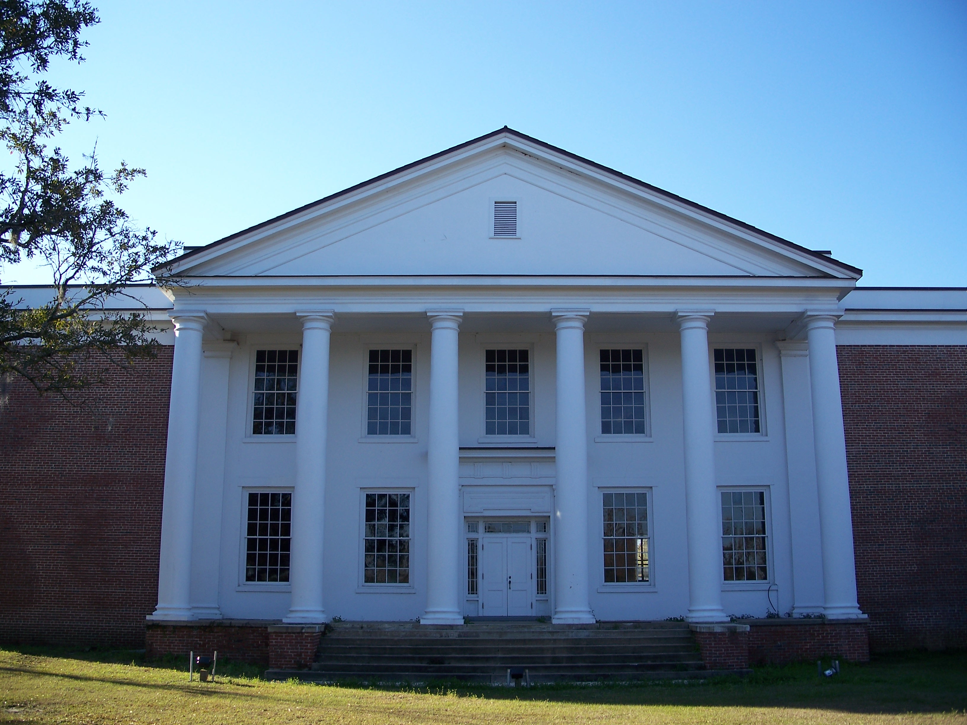
 Jefferson County Courthouse in Monticello | |
 Seal | |
 Location within the U.S. state of Florida | |
 Florida's location within the U.S. | |
| Coordinates: 30°25′N 83°54′W | |
| Country | |
| State | |
| Founded | January 20, 1827 |
| Named for | Thomas Jefferson |
| Seat | Monticello |
| Largest city | Monticello |
| Area | |
| • Total | 637 sq mi (1,650 km2) |
| • Land | 598 sq mi (1,550 km2) |
| • Water | 38 sq mi (100 km2) 6.0%% |
| Population (2020) | |
| • Total | 14,510 |
| • Density | 23/sq mi (9/km2) |
| Time zone | UTC−5 (Eastern) |
| • Summer (DST) | UTC−4 (EDT) |
| Congressional districts | 2nd, 5th |
| Website | www |
Jefferson County is part of the Tallahassee, FL Metropolitan Statistical Area but is the 3rd most rural county in Florida.[3] There are no traffic signals within the entire county.[4]
History
Jefferson County was created in 1827. It was named for Thomas Jefferson, third president of the United States, who had died the year before the county's establishment.[5]
Forts of Jefferson County
- Fort Roger Jones (1839), Aucilla (Ocilla Ferry), north of US 90.[6]
- Fort Noel (1839–1842), south of Lamont on the Aucilla River, six miles (10 km) northwest of Fort Pleasant in Taylor County. Also known as Fort Number Three (M).
- Camp Carter (1838), near Waukeenah.
- Fort Welaunee (1838), a settlers' fort on the Welaunee Plantation near Wacissa. Fort Gamble (1839–1843) was later established here.
- Fort Aucilla (1843), two miles (3 km) south-east of Fort Gamble, southwest of Lamont, between the Aucilla and Wacissa Rivers. Also spelled Ocilla.
- Fort Wacissa (1838), a settlers' fort located south of Wacissa on the Wacissa River, west of Cabbage Grove.
Geography

According to the U.S. Census Bureau, the county has a total area of 637 square miles (1,650 km2), of which 598 square miles (1,550 km2) is land and 38 square miles (98 km2) (6.0%) is water.[7]
Jefferson County is the only county in Florida which borders both the state of Georgia and the Gulf of Mexico.
Adjacent counties
- Thomas County, Georgia - north
- Brooks County, Georgia - northeast
- Madison County - east
- Taylor County - southeast
- Wakulla County - southwest
- Leon County - west
National protected area
- St. Marks National Wildlife Refuge (part)
Water Bodies
Demographics
| Historical population | |||
|---|---|---|---|
| Census | Pop. | %± | |
| 1830 | 3,312 | — | |
| 1840 | 5,713 | 72.5% | |
| 1850 | 7,718 | 35.1% | |
| 1860 | 9,876 | 28.0% | |
| 1870 | 13,398 | 35.7% | |
| 1880 | 16,065 | 19.9% | |
| 1890 | 15,757 | −1.9% | |
| 1900 | 16,195 | 2.8% | |
| 1910 | 17,210 | 6.3% | |
| 1920 | 14,502 | −15.7% | |
| 1930 | 13,408 | −7.5% | |
| 1940 | 12,032 | −10.3% | |
| 1950 | 10,413 | −13.5% | |
| 1960 | 9,543 | −8.4% | |
| 1970 | 8,778 | −8.0% | |
| 1980 | 10,703 | 21.9% | |
| 1990 | 11,296 | 5.5% | |
| 2000 | 12,902 | 14.2% | |
| 2010 | 14,761 | 14.4% | |
| 2020 | 14,510 | −1.7% | |
| U.S. Decennial Census[8] 1790-1960[9] 1900-1990[10] 1990-2000[11] 2010-2019[1] | |||
2020 census
Note: the US Census treats Hispanic/Latino as an ethnic category. This table excludes Latinos from the racial categories and assigns them to a separate category. Hispanics/Latinos can be of any race.
| Race | Pop 2010 | Pop 2020 | % 2010 | % 2020 |
|---|---|---|---|---|
| White (NH) | 8,668 | 8,720 | 58.72% | 60.1% |
| Black or African American (NH) | 5,293 | 4,600 | 35.86% | 31.7% |
| Native American or Alaska Native (NH) | 33 | 36 | 0.22% | 0.25% |
| Asian (NH) | 49 | 34 | 0.33% | 0.23% |
| Pacific Islander (NH) | 4 | 3 | 0.03% | 0.02% |
| Some Other Race (NH) | 9 | 54 | 0.06% | 0.37% |
| Mixed/Multi-Racial (NH) | 159 | 405 | 1.08% | 2.79% |
| Hispanic or Latino | 546 | 658 | 3.7% | 4.53% |
| Total | 14,761 | 14,510 |
As of the 2020 United States census, there were 14,510 people, 5,770 households, and 3,761 families residing in the county.
2010 census
As of the census[14] of 2010, there were 14,761 people, 5,646 households, and 3,798 families residing in the county. The population density was 25 people per square mile (8/km2). There were 5,251 housing units at an average density of 9 per square mile (3/km2). The racial makeup of the county was 60.4% White, 36.2% Black or African American, 0.30% Native American, 0.40% Asian, 0.0% Pacific Islander, 1.50% from other races, and 1.30% from two or more races. 3.70% of the population were Hispanic or Latino of any race.
There were 5,646 households, out of which 26.9% had individuals under the age of 18 living with them, 47.30% were married couples living together, 15.10% had a female householder with no husband present, and 32.70% were non-families. 28.1% of all households were made up of individuals, and 10.6% had someone living alone who was 65 years of age or older. The average household size was 2.38 and the average family size was 2.89.
In the county, the population was spread out, with 18.6% under the age of 18, 8.20% from 18 to 24, 25.0% from 25 to 44, 32.30% from 45 to 64, and 16.5% who were 65 years of age or older. The median age was 44.1 years. For every 100 females, there were 109.6 males. For every 100 females age 18 and over, there were 110.00 males age 18 and over.
The following income information is from the 2000 census. The median income for a household in the county was $32,998, and the median income for a family was $40,407. Males had a median income of $26,271 versus $25,748 for females. The per capita income for the county was $17,006. About 13.30% of families and 17.10% of the population were below the poverty line, including 21.70% of those under age 18 and 17.00% of those age 65 or over.
Government and politics
This section needs expansion. You can help by adding to it. (October 2008) |
Jefferson County was one of only a handful of counties in the Florida Panhandle that usually favored the Democratic Party; in recent elections it is trending toward the Republicans. In 2008, Barack Obama won it by a smaller margin than John Kerry had in the 2004 presidential race, one of the few non-Ozark, non-Appalachian, or non-Arizona counties to do so.[citation needed]
In 2016 it flipped and Donald Trump won the county. In 2018, it voted for both the winning Republican candidates in the governor's race (Ron DeSantis) and the Senate race (Rick Scott).[15]
| Year | Republican | Democratic | Third party | |||
|---|---|---|---|---|---|---|
| No. | % | No. | % | No. | % | |
| 2020 | 4,479 | 52.89% | 3,897 | 46.02% | 92 | 1.09% |
| 2016 | 3,930 | 51.11% | 3,541 | 46.05% | 218 | 2.84% |
| 2012 | 3,808 | 48.70% | 3,945 | 50.45% | 67 | 0.86% |
| 2008 | 3,797 | 47.59% | 4,088 | 51.24% | 93 | 1.17% |
| 2004 | 3,298 | 44.10% | 4,135 | 55.30% | 45 | 0.60% |
| 2000 | 2,478 | 43.91% | 3,041 | 53.89% | 124 | 2.20% |
| 1996 | 1,851 | 38.49% | 2,544 | 52.90% | 414 | 8.61% |
| 1992 | 1,506 | 32.19% | 2,271 | 48.55% | 901 | 19.26% |
| 1988 | 2,326 | 52.89% | 2,055 | 46.73% | 17 | 0.39% |
| 1984 | 2,244 | 52.16% | 2,057 | 47.81% | 1 | 0.02% |
| 1980 | 1,623 | 39.19% | 2,367 | 57.16% | 151 | 3.65% |
| 1976 | 1,361 | 36.30% | 2,310 | 61.62% | 78 | 2.08% |
| 1972 | 2,108 | 66.04% | 1,049 | 32.86% | 35 | 1.10% |
| 1968 | 459 | 14.84% | 1,066 | 34.48% | 1,567 | 50.68% |
| 1964 | 1,684 | 52.82% | 1,504 | 47.18% | 0 | 0.00% |
| 1960 | 600 | 34.70% | 1,129 | 65.30% | 0 | 0.00% |
| 1956 | 540 | 31.02% | 1,201 | 68.98% | 0 | 0.00% |
| 1952 | 665 | 36.22% | 1,171 | 63.78% | 0 | 0.00% |
| 1948 | 153 | 11.56% | 700 | 52.91% | 470 | 35.53% |
| 1944 | 188 | 14.93% | 1,071 | 85.07% | 0 | 0.00% |
| 1940 | 215 | 13.21% | 1,412 | 86.79% | 0 | 0.00% |
| 1936 | 127 | 9.27% | 1,243 | 90.73% | 0 | 0.00% |
| 1932 | 81 | 5.40% | 1,418 | 94.60% | 0 | 0.00% |
| 1928 | 235 | 20.22% | 919 | 79.09% | 8 | 0.69% |
| 1924 | 66 | 9.69% | 566 | 83.11% | 49 | 7.20% |
| 1920 | 239 | 22.85% | 754 | 72.08% | 53 | 5.07% |
| 1916 | 104 | 13.70% | 646 | 85.11% | 9 | 1.19% |
| 1912 | 47 | 8.45% | 459 | 82.55% | 50 | 8.99% |
| 1908 | 149 | 18.81% | 565 | 71.34% | 78 | 9.85% |
| 1904 | 123 | 20.20% | 471 | 77.34% | 15 | 2.46% |
| 1900 | 143 | 16.55% | 711 | 82.29% | 10 | 1.16% |
| 1896 | 242 | 11.07% | 1,909 | 87.29% | 36 | 1.65% |
| 1892 | 0 | 0.00% | 1,533 | 100.00% | 0 | 0.00% |
| 1884 | 1,525 | 67.21% | 744 | 32.79% | 0 | 0.00% |
Education
Jefferson County Schools is the school district of the county.[17] It operates public schools, including Jefferson County Middle / High School.
Library
Jefferson County's library is the R.J. Bailar Public Library, which works with the Wilderness Coast Public Libraries.
Transportation
Railroads
The sole existing railroad line is a CSX line once owned by the Seaboard Air Line Railroad that was used by Amtrak's Sunset Limited until 2005, when the service was truncated to New Orleans by Hurricane Katrina. No Amtrak trains stopped anywhere in Jefferson County.
Major highways
 Interstate 10 is the main west-to-east interstate highway in the county, and serves as the unofficial dividing line between northern and southern Jefferson County. It contains three interchanges within the county; the first being SR 59 in Lloyd (Exit 217), the second at US 19 in Drifton (Exit 225), and the third south of Aucilla at CR 257 (Exit 233). Beyond this point I-10 runs through Madison County.
 US 19 is the westernmost north-south US highway in the county. It enters from southwestern Madison County as the Georgia-Florida Parkway in a concurrency with US 27, then breaks away from US 27 in Capps to run straight north through Monticello where it encounters a traffic circle with US 90 around the historic Monticello Courthouse. North of the city it runs through the State of Georgia.
 US 27 is another north-south US highway in the county. It enters from Madison County in a concurrency with US 19, but unlike US 19 breaks away at Capps and runs west toward Tallahassee
 SR 59 is the westernmost north–south highway in Jefferson County and is the only roadway connection between U.S. 90 (at its intersection in Leon County) to the southernmost east–west route through Jefferson County, U.S. Route 98.
 US 90 was the main west-to-east highway in the county, until it was surpassed by I-10. It enters the county from Leon County twice, the second time from a causeway over the southern end of Lake Miccosukee, and eventually enters Monticello in a traffic circle with US 19. East of the city, it curves southeast through rural Jefferson County, then passes north of Aucilla before crossing the Madison County Line at a bridge over the Aucilla River.
 US 98 is the southernmost east–west route running through the Conservation Areas of the Gulf of Mexico from Wakulla to Taylor Counties. The sole major intersection is with SR 59.
 US 221 is the easternmost US highway in the county, running south and north through the northeastern portion of Jefferson County, including Ashville before crossing the Georgia State Line.
 CR 259
Communities

City
Census-designated places
Other unincorporated communities
- Alma
- Ashville
- Capps
- Casa Blanco
- Cody
- Dills
- Drifton
- Fanlew
- Festus
- Fincher
- Jarrott
- Limestone
- Lois
- Montivilla
- Nash
- Thomas City
See also
- National Register of Historic Places listings in Jefferson County, Florida
References
- "State & County QuickFacts". United States Census Bureau. Retrieved February 14, 2014.[permanent dead link]
- "Find a County". National Association of Counties. Archived from the original on May 31, 2011. Retrieved June 7, 2011.
- "Most rural counties in Florida". Stacker. Stacker Media. Retrieved February 3, 2022.
- "Visit historic Jefferson County". Visit historic Jefferson County. Jefferson County Tourism Development Council. Retrieved February 3, 2022.
- Publications of the Florida Historical Society. Florida Historical Society. 1908. p. 32.
- "IRC Library:Fort Roger Jones". Archived from the original on March 16, 2013. Retrieved August 1, 2008.
- "US Gazetteer files: 2010, 2000, and 1990". United States Census Bureau. February 12, 2011. Retrieved April 23, 2011.
- "U.S. Decennial Census". United States Census Bureau. Retrieved June 14, 2014.
- "Historical Census Browser". University of Virginia Library. Retrieved June 14, 2014.
- "Population of Counties by Decennial Census: 1900 to 1990". United States Census Bureau. Retrieved June 14, 2014.
- "Census 2000 PHC-T-4. Ranking Tables for Counties: 1990 and 2000" (PDF). United States Census Bureau. Retrieved June 14, 2014.
- "Explore Census Data". data.census.gov. Retrieved March 7, 2022.
- "Explore Census Data". data.census.gov. Retrieved March 7, 2022.
- "U.S. Census website". United States Census Bureau. Retrieved May 14, 2011.
- Journal, Pensacola News. "Florida and Jefferson County Election Results: General". Pensacola News Journal. Retrieved June 19, 2019.
- Leip, David. "Dave Leip's Atlas of U.S. Presidential Elections". uselectionatlas.org. Retrieved June 15, 2018.
- "2020 CENSUS - SCHOOL DISTRICT REFERENCE MAP: Jefferson County, FL" (PDF). U.S. Census Bureau. Retrieved July 31, 2022. - Text list
External links
Government links
- Jefferson County Home Page
- Jefferson County R.J. Bailar Public Library
- Jefferson County Economic Development Council
- Jefferson County Tourist Development Council
- Chamber of Commerce
Constitutional Offices
- Jefferson County Board of County Commissioners
- Jefferson County Supervisor of Elections
- Jefferson County Property Appraiser
- Jefferson County Sheriff's Office
- Jefferson County Tax Collector
Jefferson County Schools
- Public School System
- Private School System
Judicial Branch
- Jefferson County Clerk of Courts
- Public Defender, 2nd Judicial Circuit of Florida serving Franklin, Gadsden, Jefferson, Leon, Liberty, and Wakulla counties
- Office of the State Attorney, 2nd Judicial Circuit of Florida
- Circuit and County Court for the 2nd Judicial Circuit of Florida
Special Districts
Places adjacent to Jefferson County, Florida | ||||||||||||||||
|---|---|---|---|---|---|---|---|---|---|---|---|---|---|---|---|---|
| ||||||||||||||||
Municipalities and communities of Jefferson County, Florida, United States | ||
|---|---|---|
County seat: Monticello | ||
| City |  | |
| CDPs | ||
| Unincorporated communities |
| |
| Plantations |
| |
| Footnotes |
| |
| ||
State of Florida | |
|---|---|
Tallahassee (capital) | |
| Topics |
|
| History |
|
| Geography | |
| Major hurricanes |
|
| Society |
|
| Regions |
|
| Metro areas |
|
| Largest cities | |
| Counties |
|
North Florida | ||
|---|---|---|
Region of Florida | ||
| Topics |
|  Map of North Florida |
| Counties | ||
| Major cities | ||
| Cities and towns 50k–100k | ||
| Cities and towns 10k–40k | ||
| Metro areas |
| |
| Regions |
| |
Authority control | |
|---|---|
| General | |
| National libraries | |
| Other | |
На других языках
[de] Jefferson County (Florida)
Das Jefferson County[1] ist ein County im Bundesstaat Florida der Vereinigten Staaten. Der Verwaltungssitz (County Seat) ist Monticello. Das Jefferson County ist auch bekannt als das Key County, da es von Georgia bis an den Golf von Mexiko reicht.- [en] Jefferson County, Florida
[ru] Джефферсон (округ, Флорида)
Дже́фферсон[1] (англ. Jefferson County) — округ штата Флорида Соединённых Штатов Америки. На 2000 год в нем проживало 12 902 человека. По оценке бюро переписи населения США в 2005 году население округа составляло 14 490 человек.[2] Окружным центром является город Монтиселло (англ.).Другой контент может иметь иную лицензию. Перед использованием материалов сайта WikiSort.org внимательно изучите правила лицензирования конкретных элементов наполнения сайта.
WikiSort.org - проект по пересортировке и дополнению контента Википедии