world.wikisort.org - USA
Carbon County is a county in the U.S. state of Utah. As of the 2010 United States Census, the population was 21,403.[1] Its county seat and largest city is Price.[2]
Carbon County | |
|---|---|
U.S. county | |
 Carbon Power Plant at Castle Gate, Utah demolished in 2016 | |
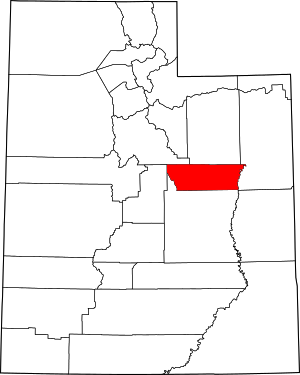 Location within the U.S. state of Utah | |
 Utah's location within the U.S. | |
| Coordinates: 39.64°N 110.58°W | |
| Country | |
| State | |
| Founded | March 8, 1894 |
| Named for | Abundant coal deposits |
| Seat | Price |
| Largest city | Price |
| Area | |
| • Total | 1,485 sq mi (3,850 km2) |
| • Land | 1,478 sq mi (3,830 km2) |
| • Water | 6.1 sq mi (16 km2) 0.4% |
| Population (2020) | |
| • Total | 20,412 |
| • Density | 14/sq mi (5.3/km2) |
| Time zone | UTC−7 (Mountain) |
| • Summer (DST) | UTC−6 (MDT) |
| Congressional district | 3rd |
| Website | www |
The Price, UT Micropolitan Statistical Area includes all of Carbon County.
History
Carbon County was part of Emery County, founded in 1880. The demographics along the Price River changed with the construction of the Denver and Rio Grande Western Railroad in 1883 and the development of coal mines, largely in upper Emery, to fuel the railroad. The Utah Territory Legislature was petitioned to split off the north part, and thus it established Carbon County effective March 8, 1894.[3] It was named for the element Carbon, to emphasize the industrial nature of the area.[4]
Carbon County is the second-largest natural gas producer in Utah (after Uintah County), with 94 billion cubic feet produced in 2008.[5]
Geography

The Green River flows south-southeastward along the county's eastern border. The lower central part of Carbon County is a continuation of Castle Valley in Emery County, but in Carbon, the valley is ringed with mountains - the Wasatch Range to the west and northwest, and the Book Cliffs to the north and northeast.[6] The county generally slopes to the south and east; its highest point is Monument Peak on the crest of the Wasatch Mountains near the midpoint of the county's western border,[6] at 10,452' (3186m) ASL.[7] The county has a total area of 1,485 square miles (3,850 km2), of which 1,478 square miles (3,830 km2) is land and 6.1 square miles (16 km2) (0.4%) is water.[8]
Airports
- Carbon County Regional Airport (PUC) - Price
Major highways
- U.S. Routes 6/191
- Utah State Route 10
- Utah State Route 96
- Utah State Route 122
- Utah State Route 123
- Utah State Route 124
- Utah State Route 139
- Utah State Route 157[6]
Adjacent counties
- Utah County - northwest
- Duchesne County - north
- Uintah County - east
- Emery County - south
- Sanpete County - west
Protected areas
Lakes
Demographics
| Historical population | |||
|---|---|---|---|
| Census | Pop. | %± | |
| 1900 | 5,004 | — | |
| 1910 | 8,624 | 72.3% | |
| 1920 | 15,489 | 79.6% | |
| 1930 | 17,798 | 14.9% | |
| 1940 | 18,459 | 3.7% | |
| 1950 | 24,901 | 34.9% | |
| 1960 | 21,135 | −15.1% | |
| 1970 | 15,647 | −26.0% | |
| 1980 | 22,179 | 41.7% | |
| 1990 | 20,228 | −8.8% | |
| 2000 | 20,422 | 1.0% | |
| 2010 | 21,403 | 4.8% | |
| 2020 | 20,412 | −4.6% | |
| US Decennial Census[9] 1790–1960[10] 1900–1990[11] 1990–2000[12] 2010–2018[1] 2019[13] 2020[14] | |||
2010 census
As of the 2010 United States Census, there were 21,403 people, 7,978 households, and 5,587 families in the county. The population density was 14.48/sqmi (5.59/km2). There were 9,551 housing units, with an average density of 6.46/sqmi (2.50/km2). The racial makeup of the county was 92.31% White, 0.43% Black or African American, 1.18% Native American, 0.58% Asian, 0.01% Pacific Islander, 3.03% from other races, and 2.36% from two or more races. 12.42% of the population were Hispanic or Latino of any race.
There were 7,978 households, of which 30.16% had children under 18. 54.50% were married couples living together, 10.65% had a female householder with no husband present, and 29.97% were non-families. 25.50% of all households were made up of individuals (one person), and 11.07% had someone living alone who was 65 years of age or older. The average household size was 2.61, and the average family size was 3.14.
The population contained 30.41% under the age of 20, 6.82% aged 20 to 24, 23.73% aged 25 to 44, 25.48% aged 45 to 64, and 13.56% who were 65 years of age or older. The median age was 34.4. For every 100 females, there were 98.40 males. For every 100 females aged 18 and over, there were 96.88 males.
2015
As of 2015 the largest self-reported ancestry groups in Carbon County, Utah are:[15]
| Largest ancestries (2015) | Percent |
|---|---|
| English | 22.7% |
| German | 11.9% |
| Italian | 11.1% |
| Irish | 6.6% |
| Danish | 5.9% |
| Scottish | 4.1% |
| Swedish | 3.3% |
| Welsh | 1.9% |
| Dutch | 1.9% |
| Polish | 1.4% |
| Norwegian | 1.4% |
Politics and Government
Carbon County historically has been the base of Democratic Party support in strongly Republican Utah with its sizable blue-collar population. It voted for Bill Clinton in 1992 and 1996 by wide margins. In 1964 Lyndon Johnson carried 72.7% of votes in the county. At the state level, it was no less Democratic; in the 1992 gubernatorial election, it was one of two counties (the other being Summit County) that voted for Democratic candidate Stewart Hanson over Republican Michael Leavitt.
After the turn of the millennium, however, Carbon County has trended Republican. It voted for George W. Bush in 2000 and 2004 while voting for the Democratic gubernatorial candidates. In 2008, John McCain won Carbon County with 52.60% vote, versus 44.59% for Barack Obama. In 2012, the county's Democratic vote fell further as Mitt Romney carried 67.3% to 30.1% for Obama. In 2016, despite Utah's strong swing against the Republicans due to the presence of conservative independent Evan McMullin, Carbon County was the only county in the state to swing more Republican, as Donald Trump won 66% to Hillary Clinton's 21.5% percent. In 2020, Donald Trump again carried the county with the largest percentage (71.4%) of any Republican to date.
| Position | District | Name | Affiliation | First Elected | |
|---|---|---|---|---|---|
| Senate | 27 | David Hinkins | Republican | 2008[16] | |
| House of Representatives | 69 | Christine Watkins | Republican | 2016[17] | |
| Board of Education | 14 | Mark Huntsman | Nonpartisan | 2014[18] | |
| Year | Republican | Democratic | Third party | |||
|---|---|---|---|---|---|---|
| No. | % | No. | % | No. | % | |
| 2020 | 6,693 | 71.44% | 2,392 | 25.53% | 284 | 3.03% |
| 2016 | 5,275 | 65.95% | 1,717 | 21.47% | 1,007 | 12.59% |
| 2012 | 5,090 | 67.27% | 2,275 | 30.06% | 202 | 2.67% |
| 2008 | 4,091 | 52.30% | 3,468 | 44.34% | 263 | 3.36% |
| 2004 | 4,950 | 58.18% | 3,415 | 40.14% | 143 | 1.68% |
| 2000 | 3,758 | 50.89% | 3,298 | 44.66% | 328 | 4.44% |
| 1996 | 2,343 | 30.90% | 4,172 | 55.03% | 1,067 | 14.07% |
| 1992 | 2,038 | 23.11% | 4,480 | 50.81% | 2,299 | 26.07% |
| 1988 | 3,019 | 35.09% | 5,521 | 64.18% | 63 | 0.73% |
| 1984 | 4,393 | 49.82% | 4,357 | 49.41% | 68 | 0.77% |
| 1980 | 4,320 | 47.67% | 4,317 | 47.63% | 426 | 4.70% |
| 1976 | 3,360 | 38.70% | 5,157 | 59.39% | 166 | 1.91% |
| 1972 | 3,956 | 53.19% | 3,335 | 44.84% | 147 | 1.98% |
| 1968 | 2,618 | 36.17% | 4,344 | 60.01% | 277 | 3.83% |
| 1964 | 2,130 | 27.30% | 5,672 | 72.70% | 0 | 0.00% |
| 1960 | 2,953 | 32.79% | 6,039 | 67.06% | 14 | 0.16% |
| 1956 | 4,507 | 50.26% | 4,460 | 49.74% | 0 | 0.00% |
| 1952 | 3,770 | 39.44% | 5,790 | 60.56% | 0 | 0.00% |
| 1948 | 2,704 | 28.89% | 6,397 | 68.34% | 259 | 2.77% |
| 1944 | 2,318 | 30.12% | 5,364 | 69.70% | 14 | 0.18% |
| 1940 | 2,242 | 30.07% | 5,180 | 69.47% | 34 | 0.46% |
| 1936 | 1,348 | 20.71% | 5,040 | 77.42% | 122 | 1.87% |
| 1932 | 1,655 | 27.04% | 4,239 | 69.26% | 226 | 3.69% |
| 1928 | 2,184 | 42.10% | 2,954 | 56.94% | 50 | 0.96% |
| 1924 | 1,878 | 37.59% | 1,528 | 30.58% | 1,590 | 31.83% |
| 1920 | 1,675 | 47.05% | 1,559 | 43.79% | 326 | 9.16% |
| 1916 | 1,301 | 44.39% | 1,478 | 50.43% | 152 | 5.19% |
| 1912 | 771 | 35.42% | 514 | 23.61% | 892 | 40.97% |
| 1908 | 1,023 | 59.82% | 581 | 33.98% | 106 | 6.20% |
| 1904 | 1,224 | 65.38% | 508 | 27.14% | 140 | 7.48% |
| 1900 | 748 | 54.01% | 621 | 44.84% | 16 | 1.16% |
| 1896 | 85 | 11.36% | 663 | 88.64% | 0 | 0.00% |
Notes:
Communities
Cities
- East Carbon
- Helper
- Price (county seat)
- Wellington
Town
Census-designated places
Unincorporated community
Ghost towns
- Castle Gate
- Coal City
- Consumers
- Hale
- Heiner
- Kiz
- Latuda
- Mutual
- National
- Peerless
- Rains
- Royal
- Spring Canyon
- Standardville
- Sweets (or Sweet)
- Wattis
- Winter Quarters
See also
- National Register of Historic Places listings in Carbon County, Utah
References
- "State & County QuickFacts". United States Census Bureau. Archived from the original on June 6, 2011. Retrieved December 29, 2013.
- "Find a County". National Association of Counties. Archived from the original on May 31, 2011. Retrieved June 7, 2011.
- "Individual County Chronologies/Carbon County UT. [[Newberry Library]] (accessed March 30, 2019)". Archived from the original on March 6, 2016. Retrieved March 30, 2019.
- "Carbon County". I Love Utah History. Utah.gov. Retrieved February 10, 2017.
- "Annual natural gas production in MCF by the top 7 producing counties in Utah" (PDF). Archived from the original (PDF) on November 7, 2010. Retrieved September 12, 2010.
- Carbon County UT Google Maps (accessed 30 March 2019)
- "Utah County High Points/Carbon County. Peakbaggers (accessed 30 March 2019)". Archived from the original on March 27, 2019. Retrieved March 30, 2019.
- "2010 Census Gazetteer Files". US Census Bureau. August 22, 2012. Retrieved March 27, 2015.
- "US Decennial Census". US Census Bureau. Retrieved March 27, 2015.
- "Historical Census Browser". University of Virginia Library. Retrieved March 27, 2015.
- Forstall, Richard L., ed. (March 27, 1995). "Population of Counties by Decennial Census: 1900 to 1990". US Census Bureau. Retrieved March 27, 2015.
- "Census 2000 PHC-T-4. Ranking Tables for Counties: 1990 and 2000" (PDF). US Census Bureau. April 2, 2001. Retrieved March 27, 2015.
- "QuickFacts. Carbon County, Utah". Retrieved May 17, 2020.
- 2020 Population and Housing State Data | Utah
- Bureau, US Census. "American FactFinder - Results". factfinder.census.govn. Archived from the original on February 13, 2020. Retrieved March 30, 2018.
- "Senator Hinkins Utah Senate". senate.utah.gov. Retrieved November 16, 2021.
- "Rep. Watkins, Christine F." Utah House of Representatives. Retrieved November 17, 2021.
- "Mark Huntsman". www.schools.utah.gov. Retrieved November 15, 2021.
- Leip, David. "Atlas of US Presidential Elections". uselectionatlas.org. Retrieved March 30, 2018.
External links
Places adjacent to Carbon County, Utah | ||||||||||||||||
|---|---|---|---|---|---|---|---|---|---|---|---|---|---|---|---|---|
| ||||||||||||||||
Municipalities and communities of Carbon County, Utah, United States | ||
|---|---|---|
County seat: Price | ||
| Cities |  | |
| Town | ||
| CDPs | ||
| Indian reservation |
| |
| Ghost towns | ||
| Footnotes | ‡This populated place also has portions in an adjacent county or counties | |
| ||
State of Utah | |||||||||||||
|---|---|---|---|---|---|---|---|---|---|---|---|---|---|
Salt Lake City (capital) | |||||||||||||
| Topics | |||||||||||||
| Society |
| ||||||||||||
| Regions |
| ||||||||||||
| Largest cities |
| ||||||||||||
| Counties | |||||||||||||
| Attractions |
| ||||||||||||
| Flora and fauna |
| ||||||||||||
Authority control | |
|---|---|
| General | |
| National libraries | |
| Other |
|
На других языках
[de] Carbon County (Utah)
Carbon County[1] ist ein County im Bundesstaat Utah der Vereinigten Staaten. Der größte Ort und Sitz der Countyverwaltung (County Seat) ist Price. 2020 lebten im Carbon County 20.412 Menschen.- [en] Carbon County, Utah
[ru] Карбон (округ, Юта)
Округ Карбон (англ. Carbon County) располагается в штате Юта, США. Официально образован в 1894 году. По состоянию на 2010 год, численность населения составляла 21 403 человек.Другой контент может иметь иную лицензию. Перед использованием материалов сайта WikiSort.org внимательно изучите правила лицензирования конкретных элементов наполнения сайта.
WikiSort.org - проект по пересортировке и дополнению контента Википедии