world.wikisort.org - USA
Daggett County (/ˈdæɡət/ DAG-ət) is a county in the northeastern corner of the U.S. state of Utah. As of the 2020 United States Census, the population was 935, making it the least populous county in Utah. Its county seat is Manila.[1] The county was named for Ellsworth Daggett, the first surveyor-general of Utah. The small community of Dutch John, located near the state line with Colorado and Wyoming, became an incorporated town in January 2016.
Daggett County | |
|---|---|
U.S. county | |
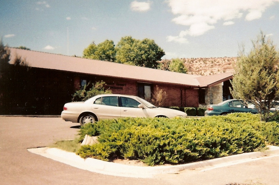 Daggett County Courthouse in Manila, May 2008 | |
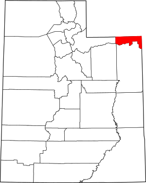 Location within the U.S. state of Utah | |
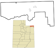
 Utah's location within the U.S. | |
| Coordinates: 40.89°N 109.51°W | |
| Country | |
| State | |
| Founded | January 7, 1918 |
| Named for | Ellsworth Daggett |
| Seat | Manila |
| Largest town | Manila |
| Area | |
| • Total | 721 sq mi (1,870 km2) |
| • Land | 697 sq mi (1,810 km2) |
| • Water | 24 sq mi (60 km2) 3.3% |
| Population (2020) | |
| • Total | 935 |
| • Density | 1.3/sq mi (0.50/km2) |
| Time zone | UTC−7 (Mountain) |
| • Summer (DST) | UTC−6 (MDT) |
| Congressional district | 1st |
| Website | www |
History
Due to dangerous roads, mountainous terrain, and frequent bad weather preventing travel via a direct route, 19th century residents in the north portion of Uintah County had to travel 400 to 800 miles (640 to 1,290 km) on both stagecoach and rail to conduct business in Vernal, the county seat, a mere 50 miles (80 km) away. The journey involved overland travel to a train station in Wyoming, to either Mack, Colorado, Price, or Salt Lake City, then a stagecoach to Vernal. In the fall 1917 election, the Uintah county voters voted to establish a separate county on the northern slope of the Uinta Mountains.[2] The act establishing the county was approved on January 7, 1918, naming Manila as the county seat.
The boundary between Daggett and Uintah counties was adjusted in 1919, with some territory being returned to Uintah. Daggett County boundaries have remained unchanged since 1919.[3]
Geography
Daggett County lies at the lower northeastern corner of Utah. Its northern border abuts the south border of the state of Wyoming, and its eastern boundary abuts the western border of the state of Colorado. Its main geographical features are the Uinta Mountains, which comprise its southwestern portion and delineate part of its southern border, and the Green River, which has carved a deep gorge through the east-central part of the county.[4] In 1958, the United States Bureau of Reclamation took advantage of this natural feature to construct the Flaming Gorge Dam, creating the Flaming Gorge Reservoir, which began filling in 1964.
The county terrain slopes to the north and east on the northern flank of the Uintas. The county's highest point is on a mountain crest along its south border, at 12,276' (3742m) ASL.[5] The county has a total area of 721 square miles (1,870 km2), of which 697 square miles (1,810 km2) is land and 24 square miles (62 km2) (3.3%) is water.[6] It is the fourth-smallest county in Utah by area. Over 90% of the land of Daggett County is under federal ownership.
Major highways
- U.S. Route 191
- Utah State Route 43
- Utah State Route 44
- Utah State Route 1364 (Browns Park Rd)
Adjacent counties
- Sweetwater County, Wyoming - north
- Moffat County, Colorado - east
- Uintah County - south
- Duchesne County - southwest
- Summit County - west
Protected areas
- Ashley National Forest (part)
- Browns Park Waterfowl Area
- Browns Park Waterfowl Management Area
- Clay Basin Wildlife Management Area
- Flaming Gorge National Recreation Area (part)
- Goslin Mountain Wildlife Management Area
- Indian Crossing Campground (BLM)
- Marshall Draw Wildlife Management Area
- Taylors Flat Wildlife Management Area
Lakes
- Big Springs
- Browne Lake
- Browns Park National Wildlife Refuge Reservoir
- Chokecherry Spring
- Cow Spring
- Daggett Lake
- Dowds Hole
- Dripping Spring
- East Grindstone Spring
- Fighting Spring
- Flaming Gorge Reservoir (part)
- Ford Spring
- Greens Lakes
- Greens Lake
- West Greens Lake
- Grindstone Spring
- Lamb Lakes
- Bummer Lake
- Ewe Lake
- Lamb Lake
- Mutton Lake
- Ram Lake
- Long Park Reservoir
- Lower Potter Lake
- One Fish Lake
- Pollen Lake
- Potter Lake (Upper Potter Lake)
- Red Lake
- Serviceberry Spring
- Sheep Creek Lake
- Spirit Lake (part)
- Spitzenburg Spring
- Stove Lake
- Tepee Lakes
- Lower Teepee Lake
- Upper Teepee Lake
- Weyman Lakes
- Anson Lake (Lower Anson Lake)
- Candy Lake
- Clear Lake
- Hidden Lake
- Penguin Lake
- Sesame Lake
- Upper Anson Lake
- Youngs Spring
Demographics
| Historical population | |||
|---|---|---|---|
| Census | Pop. | %± | |
| 1920 | 400 | — | |
| 1930 | 411 | 2.8% | |
| 1940 | 564 | 37.2% | |
| 1950 | 364 | −35.5% | |
| 1960 | 1,164 | 219.8% | |
| 1970 | 666 | −42.8% | |
| 1980 | 769 | 15.5% | |
| 1990 | 690 | −10.3% | |
| 2000 | 921 | 33.5% | |
| 2010 | 1,059 | 15.0% | |
| 2020 | 935 | −11.7% | |
| US Decennial Census[9] 1790–1960[10] 1900–1990[11] 1990–2000[12] 2010–2018[13] 2020[14] | |||
2000 census
As of the 2000 United States Census, 1,059 people, 426 households, and 287 families residing in the county. The population density was 1.52 people per square mile (0.59/km2). There were 1,141 housing units at an average density of 1.64/sqmi (0.63/km2). The racial makeup of the county was 95.94% White, 0.38% Black or African American, 0.76% Native American, 0.38% Asian, 0.09% Pacific Islander, 1.42% from other races, and 1.04% from two or more races. 3.12% of the population were Hispanic or Latino of any race.
There were 426 households, out of which 25.12% had children under the age of 18 living with them, 67.37% were married couples living together, 4.93% had a female householder with no husband present, and 32.63% were non-families. 29.11% of all households were made up of individuals, and 13.62% had someone living alone who was 65 years of age or older. The average household size was 2.34, and the average family size was 2.91.
The county population contained 23.61% under the age of 20, 3.78% from 20 to 24, 24.93% from 25 to 44, 28.71% from 45 to 64, and 18.98% who were 65 years of age or older. The median age was 42.8 years. For every 100 females, there were 129.22 males. For every 100 females aged 18 and over, there were 135.17 males.
2016
As of 2016, the largest self-reported ancestry groups in Daggett County, Utah, were:
- 35.4% were of English ancestry
- 9.2% were of Scots-Irish ancestry
- 8.8% were of German ancestry
- 8.3% were of Irish ancestry
- 7.9% were of American ancestry
- 7.2% were of Dutch ancestry
- 5.5% were of Danish ancestry.
- 3.3% were of Swedish ancestry
- 2.5% were of Scottish ancestry
- 2.1% were of Italian ancestry
- 1.6% were of Swiss ancestry
- 1.6% were of French ancestry
- 1.5% were of Norwegian ancestry
- 0.7% were of Polish ancestry[15]
Politics and Government
Daggett County is governed by three commissioners, an auditor/recorder, a clerk/treasurer, an assessor, and a sheriff, all elected for four-year terms in partisan elections. Judges stand for a non-partisan retention election every four years. Current officeholders and the year the current term began:
- Commissioner (Interim): Matt Tippets 2019
- Commission Chairman: Randy Asay 2016
- Commissioner: Jack Lytle (R) 2018
- Auditor/Recorder: Keri Pallesen (R) 2011
- Clerk/Treasurer: Brian Raymond
- Assessor: Lesa Asay (R) 2011
- Sheriff: Eric L. Bailey (R) appointed May 2017
- Justice Court Judge (Manila): Judge Charlene Hartmann (appointed 2007)
- Justice Court Judge (Dutch John): Judge Anne Steen (appointed 2007), The county commission eliminated this position in early 2014.
Daggett County has traditionally voted Republican. In no national election since 1964 has the county selected the Democratic Party candidate (as of 2020).
| Position | District | Name | Affiliation | First Elected | |
|---|---|---|---|---|---|
| Senate | 26 | Ronald Winterton | Republican | 2018[16] | |
| House of Representatives | 53 | Kera Birkeland | Republican | 2020[17] | |
| Board of Education | 12 | James Moss Jr. | Republican | 2020[18] | |
| Year | Republican | Democratic | Third party | |||
|---|---|---|---|---|---|---|
| No. | % | No. | % | No. | % | |
| 2020 | 496 | 79.74% | 111 | 17.85% | 15 | 2.41% |
| 2016 | 331 | 69.39% | 77 | 16.14% | 69 | 14.47% |
| 2012 | 406 | 78.08% | 94 | 18.08% | 20 | 3.85% |
| 2008 | 297 | 66.89% | 131 | 29.50% | 16 | 3.60% |
| 2004 | 380 | 76.15% | 108 | 21.64% | 11 | 2.20% |
| 2000 | 317 | 72.87% | 104 | 23.91% | 14 | 3.22% |
| 1996 | 237 | 55.63% | 131 | 30.75% | 58 | 13.62% |
| 1992 | 172 | 38.91% | 122 | 27.60% | 148 | 33.48% |
| 1988 | 272 | 66.02% | 132 | 32.04% | 8 | 1.94% |
| 1984 | 296 | 56.38% | 227 | 43.24% | 2 | 0.38% |
| 1980 | 290 | 69.88% | 109 | 26.27% | 16 | 3.86% |
| 1976 | 217 | 59.45% | 131 | 35.89% | 17 | 4.66% |
| 1972 | 204 | 72.86% | 50 | 17.86% | 26 | 9.29% |
| 1968 | 152 | 52.23% | 97 | 33.33% | 42 | 14.43% |
| 1964 | 112 | 39.72% | 170 | 60.28% | 0 | 0.00% |
| 1960 | 196 | 44.95% | 239 | 54.82% | 1 | 0.23% |
| 1956 | 102 | 53.13% | 90 | 46.88% | 0 | 0.00% |
| 1952 | 90 | 51.14% | 86 | 48.86% | 0 | 0.00% |
| 1948 | 69 | 41.82% | 95 | 57.58% | 1 | 0.61% |
| 1944 | 75 | 43.35% | 98 | 56.65% | 0 | 0.00% |
| 1940 | 96 | 37.50% | 160 | 62.50% | 0 | 0.00% |
| 1936 | 78 | 37.50% | 128 | 61.54% | 2 | 0.96% |
| 1932 | 90 | 52.94% | 79 | 46.47% | 1 | 0.59% |
| 1928 | 107 | 77.54% | 31 | 22.46% | 0 | 0.00% |
| 1924 | 97 | 74.05% | 26 | 19.85% | 8 | 6.11% |
| 1920 | 94 | 73.44% | 32 | 25.00% | 2 | 1.56% |
Commerce and transportation
The few commercial establishments in Daggett County exist to service tourists and users of the Flaming Gorge National Recreation Area. Throughout the county, there is one small general store, several gas stations, five cafes or restaurants, five inns/motels, and a few miscellaneous businesses that offer raft rentals. Some businesses offer guided fishing trips on the Flaming Gorge Reservoir and the Green River. The economy is primarily related to recreation, management of government land, and ranching. There are no railroads within Daggett County.
Communities
Towns
- Dutch John
- Manila (county seat)
Census-designated places
Former communities
See also
- List of counties in Utah
- National Register of Historic Places listings in Daggett County, Utah
- USS Daggett County (LST-689)
References
- "Find a County". National Association of Counties. Archived from the original on May 31, 2011. Retrieved June 7, 2011.
- Industrial Commission of Utah (1920). Report of the Industrial Commission of Utah. Kaysville UT: Inland Publishing Co. p. 346. Retrieved May 1, 2010.
- ""Individual County Chronologies/Daggett County UT". [[Newberry Library]] (accessed March 26, 2019)". Archived from the original on March 6, 2016. Retrieved March 27, 2019.
- Daggett County UT Google Maps (accessed 26 March 2019)
- ""Utah County High Points/Daggett Co." Peakbagger (accessed 26 March 2019)". Archived from the original on March 27, 2019. Retrieved March 27, 2019.
- "2010 Census Gazetteer Files". US Census Bureau. August 22, 2012. Retrieved March 27, 2015.
- "Geographic Names Information System". United States Geological Survey. Retrieved August 30, 2022.
- Pettengill, Tom (1996). Lakes of the High Uintas: Sheep Creek, Carter Creek & Burnt Fork Drainages (PDF). Utah Division of Wildlife Resources.
- "US Decennial Census". US Census Bureau. Retrieved March 27, 2015.
- "Historical Census Browser". University of Virginia Library. Retrieved March 27, 2015.
- Forstall, Richard L., ed. (March 27, 1995). "Population of Counties by Decennial Census: 1900 to 1990". US Census Bureau. Retrieved March 27, 2015.
- "Census 2000 PHC-T-4. Ranking Tables for Counties: 1990 and 2000" (PDF). US Census Bureau. April 2, 2001. Retrieved March 27, 2015.
- "State & County QuickFacts". United States Census Bureau. Archived from the original on June 6, 2011. Retrieved December 29, 2013.
- 2020 Population and Housing State Data | Utah
- Bureau, US Census. "American FactFinder - Results". factfinder.census.gov. Archived from the original on February 13, 2020. Retrieved March 30, 2018.
- "Senator Winterton Utah Senate". senate.utah.gov. Retrieved November 16, 2021.
- "Rep. Birekeland, Kera". Utah House of Representatives. Retrieved November 17, 2021.
- "James Moss Jr". www.schools.utah.gov. Retrieved November 16, 2021.
- Leip, David. "Atlas of US Presidential Elections". uselectionatlas.org. Retrieved March 30, 2018.
External links
Places adjacent to Daggett County, Utah | |
|---|---|
Municipalities and communities of Daggett County, Utah, United States | ||
|---|---|---|
County seat: Manila | ||
| Town |  | |
| CDPs | ||
| Ghost towns | ||
| Footnotes | ‡This populated place also has portions in an adjacent state | |
| ||
State of Utah | |||||||||||||
|---|---|---|---|---|---|---|---|---|---|---|---|---|---|
Salt Lake City (capital) | |||||||||||||
| Topics | |||||||||||||
| Society |
| ||||||||||||
| Regions |
| ||||||||||||
| Largest cities |
| ||||||||||||
| Counties | |||||||||||||
| Attractions |
| ||||||||||||
| Flora and fauna |
| ||||||||||||
На других языках
- [en] Daggett County, Utah
[ru] Даггетт (округ)
Округ Даггетт (англ. Daggett County) располагается в штате Юта, США. Официально образован в 1918 году. По состоянию на 2010 год, численность населения составляла 1 059 человек.Другой контент может иметь иную лицензию. Перед использованием материалов сайта WikiSort.org внимательно изучите правила лицензирования конкретных элементов наполнения сайта.
WikiSort.org - проект по пересортировке и дополнению контента Википедии