world.wikisort.org - USA
Anderson County is a county located in the U.S. state of Kentucky. As of the 2020 census, the population was 23,852.[1] Its county seat is Lawrenceburg.[2] The county was formed in 1827 and named for Richard Clough Anderson Jr., a Kentucky legislator, U.S. Congressman and Minister to Colombia.[3] Anderson County is part of the Frankfort, KY Micropolitan Statistical Area, which is also included in the Lexington-Fayette-Richmond-Frankfort, KY Combined Statistical Area.
Anderson County | |
|---|---|
U.S. county | |
 Anderson County courthouse in Lawrenceburg | |
 Location within the U.S. state of Kentucky | |
 Kentucky's location within the U.S. | |
| Coordinates: 38°00′N 84°59′W | |
| Country | |
| State | |
| Founded | 1827 |
| Named for | Richard Clough Anderson Jr. |
| Seat | Lawrenceburg |
| Largest city | Lawrenceburg |
| Area | |
| • Total | 204 sq mi (530 km2) |
| • Land | 202 sq mi (520 km2) |
| • Water | 2.4 sq mi (6 km2) 1.2% |
| Population (2020) | |
| • Total | 23,852 |
| • Estimate (2021) | 24,035 |
| • Density | 120/sq mi (45/km2) |
| Time zone | UTC−5 (Eastern) |
| • Summer (DST) | UTC−4 (EDT) |
| Congressional district | 6th |
| Website | andersoncounty |
History
Anderson County was established in 1827 from land given by Franklin, Mercer, and Washington counties.[4]
Geography
According to the United States Census Bureau, the county has a total area of 204 square miles (530 km2), of which 202 square miles (520 km2) is land and 2.4 square miles (6.2 km2) (1.2%) is water.[5] The county is in the heart of the Kentucky Bluegrass region along the Kentucky River.[6]
Adjacent counties
- Franklin County (north)
- Woodford County (east)
- Mercer County (southeast)
- Washington County (south)
- Nelson County (southwest)
- Spencer County (west)
- Shelby County (northwest)
Demographics
| Historical population | |||
|---|---|---|---|
| Census | Pop. | %± | |
| 1830 | 4,520 | — | |
| 1840 | 5,452 | 20.6% | |
| 1850 | 6,260 | 14.8% | |
| 1860 | 7,404 | 18.3% | |
| 1870 | 5,449 | −26.4% | |
| 1880 | 9,361 | 71.8% | |
| 1890 | 10,610 | 13.3% | |
| 1900 | 10,051 | −5.3% | |
| 1910 | 10,146 | 0.9% | |
| 1920 | 9,982 | −1.6% | |
| 1930 | 8,494 | −14.9% | |
| 1940 | 8,936 | 5.2% | |
| 1950 | 8,984 | 0.5% | |
| 1960 | 8,618 | −4.1% | |
| 1970 | 9,358 | 8.6% | |
| 1980 | 12,567 | 34.3% | |
| 1990 | 14,571 | 15.9% | |
| 2000 | 19,111 | 31.2% | |
| 2010 | 21,421 | 12.1% | |
| 2020 | 23,852 | 11.3% | |
| 2021 (est.) | 24,035 | [7] | 0.8% |
| U.S. Decennial Census[8] 1790-1960[9] 1900-1990[10] 1990-2000[11] 2010-2020[1] | |||
As of the census of 2020, there were 23,852 people, 9,539 housing units, and 8,694 households with an average family size of 2.57 per household residing in the county. The population density was 106.1 per square mile (36/km2). The racial makeup of the county was 95.10% White, 2.10% Black or African American, 0.3% Native American, 0.7% Asian, 0.01% Pacific Islander, 0.17% from other races, and 1.8% from two or more races. 1.9% of the population were Hispanic or Latino of any race.
There were 8,694 households, of which 33.80% had children under the age of 18 living with them, 50.2% were married couples living together, 27.1% had a female householder with no husband present. 32.79% of all households were made up of individuals without children, and 12.1% had someone living alone who was 65 years of age or older. The average household size was 2.57 and the average family size was 3.03.
Age distribution was 23.5% under the age of 18, 11.8% from 15 to 24, 24.3% from 25 to 44, 28.9% from 45 to 64, and 16.3% who were 65 years of age or older. The median age was 41.4 years and the population is estimated to be 51% Female and 49% Male.
The median household income was $55,334, and the median family income was $67,681. Males had a median full-time income of $47,027 versus $38,894 for females. The per capita income for the county was $27,250. About 12.2% of families and 15.7% of the population were below the poverty line, including 23.8% of those under age 18 and 8.7% of those age 65 or over.
Politics
Voter Registration
| Anderson County Voter Registration & Party Enrollment as of September 15, 2021[12] | |||||
|---|---|---|---|---|---|
| Political Party | Total Voters | Percentage | |||
| Republican | 9,096 | 48.11% | |||
| Democratic | 8,401 | 44.33% | |||
| Others | 743 | 3.93% | |||
| Independent | 595 | 3.15% | |||
| Libertarian | 66 | 0.35% | |||
| Green | 2 | 0.01% | |||
| Total | 15,760 | 100% | |||
Statewide Elections
| Year | Republican | Democratic | Third party | |||
|---|---|---|---|---|---|---|
| No. | % | No. | % | No. | % | |
| 2020 | 9,661 | 72.89% | 3,348 | 25.26% | 245 | 1.85% |
| 2016 | 8,242 | 72.16% | 2,634 | 23.06% | 546 | 4.78% |
| 2012 | 6,822 | 66.10% | 3,315 | 32.12% | 183 | 1.77% |
| 2008 | 6,885 | 65.25% | 3,462 | 32.81% | 205 | 1.94% |
| 2004 | 6,363 | 66.34% | 3,141 | 32.75% | 87 | 0.91% |
| 2000 | 4,909 | 61.62% | 2,902 | 36.43% | 156 | 1.96% |
| 1996 | 2,972 | 44.67% | 2,898 | 43.56% | 783 | 11.77% |
| 1992 | 2,731 | 42.20% | 2,491 | 38.49% | 1,250 | 19.31% |
| 1988 | 3,225 | 59.17% | 2,176 | 39.93% | 49 | 0.90% |
| 1984 | 3,425 | 66.06% | 1,717 | 33.11% | 43 | 0.83% |
| 1980 | 2,052 | 43.07% | 2,567 | 53.88% | 145 | 3.04% |
| 1976 | 1,682 | 40.71% | 2,388 | 57.79% | 62 | 1.50% |
| 1972 | 2,298 | 62.62% | 1,302 | 35.48% | 70 | 1.91% |
| 1968 | 1,594 | 44.33% | 1,334 | 37.10% | 668 | 18.58% |
| 1964 | 1,085 | 30.26% | 2,491 | 69.46% | 10 | 0.28% |
| 1960 | 2,033 | 49.94% | 2,038 | 50.06% | 0 | 0.00% |
| 1956 | 1,878 | 47.27% | 2,089 | 52.58% | 6 | 0.15% |
| 1952 | 1,445 | 40.06% | 2,153 | 59.69% | 9 | 0.25% |
| 1948 | 971 | 30.32% | 2,135 | 66.68% | 96 | 3.00% |
| 1944 | 1,409 | 39.37% | 2,148 | 60.02% | 22 | 0.61% |
| 1940 | 1,244 | 33.01% | 2,515 | 66.73% | 10 | 0.27% |
| 1936 | 1,360 | 35.56% | 2,454 | 64.16% | 11 | 0.29% |
| 1932 | 1,184 | 32.58% | 2,415 | 66.46% | 35 | 0.96% |
| 1928 | 1,859 | 51.96% | 1,718 | 48.02% | 1 | 0.03% |
| 1924 | 1,419 | 39.84% | 2,089 | 58.65% | 54 | 1.52% |
| 1920 | 1,819 | 42.01% | 2,499 | 57.71% | 12 | 0.28% |
| 1916 | 1,065 | 40.76% | 1,521 | 58.21% | 27 | 1.03% |
| 1912 | 579 | 24.16% | 1,391 | 58.03% | 427 | 17.81% |
| Year | Republican | Democratic | Third parties |
|---|---|---|---|
| 2019 | 56.12% 5,380 | 41.50% 3,978 | 2.37% 227 |
| 2015 | 55.34% 3,724 | 39.16% 2,635 | 5.50% 370 |
| 2011 | 25.99% 1,577 | 50.23% 3,048 | 23.78% 1,443 |
| 2007 | 39.46% 2,844 | 60.54% 4,363 | 0.00% 0 |
| 2003 | 58.80% 4,052 | 41.20% 2,839 | 0.00% 0 |
| 1999 | 14.99% 496 | 59.28% 1,961 | 25.73% 851 |
| 1995 | 51.38% 2,783 | 47.83% 2,591 | 0.79% 43 |
Communities
- Alton
- Ballard
- Glensboro
- Lawrenceburg
- McBrayer
- Stringtown
- Tyrone
Ghost towns
- Ripyville
See also
- National Register of Historic Places listings in Anderson County, Kentucky
References
- "State & County QuickFacts". United States Census Bureau. Retrieved August 28, 2022.
- "Find a County". National Association of Counties. Archived from the original on May 31, 2011. Retrieved June 7, 2011.
- The Register of the Kentucky State Historical Society, Volume 1. Kentucky State Historical Society. 1903. pp. 34.
- Hogan, Roseann Reinemuth (1992). Kentucky Ancestry: A Guide to Genealogical and Historical Research. Ancestry Publishing. p. 187. ISBN 9780916489496. Retrieved July 26, 2013.
- "2010 Census Gazetteer Files". United States Census Bureau. August 22, 2012. Archived from the original on August 12, 2014. Retrieved August 11, 2014.
- Welcome to Anderson County Kentucky!, Anderson County Local Government Website
- "Annual Estimates of the Resident Population for Counties: April 1, 2020 to July 1, 2021". Retrieved August 28, 2022.
- "U.S. Decennial Census". United States Census Bureau. Retrieved August 11, 2014.
- "Historical Census Browser". University of Virginia Library. Retrieved August 11, 2014.
- "Population of Counties by Decennial Census: 1900 to 1990". United States Census Bureau. Retrieved August 11, 2014.
- "Census 2000 PHC-T-4. Ranking Tables for Counties: 1990 and 2000" (PDF). United States Census Bureau. Retrieved August 11, 2014.
- "Commonwealth of Kentucky - State Board of Elections Voter Registration Statistics Report" (PDF). Retrieved September 21, 2021.
- Leip, David. "Dave Leip's Atlas of U.S. Presidential Elections". uselectionatlas.org. Retrieved June 29, 2018.
Municipalities and communities of Anderson County, Kentucky, United States | ||
|---|---|---|
County seat: Lawrenceburg | ||
| City | 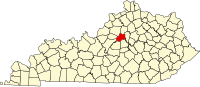 | |
| Unincorporated communities | ||
| Ghost town |
| |
| ||
Authority control | |
|---|---|
| General | |
| National libraries | |
| Other | |
На других языках
[de] Anderson County (Kentucky)
Das Anderson County[1] ist ein County im US-Bundesstaat Kentucky. Der Verwaltungssitz (County Seat) ist Lawrenceburg[2], das nach William Lawrence benannt wurde, einem hiesigen Tavernenbesitzer.- [en] Anderson County, Kentucky
[ru] Андерсон (округ, Кентукки)
Округ Андерсон (англ. Anderson County) располагается в штате Кентукки, США. Официально образован в 1827 году. По состоянию на 2010 год, численность населения составляла 21 421 человека.Другой контент может иметь иную лицензию. Перед использованием материалов сайта WikiSort.org внимательно изучите правила лицензирования конкретных элементов наполнения сайта.
WikiSort.org - проект по пересортировке и дополнению контента Википедии