world.wikisort.org - Uruguay
Las Toscas is a village or populated centre in the Tacuarembó Department of northern-central Uruguay.
Las Toscas | |
|---|---|
Village | |
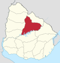
 Las Toscas Location in Uruguay | |
| Coordinates: 32°9′0″S 55°0′30″W | |
| Country | |
| Department | Tacuarembó Department |
| Population (2011) | |
| • Total | 1,142 |
| Time zone | UTC -3 |
| Postal code | 45019 |
| Dial plan | +598 463 (+5 digits) |
Location
The village is located on Route 26, about 6.5 kilometres (4.0 mi) northwest of its intersection with Route 6 and about 60 kilometres (37 mi) southeast of Ansina. The stream Arroyo Caraguatá flows by the west limits of the village.
Population
In 2011 Las Toscas had a population of 1,142.[1]
| Year | Population |
|---|---|
| 1975 | 175 |
| 1985 | 461 |
| 1996 | 651 |
| 2004 | 781 |
| 2011 | 1,142 |
Source: Instituto Nacional de Estadística de Uruguay[2]
Places of worship
- Parish Church of the Holy Sacrament and St. Thérèse of Lisieux (Roman Catholic)
References
- "Censos 2011 Cuadros Tacuarembó". INE. 2012. Archived from the original on 8 January 2013. Retrieved 25 August 2012.
- "1963–1996 Statistics / L". Instituto Nacional de Estadística de Uruguay. 2004. Archived from the original (DOC) on 29 November 2011. Retrieved 3 July 2011.
External links
Capital: Tacuarembó | ||
| Municipalities |
|  |
| Towns and villages | ||
| Sights | ||
This article about a place in Tacuarembó Department is a stub. You can help Wikipedia by expanding it. |
На других языках
[de] Las Toscas (Tacuarembó)
Las Toscas ist eine Ortschaft in Uruguay.- [en] Las Toscas, Tacuarembó
[ru] Лас-Тоскас
Лас-Тоскас (исп. Las Toscas) — населённый пункт в северной части Уругвая, в департаменте Такуарембо.Текст в блоке "Читать" взят с сайта "Википедия" и доступен по лицензии Creative Commons Attribution-ShareAlike; в отдельных случаях могут действовать дополнительные условия.
Другой контент может иметь иную лицензию. Перед использованием материалов сайта WikiSort.org внимательно изучите правила лицензирования конкретных элементов наполнения сайта.
Другой контент может иметь иную лицензию. Перед использованием материалов сайта WikiSort.org внимательно изучите правила лицензирования конкретных элементов наполнения сайта.
2019-2025
WikiSort.org - проект по пересортировке и дополнению контента Википедии
WikiSort.org - проект по пересортировке и дополнению контента Википедии