world.wikisort.org - Uruguay
Paso del Cerro is a village or populated centre in the Tacuarembó Department of northern-central Uruguay.
Paso del Cerro | |
|---|---|
Village | |
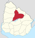
 Paso del Cerro Location in Uruguay | |
| Coordinates: 31.4781°S 55.8330°W | |
| Country | |
| Department | Tacuarembó Department |
| Population (2011) | |
| • Total | 235 |
| Time zone | UTC -3 |
| Postal code | 45005 |
| Dial plan | +598 463 (+5 digits) |
Location and geography
It is located near the border with Rivera Department, about 19 kilometres (12 mi) in a westward direction along a road that splits from the intersection of Route 5 with Route 29, 38 kilometres (24 mi) northeast of the department capital Tacuarembó. The railroad track Montevideo - Tacuarembó - Rivera passes through the village. The stream Arroyo Laureles, a main tributary of Río Tacuarembó, flows 2.2 kilometres (1.4 mi) northeast of the village.
Population
In 2011 Paso del Cerro had a population of 235.[1]
| Year | Population |
|---|---|
| 1963 | 528 |
| 1975 | 308 |
| 1985 | 341 |
| 1996 | 231 |
| 2004 | 310 |
| 2011 | 235 |
Source: Instituto Nacional de Estadística de Uruguay[2]
References
- "Censos 2011 Tacuarembó (needs flash plugin)". INE. 2012. Retrieved 25 August 2012.
- "1963–1996 Statistics / P" (DOC). Instituto Nacional de Estadística de Uruguay. 2004. Retrieved 4 July 2011.
External links
Capital: Tacuarembó | ||
| Municipalities |
|  |
| Towns and villages |
| |
| Sights | ||
This article about a place in Tacuarembó Department is a stub. You can help Wikipedia by expanding it. |
Другой контент может иметь иную лицензию. Перед использованием материалов сайта WikiSort.org внимательно изучите правила лицензирования конкретных элементов наполнения сайта.
WikiSort.org - проект по пересортировке и дополнению контента Википедии