world.wikisort.org - Uruguay
Tacuarembó (Spanish pronunciation: [ta.kwa.ɾemˈbo] Guarani: Takuarembo, literally: "Bamboo shoot") is the capital city of the Tacuarembó Department in north-central Uruguay.
Tacuarembó | |
|---|---|
Capital city | |
 Governmental building and Cathedral of St. Fructuosus | |
 Tacuarembó | |
| Coordinates: 31°44′0″S 55°59′0″W | |
| Country | |
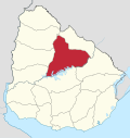
| Department | Tacuarembó Department |
| Founded | January 21, 1832 |
| Founded by | Bernabé Rivera |
| Government | |
| • City Manager | Wilson Ezquerra Martinotti |
| Elevation | 137 m (449 ft) |
| Population (2011 Census) | |
| • Total | 54,755 |
| • Rank | 8th |
| • Demonym | tacuaremboense |
| Time zone | UTC -3 |
| Postal code | 45000 |
| Dial plan | +598 463 (+5 digits) |
| Climate | Cfa |
Location and geography
The city is located on Km. 390 of Route 5, 113 kilometres (70 mi) south-southwest of Rivera, the capital city of the Rivera Department. Routes 26 and 31 also meet Route 5 within the city limits. The stream Arroyo Tacuarembó Chico, a tributary of Río Tacuarembó, flows through the north part of the city. As of the census of 2011, it is the eighth most populated city of the country.
History
On 24 October 1831, a presidential decree by Fructuoso Rivera ordered the creation of a city in the region. The task was entrusted to the President's brother, Colonel Bernabé Rivera.

Colonel Rivera left Montevideo on a three-month journey with a caravan of wagons and families, towards the shore of the Tacuaremboty River, which in the Guaraní language means "river of the reeds". The area was surveyed and divided into blocks for settlement. On January 21, 1832, Coronel Rivera founded the town under the name "San Fructuoso", after Saint Fructuosus of Tarragona (whose Saint's Day is January 21[1]) and after his (Benjamin's) brother.
By 1837, San Fructuoso was a growing town. It had more than 500 residents, a justice of the peace, a military commander, a parish priest, a mayor, and a Public Works Commission. On 16 June 1837, the Tacuarembó Department was created (along with Salto and Paysandú), and San Fructuoso was named the capital.
Over time, the community continued to grow. According to the Act of Ley Nº 2.389, on 17 July 1895 it held the status of "Villa" (town). Its name changed to "Tacuarembó", and on 24 June 1912, its status was elevated to "Ciudad" (city) by the Act of Ley Nº 4.031.[2]
Population
In 2011, Tacuarembó had a population of 54,755.[3]
| Year | Population |
|---|---|
| 1908 | 7,546 |
| 1963 | 28,182 |
| 1975 | 37,692 |
| 1985 | 40,511 |
| 1996 | 45,891 |
| 2004 | 51,224 |
| 2011 | 54,755 |
Source: Instituto Nacional de Estadística de Uruguay[2]
Places of worship
- St. Fructuosus Cathedral (Roman Catholic)
- Holy Cross Parish Church (Roman Catholic)
- St. Joseph Parish Church (Roman Catholic)
- Our Lady of Lourdes Parish Church (Roman Catholic)
Climate
Tacuarembó has a humid subtropical climate, described by the Köppen climate classification as Cfa. Summers are warm to hot and winters are cool, with frequent frosts and fog. The precipitation is evenly distributed throughout the year, with an average of 1,165 mm (45.87 in), and the annual average temperature is 18 °C (64.4 °F).
| Climate data for Tacuarembó (1980–2009) | |||||||||||||
|---|---|---|---|---|---|---|---|---|---|---|---|---|---|
| Month | Jan | Feb | Mar | Apr | May | Jun | Jul | Aug | Sep | Oct | Nov | Dec | Year |
| Average high °C (°F) | 30.3 (86.5) |
29.1 (84.4) |
27.6 (81.7) |
23.7 (74.7) |
19.9 (67.8) |
17.1 (62.8) |
17.0 (62.6) |
19.1 (66.4) |
20.1 (68.2) |
23.4 (74.1) |
26.1 (79.0) |
28.7 (83.7) |
23.5 (74.3) |
| Daily mean °C (°F) | 24.5 (76.1) |
23.7 (74.7) |
22.3 (72.1) |
18.7 (65.7) |
15.1 (59.2) |
12.6 (54.7) |
12.2 (54.0) |
13.8 (56.8) |
15.0 (59.0) |
18.1 (64.6) |
20.5 (68.9) |
22.9 (73.2) |
18.3 (64.9) |
| Average low °C (°F) | 18.7 (65.7) |
18.4 (65.1) |
17.1 (62.8) |
13.8 (56.8) |
10.4 (50.7) |
8.1 (46.6) |
7.4 (45.3) |
8.6 (47.5) |
9.8 (49.6) |
12.8 (55.0) |
14.9 (58.8) |
17.2 (63.0) |
13.1 (55.6) |
| Average precipitation mm (inches) | 117.6 (4.63) |
137.8 (5.43) |
144.7 (5.70) |
159.3 (6.27) |
126.8 (4.99) |
104.1 (4.10) |
75.2 (2.96) |
79.0 (3.11) |
107.1 (4.22) |
133.5 (5.26) |
120.2 (4.73) |
121.4 (4.78) |
1,426.6 (56.17) |
| Average relative humidity (%) | 66 | 70 | 72 | 74 | 77 | 79 | 76 | 73 | 72 | 71 | 68 | 66 | 72 |
| Mean monthly sunshine hours | 282.1 | 228.8 | 226.3 | 180.0 | 176.7 | 141.0 | 164.3 | 182.9 | 189.0 | 220.1 | 252.0 | 272.8 | 2,516 |
| Mean daily sunshine hours | 9.1 | 8.1 | 7.3 | 6.0 | 5.7 | 4.7 | 5.3 | 5.9 | 6.3 | 7.1 | 8.4 | 8.8 | 6.9 |
| Source: Instituto Nacional de Investigación Agropecuaria[4] | |||||||||||||
Notable residents
Writers Circe Maia, Mario Benedetti, Tomás de Mattos, and Jorge Majfud are from Tacuarembó, as is José Núñez, 19th century Nicaraguan politician. Some Uruguayans claim that the tango musician Carlos Gardel was born near Tacuarembó, in the village of Valle Edén.[5][6] Scholarly consensus is that he was born in Toulouse, France, then raised in Buenos Aires, but as an adult he obtained legal papers saying he was born in Tacuarembó, probably to avoid French military authorities.[7][8][9][10]
See also
References
- "Fructuoso (Obispo de Tarragona), Augurio y Eulogio (Diáconos), Santos".
- "Statistics of urban localities (1908–2004) (see also "San Fructuoso")" (PDF). INE. 2012. Retrieved 5 September 2012.
- "Censos 2011 Cuadros Tacuarembó". INE. 2012. Retrieved 25 August 2012.
- Castaño, José; Giménez, Agustín; Ceroni, Mauricio; Furest, José; Aunchayna, Rossina. "Caracterización Agroclimática del Uruguay 1980–2009" (PDF) (in Spanish). Instituto Nacional de Investigación Agropecuaria. Retrieved December 17, 2015.
- (in Spanish) En Argentina no dejan en paz a Gardel, El País, retrieved 2012-10-04.
- Victoria Molnar (October 2012). "Nos contaron algo que no tiene nada que ver con Gardel" (in Spanish). El País Digital. Retrieved 21 October 2012.
- Verónica Dema (September 20, 2012). "Fin del misterio: muestran la partida de nacimiento de Gardel" [End of the mystery: they show Gardel's birth certificate]. La Nación (in Spanish). Retrieved October 3, 2012.
- Collier, Simon (1986). The Life, Music, and Times of Carlos Gardel. University of Pittsburgh Press. p. 5. ISBN 0822984989.
- Barsky, Julián; Barsky, Osvaldo (2004). Gardel: La biografía (in Spanish). Taurus. ISBN 9870400132.
- Ruffinelli, Jorge (2004). La sonrisa de Gardel: Biografía, mito y ficción (in Spanish). Ediciones Trilce. p. 31. ISBN 9974323568.
External links
| Wikimedia Commons has media related to Tacuarembó. |
| Wikivoyage has a travel guide for Tacuarembó. |
- DelTacua.com.uy Community
- Article on the Laguna de Lavaderas of the city's park, Official Portal of Uruguayan Government
- "Fundamentos Culturales de Tacuarembó" Washington Benavides, Ciudadano Ilustre de Tacuarembó.
- INE map of Tacuarembó and La Pedrera
Capital: Tacuarembó | ||
| Municipalities |
|  |
| Towns and villages |
| |
| Sights | ||
Authority control | |
|---|---|
| General |
|
| National libraries | |
| Other |
|
На других языках
- [en] Tacuarembó
[es] Tacuarembó
Tacuarembó es la ciudad uruguaya capital del departamento homónimo. Se ubica al norte del departamento, en el kilómetro 388 de la ruta 5, Brigadier General Fructuoso Rivera, y se vincula con el litoral uruguayo a través de la ruta 26, General Leandro Gómez.[ru] Такуарембо
Такуарембо (исп. Tacuarembó) — город на севере центральной части Уругвая, административный центр одноимённого департамента.Другой контент может иметь иную лицензию. Перед использованием материалов сайта WikiSort.org внимательно изучите правила лицензирования конкретных элементов наполнения сайта.
WikiSort.org - проект по пересортировке и дополнению контента Википедии