world.wikisort.org - Uruguay
Paso Bonilla is a village or populated centre in the Tacuarembó Department of northern-central Uruguay.
Paso Bonilla | |
|---|---|
Village | |
 | |
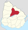
 Paso Bonilla Location in Uruguay | |
| Coordinates: 32°9′0″S 56°7′0″W | |
| Country | |
| Department | Tacuarembó Department |
| Population (2011) | |
| • Total | 510 |
| Time zone | UTC -3 |
| Postal code | 45011 |
| Dial plan | +598 463 (+5 digits) |
Location
The village is located on the junction of Route 5 with Route 59, about 10 kilometres (6.2 mi) south of the department capital city Tacuarembó. About 1.5 kilometres (0.93 mi) north of the village is the so-called "Paso Bonilla", which coincides with the actual bridge of Route 5 over the stream Arroyo Tranqueras.
Population
In 2011 Paso Bonilla had a population of 510.[1]
| Year | Population |
|---|---|
| 1963 | 74 |
| 1975 | 368 |
| 1985 | 743 |
| 1996 | 286 |
| 2004 | 445 |
| 2011 | 510 |
Source: Instituto Nacional de Estadística de Uruguay[2]
References
- "Censos 2011 Tacuarembó (needs flash plugin)". INE. 2012. Retrieved 25 August 2012.
- "1963–1996 Statistics / P" (DOC). Instituto Nacional de Estadística de Uruguay. 2004. Retrieved 4 July 2011.
External links
Wikimedia Commons has media related to Paso Bonilla.
Capital: Tacuarembó | ||
| Municipalities |
|  |
| Towns and villages |
| |
| Sights | ||
This article about a place in Tacuarembó Department is a stub. You can help Wikipedia by expanding it. |
На других языках
- [en] Paso Bonilla
[ru] Пасо-Бонилья
Пасо-Бонилья (исп. Paso Bonilla) — населённый пункт сельского типа на севере центральной части Уругвая, в департаменте Такуарембо.Текст в блоке "Читать" взят с сайта "Википедия" и доступен по лицензии Creative Commons Attribution-ShareAlike; в отдельных случаях могут действовать дополнительные условия.
Другой контент может иметь иную лицензию. Перед использованием материалов сайта WikiSort.org внимательно изучите правила лицензирования конкретных элементов наполнения сайта.
Другой контент может иметь иную лицензию. Перед использованием материалов сайта WikiSort.org внимательно изучите правила лицензирования конкретных элементов наполнения сайта.
2019-2026
WikiSort.org - проект по пересортировке и дополнению контента Википедии
WikiSort.org - проект по пересортировке и дополнению контента Википедии